
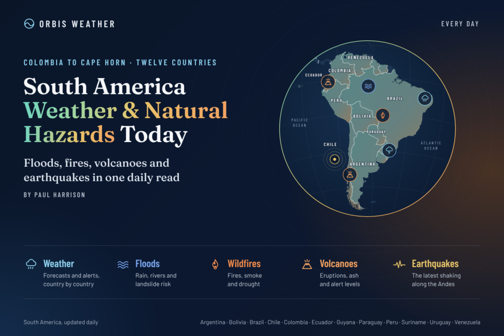
South America Weather & Natural Hazards Today

- Europe Weather & Natural Hazards Today – Sunday, November 15, 2026 7:41 PM
- Africa Weather & Natural Hazards Today — Sunday, November 15, 2026 7:34 PM
- Middle East Weather & Natural Hazards Today – November 15, 2026 7:26 PM
- Southeast Asia Natural Hazards This Week: Sunday, November 15, 2026 7:18 PM
- Southeast Asia Weather & Natural Hazards Today: Sunday, November 15, 2026 7:07 PM
- Earth’s Hot Spots This Week November 14, 2026 3:26 PM
- Australia, New Zealand & Oceania Weather & Natural Hazards Today — Sunday, November 15, 2026 11:06 AM
- North America Weather & Natural Hazards Today – November 14, 2026 10:45 AM
- Central America Weather & Natural Hazards Today – Saturday, November 14, 2026 10:36 AM
- South America Weather & Natural Hazards Today – November 14, 2026 10:26 AM
- WESTERN PACIFIC Tropical Weather Update – November 14, 2026 10:19 AM
- U.S. Weather Outlook (Next 7 Days): Nov. 14–20, 2026 9:28 AM
- Australian Region Tropical Weather Update: Saturday, November 14, 2026 9:13 AM
- Daily Earthquakes, Storms, Fires & Floods Report — November 14, 2026 8:50 AM
- Southwest Indian Ocean Tropical Weather Update: Saturday, November 14, 2026 8:40 AM





South America Weather & Natural Hazards Today – November 14, 2026
By Paul Harrison | Orbis Weather
Saturday, November 14, 2026
Heavy Rain Threatens Peru and Ecuador as Thunderstorms Spread Across Brazil, Colombia and Argentina
South America enters the weekend facing a complex combination of heavy rainfall, severe thunderstorms, localized flooding, dangerous winds and rising temperatures.
The most significant weather concerns on Saturday, November 14, are concentrated across Peru, Ecuador, Brazil, Colombia and northern Argentina, where official meteorological forecasts identify several areas vulnerable to intense rainfall and potentially hazardous conditions.
Peru remains under a multiday rainfall warning, with particularly intense precipitation possible along the northern coast. Ecuador faces substantial rainfall along its Pacific coast, while Brazil’s warm, humid atmosphere continues to generate widespread thunderstorms.
Colombia is preparing for a weekend of contrasting weather, with heavy rainfall in western and southeastern regions and temperatures approaching or exceeding 35°C (95°F) in several northern cities.
Farther south, a developing weather system is expected to bring additional rainfall across Argentina, Paraguay, Uruguay and southern Brazil.
This report distinguishes official forecasts from broader regional hazards that require continued monitoring.
1. Peru – Heavy Rainfall, Flash Flooding and Landslide Threats
Peru faces one of South America’s most significant rainfall threats this weekend.
The country’s National Institute of Civil Defense (INDECI), using forecasts from SENAMHI, has issued Meteorological Bulletin No. 464-2026, covering November 12–14.
The bulletin warns of moderate to extreme rainfall in mountainous regions and potentially intense rainfall along the northern coast.
Forecast rainfall amounts
Region | Potential daily rainfall |
|---|---|
Northern coast | Near 80 mm (3.1 inches) |
Northern Andes | 5–26 mm (0.2–1.0 inches) |
Central Andes | 6–20 mm (0.2–0.8 inches) |
Southern Andes | Near 27 mm (1.1 inches) |
Areas of particular concern
Tumbes faces the possibility of strong to extreme rainfall, while inland parts of Piura could experience moderate to heavy precipitation.
Other departments included in the official preparedness bulletin include Cajamarca, Lambayeque, La Libertad, Áncash, Cusco, Junín, Arequipa and Puno.
Additional hazards include:
Flash flooding in low-lying communities and urban areas.
Landslides and debris flows along steep Andean slopes.
Hail at elevations above 2,800 meters (9,186 feet).
Thunderstorms accompanied by wind gusts approaching 40 km/h (25 mph).
The greatest concern is where intense rainfall falls over vulnerable hillsides or rapidly drains into narrow river valleys.
Outlook: The official warning remains valid through Saturday, November 14. Residents should monitor updated guidance before assuming the threat has ended.
Source: INDECI Meteorological Bulletin 464-2026.
2. Ecuador – Heavy Pacific Rainfall and Flooding Concerns
Western Ecuador is another important area of concern as moisture from the Pacific Ocean feeds developing rainfall systems.
The U.S. National Weather Service’s South American Forecast Discussion, issued November 12, anticipates substantial rainfall across western and southwestern Ecuador through the weekend.
Forecast accumulations include:
Friday into Saturday: Approximately 40–80 mm (1.6–3.1 inches) across southwestern Ecuador.
Saturday into Sunday: Additional heavy rainfall potential around the Gulf of Guayaquil.
The forecast identifies atmospheric moisture convergence and developing circulation patterns as factors supporting the rainfall.
Main hazards
Communities around Guayaquil and other low-lying coastal areas should monitor the possibility of localized flooding.
Heavy rainfall could also affect transportation, particularly where roads cross drainage channels or flood-prone terrain.
In mountainous western Ecuador, intense rainfall can increase landslide susceptibility.
These are forecast hazards, not confirmation that widespread flooding has already occurred.
Source: NOAA/NWS Weather Prediction Center, South American Forecast Discussion, November 12.
3. Brazil – Widespread Thunderstorms, Heavy Rain and Intense Heat
Brazil’s National Institute of Meteorology (INMET) forecasts another unsettled day across large sections of the country.
A broad area of warm, humid air is helping generate showers and thunderstorms across northern, central and southeastern Brazil.
INMET identifies yellow-level potential-danger thunderstorm advisories across affected areas.
Central-West Brazil
Mato Grosso, Goiás, the Federal District and portions of Mato Grosso do Sul face additional thunderstorms on Saturday.
Rainfall may become locally heavy, with lightning and gusty winds accompanying stronger storms.
Cuiabá could reach approximately 36°C (97°F), providing additional daytime heating.
Northern Brazil and the Amazon
Thunderstorms are expected across parts of Amazonas, Acre, Rondônia, southern Pará and Tocantins.
Northern Amapá could also experience isolated thunderstorms as moisture associated with the Intertropical Convergence Zone approaches the coast.
Elsewhere, hot weather continues, with temperatures around:
City | Forecast high |
|---|---|
Manaus | 35°C (95°F) |
Belém | 35°C (95°F) |
Porto Velho | 35°C (95°F) |
Rio Branco | 35°C (95°F) |
Boa Vista | 36°C (97°F) |
Teresina | 37°C (99°F) |
Southeastern and northeastern Brazil
Thunderstorms remain a concern across the country’s central and southeastern regions, while instability is expected to intensify across southern Maranhão, Piauí and western, central and southern Bahia.
Main risks: Lightning, short-duration intense rainfall, urban flooding and isolated wind damage.
Source: INMET official November 13–14 forecast.
4. Colombia – Heavy Rainfall in the West and Intense Heat in the North
Colombia’s Institute of Hydrology, Meteorology and Environmental Studies (IDEAM) has issued Special Communication No. 125, highlighting significant rainfall and unusually high temperatures during the November 14–16 holiday weekend.
Saturday rainfall outlook
IDEAM forecasts the heaviest rainfall across:
The foothills of the Sierra Nevada de Santa Marta.
Southern Bolívar and the Gulf of Urabá.
Eastern Antioquia and Santander.
Chocó, Cauca and Nariño.
Lighter to moderate rainfall is expected across additional areas of northern, western and southeastern Colombia.
Communities along steep hillsides and near rivers should remain alert for rapid runoff, localized flooding and landslides.
Heat across northern Colombia
Cúcuta
37°C
99°F
Arauca
35°C
95°F
Santa Marta
35°C
95°F
IDEAM also reports that several temperature records were exceeded between November 9 and 12, with preliminary observations showing unusually warm conditions in parts of Quindío, Antioquia, Boyacá and Santander.
Outlook: Heavy rainfall remains possible in western Colombia on Sunday, while northern cities continue experiencing high temperatures.
Source: IDEAM Special Communication No. 125, November 13.
5. Argentina – Thunderstorms, Strong Winds and Developing Rainfall
Argentina is experiencing a changing spring weather pattern as frontal systems interact with warm, moisture-rich air.
The NOAA Weather Prediction Center’s November 12 discussion identifies additional precipitation across La Pampa and Buenos Aires Province, with heavier rainfall potential in Córdoba and Santa Fe.
Northern Argentina
A developing low-pressure system is expected to encourage moisture transport and thunderstorm development.
The forecast indicates that rainfall could continue into Sunday across the Gran Chaco region, including neighboring Paraguay.
Patagonia
Northern Patagonia has also been affected by a frontal weather pattern associated with heavy rainfall and strong atmospheric winds.
The earlier NOAA forecast identified 25–50 mm (1–2 inches) of rainfall in parts of northern Patagonia through Friday.
That forecast does not establish that the same rainfall intensity continues everywhere on Saturday.
Main hazards: Localized flooding, lightning, hail, strong winds and difficult travel conditions.
Residents should consult Argentina’s National Meteorological Service for the latest province-specific alerts.
Source: NOAA Weather Prediction Center, November 12 forecast discussion.
6. Paraguay and Uruguay – Rainfall Moving Across the Southern Cone
The developing weather pattern over Argentina is expected to influence neighboring countries.
Paraguay
Additional rainfall is forecast across parts of the Chaco region as atmospheric moisture converges over northern Argentina and Paraguay.
Stronger thunderstorms could produce localized heavy rain and lightning.
Uruguay
Remnants of the frontal system are forecast to bring rainfall toward Uruguay and Rio Grande do Sul in southern Brazil.
The precise intensity and geographical coverage of thunderstorms remain uncertain.
No separate, current nationwide severe-weather alert for Paraguay or Uruguay was independently confirmed for this edition.
Source: NOAA Weather Prediction Center.
7. Chile – Andean Weather, Strong Winds and Geological Hazards
Chile’s extensive north-to-south geography produces widely different weather conditions.
Northern Chile generally experiences dry conditions, while central and southern regions are more exposed to changing Pacific weather systems.
Across Patagonia and the southern Andes, strong winds and rapidly changing mountain conditions remain important hazards for travelers.
Earthquakes and volcanoes
Chile sits along an active tectonic boundary, making earthquake and volcanic monitoring essential throughout the year.
The principal geological hazards include earthquakes, volcanic ash emissions, landslides and, following certain offshore earthquakes, tsunami threats.
Verification note: No specific major earthquake, volcanic eruption or nationwide weather emergency in Chile has been independently established for November 14 in this report.
Readers should consult Chile’s National Seismological Center, SENAPRED and SERNAGEOMIN for current information.
8. Bolivia – Seasonal Thunderstorms and Mountain Weather
Bolivia’s weather varies dramatically between its tropical lowlands and high-altitude Andean regions.
In the eastern lowlands, rising temperatures and increasing seasonal moisture can support thunderstorms and heavy showers.
In the Andes, localized rainfall may create dangerous conditions on mountain roads and steep slopes.
The main hazards to monitor include flash flooding, lightning, landslides and rapid temperature changes at high elevations.
No specific nationwide severe-weather emergency has been independently confirmed for Bolivia today.
9. Venezuela and the Guianas – Tropical Rainfall and Localized Flood Risks
Northern South America remains vulnerable to heavy tropical showers, particularly where daytime heating combines with abundant atmospheric moisture.
In Venezuela, mountainous and river-valley communities should monitor intense rainfall and rapidly changing river levels.
Across Guyana, Suriname and French Guiana, tropical showers and thunderstorms can produce localized flooding, especially in poorly drained urban areas.
These are regional monitoring concerns rather than confirmed widespread emergencies for November 14.
10. Amazon Basin – Thunderstorms, River Conditions and Environmental Hazards
The Amazon Basin continues to experience substantial regional differences in rainfall, temperature and river conditions.
Thunderstorms are forecast across parts of western and southern Amazonas, Acre, Rondônia and southern Pará.
However, rainfall across the Amazon is highly variable, and heavy thunderstorms in one area do not necessarily indicate widespread river flooding.
Environmental concerns
Weather-related hazards across the Amazon include flooding, drought, wildfire smoke and reduced water availability.
River levels should be assessed using official hydrological observations rather than rainfall forecasts alone.
Brazil’s INMET forecast supports continued thunderstorm monitoring across portions of the basin this weekend.
South America Natural Hazards Summary – November 14, 2026
Country or region | Main concern | Assessment |
|---|---|---|
Peru | Heavy rain, flash flooding, landslides | Official warning |
Ecuador | Heavy coastal rainfall, flooding potential | Official forecast |
Brazil | Thunderstorms, intense rainfall, heat | Official forecast |
Colombia | Heavy rain, landslides, high temperatures | Official forecast |
Argentina | Thunderstorms, frontal rainfall, winds | Regional forecast |
Paraguay | Rainfall and thunderstorm potential | Regional forecast |
Uruguay | Frontal rainfall | Regional forecast |
Chile | Mountain weather and geological hazards | Monitoring |
Bolivia | Seasonal storms and mountain hazards | Monitoring |
Venezuela | Tropical rainfall and river conditions | Monitoring |
Guianas | Tropical thunderstorms and localized flooding | Monitoring |
Assessment categories describe the type of information verified for this report. They are not standardized warning levels or confirmations of disaster impacts.
South America Weather Outlook – November 15–17, 2026
Several weather developments deserve continued attention over the coming days.
Sunday, November 15: Heavy rainfall remains a concern around southwestern Ecuador and the Gulf of Guayaquil. Colombia’s IDEAM also forecasts significant rainfall in parts of the west, including Chocó, Cauca and Nariño.
Sunday into Monday: The regional weather pattern may continue producing rainfall across northern Argentina, Paraguay, Uruguay and southern Brazil.
Monday, November 16: Colombia’s official outlook identifies further heavy rainfall potential across western and central-western departments.
Tuesday, November 17: Forecast confidence is more limited without newer regional bulletins. Updated national forecasts should determine whether the weekend’s rain systems persist, weaken or move into new areas.
The November 12 NOAA South American discussion was the latest available discussion used here and was scheduled to resume updates on November 16.
Earthquake, Volcano and Tsunami Monitoring
South America’s Pacific margin remains one of the world’s most seismically active regions.
The Andes and adjacent offshore zones require continuous monitoring for earthquakes and volcanic activity.
Countries particularly exposed to geological hazards include Chile, Peru, Ecuador and Colombia.
This report does not claim that a significant new earthquake, eruption or tsunami warning has occurred today. A verified list of November 14 geological incidents was not available from the sources reviewed.
For real-time information, readers should consult the USGS Earthquake Hazards Program, national geological agencies and official tsunami warning centers.
Safety Advice for Residents and Travelers
Heavy rain and flooding: Avoid flooded roads, underpasses and fast-moving water.
Thunderstorms: Seek shelter indoors when lightning is nearby.
Landslides: Watch for cracking ground, falling rocks, unusual slope movement and rapidly rising streams.
Extreme heat: Drink water regularly, limit strenuous outdoor activity and check on vulnerable people.
Mountain travel: Monitor local forecasts before entering exposed Andean routes.
Earthquakes and tsunamis: Follow official evacuation instructions and move away from hazardous coastal areas after strong or prolonged shaking.
Official Weather and Natural Hazard Sources
Orbis Weather uses established meteorological, geological and emergency management agencies when preparing regional reports.
Country or region | Official source |
|---|---|
Brazil | |
Argentina | |
Peru | |
Colombia | |
Ecuador | |
Chile | |
Uruguay | |
Regional forecasts | |
Earthquakes |
Orbis Weather Editorial Methodology
This article has been prepared using official national meteorological forecasts, government emergency bulletins and regional scientific forecast discussions.
The principal dated sources include Peru’s November 12–14 rainfall warning, Brazil’s November 13–14 forecast, Colombia’s November 13 special communication and NOAA’s November 12 South American forecast discussion.
Forecast rainfall totals are estimates, not measurements of rainfall already received. Where a specific active warning or disaster incident could not be independently confirmed, the report identifies the relevant hazard as a monitoring concern.
Orbis Weather does not issue official weather warnings. National meteorological services and emergency management authorities remain the primary sources for public safety instructions.
Report date: November 14, 2026
Prepared by: Paul Harrison
Publication: Orbis Weather
Editorial status: Official forecast information reviewed for publication. Not a continuously updated emergency alert feed.
Final Outlook
South America’s weather remains unsettled this weekend, with heavy rainfall presenting the greatest immediate concern across parts of Peru and Ecuador.
Brazil continues to experience widespread thunderstorms and high temperatures, while Colombia faces a combination of intense rainfall in western regions and significant heat farther north.
Across Argentina, Paraguay, Uruguay and southern Brazil, developing frontal systems could bring additional rainfall and thunderstorms into Sunday.
The most important developments to monitor over the next 24–48 hours are rainfall accumulation in northern Peru and western Ecuador, storm development across Brazil and Colombia, and the evolution of the weather system affecting the Southern Cone.
Orbis Weather will continue monitoring official forecasts and natural hazard developments across South America.
About the Author
Paul Harrison — Founder & Publisher, Orbis Weather
Paul Harrison founded Orbis Weather in 2026 to make global weather and natural-hazard information easier to find, follow and understand. His coverage includes tropical cyclones, severe weather, extreme temperatures, earthquakes, volcanoes, wildfires, flooding and significant natural disasters worldwide.
View all articles by Paul Harrison → | Editorial Standards →
Global Weather Tracker Hub
Explore weather maps, tropical systems, storms and natural hazards around the world.
No matching trackers found.