
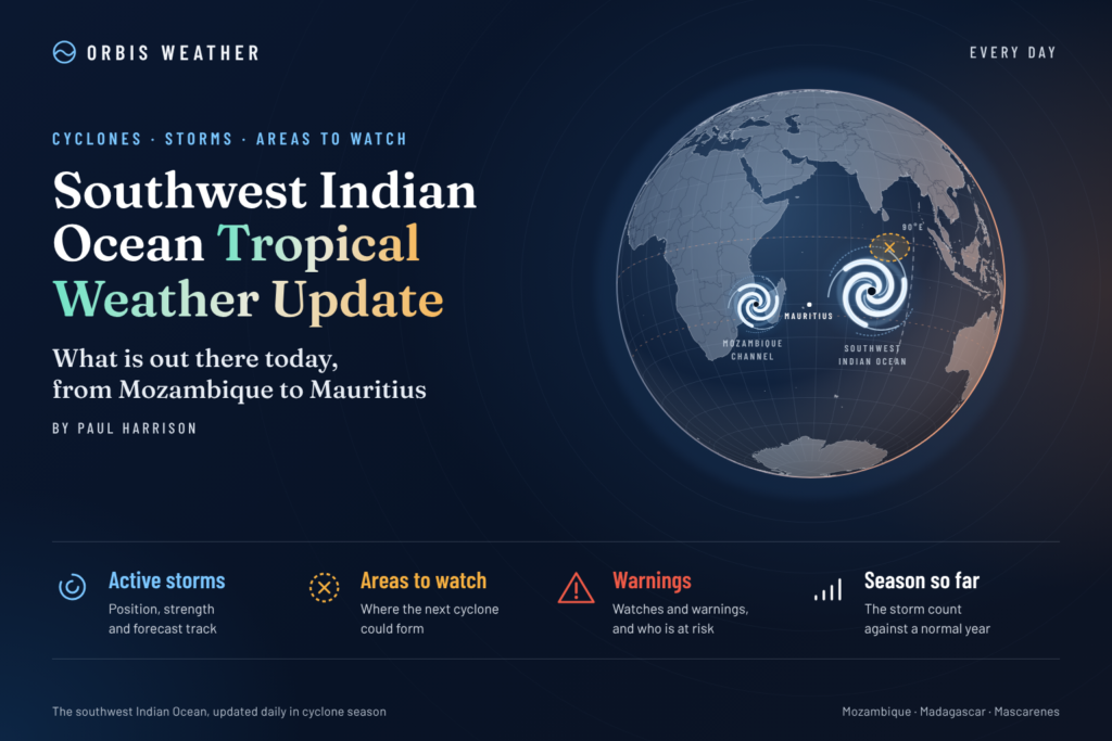
🌀 Southwest Indian Ocean Tropical Weather Update

- Earth’s Cold Spots This Week November 11, 2026 3:06 PM
- Severe Thunderstorms Batter Queensland and NSW as Giant Hail, Damaging Winds and Flash Flooding Threaten 12:05 PM
- Australian Region Tropical Weather Update — Thursday, November 12, 2026 11:46 AM
- Southwest Indian Ocean Tropical Weather Update – Thursday, November 12, 2026 11:36 AM
- Australia, New Zealand & Oceania Weather & Natural Hazards Today — Thursday, November 12, 2026 11:01 AM
- North America Weather & Natural Hazards Today — Wednesday, November 11, 2026 8:36 AM
- Central America Weather & Natural Hazards Today – Wednesday, November 11, 2026 8:28 AM
- South America Weather & Natural Hazards Today – November 11, 2026 8:20 AM
- Daily Earthquakes, Storms, Fires & Floods Report — November 11, 2026 8:08 AM
- Weekly Earth’s Extreme Weather Report — Wednesday, November 11, 2026 8:01 AM
- Tropical Atlantic Daily Report: Wednesday, November 11, 2026 7:54 AM
- Eastern & Central Pacific Tropical Weather Update: Wednesday, November 11, 2026 7:47 AM
- WESTERN PACIFIC Tropical Weather Update – November 11, 2026 7:38 AM





🌀 Southwest Indian Ocean Tropical Weather Update – Thursday, November 12, 2026
By Paul Harrison | Orbis Weather
Published: Thursday, November 12, 2026 (Southwest Indian Ocean local date)
Forecast period: November 12–17, 2026
Coverage: Madagascar, Mozambique, Mozambique Channel, Mauritius, Réunion, Rodrigues, Mayotte, Comoros, Seychelles and surrounding Indian Ocean waters.
Latest verified official cyclone bulletin: Météo-France La Réunion, November 10, 2026, 16:24 Réunion local time.
Verification note: The November 12 official cyclone bulletin was not available for independent verification when this report was prepared. Current-system assessments below are based on the latest official bulletin retrieved, rather than a confirmed November 12 observation.
🌍 Southwest Indian Ocean: Tropical Depression Weakens as Forecasters Monitor New Disturbance Potential
The Southwest Indian Ocean enters Thursday, November 12, with the latest verified regional cyclone outlook indicating no organized tropical depression or named tropical cyclone being actively tracked.
Former Tropical Depression 02-20262027 has been weakening near the northern Mozambique Channel and was expected to dissipate by Wednesday evening.
Meanwhile, a separate low-pressure circulation over the southern Mozambique Channel was also forecast to weaken without developing into a subtropical storm.
Farther east, meteorologists are monitoring the possibility of another disturbed weather area forming over the central or northeastern basin later this week.
The November 10 official bulletin indicated no tropical storm formation risk during its following five days. That assessment should not be extended beyond its validity without newer guidance.
🌀 1. Tropical Cyclone Activity: Latest Verified Status
Tropical indicator | Assessment |
|---|---|
Active named tropical cyclones | None reported |
Active tracked tropical depressions | None reported |
Former Depression 02 | Dissipation forecast |
Southern Mozambique Channel low | Weakening expected |
Five-day tropical storm formation risk | None indicated in November 10 bulletin |
Potential development area | Central/northeastern basin |
Principal localized concerns | Rainfall, thunderstorms and marine conditions |
Source: Météo-France La Réunion, bulletin issued November 10, 2026. These are not independently confirmed November 12 conditions.
What happened to Tropical Depression 02?
On November 10, the residual center was positioned approximately 100 km (62 miles) northeast of Aldabra Island and 450 km (280 miles) north-northwest of Madagascar’s northern tip.
The system was expected to continue west-northwestward, passing southwest of the Seychelles before dissipating on November 11.
Although its organized circulation had weakened, moisture around the system contributed to thunderstorms over Mayotte earlier in the week.
Assessment: The official forecast anticipated complete dissipation by Wednesday evening. Its final status requires confirmation from a newer bulletin.
🌊 2. Southern Mozambique Channel: Another Weak Circulation
A second area of low pressure was identified over the southern Mozambique Channel.
According to the November 10 Météo-France bulletin, its circulation was approximately:
100 km (62 miles) south of Europa Island.
300 km (186 miles) west of Toliara, southwestern Madagascar.
Forecasters did not expect the system to become a subtropical storm.
It was forecast to dissipate over the following days without threatening inhabited land.
This was a separate circulation from former Tropical Depression 02.
Why it still deserves monitoring
Even weak low-pressure areas can influence local winds, showers and sea conditions. However, there is no verified evidence from the reviewed bulletin of a developing tropical cyclone threatening southern Madagascar or Mozambique.
🇲🇬 3. Madagascar: Northern and Southwestern Coastal Outlook
Madagascar remains an important monitoring area because of its exposure to tropical systems moving through the Mozambique Channel and approaching from the eastern Indian Ocean.
Northern Madagascar
Former Depression 02 was expected to move away from the northern coastline and dissipate.
The main considerations are residual tropical moisture, localized thunderstorms and marine conditions.
No renewed cyclone approach was indicated in the verified November 10 bulletin.
Southwestern Madagascar
The weak circulation west of Toliara was forecast to dissipate without developing into a subtropical storm.
Coastal communities should nevertheless follow local marine forecasts, particularly where fishing and small-vessel operations are concerned.
Eastern Madagascar
The reviewed cyclone outlook did not identify an organized tropical cyclone approaching the eastern coastline.
However, eastern Madagascar remains exposed to heavy tropical rainfall and rough surf during the cyclone season.
Outlook: No confirmed direct tropical cyclone threat in the latest verified regional bulletin. Local rainfall and marine warnings require updated national forecasts.
🇾🇹 4. Mayotte and Comoros: Lingering Moisture Remains Important
Mayotte experienced unsettled weather associated with moisture circulating around the southern side of former Depression 02.
The official November 10 bulletin specifically noted thunderstorm conditions over Mayotte earlier in the week.
Hazards to monitor
Localized heavy rainfall and thunderstorms.
Reduced visibility during intense showers.
Rapid runoff in vulnerable drainage areas.
Changing coastal conditions.
For the Comoros, proximity to tropical disturbances does not automatically mean widespread severe weather. Local forecasts determine whether rainfall or marine warnings are necessary.
Outlook: The weakening depression reduced the organized cyclone threat, but localized weather hazards must be assessed separately.
🇲🇺 5. Mauritius and Rodrigues: Early-Season Cyclone Monitoring
Mauritius and Rodrigues remain important monitoring locations as the Southern Hemisphere cyclone season develops.
The November 10 basin bulletin did not identify an organized tropical cyclone approaching either island.
Mauritius
Attention should remain focused on local rainfall, trade winds, thunderstorms and coastal sea conditions.
No Mauritius-specific cyclone warning for November 12 was independently verified for this report.
Rodrigues
Located farther east, Rodrigues can be particularly relevant when tropical disturbances organize over the central Indian Ocean.
Any new disturbance developing in the eastern portion of the basin should be monitored for its eventual track and intensity.
Outlook: No direct cyclone threat was identified in the reviewed basin bulletin. Updated local conditions should be obtained from Mauritius Meteorological Services.
🇷🇪 6. Réunion: Monitoring Rainfall and Marine Conditions
Réunion is not identified as a direct impact area from former Tropical Depression 02 in the verified regional outlook.
However, the island’s mountainous terrain makes local rainfall forecasting particularly important.
Heavy showers can produce rapid changes in river levels, especially in steep catchments.
Coastal weather can also differ considerably between the island’s windward and leeward sides.
Monitoring priorities
Heavy showers over mountainous terrain.
Localized thunderstorms.
Coastal swell and marine warnings.
Changes in regional tropical activity.
No current island-wide warning status has been independently verified for November 12.
Residents should consult Météo-France La Réunion for the latest local vigilance information.
🇸🇨 7. Seychelles: Weakening Depression Moves Away
The remnants of Tropical Depression 02 were forecast to pass southwest of the Seychelles before dissipating.
The official November 10 outlook did not indicate a particular cyclone threat to the islands.
Nevertheless, scattered tropical thunderstorms can occur without an organized cyclone.
Marine operators should monitor changing winds, visibility and sea conditions, especially on routes between islands.
Outlook: No organized cyclone impact was forecast in the verified bulletin, although updated observations are needed to confirm the final position and dissipation of the remnants.
🇲🇿 8. Mozambique: No Confirmed Cyclone Landfall Threat
The northern and central Mozambique coastline remains vulnerable to tropical disturbances moving westward through the Mozambique Channel.
However, the latest verified regional outlook does not identify an organized cyclone approaching Mozambique.
Northern Mozambique
The primary monitoring priorities are localized thunderstorms, coastal rainfall and marine conditions.
Central Mozambique
No confirmed tropical cyclone landfall forecast is available in the reviewed information.
Southern Mozambique
The weak circulation over the southern Mozambique Channel was not expected to develop into a subtropical storm or threaten inhabited land.
Outlook: No verified cyclone landfall threat from either monitored circulation, but local weather hazards remain possible.
🔎 9. Could Another Tropical Disturbance Develop?
Météo-France La Réunion indicated on November 10 that a new area of disturbed weather could begin forming toward the weekend between the central and northeastern portions of the basin.
However, the same bulletin assessed no tropical storm formation risk during the next five days.
This distinction is important.
A tropical disturbance is not automatically a tropical depression, and a tropical depression is not automatically a named tropical storm.
Meteorologists monitor several ingredients before assessing development potential:
Persistent thunderstorms near a low-pressure center.
A developing low-level circulation.
Favorable upper-level winds.
Warm ocean water and sufficient atmospheric moisture.
Increasing organization over successive observations.
At this stage, the verified information does not support assigning a name, landfall location, storm track or intensity to the possible new disturbance.
📅 10. Five-Day Tropical Weather Outlook: November 12–17
The following is a monitoring outlook based on the verified November 10 bulletin, not a newly issued daily forecast.
Date | Monitoring assessment |
|---|---|
Thu, Nov 12 | Verify dissipation of former Depression 02 and monitor residual moisture |
Fri, Nov 13 | Monitor weakening southern Mozambique Channel circulation |
Sat, Nov 14 | Watch for disturbed weather developing over the central/northeastern basin |
Sun, Nov 15 | Reassess organization and updated official formation guidance |
Mon, Nov 16 | Obtain a new official outlook; original five-day assessment is approaching its limit |
Tue, Nov 17 | Outside the original five-day assessment; updated forecast required |
Forecast confidence
Higher confidence: Both previously identified circulations were weakening in the verified official assessment.
Moderate confidence: The central or northeastern basin could experience renewed disturbed weather later in the week.
Lower confidence: Exact timing, location and organization of any future disturbance, as well as localized rainfall and marine conditions.
No specific cyclone track, wind speed or rainfall accumulation is forecast here without supporting official guidance.
🌡️ 11. The 2026–2027 Cyclone Season: El Niño Could Reduce Activity
A new seasonal assessment from the World Meteorological Organization, published November 5, indicates that a strong El Niño is expected to favor below-average tropical cyclone activity in the Southwest Indian Ocean during the 2026–2027 season.
Probability of below-normal activity
70%
Forecast named storms
6–10
Forecast tropical cyclones
3–5
Average named storms per season
10
Why El Niño matters
El Niño can change upper-level winds and atmospheric circulation across the Indian Ocean, making conditions less favorable for some tropical cyclones to form or intensify.
The WMO outlook also identifies a negative Subtropical Indian Ocean Dipole as another influence on the season.
However, a below-average season does not mean a safe season.
One powerful cyclone can still cause catastrophic flooding, coastal destruction and loss of life.
Seasonal rainfall outlook
For November 2026 through January 2027, the WMO outlook indicates:
Region | Seasonal rainfall tendency |
|---|---|
Northern Madagascar | Above normal |
Comoros | Above normal |
Parts of Seychelles | Above normal |
Southern and central Mozambique | Below normal |
Parts of western Madagascar | Below normal |
Mascarene Islands | Near normal |
These are seasonal probabilities, not forecasts for individual days or specific storms.
⚠️ 12. Main Tropical Weather Hazards
🌧️ Heavy rainfall and flash flooding
Weak tropical systems can still produce significant rainfall.
Localized flooding may develop where thunderstorms repeatedly affect the same area, even when no named cyclone exists.
🌊 Dangerous surf and coastal conditions
Large swells can travel far from their originating storms.
Marine hazards may occur independently of a direct cyclone threat.
⛰️ Landslides
Mountainous terrain across Madagascar, Réunion and other islands can become vulnerable to landslides following prolonged or intense rainfall.
💨 Strong winds and squalls
Tropical thunderstorms may produce sudden gusts capable of affecting small boats and exposed coastal communities.
⚡ Lightning
Lightning remains a serious danger during tropical thunderstorms, particularly for fishing vessels and outdoor activities.
These are general regional hazards, not a declaration that all are currently occurring.
📡 13. What Orbis Weather Is Monitoring Over the Next 72 Hours
The principal developments requiring updated official verification are:
Former Depression 02: Confirmation of complete dissipation northwest of Madagascar.
Southern Mozambique Channel: Continued weakening of the separate low-pressure circulation.
Mayotte and Comoros: Whether residual moisture produces additional thunderstorms.
Central and northeastern Indian Ocean: Possible organization of a new disturbance.
Mauritius, Rodrigues and Réunion: Any changes in local marine warnings or rainfall conditions.
A new named storm, cyclone classification or warning should only be reported after confirmation from the appropriate official meteorological agency.
📚 14. Official Sources and Forecast Verification
Orbis Weather prioritizes official meteorological agencies, regional cyclone centers and recognized scientific organizations.
Agency | Information provided |
|---|---|
Official basin cyclone outlooks and tracking | |
Mauritius and Rodrigues forecasts | |
National weather information | |
Local weather and vigilance information | |
Regional coordination and seasonal outlooks | |
Mozambique forecasts and warnings |
Source verification record
The cyclone activity assessment in this article is based on the Météo-France La Réunion bulletin issued November 10 at 16:24 local time.
The seasonal cyclone and rainfall information comes from the WMO update published November 5, 2026.
A November 12 official bulletin was not independently verified during preparation. Consequently, this article does not claim to provide a fully verified live basin status for that date.
Editorial methodology
Orbis Weather independently summarizes official meteorological information for a general international audience.
Our reporting distinguishes between:
Observed conditions: Information directly reported by an official weather agency.
Official forecasts: Expected developments published by authorized forecasting centers.
Meteorological analysis: Explanations of weather processes and potential hazards.
Unverified developments: Situations requiring newer official observations or bulletins.
Forecast uncertainty increases with time, particularly for developing tropical disturbances.
Orbis Weather does not create official cyclone warnings or assign storm names.
Corrections and updates policy
Material changes to cyclone position, intensity, classification, forecast track or official warnings should be reflected in an updated article with the relevant bulletin’s date and time.
Any substantive factual correction should be identified transparently.
Readers should use official national meteorological agencies and emergency management authorities when making safety decisions.
🌍 15. Southwest Indian Ocean Tropical Weather Summary
The Southwest Indian Ocean enters Thursday, November 12, 2026, following a period of weakening tropical activity.
Former Tropical Depression 02 was forecast to dissipate northwest of Madagascar, while a separate low-pressure circulation over the southern Mozambique Channel was also expected to weaken without developing into a storm.
The latest verified regional bulletin identified no active organized tropical cyclone and no tropical storm formation risk during its five-day assessment period.
However, forecasters indicated that a new disturbed weather area could begin forming over the central or northeastern basin later in the week.
Madagascar, Mayotte, Comoros, Mauritius, Réunion, Rodrigues, Seychelles and Mozambique should continue monitoring local rainfall, thunderstorm and marine forecasts.
The broader 2026–2027 season is expected to experience below-average cyclone activity because of El Niño, but individual dangerous storms remain possible.
The bottom line: The verified regional outlook suggests a relatively quiet period for organized tropical cyclones, with attention shifting toward the possible emergence of another disturbance later this week. Newer official bulletins are required to confirm the November 12 status.
Orbis Weather | Global Weather, Tropical Cyclones & Natural Hazards
Reported by Paul Harrison
Published: November 12, 2026
Latest verified basin bulletin: November 10, 2026
Disclaimer: This article provides independent meteorological reporting and educational analysis. It is not an official weather warning, emergency notification or substitute for instructions from local authorities. Tropical conditions can change rapidly, and readers should consult official forecasts before making travel, maritime or safety decisions.
About the Author
Paul Harrison — Founder & Publisher, Orbis Weather
Paul Harrison founded Orbis Weather in 2026 to make global weather and natural-hazard information easier to find, follow and understand. His coverage includes tropical cyclones, severe weather, extreme temperatures, earthquakes, volcanoes, wildfires, flooding and significant natural disasters worldwide.
View all articles by Paul Harrison → | Editorial Standards →
Global Weather Tracker Hub
Explore weather maps, tropical systems, storms and natural hazards around the world.
No matching trackers found.