
🌍 Australia, New Zealand & Oceania Weather & Natural Hazards Today

- Europe Weather & Natural Hazards Today – Wednesday, November 18, 2026 7:09 PM
- Southeast Asia Weather & Natural Hazards Today: Wednesday, November 18, 2026 7:01 PM
- Singapore Lightning & Thunderstorms This Week — Wednesday, November 18, 2026 6:54 PM
- Africa Weather & Natural Hazards Today — Wednesday, November 18, 2026 5:12 PM
- Middle East Weather & Natural Hazards Today – Wednesday, November 18, 2026 3:58 PM
- Europe’s Cold Spots This Week Nov 17, 2026 2:56 PM
- Australia, New Zealand & Oceania Weather & Natural Hazards Today — Wednesday, November 18, 2026 11:04 AM
- North America Weather & Natural Hazards Today – November 17, 2026 8:16 AM
- Central America Weather & Natural Hazards Today – Tuesday, November 17, 2026 8:03 AM
- South America Weather & Natural Hazards Today – Tuesday, November 17, 2026 7:50 AM
- Weekly Tropical Storm Tracker: Tuesday, November 17, 2026 7:37 AM
- Daily Earthquakes, Storms, Fires & Floods Report — November 17, 2026 7:29 AM
- Australian Region Tropical Weather Update: Tuesday, November 17, 2026 7:09 AM
- Southwest Indian Ocean Tropical Weather Update: Tuesday, November 17, 2026 7:01 AM
- WESTERN PACIFIC Tropical Weather Update – November 17, 2026 6:56 AM





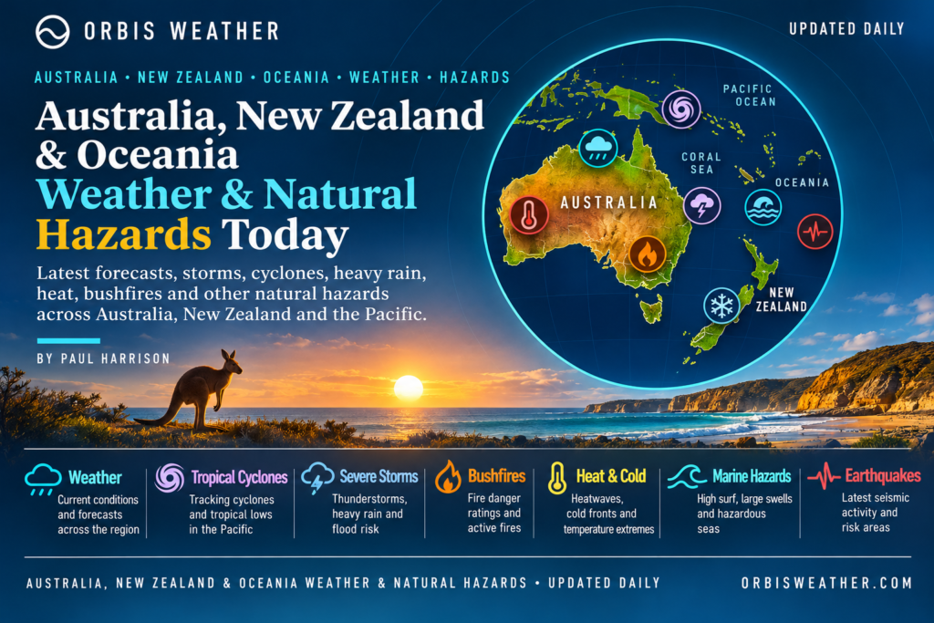
🌏 Australia, New Zealand & Oceania Weather & Natural Hazards Today — Wednesday, November 18, 2026
By Paul Harrison | Orbis Weather | Regional Weather & Natural Hazards Report
Forecast period: Wednesday, November 18, 2026 (local time), with an outlook through Thursday, November 19.
Coverage: Australia, New Zealand, Papua New Guinea, Fiji, Vanuatu, Solomon Islands, Tonga, Samoa, Cook Islands and the wider South Pacific.
🚨 Regional Overview: Severe Tropical Cyclone Xavier, Australian Thunderstorms and New Zealand Rainfall
A powerful tropical cyclone near the northern Cook Islands is the leading natural hazard across Oceania as Wednesday, November 18, begins.
Severe Tropical Cyclone Xavier has intensified over the South Pacific, raising concerns about destructive winds, torrential rainfall, dangerous seas and coastal flooding in vulnerable island communities.
Elsewhere, Australia faces a changing pattern of thunderstorms, with unsettled weather moving across parts of the continent, while northern tropical districts remain exposed to heat and heavy downpours.
New Zealand continues to monitor rainfall, strong winds and river conditions following a period of unsettled weather.
Across the wider Pacific, the arrival of the Southern Hemisphere’s tropical cyclone season makes preparedness increasingly important, particularly for remote islands where transport, communications and emergency services can be disrupted by severe weather.
The forecast below uses the latest information available during preparation, including official guidance issued on November 17. Conditions and warnings may change during November 18.
⚠️ Main Weather Hazards for Wednesday, November 18
🌀 Northern Cook Islands: Severe Tropical Cyclone Xavier poses a significant threat from damaging winds, heavy rain and dangerous seas.
⛈️ Western and Central Australia: Thunderstorms and locally heavy rainfall remain possible as weather systems move eastward.
🌡️ Northern Australia: Heat, humidity and tropical thunderstorms remain important concerns.
🌧️ New Zealand: Further rainfall could affect already saturated catchments, with localized flooding possible.
🌊 Samoa and American Samoa: Heavy tropical rainfall and hazardous marine conditions require monitoring.
🌋 Papua New Guinea and Vanuatu: Earthquake, volcanic and landslide hazards remain important monitoring priorities.
🌀 Northern Cook Islands: Severe Tropical Cyclone Xavier
The most significant regional weather threat is Severe Tropical Cyclone Xavier, which strengthened rapidly after developing over the South Pacific on November 15.
Reports available on November 17 placed Xavier at Category 3 on the Fiji Meteorological Service scale, with further intensification toward Category 4 forecast.
The storm’s projected movement places the northern Cook Islands under particular concern during November 17–19.
Potential impacts include destructive wind gusts, intense rainfall, flash flooding, coastal inundation, dangerous surf and significant disruption to maritime activities.
Small island communities are especially vulnerable because severe weather can damage coastal roads, restrict boat movements and interrupt essential supplies.
The precise intensity, track and proximity of Xavier to individual islands remain critical forecast uncertainties.
Residents should follow the latest instructions from the Cook Islands Meteorological Service, Fiji Meteorological Service and local emergency authorities.
Important: The Category 4 intensity was a forecast in guidance available November 17, not a verified observation for November 18.
Latest verified cyclone intensity
A more recent Fiji Meteorological Service bulletin, issued at 12:45 UTC on November 17, confirms that Xavier had reached Category 5, with sustained winds near its center of approximately 215 km/h (134 mph) and gusts reaching 295 km/h (183 mph).
The cyclone was located near 9.3°S, 163.9°W, moving west at approximately 13 km/h (8 mph).
Official warnings included:
Pukapuka and Nassau: Gale warnings, with gusts potentially reaching 120 km/h (75 mph).
Suwarrow: Gale alert, heavy rain, hazardous seas and coastal inundation risk.
Manihiki and Rakahanga: Strong-wind warnings, rough seas and heavy showers.
Penrhyn: Gusty winds, occasional heavy rain and thunderstorms.
The Fiji Meteorological Service forecast further intensification into November 18, with maximum sustained winds potentially reaching 120 knots (222 km/h or 138 mph).
These figures describe the cyclone’s central intensity, not the winds expected on every island.
🇦🇺 Australia: Thunderstorms, Heat and Changing Weather Conditions
⛈️ Western Australia and South Australia
A developing weather pattern across western and central Australia could bring showers and thunderstorms into parts of South Australia during Wednesday.
The main concerns associated with stronger thunderstorms are localized heavy rainfall, lightning, damaging wind gusts and reduced visibility.
However, the possibility of thunderstorms does not mean that every affected district is under an official severe thunderstorm warning.
Residents should consult the Bureau of Meteorology for district-specific warnings.
🌡️ Queensland and Northern Australia
Hot conditions continue across parts of northern Queensland, with the Peninsula district forecast to reach approximately 34–39°C (93–102°F) on Wednesday.
Afternoon and evening thunderstorms remain possible, particularly over inland tropical areas.
Extreme ultraviolet exposure is another significant concern. The Bureau of Meteorology forecasts UV levels reaching 14 in parts of the Peninsula district.
Heat exposure, dehydration and lightning are particularly relevant for outdoor workers, travelers and communities far from major medical facilities.
🌤️ New South Wales, Victoria and Southeast Australia
Conditions across parts of southeastern Australia are expected to become generally warmer and drier during the middle of the week.
Nevertheless, isolated showers or thunderstorms remain possible, particularly near elevated terrain.
Any lingering wet ground from earlier storms could contribute to localized hazards, even after rainfall eases.
🌊 Queensland Coastal Waters
Marine conditions require attention along Queensland’s coastline.
The Bureau of Meteorology forecasts southeasterly winds around 10–15 knots across Moreton Bay on Wednesday, locally reaching 20 knots early in the morning.
Farther north, a strengthening ridge and a southeasterly wind surge are expected to influence tropical coastal waters later in the week.
Boaters should remember that individual wind gusts can be considerably stronger than forecast averages, particularly near thunderstorms.
🇳🇿 New Zealand: Rainfall, Strong Winds and Flood Monitoring
New Zealand enters Wednesday with continued attention on unsettled weather and the possibility of additional rainfall.
Recent heavy rain and strong winds have highlighted the vulnerability of exposed coastal areas, mountain districts and river catchments.
North Island
Further showers could affect parts of the North Island, with particular concern wherever catchments remain saturated.
Potential impacts include localized surface flooding, slippery roads and rapidly changing river conditions.
South Island
Mountainous areas of the South Island remain vulnerable to sudden weather changes, including heavy rainfall, strong winds and poor visibility.
Travelers crossing alpine routes should check current road conditions and official forecasts before departure.
Forecast confidence: A new nationwide severe-weather warning for November 18 could not be independently verified during preparation. These are monitoring priorities rather than claims of active warnings across New Zealand.
Official forecasts: MetService New Zealand.
🇫🇯 Fiji: Tropical Cyclone Monitoring and Marine Conditions
Fiji remains in its tropical cyclone season, although the most serious confirmed cyclone threat is concentrated around the northern Cook Islands.
Xavier’s development illustrates how quickly tropical cyclones can intensify over warm South Pacific waters.
For Fiji’s main islands, the immediate priority is monitoring local rainfall, wind and marine forecasts rather than assuming the cyclone will directly affect the country.
The Fiji Meteorological Service continues to provide regional tropical cyclone advisories through its RSMC Nadi forecasting center.
Official information: Fiji Meteorological Service.
🇻🇺 Vanuatu and 🇸🇧 Solomon Islands: Tropical Rainfall and Flood Risk
Vanuatu and the Solomon Islands remain vulnerable to tropical thunderstorms, intense rainfall and localized flooding during the Southern Hemisphere wet season.
In Vanuatu, the Meteorology and Geo-Hazards Department’s November 17 outlook reported no existing tropical cyclone within its area of responsibility and assessed the probability of cyclone development over the following five days as low.
That does not eliminate the possibility of heavy showers or thunderstorms.
Across the Solomon Islands, steep terrain and poorly drained communities can experience flooding or landslides during prolonged heavy rainfall.
No specific new nationwide flood emergency was independently confirmed for either country in this report.
🇵🇬 Papua New Guinea: Flooding, Landslides and Geological Hazards
Papua New Guinea faces several natural hazards associated with its tropical climate and tectonic setting.
Heavy rainfall can trigger landslides across mountainous districts, particularly where soils are already saturated.
Remote communities may face additional challenges when flooding damages roads, bridges or communications infrastructure.
Papua New Guinea also lies along an active tectonic boundary, making earthquake and volcanic monitoring an essential part of regional hazard preparedness.
No newly verified major earthquake, volcanic eruption or nationwide flood disaster is being claimed for November 18.
Residents should follow local disaster management authorities and official geological monitoring services for updates.
🇼🇸 Samoa, American Samoa and 🇹🇴 Tonga
Tropical Cyclone Xavier remains the principal weather system requiring attention across the wider South Pacific.
Although its strongest winds are concentrated near the northern Cook Islands, tropical moisture associated with the system could produce heavy rainfall elsewhere.
Earlier regional forecasts highlighted the possibility of substantial rainfall affecting Samoa and American Samoa.
Such rainfall could create flash flooding in low-lying areas and dangerous conditions near streams and coastal roads.
Tonga should continue monitoring tropical cyclone outlooks and marine forecasts, but a direct Xavier-related cyclone warning for Tonga has not been established in the official bulletins reviewed.
🌋 Earthquakes, Volcanoes and Tsunami Monitoring
The Pacific Ring of Fire remains one of the world’s most seismically active regions.
Papua New Guinea, Vanuatu, Tonga, the Solomon Islands and New Zealand are all exposed to varying levels of earthquake and tsunami risk.
Strong undersea earthquakes can generate dangerous tsunami waves, although most earthquakes do not produce destructive tsunamis.
No specific major earthquake or tsunami warning for November 18 has been independently verified for this report.
Readers can check current activity through the following official services:
A tsunami warning should never be inferred solely from an earthquake’s magnitude. Official tsunami assessments also consider location, depth, fault movement and observed sea-level changes.
📊 Regional Natural Hazards Summary — November 18, 2026
Region | Main hazard | Assessment |
|---|---|---|
Northern Cook Islands | Category 5 Cyclone Xavier | Severe cyclone warnings issued November 17 |
Western Australia | Thunderstorms | Forecast monitoring |
South Australia | Showers and thunderstorms | Developing weather risk |
Northern Queensland | Heat and thunderstorms | Elevated heat and UV exposure |
Southeast Australia | Isolated showers and storms | Generally improving conditions |
New Zealand | Rainfall and strong winds | Monitor local warnings |
Fiji | Tropical cyclone season | Regional monitoring |
Vanuatu | Tropical rainfall | Low cyclone development likelihood in latest reviewed outlook |
Solomon Islands | Heavy tropical showers | Seasonal flood risk |
Papua New Guinea | Floods and landslides | Seasonal and geological hazards |
Samoa and American Samoa | Tropical rainfall | Monitor Xavier-related moisture |
Tonga | Marine and tropical weather | Seasonal monitoring |
Assessments distinguish verified cyclone warnings from forecast risks and seasonal hazards. This table is not a live emergency alert feed.
🔭 Weather Outlook: Thursday, November 19, 2026
Australia
Showers and thunderstorms may continue across portions of western, central and northern Australia.
Hot conditions are expected to persist in northern Queensland, where further thunderstorms remain possible.
New Zealand
Rainfall and wind conditions should be monitored closely, particularly in mountainous regions and catchments affected by previous wet weather.
South Pacific
Severe Tropical Cyclone Xavier remains the leading concern.
Forecast guidance issued November 17 suggested the cyclone could slow and eventually turn toward the south or southeast.
Any change in movement could substantially alter which islands experience the strongest winds, rainfall and dangerous seas.
The official forecast should be checked frequently, particularly by residents and marine operators in the northern Cook Islands.
📝 Final Assessment
Wednesday, November 18, is shaping up to be a particularly important day for tropical cyclone monitoring across the South Pacific.
Severe Tropical Cyclone Xavier, confirmed at Category 5 intensity in the latest reviewed bulletin, presents the clearest immediate danger, especially to communities in the northern Cook Islands.
Across Australia, the main concerns involve thunderstorms, high temperatures and changing marine conditions.
New Zealand continues to require rainfall and wind monitoring, while Papua New Guinea and other Pacific island nations remain exposed to seasonal flooding, landslides and geological hazards.
The priority throughout the region is reliable official information, early preparation and careful attention to rapidly changing conditions.
Orbis Weather will continue monitoring significant weather systems, tropical cyclone developments, earthquakes, volcanic activity and other natural hazards across Australia, New Zealand and Oceania
About the Author
Paul Harrison — Founder & Publisher, Orbis Weather
Paul Harrison founded Orbis Weather in 2026 to make global weather and natural-hazard information easier to find, follow and understand. His coverage includes tropical cyclones, severe weather, extreme temperatures, earthquakes, volcanoes, wildfires, flooding and significant natural disasters worldwide.
View all articles by Paul Harrison → | Editorial Standards →
Global Weather Tracker Hub
Explore weather maps, tropical systems, storms and natural hazards around the world.
No matching trackers found.