
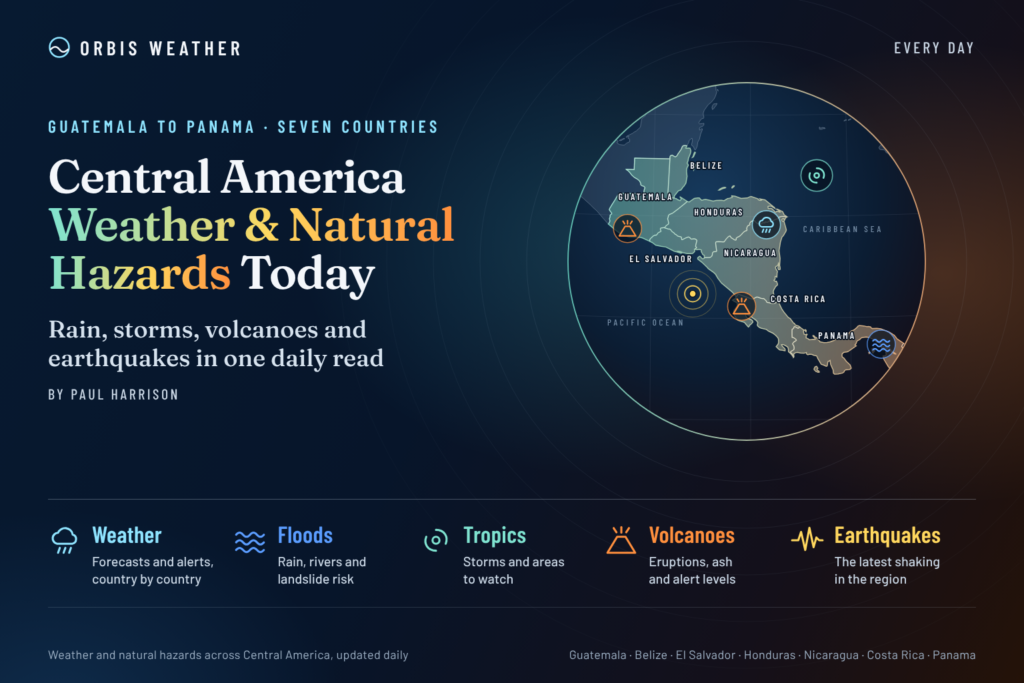
Central America Weather & Natural Hazards Today

- North America Weather & Natural Hazards Today – November 17, 2026 8:16 AM
- Central America Weather & Natural Hazards Today – Tuesday, November 17, 2026 8:03 AM
- South America Weather & Natural Hazards Today – Tuesday, November 17, 2026 7:50 AM
- Weekly Tropical Storm Tracker: Tuesday, November 17, 2026 7:37 AM
- Daily Earthquakes, Storms, Fires & Floods Report — November 17, 2026 7:29 AM
- Australian Region Tropical Weather Update: Tuesday, November 17, 2026 7:09 AM
- Southwest Indian Ocean Tropical Weather Update: Tuesday, November 17, 2026 7:01 AM
- WESTERN PACIFIC Tropical Weather Update – November 17, 2026 6:56 AM





Central America Weather & Natural Hazards Today – Tuesday, November 17, 2026
By Paul Harrison | Orbis Weather
Published: Tuesday, November 17, 2026
Forecast Period: November 17–19, 2026
Coverage: Belize, Guatemala, Honduras, El Salvador, Nicaragua, Costa Rica and Panama
Regional Overview: Changing Trade Winds, Caribbean Rainfall and Continuing Flood Risks
Central America enters Tuesday, November 17, with a changing regional weather pattern, as strengthening trade winds, Caribbean moisture, localized rainfall and lingering flood vulnerability remain important concerns.
The encouraging news is that the National Hurricane Center reports no active tropical cyclones across the Atlantic or eastern North Pacific basins in its early Tuesday update. No tropical disturbances are highlighted on its current seven-day outlook graphics.
However, the absence of a named tropical storm does not mean the region is free from weather-related hazards.
Costa Rica is experiencing a transition toward stronger trade winds, with rainfall expected to become more prominent along its Caribbean side during the middle of the week. Elsewhere, the principal concerns include localized flooding, landslide-prone mountain roads, variable rainfall and longer-term agricultural drought.
Central America’s complex geography means conditions can differ dramatically over relatively short distances. While some Pacific-facing communities experience sunshine and warm temperatures, nearby Caribbean districts and mountainous areas can receive showers and periods of heavier rainfall.
The main message for Tuesday is to remain alert to local weather changes, particularly in areas where rivers remain elevated or soils have been saturated by earlier rainfall.
Today’s Key Weather and Natural Hazard Concerns
Hazard | Areas to Monitor | Assessment |
|---|---|---|
Heavy rainfall | Caribbean-facing Central America, Costa Rica and Panama | Localized rainfall potential |
Flash flooding | Low-lying communities and urban drainage areas | Conditional risk during intense showers |
Landslides | Guatemala, Honduras, Costa Rica and Panama | Higher vulnerability on saturated slopes |
Strong winds | Costa Rican mountains and northern Guanacaste | Strengthening trade-wind pattern |
Tropical cyclones | Caribbean Sea and eastern Pacific | No active cyclones reported |
Drought | Central American Dry Corridor | Longer-term agricultural concern |
Earthquakes and volcanoes | Pacific volcanic and seismic belt | Continued routine monitoring |
These are regional monitoring priorities, not a list of newly issued emergency warnings. Specific local alerts should be confirmed through the responsible national authorities.
Tropical Weather Update: Atlantic, Caribbean and Eastern Pacific
Atlantic Ocean and Caribbean Sea
As of the National Hurricane Center’s early Tuesday advisory cycle, there are no active tropical cyclones in the Atlantic basin, including the Caribbean Sea and Gulf of Mexico.
The Atlantic hurricane season officially continues until November 30, leaving approximately two weeks of the season remaining.
Late-season tropical development is still possible, particularly over the warm waters of the Caribbean. Nevertheless, no active tropical cyclone is currently threatening Central America according to the latest available NHC information.
Eastern North Pacific
The eastern Pacific basin is also free of active tropical cyclones in the latest NHC update.
This is welcome news for the Pacific-facing coastlines of Guatemala, El Salvador, Nicaragua and Costa Rica.
Marine conditions, however, can still be affected by local winds, thunderstorms and changing swell patterns without a tropical cyclone.
Official source: NOAA National Hurricane Center.
Country-by-Country Weather and Natural Hazards
🇧🇿 Belize: Caribbean Moisture, Coastal Showers and Water Supply Concerns
Belize continues to face a mixture of seasonal weather conditions and longer-term environmental challenges.
Caribbean moisture can produce passing showers along coastal districts, while inland communities may experience periods of warmer and comparatively drier weather.
Areas to monitor include Belize City, Belmopan, Orange Walk, Corozal, Dangriga and Punta Gorda.
Northern Belize has featured in earlier regional assessments of abnormal dryness and elevated heat risk. These conditions can affect agriculture, water availability and vegetation, although earlier assessments do not establish Tuesday’s local temperatures or drought severity.
Tuesday’s outlook: Monitor updated coastal rainfall forecasts, local thunderstorm development and agricultural water conditions.
Official source: National Meteorological Service of Belize.
🇬🇹 Guatemala: Mountain Weather, Landslide Exposure and Volcanic Monitoring
Guatemala’s mountainous terrain continues to present challenges when heavy rainfall develops.
The Pacific coastal plain, central highlands, northern Petén region and Caribbean-facing departments can experience very different weather conditions.
Areas to monitor include Guatemala City, Quetzaltenango, Alta Verapaz, Izabal, Huehuetenango and Petén.
Rainfall over steep terrain can quickly increase runoff into streams and rivers, particularly where soils remain saturated.
Motorists traveling through mountainous districts should be alert to falling rocks, unstable slopes and rapidly changing visibility during showers.
Volcanic hazards
Guatemala’s active volcanic systems include Fuego, Santiaguito and Pacaya.
Volcanic ash, gas emissions and rain-triggered lahars remain important hazards around active volcanic terrain.
No new eruption or emergency is independently confirmed for November 17 in this report.
Tuesday’s outlook: Monitor local rainfall, mountain road conditions and official volcanic bulletins.
Official sources: INSIVUMEH and CONRED.
🇭🇳 Honduras: Caribbean Rainfall and Flood-Prone Mountain Valleys
Honduras remains vulnerable to contrasting rainfall conditions between its Caribbean coast, mountainous interior and drier southern districts.
Northern communities, including San Pedro Sula and La Ceiba, can be affected by moisture moving inland from the Caribbean Sea.
Meanwhile, steep valleys around Tegucigalpa and other inland communities can experience rapid runoff during intense rainfall.
The Central American Dry Corridor also remains an important concern for agriculture, particularly where rainfall has been insufficient.
Tuesday’s outlook: Monitor northern coastal showers, river levels, mountain roads and any updated flood advisories.
Official source: COPECO Honduras.
🇸🇻 El Salvador: Localized Rainfall, Urban Flooding and Geological Hazards
El Salvador’s Pacific coastline, volcanic highlands and densely populated urban areas remain exposed to localized weather hazards.
Areas of interest include San Salvador, Santa Ana, Sonsonate, La Libertad, San Miguel, Usulután and La Unión.
Where thunderstorms develop, heavy downpours can overwhelm drainage systems, particularly in urban neighborhoods and low-lying roads.
Mountain communities also face the possibility of localized landslides during prolonged or intense rainfall.
Earthquake and volcanic monitoring
El Salvador lies within one of Central America’s most seismically active regions.
The country’s volcanic systems, including Santa Ana and San Miguel, require ongoing monitoring, alongside the possibility of earthquakes associated with regional tectonic activity.
This report does not establish a new significant earthquake or volcanic emergency for Tuesday.
Tuesday’s outlook: Monitor local rainfall forecasts, drainage conditions and geological bulletins.
Official source: El Salvador Environmental Monitoring Service.
🇳🇮 Nicaragua: Caribbean Rainfall, River Monitoring and Volcanic Activity
Nicaragua continues to experience contrasting weather risks between its Caribbean and Pacific regions.
The eastern Caribbean coast can receive significant tropical rainfall, while western agricultural areas are more vulnerable to periods of seasonal dryness.
Areas to monitor include Managua, León, Chinandega, Granada, Rivas, Bluefields and Puerto Cabezas.
Earlier November regional assessments identified flooding concerns in parts of Nicaragua, alongside abnormal dryness in western districts.
Those assessments provide background information rather than confirmation of active Tuesday warnings.
Volcanic monitoring
Nicaragua’s volcanic chain includes Masaya, San Cristóbal and Telica.
Residents near active volcanic areas should follow official monitoring reports, particularly when weather conditions could affect visibility, ash dispersion or slope stability.
Tuesday’s outlook: Monitor Caribbean rainfall, river conditions, agricultural water availability and volcanic advisories.
Official source: INETER Nicaragua.
🇨🇷 Costa Rica: Strong Trade Winds, Hotter Weather and Isolated Pacific Thunderstorms
Costa Rica is experiencing one of the clearest weather developments across Central America this Tuesday.
The National Meteorological Institute (IMN) forecasts increasing trade winds and decreasing atmospheric moisture across the Caribbean and Northern Zone.
This should bring more stable conditions to much of the country, along with warmer daytime temperatures.
Central Valley gusts
40–70
km/h (25–43 mph)Mountain gusts
85
km/h (53 mph), up toLiberia high
35.7°
C (96°F)The IMN’s November 17 regional forecast identifies several notable conditions:
Central Valley: Mostly sunny to partly cloudy, with gusty winds.
Northern Pacific: Sunny, hot and windy, particularly around Liberia and Guanacaste.
Central Pacific: Scattered afternoon showers possible.
Southern Pacific: Isolated afternoon downpours and thunderstorms.
Caribbean and Northern Zone: Generally more stable conditions as humidity decreases.
The IMN forecasts a high of approximately 27°C (81°F) in San José and 35.7°C (96°F) in Liberia.
Flooding and landslide background
Earlier this month, significant rainfall affected Costa Rica, including accumulations exceeding 300 millimeters (11.8 inches) over two days in parts of the Nicoya Peninsula.
Although the responsible low-pressure system moved away, saturated slopes can remain vulnerable if additional heavy rainfall occurs.
Tuesday’s outlook: Strong winds are the main confirmed weather concern, while isolated thunderstorms remain possible in the southern Pacific region.
Official source: Costa Rica National Meteorological Institute.
🇵🇦 Panama: Localized Thunderstorms, Flood Monitoring and Mountain Hazards
Panama continues through its late-year rainy-season transition, with localized rainfall and thunderstorms remaining important weather considerations.
Areas to monitor include Panama City, Colón, Bocas del Toro, Chiriquí, Veraguas, Darién and the Azuero Peninsula.
The country’s mountainous western provinces are particularly vulnerable to runoff and landslides when prolonged or intense rainfall develops.
In Panama City, heavy showers can cause temporary street flooding, while rivers and smaller streams in rural districts can rise quickly following intense rainfall.
Coastal thunderstorms may also disrupt fishing operations and small-vessel navigation.
These are seasonal and geographical vulnerabilities; no new nationwide flooding emergency has been independently verified for November 17 in this report.
Tuesday’s outlook: Monitor updated local rainfall forecasts, river conditions, mountain roads and official emergency management notices.
Official source: SINAPROC Panama.
Regional Flooding, Landslides and Drought Outlook
Central America’s weather risks extend well beyond hurricanes.
Heavy rainfall can produce dangerous flash flooding even without a tropical cyclone, especially in mountainous regions where water moves rapidly into valleys and populated areas.
At the same time, portions of the Central American Dry Corridor continue to face longer-term challenges associated with irregular rainfall, agricultural drought and water availability.
The Dry Corridor includes parts of Guatemala, Honduras, El Salvador and Nicaragua, with related dry conditions also affecting other parts of Central America.
These concerns should be considered separately from short-term flood threats. A region can experience a significant rainfall deficit over several months while still being vulnerable to sudden flooding during an isolated thunderstorm.
Earthquake and volcanic hazards
Central America lies along an active tectonic boundary where the Cocos Plate interacts with the Caribbean Plate and neighboring geological structures.
This creates continuing earthquake and volcanic hazards, particularly along the Pacific side of the region.
Important monitoring areas include Guatemala’s Fuego and Santiaguito volcanoes, El Salvador’s volcanic systems, Nicaragua’s volcanic chain and Costa Rica’s active volcanoes.
No specific new major earthquake or eruption is confirmed by the sources reviewed for this edition. Residents should consult official seismic and volcanic monitoring agencies for the latest activity.
What to Watch Over the Next 48 Hours: November 17–19
The following priorities combine the confirmed Costa Rican forecast, the NHC’s tropical outlook and broader regional hazard monitoring.
Country | Main monitoring priority |
|---|---|
Belize | Caribbean showers and water availability |
Guatemala | Mountain rainfall, landslides and volcanic bulletins |
Honduras | Caribbean coastal rainfall and river conditions |
El Salvador | Localized showers, drainage and geological monitoring |
Nicaragua | Caribbean moisture, river levels and volcanic activity |
Costa Rica | Strong trade winds, heat and isolated southern Pacific storms |
Panama | Localized thunderstorms and flood-prone terrain |
For Costa Rica, the outlook is supported by the IMN’s November 16–23 weekly forecast, which anticipates reduced rainfall across much of the country and a strengthening trade-wind pattern. Other country entries identify monitoring priorities rather than verified, location-specific 48-hour forecasts.
Orbis Weather Assessment: A Quieter Tropical Picture, but Local Hazards Remain
Central America enters Tuesday with no active tropical cyclones across the Atlantic or eastern North Pacific, according to the National Hurricane Center.
This provides some welcome relief as the 2026 hurricane season approaches its official conclusion.
The most notable confirmed weather development is in Costa Rica, where strengthening trade winds, hotter daytime conditions and a reduction in atmospheric moisture are bringing a change in the regional pattern.
Elsewhere, the emphasis remains on monitoring localized rainfall, rivers, mountain slopes and longer-term drought vulnerability.
The important distinction is that tropical cyclone activity and local weather hazards are not the same thing. A quiet hurricane outlook does not rule out flash flooding, thunderstorms, strong winds or landslides.
For residents, farmers, travelers and coastal communities, the safest approach remains following updated forecasts from national meteorological agencies rather than relying solely on basin-wide tropical outlooks.
Official Weather and Natural Hazard Sources
Orbis Weather uses national meteorological agencies and international scientific organizations to inform its regional coverage.
NOAA National Hurricane Center — Tropical cyclones and Atlantic/eastern Pacific outlooks.
Costa Rica IMN — National forecasts, wind conditions and weather advisories.
INSIVUMEH Guatemala — Weather, earthquakes and volcanoes.
Belize National Meteorological Service — Belize forecasts.
COPECO Honduras — Emergency management and hazard information.
INETER Nicaragua — Weather, seismic and volcanic monitoring.
SINAPROC Panama — Civil protection and emergency alerts.
USGS Earthquake Map — Regional and global earthquake monitoring.
Editorial Methodology and Disclaimer
Prepared for Orbis Weather by Paul Harrison | November 17, 2026
This report combines available official weather forecasts, tropical cyclone information and established regional natural hazard information.
The November 17 Costa Rican forecast and National Hurricane Center tropical status have been checked against official sources. For other countries, where a current local forecast or warning could not be independently verified, the report identifies general weather vulnerabilities and monitoring priorities rather than presenting unconfirmed conditions as established facts.
Forecasts and warnings may change throughout the day. This article is intended for general public information and does not replace official emergency instructions, marine warnings or location-specific forecasts.
Readers should follow their national meteorological service and emergency management authorities whenever severe weather threatens.
Orbis Weather — Tracking the World’s Weather and Natural Hazards
About the Author
Paul Harrison — Founder & Publisher, Orbis Weather
Paul Harrison founded Orbis Weather in 2026 to make global weather and natural-hazard information easier to find, follow and understand. His coverage includes tropical cyclones, severe weather, extreme temperatures, earthquakes, volcanoes, wildfires, flooding and significant natural disasters worldwide.
View all articles by Paul Harrison → | Editorial Standards →
Global Weather Tracker Hub
Explore weather maps, tropical systems, storms and natural hazards around the world.
No matching trackers found.