
South America Weather & Natural Hazards Today

- North America Weather & Natural Hazards Today – November 17, 2026 8:16 AM
- Central America Weather & Natural Hazards Today – Tuesday, November 17, 2026 8:03 AM
- South America Weather & Natural Hazards Today – Tuesday, November 17, 2026 7:50 AM
- Weekly Tropical Storm Tracker: Tuesday, November 17, 2026 7:37 AM
- Daily Earthquakes, Storms, Fires & Floods Report — November 17, 2026 7:29 AM
- Australian Region Tropical Weather Update: Tuesday, November 17, 2026 7:09 AM
- Southwest Indian Ocean Tropical Weather Update: Tuesday, November 17, 2026 7:01 AM
- WESTERN PACIFIC Tropical Weather Update – November 17, 2026 6:56 AM





South America Weather & Natural Hazards Today – Tuesday, November 17, 2026
By Paul Harrison | Orbis Weather
Published: Tuesday, November 17, 2026 | South America Regional Weather & Natural Hazards Report
Heavy Rain Threatens Parts of Brazil as Colombia Issues Landslide Alerts and South America Monitors Flooding, Heat and Severe Storms
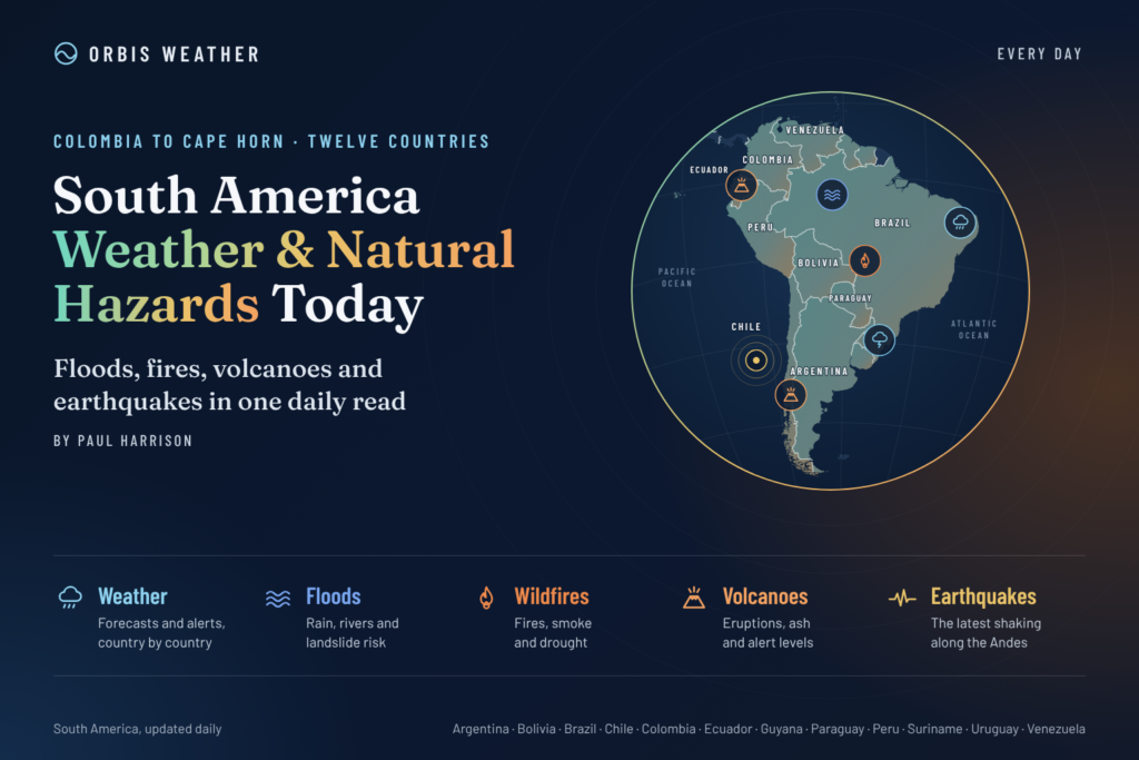
South America enters Tuesday, November 17, with heavy rainfall, thunderstorms, landslide threats and changing seasonal weather patterns among the continent’s principal natural hazard concerns.
Brazil remains an important region to watch as tropical moisture and developing weather systems create the potential for heavy downpours across central and southeastern areas. Colombia faces a more clearly documented threat, with its national meteorological agency identifying high landslide danger in municipalities across eight departments.
Meanwhile, Ecuador and Peru require continued monitoring for rainfall-related hazards and changing temperatures, while Argentina, Paraguay and Uruguay face the possibility of unsettled spring weather as summer approaches.
The developing 2026 El Niño event is also influencing the broader atmospheric circulation across South America, potentially affecting rainfall distribution, drought vulnerability and the frequency of extreme weather conditions. However, individual storms and disasters cannot automatically be attributed to El Niño.
Today’s principal weather concerns: Heavy rain, flash flooding, thunderstorms, lightning, landslides, changing river conditions, heat exposure and mountain weather.
Reporting note: This update combines newly available official November 17 information with earlier forecasts and seasonal risk assessments. Confirmed alerts are distinguished from potential hazards. It is not a complete real-time inventory of every warning across South America.
1. Brazil – Heavy Rain and Thunderstorms Remain a Major Concern
Brazil is one of the continent’s main weather-monitoring priorities as the country moves further into its warm and increasingly humid season.
Earlier forecasts from Brazil’s National Institute of Meteorology (INMET) identified the potential for substantial rainfall across parts of central and southeastern Brazil during the beginning of the week.
Central and southeastern Brazil
Areas to monitor include:
São Paulo and Rio de Janeiro
Minas Gerais and Espírito Santo
Goiás and the Federal District
Mato Grosso and Mato Grosso do Sul
Where thunderstorms organize, potential hazards include intense short-duration rainfall, lightning, strong wind gusts, isolated hail and localized flash flooding.
Urban centers such as São Paulo and Belo Horizonte are particularly vulnerable to drainage problems during intense downpours.
However, the exact locations and severity of Tuesday’s storms require confirmation from the latest INMET warning maps.
Southern Brazil
Paraná, Santa Catarina and Rio Grande do Sul should continue monitoring frontal systems and thunderstorm development.
Additional rainfall would be especially concerning in locations experiencing saturated ground or elevated river levels.
A new widespread flooding emergency for November 17 has not been independently established from the sources reviewed.
Northern Brazil and the Amazon
Across Amazonas, Pará and neighboring states, tropical moisture can support afternoon showers and thunderstorms.
Lightning, heavy local rainfall and rapidly changing river conditions remain important seasonal hazards.
Brazil outlook: Heavy rainfall and thunderstorms remain the main concerns, particularly across central and southeastern areas. Local warning levels should be verified through INMET before travel or outdoor activities.
2. Colombia – Official High Landslide Alerts Across Eight Departments
Colombia has one of the clearest officially documented natural hazard threats in today’s report.
The Institute of Hydrology, Meteorology and Environmental Studies (IDEAM) issued a landslide threat assessment dated November 17, identifying areas where recent rainfall has increased soil moisture and slope instability.
High landslide threat
IDEAM identifies high landslide threat levels for certain municipalities in the following departments:
Antioquia
Caldas
Cauca
Chocó
Nariño
Putumayo
Santander
Tolima
These warnings apply to particular municipalities, not necessarily every location within each department.
Moderate landslide threat
Moderate threat levels also affect municipalities in several departments, including Arauca, Boyacá, Caquetá, Cundinamarca, Córdoba, Meta, Norte de Santander, Risaralda and Valle del Cauca, alongside some of the departments already mentioned.
The warning reflects the accumulation of rainfall and increased moisture in steep terrain, where slopes may become unstable.
Residents should remain alert for cracks in the ground, falling rocks, unusual water seepage and sudden changes in streams or drainage channels.
Mountain roads are particularly vulnerable to landslides, especially where heavy vehicles and traffic use narrow routes cut into steep hillsides.
IDEAM has also published a national weather forecast covering November 17–19, providing updated guidance for rainfall and atmospheric conditions.
Colombia outlook: Landslides are a significant documented hazard today. Residents and travelers in affected municipalities should consult IDEAM’s local threat classifications and follow emergency instructions.
3. Peru – Heavy Rain, Lightning and Hail Warning Through Tuesday
Peru faces a documented rainfall threat today, particularly across its northern coast and Andean highlands.
The National Institute of Civil Defense (INDECI), using meteorological information from SENAMHI, issued Bulletin No. 467-2026 covering November 15–17.
The bulletin forecasts light to heavy precipitation across sections of the highlands, with locally intense rainfall also possible in northern coastal areas.
Areas of greatest concern
Tumbes and inland coastal sections of Piura are highlighted for potentially heavy rainfall.
Across the Andes, the warning includes the possibility of thunderstorms, strong wind gusts and hail at higher elevations.
Forecast daily rainfall amounts in the bulletin include:
Region | Forecast rainfall |
|---|---|
Northern coast | 4–12 mm (0.16–0.47 in) |
Northern highlands | 5–29 mm (0.20–1.14 in) |
Central highlands | 6–13 mm (0.24–0.51 in) |
Southern highlands | Around 13 mm (0.51 in) |
Hail is possible above approximately 2,800 meters (9,186 feet) in the central and southern highlands.
Thunderstorms may produce wind gusts approaching 40 km/h (25 mph).
These are forecast ranges across the warning period and affected regions, not confirmed rainfall measurements for individual cities.
Peru outlook: Heavy rainfall, lightning, hail and localized flooding remain important hazards through Tuesday. Mountain communities should be particularly cautious around steep slopes and vulnerable roads.
4. Ecuador – Rainfall and Landslide Vulnerability Remain Under Watch
Ecuador continues to require monitoring for rainfall-related hazards, particularly across western coastal regions and mountainous communities.
The combination of tropical moisture, steep terrain and localized thunderstorms can create rapidly changing conditions.
Western Ecuador
Guayas, Los Ríos, Manabí and neighboring areas should monitor local rainfall forecasts.
Where heavy downpours develop, temporary street flooding and rising water levels in small streams are possible.
Guayaquil and surrounding low-lying communities are particularly sensitive to intense rainfall combined with drainage limitations.
Andean Ecuador
Across the highlands, heavy rainfall can destabilize slopes and affect mountain roads.
Travelers should check conditions before crossing remote mountain passes or using roads previously affected by landslides.
Ecuador outlook: Flooding and landslide vulnerability remain monitoring priorities. No new nationwide emergency declaration for November 17 was independently verified in the reviewed sources.
5. Argentina – Spring Thunderstorms and Changing Weather Systems
Argentina continues its transition toward the Southern Hemisphere summer, bringing increasingly warm conditions across northern and central provinces.
Changing atmospheric systems may produce thunderstorms, gusty winds and periods of heavy rainfall.
Northern Argentina
Corrientes, Chaco, Formosa and Misiones should monitor thunderstorm development and local river conditions.
Communities near major waterways should remain attentive to official river forecasts, particularly where previous rainfall has affected drainage or infrastructure.
Central Argentina
Córdoba, Santa Fe and Buenos Aires Province may experience changing weather as frontal systems move across the country.
Potential thunderstorm hazards include lightning, localized heavy rainfall and strong gusts.
Patagonia
Southern Argentina remains vulnerable to strong winds and rapidly changing weather, especially across exposed mountain areas.
Travelers visiting Patagonia should prepare for significant differences between sheltered valleys and elevated terrain.
Argentina outlook: Thunderstorms, wind and changing frontal conditions are the principal monitoring concerns. Specific severe-weather alerts for Tuesday should be confirmed through Argentina’s Servicio Meteorológico Nacional.
6. Paraguay and Uruguay – Thunderstorm and River Monitoring
Paraguay
Paraguay remains vulnerable to periods of heavy rainfall and river flooding, particularly near the Paraguay and Paraná river systems.
Changing weather patterns across neighboring Brazil and Argentina can influence rainfall and river conditions.
Additional thunderstorms could create localized flooding in poorly drained communities.
However, the presence of an active nationwide flooding emergency on November 17 has not been independently verified.
Uruguay
Uruguay faces changing spring weather as frontal systems move across southern South America.
Showers, thunderstorms and gusty winds are possible when these systems cross the region.
Coastal areas should also monitor marine forecasts when strong winds develop.
Paraguay and Uruguay outlook: Thunderstorms and localized flooding remain potential hazards, with current warnings requiring confirmation from national meteorological agencies.
7. Chile – Mountain Weather, Wind and Wildfire Awareness
Chile’s weather varies considerably between the Atacama Desert, central valleys, southern forests and Patagonia.
Northern Chile
Dry conditions are characteristic of much of the Atacama region, although mountain weather can change rapidly.
Travelers crossing high-altitude routes should monitor forecasts for wind, temperature changes and possible precipitation.
Central Chile
As temperatures rise toward summer, dry vegetation and periods of strong wind can increase wildfire susceptibility.
Communities around Santiago, Valparaíso and surrounding valleys should remain attentive to official fire-risk information.
Southern Chile
Southern Chile and Patagonia may experience periods of wind, rainfall and rapidly changing mountain conditions.
Chile outlook: Mountain weather, strong winds and seasonal wildfire vulnerability remain important concerns. No new major wildfire emergency for November 17 was confirmed in the reviewed sources.
8. Bolivia – Thunderstorms and Mountain Hazards
Bolivia’s weather is increasingly influenced by seasonal moisture as the Southern Hemisphere summer approaches.
The country’s tropical lowlands, foothills and high-altitude regions experience markedly different conditions.
Tropical lowlands
Areas around Santa Cruz, Beni and Pando may experience afternoon thunderstorms when moisture and atmospheric instability increase.
Heavy downpours can produce localized flooding, particularly in poorly drained areas.
Andes and foothills
Steep slopes and mountain roads can become dangerous during prolonged rainfall.
Lightning and sudden changes in visibility are additional concerns.
Bolivia outlook: Thunderstorms, localized flooding and landslide vulnerability are seasonal risks, but specific new emergency warnings for today have not been independently verified.
9. Venezuela, Guyana, Suriname and French Guiana – Tropical Rainfall Monitoring
Northern South America remains influenced by tropical moisture and atmospheric convergence.
Venezuela
Warm conditions and scattered thunderstorms can affect parts of the country, with local rainfall intensity varying considerably.
Mountainous areas require additional caution when prolonged rainfall develops.
Guyana, Suriname and French Guiana
Tropical showers and thunderstorms remain possible across coastal and inland areas.
The principal potential hazards include lightning, localized flooding and rapidly rising streams.
No new region-wide natural disaster emergency has been confirmed from the reviewed information.
10. Earthquakes, Volcanoes and Other Geological Hazards
South America’s Pacific margin remains one of the world’s most seismically active regions.
Chile, Peru, Ecuador and Colombia lie along tectonic boundaries where earthquakes can occur with little warning.
Earthquake monitoring
The principal sources for verified earthquake information include the USGS Earthquake Hazards Program and national seismic agencies.
No specific significant earthquake occurring on November 17 is being reported here without independently verified event data.
Volcanic activity
Active volcanic systems in Chile, Ecuador, Peru and Colombia require continuous monitoring.
Volcanic ash can disrupt aviation, affect air quality and create hazards for communities close to active volcanoes.
No new major eruption is claimed in this report without a current official bulletin.
Residents near active volcanoes should follow the relevant national geological service rather than relying on regional weather forecasts alone.
11. South America Natural Hazards Summary – November 17, 2026
Country | Main weather or natural hazard concern | Information status |
|---|---|---|
Brazil | Heavy rain, severe thunderstorms, hail and flooding | Official forecast |
Colombia | High landslide threat in multiple municipalities | Official alert |
Peru | Heavy rain, lightning, hail and strong winds | Official bulletin |
Ecuador | Flooding and landslide vulnerability | Monitoring |
Argentina | Thunderstorms and changing frontal weather | Monitoring |
Paraguay | Rainfall and river flooding vulnerability | Monitoring |
Uruguay | Frontal systems and thunderstorms | Monitoring |
Chile | Mountain weather and wildfire potential | Seasonal risk |
Bolivia | Thunderstorms and landslide vulnerability | Seasonal risk |
Venezuela and Guianas | Tropical showers and lightning | Seasonal risk |
These classifications are editorial descriptions of the available evidence, not official emergency alert levels.
12. South America Weather Outlook – November 18–19
Wednesday, November 18
Brazil’s National Institute of Meteorology expects the atmospheric trough responsible for the current unsettled pattern to persist at least through Wednesday.
Its latest weekly forecast, covering November 16–23, identifies several areas with potentially substantial rainfall totals.
Selected forecast rainfall accumulations for November 16–23
These are multi-day forecasts, not 24-hour totals.
| Central/northern Goiás and parts of Tocantins | Up to 200 mm (7.9 in), locally higher |
| Western/southwestern Bahia | Around 150–200 mm (5.9–7.9 in) in wetter areas |
| Parts of Amazonas | 100–150 mm (3.9–5.9 in), locally over 200 mm |
| Western/northern Rio Grande do Sul and nearby Santa Catarina | 100–150 mm (3.9–5.9 in) |
INMET also identifies the possibility of intense thunderstorms developing in southwestern Rio Grande do Sul late Wednesday, with the activity moving toward northwestern areas and Santa Catarina.
Thursday, November 19
Further unsettled weather remains possible across Brazil, while Colombia’s mountainous regions will require continued landslide monitoring.
In Peru, new forecasts will be needed to determine whether the rainfall threat continues beyond the November 17 bulletin.
Across the remainder of the continent, local weather systems and updated national warnings will determine the extent of any severe conditions.
13. Weather and Natural Hazard Safety Advice
Residents and travelers across South America should take precautions appropriate to local conditions.
Flooding: Never drive through flooded roads. Water depth and current strength can be deceptive.
Landslides: Avoid unstable slopes and watch for cracks, falling rocks or sudden changes in water flow.
Thunderstorms: Seek shelter inside a substantial building when lightning approaches.
Strong winds: Secure loose outdoor objects and avoid standing beneath trees during severe gusts.
Heat: Maintain hydration, limit strenuous activity during peak temperatures and use sun protection.
Earthquakes: Drop, cover and hold on during shaking. Follow coastal tsunami evacuation instructions if strong or prolonged shaking occurs.
Volcanoes: Follow official exclusion zones and aviation advisories where volcanic ash is present.
14. Official Weather and Natural Hazard Sources
Orbis Weather recommends consulting the following agencies for local warnings and emergency information.
Country or region | Official source |
|---|---|
Brazil | |
Colombia | |
Peru | |
Ecuador | |
Argentina | |
Chile | |
Bolivia | |
Paraguay | |
Uruguay | |
International earthquakes | |
Regional climate |
Final Outlook – South America, Tuesday, November 17, 2026
South America’s weather concerns today are dominated by the potential for heavy rainfall and severe thunderstorms across Brazil, documented landslide threats in Colombia and officially forecast rainfall across parts of Peru.
Brazil’s situation deserves particular attention.
INMET’s November 16 forecast confirms a broad moisture corridor stretching from the southern Amazon toward central and southeastern Brazil, with heavy rainfall and thunderstorms expected to persist into Wednesday.
The agency also identifies a hail threat across southern Brazil and potentially severe thunderstorms later in the week.
Colombia’s November 17 landslide assessment provides another important warning, identifying high-risk municipalities across eight departments.
Peru’s official rainfall bulletin remains valid through Tuesday, with heavy rain possible in the north and thunderstorms, hail and strong gusts affecting portions of the highlands.
Across the continent, the interaction between tropical moisture, frontal systems, complex mountain terrain and the developing El Niño event makes continued monitoring essential.
Orbis Weather will continue following significant storms, flooding, earthquakes, volcanic activity, wildfires and other natural hazards affecting South America
About the Author
Paul Harrison — Founder & Publisher, Orbis Weather
Paul Harrison founded Orbis Weather in 2026 to make global weather and natural-hazard information easier to find, follow and understand. His coverage includes tropical cyclones, severe weather, extreme temperatures, earthquakes, volcanoes, wildfires, flooding and significant natural disasters worldwide.
View all articles by Paul Harrison → | Editorial Standards →
Global Weather Tracker Hub
Explore weather maps, tropical systems, storms and natural hazards around the world.
No matching trackers found.