
Southeast Asia Earthquake Tracker – Live Earthquakes

- Europe Weather & Natural Hazards Today – Friday, November 13, 2026 7:18 PM
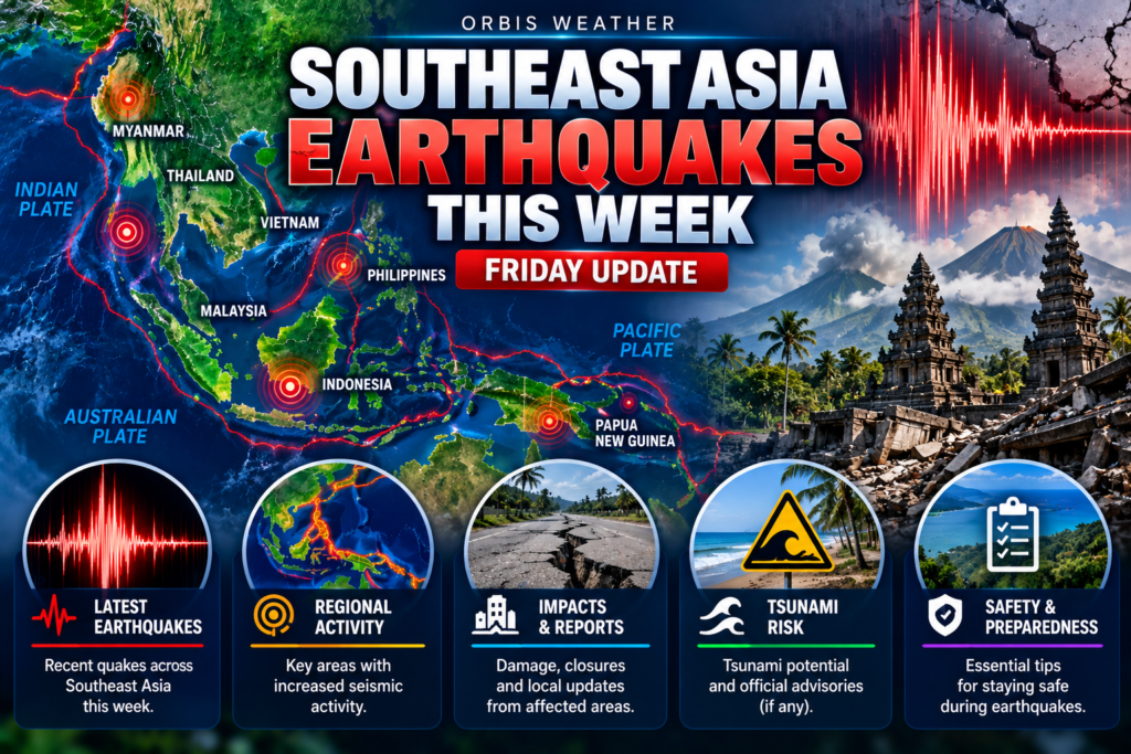
- Southeast Asia Earthquakes This Week: Friday, November 13, 2026 7:09 PM
- Southeast Asia Weather & Natural Hazards Today: Friday, November 13, 2026 6:58 PM
- Africa Weather & Natural Hazards Today — Friday, November 13, 2026 6:35 PM
- Middle East Weather & Natural Hazards Today – November 13, 2026 4:07 PM
- America’s Hot Spots This Week November 12, 2026 3:17 PM
- Australian Region Tropical Weather Update — Friday, November 13, 2026 11:49 AM
- Southwest Indian Ocean Tropical Weather Update – Friday, November 13, 2026 11:40 AM
- Australia, New Zealand & Oceania Weather & Natural Hazards Today — Friday, November 13, 2026 11:16 AM
- Evacuation Alert Issued for Entire Village of Pemberton as Flood Risk Rises 10:36 AM
- North America Weather & Natural Hazards Today — November 12, 2026 9:49 AM
- Central America Weather & Natural Hazards Today – Thursday, November 12, 2026 9:35 AM
- South America Weather & Natural Hazards Today – Thursday, November 12, 2026 9:09 AM
- Daily Earthquakes, Storms, Fires & Floods Report — November 12, 2026 9:00 AM
- Weekly Global Climate Pulse: Thursday, November 12, 2026 8:50 AM
- Tropical Atlantic Daily Report: Thursday, November 12, 2026 7:26 AM
- Eastern & Central Pacific Tropical Weather Update: Thursday, November 12, 2026 7:18 AM
- Western Pacific Tropical Weather Update – November 12, 2026 7:10 AM




Southeast Asia Earthquakes This Week: Friday, November 13, 2026
· @Paul
By Paul Harrison, Orbis Weather
The strongest earthquake in Southeast Asia this week struck the sea east of Seram, Maluku, at 18:48 WIT (UTC+9) on Monday 9 November. Indonesia’s meteorology and geophysics agency, BMKG, measured it at magnitude 5.5; the US Geological Survey (USGS) gave 5.4. A second USGS magnitude 5.4 hit the sea south-west of the Tanimbar Islands at 10:53 WIT on Tuesday 10 November, which BMKG also rated 5.4. BMKG said none of the week’s magnitude 5+ quakes had tsunami potential, and news reports carried no damage or casualties.
It was a moderate week, with activity concentrated in eastern Indonesia. The most widely felt quake was a deep one under Sukabumi, West Java, on Tuesday night, felt as far as the Bandung area. The strongest shaking BMKG reported was intensity IV, in Sigi (Central Sulawesi) and Konawe Selatan (Southeast Sulawesi). This report is current to 06:58 WIB (Jakarta/Bangkok, UTC+7) and 07:58 (Manila/Makassar/Singapore, UTC+8) on Friday 13 November, which is 18:58 EST on Thursday 12 November.
Key facts
Item | Figure | Source |
|---|---|---|
Period covered | 00:00 UTC Fri 6 Nov to 23:58 UTC Thu 12 Nov 2026 | USGS query time |
Quakes of M4.5+ in the region | 20 | USGS |
Largest by USGS | M5.4 east of Seram (9 Nov) and M5.4 south-west of Tanimbar (10 Nov) | USGS |
Largest by BMKG | M5.5, 20 km north-west of Seram Bagian Timur (9 Nov) | BMKG |
Largest in the Philippines | M4.9 twice: off Davao Occidental (6 Nov) and 607 km deep under the Moro Gulf area (8 Nov) | USGS |
Strongest shaking reported | Intensity IV in Sigi (7 Nov) and Konawe Selatan (11 Nov) | BMKG |
Tsunami | None; BMKG: “Tidak Berpotensi Tsunami” (no tsunami potential) for all M5+ events | BMKG |
Deaths or damage | None reported | News reports, 7 to 13 Nov |
Latest felt quake | M4.6, 03:14 WITA Fri 13 Nov, sea north-west of Pulau Panjang, West Nusa Tenggara | BMKG |
This week’s earthquakes of magnitude 4.5 and above
USGS recorded 20 quakes of magnitude 4.5 or more in Southeast Asia this week. The table lists the 16 largest, because two magnitude 4.6 events tie for 15th place.
Local date and time | USGS magnitude | USGS location (area) | Depth (km) |
|---|---|---|---|
Wed 11 Nov, 21:17 WIT | 4.7 | 168 km W of Fakfak (sea east of Seram, Maluku) | 10 |
Wed 11 Nov, 21:10 WIT | 4.6 | 130 km E of Masohi (sea east of Seram, Maluku) | 10 |
Wed 11 Nov, 20:32 WIT | 5.1 | Pulau Pulau Tanimbar (Tanimbar Islands, Maluku) | 15 |
Wed 11 Nov, 00:51 WIT | 5.1 | 139 km ESE of Labuha (sea off South Halmahera, North Maluku) | 10 |
Tue 10 Nov, 21:31 WIB | 4.7 | 3 km SSE of Sukabumi (West Java) | 101 |
Tue 10 Nov, 17:34 WIT | 5.0 | 58 km NE of Fef (sea off the Bird’s Head, West Papua) | 35 |
Tue 10 Nov, 10:53 WIT | 5.4 | Pulau Pulau Tanimbar (Tanimbar Islands, Maluku) | 10 |
Mon 9 Nov, 20:25 WIT | 4.7 | 271 km N of Tobelo (sea north of Halmahera) | 98 |
Mon 9 Nov, 18:53 WIT | 4.8 | 183 km E of Masohi (sea east of Seram, Maluku) | 10 |
Mon 9 Nov, 18:48 WIT | 5.4 | 160 km E of Masohi (sea east of Seram, Maluku) | 10 |
Mon 9 Nov, 01:45 WIT | 4.6 | 117 km NE of Tobelo (sea north-east of Halmahera) | 225 |
Sun 8 Nov, 07:25 PHT | 4.9 | 41 km WSW of Gadung (Moro Gulf area, Mindanao) | 607 |
Sun 8 Nov, 05:55 WIT | 4.7 | 43 km ESE of Ambon (Maluku) | 137 |
Sat 7 Nov, 17:47 WITA | 4.7 | 156 km ESE of Modisi (Molucca Sea) | 39 |
Sat 7 Nov, 03:07 WITA | 4.8 | 36 km WNW of Poso (Central Sulawesi) | 10 |
Fri 6 Nov, 14:28 PHT | 4.9 | 41 km SW of Balangonan (sea off southern Mindanao) | 35 |
Source: USGS earthquake catalogue query, run at 23:58 UTC on 12 November. Not shown: four magnitude 4.5 events, east of Masohi, off Bitung, near Blangpidie (Aceh) and west of Abepura (Papua). Time zones: WIB is UTC+7, WITA and PHT are UTC+8, WIT is UTC+9.
The week’s notable quakes
Seram cluster, Maluku (Mon 9 to Wed 11 Nov). BMKG placed the M5.5 main shock at sea 20 km north-west of Seram Bagian Timur, 10 km deep, at 18:48 WIT. It was felt at intensity III–IV in Bula. BMKG advised residents to “be careful of aftershocks that may occur”. USGS rated it M5.4 (moment magnitude), with a green alert on its PAGER loss-estimate system. USGS then logged five more quakes of M4.3 to M4.8 in the same sea area by Wednesday night.
Tanimbar pair, Maluku (Tue 10 and Wed 11 Nov). BMKG’s M5.4 struck at sea 90 km south-west of Tanimbar, 84 km deep, and was felt at intensity III in Saumlaki. USGS gave M5.4 but a depth of only 10 km. Liputan6 reported no casualties or material damage. USGS recorded a second quake nearby, M5.1 at 15 km, at 20:32 WIT on Wednesday.
Halmahera and West Papua (Tue 10 and Wed 11 Nov). At 00:51 WIT (Wednesday), a BMKG M5.1 struck at sea 122 km north-east of South Halmahera, 10 km deep. BMKG attributed it to strike-slip (sideways) movement on the Sorong fault; it was felt at intensity II–III. USGS also gave M5.1. Earlier, at 17:34 WIT, BMKG first measured M5.3 off Manokwari, then updated it to M5.0 at 11 km, 136 km north-west of Manokwari. BMKG described thrust movement on an active fault, felt at II–III in Manokwari. USGS gave M5.0 at 35 km.
Felt quakes in Java, Sulawesi, Aceh and Nusa Tenggara. The Sukabumi quake (21:31 WIB Tuesday) was M4.0 at 102 km depth by BMKG and M4.7 by USGS. It was felt at intensity III in Cianjur and II–III in Ciwidey and Pangalengan. One Kebonpedes resident told Liputan6: “I was watching TV when suddenly it shook.” Other felt events:
- Sigi, Central Sulawesi, Sat 7 Nov, 03:07 WITA: BMKG M4.9 (USGS M4.8), intensity IV in Sigi, III in Palu. Djati Cipto Kuncoro, head of BMKG’s Palu station, linked it to the Palolo Fault, segment Palolo A.
- Konawe Selatan, Southeast Sulawesi, Wed 11 Nov, 00:04 WITA: BMKG M4.0, 5 km deep, intensity IV; one M2.6 aftershock followed, Kendariinfo reported.
- Gayo Lues, Aceh, Wed 11 Nov, 05:09 WIB: BMKG M4.9, 4 km deep, intensity III–IV; an M4.3 followed at 06:05 WIB. USGS gave M4.5.
- Off Pulau Panjang, West Nusa Tenggara, Fri 13 Nov, 03:14 WITA: BMKG M4.6, 17 km deep, intensity III on Sumbawa and Lombok, with two aftershocks reported by 03:40 WITA.
Philippines. The two largest USGS events were M4.9 at sea off southern Mindanao (14:28 PHT Friday 6 Nov, 35 km deep) and M4.9 at 607 km beneath the Moro Gulf area (07:25 PHT Sunday). PHIVOLCS listed an M4.6 57 km south-south-west of Maasim, Sarangani, at 00:27 PHT on Wednesday, 8 km deep. It recorded an Ms 4.2 off Balut Island on Sunday, felt weakly in Sarangani province. PHIVOLCS classed that one as an aftershock of June’s Mw7.8 offshore Sarangani and Mw6.5 offshore Davao Occidental quakes. Several M4.0 events struck off Surigao del Sur and Surigao del Norte on 10 and 11 November.
Elsewhere. Timor-Leste: USGS recorded only an M4.3 at sea 78 km north-west of Pante Makasar (06:06 UTC+9, Tuesday). Myanmar: the Department of Meteorology and Hydrology logged five minor quakes, the largest M4.2 near Yedashe at 16:07 (UTC+6:30) on Wednesday, with no felt reports. Thailand’s Meteorological Department measured that event at M4.5. The Andaman Sea, Thailand, Vietnam, Laos, Cambodia, Malaysia, Singapore and Brunei had no M4.0+ events in the USGS catalogue.
Damage, casualties and tsunami status
No deaths, injuries or damage were reported this week. Liputan6 reported no casualties or material damage from the Tanimbar quake and no damage from the Halmahera quake (10 November). Local outlets reported no damage in Sukabumi, Sigi, Konawe Selatan and Pulau Panjang (7 to 13 November). For Gayo Lues, Liputan6 said there were “no official reports yet of building damage or casualties” (11 November). BMKG stated that each of its four M5+ events had no tsunami potential, and USGS flagged none for tsunami.
Why Southeast Asia has so many earthquakes
The region sits where several tectonic plates converge, and this week’s quakes followed those boundaries. The Seram and Tanimbar events lie along the Banda Arc, where the Indo-Australian and Eurasian plates are converging. Off Sumatra and Java, the Indo-Australian plate dives beneath the Eurasian plate along the Sunda megathrust, a fault about 5,500 km long. East of the Philippines, the Philippine Trench marks a further subduction zone, where one plate slides beneath another. BMKG itself blamed smaller faults for several felt quakes: the Sorong fault off Halmahera, the Palolo Fault in Sigi, and local active faults off Manokwari, Konawe Selatan and Sumbawa. USGS classes quakes 0–70 km deep as shallow, 70–300 km as intermediate and 300–700 km as deep, so the Sukabumi event was intermediate and the Moro Gulf event deep.
What to watch
The main things to follow are aftershocks in eastern Indonesia and southern Mindanao, and volcanoes on raised alert.
- Seram and Tanimbar seas: both areas produced repeated M4.5+ quakes over three days; BMKG has advised caution over possible aftershocks.
- Sarangani and Davao Occidental: PHIVOLCS logged a string of small quakes (M1.7 to M3.4) near Balut and Sarangani islands on 7 and 8 November, in the area of June’s offshore quakes.
- Mayon, Philippines: PHIVOLCS recorded a low- to moderate-level eruption at about 11:56 on 11 November; Alert Level 3 remains, with entry to the 6 km Permanent Danger Zone prohibited (Daily Tribune).
- Semeru, Merapi and Anak Krakatau, Indonesia: all three are at Level III (Siaga) per volcanology agency PVMBG; Semeru sent a pyroclastic flow 5 km toward Curah Kobokan on 6 November.
- Official channels: BMKG (warning.bmkg.go.id) and PHIVOLCS (earthquake.phivolcs.dost.gov.ph) issue the authoritative magnitudes and any tsunami warnings.
About this article
This article summarises agency catalogues and news reports; it is not an official warning. The week runs from 00:00 UTC on Friday 6 November to the USGS query at 23:58 UTC on Thursday 12 November. The USGS search box spans latitudes 12°S to 29°N and longitudes 91°E to 142°E; events near China, Taiwan and Japan’s Bonin Islands (up to M4.9) fall outside the region and are left out. Agencies use different stations and magnitude types, so their figures differ. BMKG issues automatic first parameters within minutes and may update them, as it did off Manokwari. Felt reports depend on who reports shaking, so they are incomplete for remote areas.
Glossary
- Magnitude: the size of an earthquake at its source; each whole step means about 32 times more energy, according to USGS.
- Intensity (MMI): how strongly shaking is felt at a given place, in Roman numerals; it mostly depends on distance from the rupture.
- Epicentre: the point on the surface directly above where the rupture starts.
- Aftershock: a smaller quake that follows a larger one in the same area.
- Subduction: one tectonic plate sinking beneath another, as along the Sunda megathrust.
Frequently asked questions
Was there a tsunami threat this week? No. BMKG stated “Tidak Berpotensi Tsunami” (no tsunami potential) for every magnitude 5+ event, and USGS flagged none. All of the week’s quakes were below magnitude 6.
Why do BMKG and USGS give different magnitudes? The agencies use different station networks and magnitude methods. BMKG put the Seram quake at 5.5 and the Sukabumi quake at 4.0; USGS gave 5.4 and 4.7. Depths can differ too, as at Tanimbar (84 km versus 10 km).
Where was the Sukabumi quake felt? BMKG placed it under land 15 km south of Kota Sukabumi. Shaking was reported in Cianjur, Sukabumi and towns around Bandung such as Lembang and Padalarang, mostly at intensity II–III.
Is the activity near Seram a sign of a bigger quake to come? No agency has said so, and earthquakes cannot be predicted. BMKG’s standing advice after these events is to stay alert for aftershocks.
How does this week compare with the year’s major quakes? It was far quieter. According to Wikipedia’s list of 2026 earthquakes, the region’s largest this year was a magnitude 7.8 off Mindanao on 7 June, which killed 82 people.
Sources
Catalogues and bulletins
- USGS catalogue, M4.5+, 6–12 Nov 2026 (queried 12 Nov, 23:58 UTC)
- USGS catalogue, M4.0+ by magnitude (12 Nov)
- USGS catalogue, M5.5+ since 15 Oct (12 Nov)
- BMKG: Gempabumi Dirasakan and BMKG: Gempabumi M5+ (13 Nov)
- BMKG event pages: Seram, 9 Nov; Tanimbar, 10 Nov; Manokwari, 10 Nov; Halmahera Selatan, 10 Nov
- BMKG InaTEWS warning page (13 Nov)
- PHIVOLCS latest earthquake information (13 Nov)
- Myanmar DMH earthquake reports: 6 Nov, 8 Nov, 8 Nov, 10 Nov, 11 Nov
- Thai Meteorological Department earthquake list (13 Nov)
News
- iNews: M5.5 Seram Bagian Timur (9 Nov)
- Liputan6: M5.4 Tanimbar (10 Nov)
- VIVA Bogor: M5.3 Manokwari (10 Nov)
- Liputan6: M5.1 Halmahera Selatan (10 Nov)
- BeritaSatu: M4.0 Sukabumi (10 Nov)
- Liputan6: Sukabumi residents (10 Nov)
- Koran Jakarta: M4.9 Sigi, Palolo Fault (7 Nov)
- Kendariinfo: M4.0 Konawe Selatan (11 Nov)
- detikNews: M4.9 Gayo Lues (11 Nov)
- Liputan6: M4.3 Gayo Lues (11 Nov)
- kicknews.today: M4.6 Lombok and Sumbawa (13 Nov)
- PhilNews: Ms 4.2 off Balut Island (8 Nov)
- Daily Tribune: Mayon ashfall advisory (11 Nov)
- Liputan6: three Java volcanoes at Siaga (12 Nov)
- MalangTIMES: Semeru pyroclastic flow (6 Nov)
Background
🕒 Latest M4.0+ Earthquakes
🌏 Regional Activity • Last 7 Days
🌊 Tsunami Note
Official Sources
Global Weather Tracker Hub
Explore weather maps, tropical systems, storms and natural hazards around the world.
No matching trackers found.
🌏 Southeast Asia Earthquake Tracker – Live Earthquakes
Monitor earthquakes across Indonesia, the Philippines, Myanmar, Malaysia, Singapore, Thailand, Vietnam and surrounding areas with the Orbis Weather Southeast Asia Earthquake Tracker.
Southeast Asia lies within one of the most geologically active regions on Earth. Powerful tectonic forces surrounding Indonesia and the Philippines regularly produce earthquakes, volcanic activity and, in some circumstances, tsunamis.
The Orbis Weather tracker provides a regional view of significant earthquake activity, including recent M4.0+ earthquakes, stronger events and earthquakes carrying tsunami-related flags in the source data.
Earthquake parameters can be revised as seismic agencies analyze additional information, so always consult national authorities for official earthquake and tsunami warnings.
🌏 Why Southeast Asia Has So Many Earthquakes
Southeast Asia sits near the boundaries of several major and smaller tectonic plates.
These enormous sections of Earth’s crust move slowly relative to one another.
Where plates collide, slide past each other or one plate descends beneath another, stress can accumulate in the Earth’s crust.
When that stress is suddenly released, an earthquake occurs.
Indonesia and the Philippines are particularly active because they lie along complicated plate boundaries associated with the broader Pacific Ring of Fire.
🔥 What Is the Pacific Ring of Fire?
The Pacific Ring of Fire is a vast zone of earthquakes and volcanoes surrounding much of the Pacific Ocean.
It extends through areas including New Zealand, Indonesia, the Philippines, Japan, Russia, Alaska and the western coasts of North and South America.
Many of the world’s active volcanoes and powerful earthquakes occur within this broad tectonic region.
Indonesia and the Philippines form important parts of this system.
🇮🇩 Why Indonesia Has So Many Earthquakes
Indonesia is one of the most earthquake-prone countries in the world.
The country sits at the meeting point of several tectonic systems, including major subduction zones.
Along a subduction zone, one tectonic plate is forced beneath another.
These boundaries can produce powerful earthquakes when accumulated tectonic stress is suddenly released.
Indonesia’s geography — thousands of islands spread across several active tectonic zones — means earthquake activity can occur from Sumatra and Java through Sulawesi, the Banda Sea, Maluku and Papua.
🇵🇭 Earthquakes in the Philippines
The Philippines is also highly seismically active.
The country lies between major tectonic systems and contains numerous active faults and offshore trenches.
Earthquakes can occur beneath the islands or offshore.
Some offshore earthquakes may require tsunami evaluation depending on their magnitude, depth, location and fault movement.
As in Indonesia, earthquake risk varies considerably between different parts of the country.
🇲🇲 Earthquakes in Myanmar
Myanmar has a different but still important tectonic setting.
One of its major geological features is the Sagaing Fault, a large strike-slip fault extending through much of the country.
Strike-slip faults occur where blocks of Earth’s crust move primarily horizontally past each other.
Significant earthquakes along active faults can cause intense ground shaking, particularly near populated areas.
🇸🇬 Can Singapore Experience Earthquakes?
Singapore has a much lower local earthquake hazard than Indonesia or the Philippines because it is not located directly on a major active plate boundary.
However, powerful earthquakes in Sumatra can sometimes produce noticeable shaking in Singapore.
Shaking may be particularly noticeable to occupants of taller buildings.
This does not mean Singapore has suddenly become the epicenter of an earthquake. Seismic waves from sufficiently powerful regional earthquakes can travel considerable distances.
🇲🇾 Earthquakes and Malaysia
Much of Peninsular Malaysia has relatively low seismicity compared with neighboring Indonesia.
However, earthquakes in Sumatra can sometimes be felt across parts of Malaysia.
East Malaysia is closer to more active tectonic regions, and Sabah in particular has experienced damaging earthquakes.
Regional earthquake monitoring is therefore relevant even in countries that experience fewer major local earthquakes.
🇹🇭 Earthquakes in Thailand
Thailand is not as seismically active as Indonesia, but earthquake hazards still exist.
Northern and western Thailand contain active faults, while powerful earthquakes in neighboring Myanmar can produce shaking across the border.
Earthquake risk should therefore not be considered zero simply because major events occur less frequently.
🇻🇳 Earthquakes in Vietnam
Vietnam generally experiences less earthquake activity than Indonesia or the Philippines, but earthquakes do occur.
Northern Vietnam and other areas contain active fault systems capable of producing seismic activity.
Offshore earthquakes elsewhere in the region may also be relevant when evaluating tsunami hazards.
📏 What Does Earthquake Magnitude Mean?
Magnitude measures the size of an earthquake at its source.
The scale is logarithmic rather than linear.
That means the difference between a magnitude 5 and magnitude 6 earthquake is much more substantial than the numbers might suggest.
Each whole-number increase represents approximately 32 times more energy release.
A magnitude 6 earthquake therefore releases roughly 32 times as much energy as a magnitude 5 earthquake.
Magnitude alone does not determine how destructive an earthquake will be.
📍 What Is an Earthquake Epicenter?
The earthquake begins underground at a location known as the hypocenter, or focus.
The epicenter is the point on Earth’s surface directly above that underground source.
Maps generally display the epicenter because it provides a convenient geographic location for the earthquake.
The strongest shaking does not necessarily occur exactly at that point.
Local geology, fault rupture direction, building construction and earthquake depth can all influence shaking.
⬇️ Why Earthquake Depth Matters
Earthquakes can occur at very different depths.
A shallow earthquake places the source of seismic energy closer to the surface and can therefore produce strong shaking near the epicenter.
Deeper earthquakes may be felt across larger areas but often produce less intense surface shaking near their epicenters than a similarly sized shallow event.
Southeast Asia experiences both shallow and very deep earthquakes because of its complex subduction zones.
⚠️ What Does M4.0+ Mean on the Orbis Tracker?
The Orbis Weather regional tracker focuses primarily on earthquakes of magnitude 4.0 and above.
This helps prevent the map from becoming overwhelmed by the very large number of small earthquakes detected across such an active region.
Many M4-range earthquakes cause little or no damage.
The effects of any earthquake depend on magnitude, depth, distance from populated areas, local ground conditions and construction quality.
🔴 What Does an M6.0+ Earthquake Mean?
Magnitude 6 and larger earthquakes deserve increased attention because they have greater potential to produce damaging shaking.
That does not mean every M6 earthquake will cause a disaster.
A deep M6 earthquake far offshore may have relatively limited effects, while a shallow earthquake close to a densely populated city can be considerably more dangerous.
Location and depth always matter.
🌊 Can Southeast Asian Earthquakes Cause Tsunamis?
Yes.
Southeast Asia contains several tectonic zones capable of generating tsunamis.
However, not every large earthquake produces a tsunami.
A damaging tsunami generally requires substantial displacement of ocean water. Large, shallow earthquakes beneath or near the ocean are therefore of particular concern when they involve vertical seafloor movement.
Indonesia’s BMKG operates earthquake and tsunami-warning services and publishes tsunami-related earthquake information.
🌊 What Does the Tsunami Flag Mean?
The Orbis tracker identifies USGS events carrying a tsunami flag.
This requires careful interpretation.
A tsunami flag does not mean a destructive tsunami is heading toward every coastline.
It indicates that the earthquake has tsunami-related significance within the source data.
The Orbis page already correctly warns readers that official tsunami warnings and local emergency instructions should be used for large or shallow offshore earthquakes.
Keep that warning exactly in spirit.
🌊 Why Offshore Earthquake Location Matters
A powerful earthquake beneath land cannot directly displace a large body of seawater in the same way as an undersea earthquake.
For tsunami generation, the type of fault movement is also important.
A large undersea earthquake involving substantial vertical displacement of the seafloor can suddenly move the water above it.
That disturbance can generate tsunami waves traveling away from the source.
Scientists therefore examine much more than magnitude when assessing tsunami potential.
🌊 The 2004 Indian Ocean Tsunami
Southeast Asia’s earthquake risk was tragically demonstrated by the December 2004 Sumatra-Andaman earthquake and Indian Ocean tsunami.
The enormous undersea earthquake off northern Sumatra generated a devastating tsunami affecting coastlines around the Indian Ocean.
The disaster fundamentally changed tsunami awareness and contributed to major improvements in regional warning and monitoring systems.
It also demonstrated why people living near tsunami-prone coastlines should understand natural warning signs and official evacuation procedures.
🌋 Earthquakes and Volcanoes
Indonesia and the Philippines experience both frequent earthquakes and volcanic eruptions because the same broad tectonic processes contribute to both hazards.
However, an earthquake occurring near a volcano does not automatically mean the volcano is about to erupt.
Volcanologists examine many indicators when evaluating volcanic unrest, including earthquake patterns, ground deformation, volcanic gas emissions and changes in temperature.
For Indonesian volcanic activity, visitors can use the Orbis Weather Indonesia Volcano Tracker alongside this earthquake page.
🔁 What Are Aftershocks?
Aftershocks are earthquakes occurring after a larger earthquake as the surrounding crust adjusts to the new distribution of stress.
Some aftershocks can be strong enough to cause additional damage.
They may continue for days, weeks, months or longer following a major earthquake.
The largest aftershocks are especially important when buildings have already been weakened by the initial earthquake.
📈 What Is an Earthquake Swarm?
An earthquake swarm is a sequence containing many earthquakes in a relatively small area without one event necessarily dominating the sequence as a clear mainshock.
Swarm activity can occur for different geological reasons.
An earthquake swarm by itself does not mean that a major earthquake or volcanic eruption is imminent.
Scientists analyze the location, depth, frequency and other characteristics of the earthquakes to understand what may be happening.
🔄 Why Earthquake Magnitudes Sometimes Change
Initial earthquake information is often preliminary.
As additional seismic stations report data and scientists refine their analysis, the estimated magnitude, depth and exact epicenter can change.
Indonesia’s BMKG explicitly warns that earthquake parameters can change during the first minutes after an event before expert review.
That is normal and does not mean the earthquake itself changed after it occurred.
It means scientists obtained a better estimate.
🏙️ Why Some Earthquakes Cause More Damage Than Others
Magnitude is only one factor.
Damage can depend on:
Earthquake depth — shallow earthquakes can create intense nearby shaking.
Distance — communities closer to the rupture generally experience stronger shaking.
Ground conditions — soft sediments can amplify seismic waves.
Building construction — earthquake-resistant structures generally perform better.
Duration — prolonged strong shaking can increase damage.
Population density — the same earthquake can have dramatically different human consequences depending on where it occurs.
🏢 Why Tall Buildings Can Feel Distant Earthquakes
Long-period seismic waves from powerful earthquakes can travel great distances.
Tall buildings can respond more noticeably to these slower oscillations than small, rigid structures.
This helps explain why people in high-rise buildings in places such as Singapore or Kuala Lumpur may occasionally report swaying from a powerful distant earthquake.
Feeling an earthquake does not necessarily mean structural damage is occurring.
🧭 Can Scientists Predict Earthquakes?
Scientists cannot currently predict the exact time, location and magnitude of a future earthquake with the precision needed to issue conventional short-term earthquake forecasts.
Seismologists can identify active faults, estimate long-term earthquake probabilities and rapidly detect earthquakes after they begin.
Earthquake early-warning systems can sometimes provide seconds of warning after an earthquake has started but before the strongest seismic waves reach locations farther away.
That is fundamentally different from predicting an earthquake days or weeks in advance.
🛡️ What Should You Do During an Earthquake?
Earthquake safety advice can vary somewhat by country and environment, so local emergency guidance should take priority.
In many situations, people indoors are advised to Drop, Cover and Hold On — drop to the ground, take cover beneath sturdy furniture if available and hold on until shaking stops.
Stay away from windows and objects that could fall.
After strong shaking near a tsunami-prone coastline, immediately follow local tsunami evacuation instructions.
🛰️ How the Southeast Asia Earthquake Tracker Works
The Orbis Weather Southeast Asia Earthquake Tracker queries the USGS Earthquake Catalog for regional seismic activity.
The USGS catalog supports filtering earthquake information by magnitude, date, geographic region and depth.
Orbis organizes that information into a simplified Southeast Asia dashboard showing recent activity, stronger earthquakes and regional groupings.
Country groupings are approximate geographic classifications based on epicenter coordinates rather than official political or seismic-agency boundaries.
📡 Official Earthquake Sources
The USGS provides the live event data used by the current Orbis browser widget.
For Indonesia, BMKG is an essential official regional source for earthquake and tsunami information.
National geological, meteorological and disaster-management agencies should always be consulted when a significant earthquake affects a particular country.
Official authorities — not Orbis Weather — determine local tsunami warnings, evacuation orders and emergency actions. BMKG’s tsunami service similarly states that national, state and local authorities are responsible for official threat and warning decisions.
🌏 Monitor Earthquakes Across Southeast Asia
Southeast Asia’s complicated tectonic setting makes continuous earthquake monitoring valuable.
Indonesia and the Philippines experience particularly frequent seismic activity, while earthquakes in Myanmar, Malaysia, Thailand, Vietnam and neighboring areas can also pose local or regional hazards.
Use the Orbis Weather Southeast Asia Earthquake Tracker to monitor significant seismic activity, then consult official national authorities whenever a potentially damaging earthquake or tsunami threat develops.
For additional regional monitoring, explore the Orbis Weather Indonesia Volcano Tracker, Southeast Asia Natural Hazards, Singapore Weather & Natural Hazards and Daily Southeast Asia Weather & Natural Hazards Briefing.
⚠️ Important Earthquake & Tsunami Disclaimer
The Orbis Weather Southeast Asia Earthquake Tracker is provided for general information, education and situational awareness.
Earthquake magnitudes, locations and depths may initially be preliminary and can be revised as additional seismic data becomes available.
A tsunami flag displayed by the tracker does not mean a tsunami has been confirmed or that a particular coastline will be affected.
For significant earthquakes, tsunami warnings, evacuation information and emergency instructions, consult the responsible national and local authorities.
Do not use Orbis Weather alone for earthquake or tsunami life-safety decisions