
🌍 Australia, New Zealand & Oceania Weather & Natural Hazards Today

- Australian Region Tropical Weather Update — Saturday, November 14, 2026 11:26 AM
- Southwest Indian Ocean Tropical Weather Nov 14 2026 11:18 AM
- Australia, New Zealand & Oceania Weather & Natural Hazards Today — Saturday, November 14, 2026 11:05 AM
- Nor’easter soaks I-95 and brings first snow inland 9:51 AM
- Storm Charles causes floods and flight cancellations across southern Europe 9:30 AM
- North America Weather & Natural Hazards Today – November 13, 2026 9:11 AM
- Central America Weather & Natural Hazards Today – Friday, November 13, 2026 9:03 AM
- South America Weather & Natural Hazards Today – November 13, 2026 8:44 AM
- Daily Earthquakes, Storms, Fires & Floods Report — November 13, 2026 8:18 AM
- Global Natural Disasters This Week — November 13, 2026 8:01 AM
- Tropical Atlantic Daily Report: Friday, November 13, 2026 7:47 AM
- Eastern & Central Pacific Tropical Weather Update: Friday, November 13, 2026 7:38 AM
- WESTERN PACIFIC Tropical Weather Update – November 13, 2026 7:21 AM





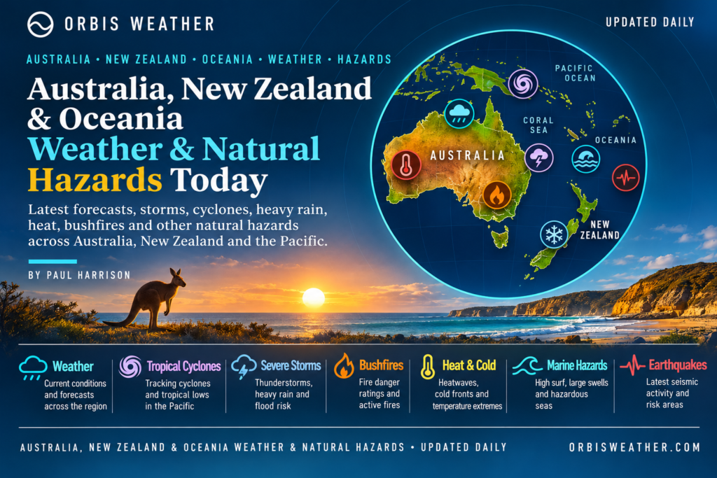
🌏 Australia, New Zealand & Oceania Weather & Natural Hazards Today — Saturday, November 14, 2026
By Paul Harrison | Orbis Weather
Regional coverage: Australia, New Zealand, Papua New Guinea, Fiji, Vanuatu, Solomon Islands, Tonga, Samoa and the wider South Pacific.
Forecast period: Saturday, November 14, 2026, using local dates across Australia, New Zealand and Oceania, with an outlook into Sunday, November 15.
🚨 Regional Overview: Severe Australian Thunderstorms Dominate the Weekend Weather Outlook
Severe thunderstorms, damaging winds, large hail and localized flash flooding are the principal weather threats across parts of Australia as the region moves into Saturday, November 14.
Australia’s Bureau of Meteorology (BOM) is forecasting a widespread outbreak of showers and thunderstorms during the weekend, with Queensland, New South Wales and Western Australia identified as areas where severe storms are possible.
The most significant threats include intense downpours, flash flooding, hail damage, lightning and potentially damaging wind gusts.
Meanwhile, New Zealand and the wider South Pacific face their own seasonal weather challenges, including changing spring conditions, tropical rainfall, rough seas and the beginning of the southwest Pacific tropical cyclone season.
Although Australia currently dominates the verified severe-weather forecast, communities across Oceania should continue monitoring official warnings for rapidly developing local hazards.
⚠️ Major Weather Hazards — November 14
Region | Primary hazard | Assessment |
|---|---|---|
🌩️ Queensland | Severe thunderstorms, hail, heavy rain | Elevated |
⛈️ New South Wales | Severe storms, damaging winds, flash flooding | Elevated |
🌧️ Western Australia | Developing thunderstorms and heavy rain | Elevated |
🌦️ Victoria | Showers and changing conditions | Monitor |
⛈️ Northern Australia | Tropical thunderstorms and lightning | Monitor |
🌧️ New Zealand | Localized heavy rain and strong winds | Monitor |
🌀 Fiji, Vanuatu and Tonga | Tropical cyclone season monitoring | Seasonal |
🌧️ Papua New Guinea | Tropical rain and landslide exposure | Seasonal |
🌊 Pacific Islands | Rough seas and coastal hazards | Monitor |
🌋 Pacific Ring of Fire | Earthquakes, volcanoes and tsunami exposure | Ongoing |
These are Orbis Weather editorial hazard assessments, not official warning levels. An elevated assessment indicates a forecast concern, not confirmation of an active warning in every location.
🇦🇺 Australia: Severe Thunderstorms Threaten Several States
🌩️ Queensland — Heavy Rain, Large Hail and Damaging Winds
Queensland is again among the regions facing the greatest potential for severe thunderstorms.
The Bureau of Meteorology expects showers and thunderstorms across much of southeastern Queensland and the southern interior on Saturday, with widespread afternoon and evening storms potentially becoming severe.
The principal hazards are:
Large hail capable of damaging vehicles and property.
Damaging wind gusts that could bring down trees and power lines.
Heavy rainfall capable of triggering localized flash flooding.
Dangerous lightning and rapidly deteriorating road conditions.
The weekend threat follows several days of significant thunderstorm activity across southern and southeastern Queensland.
Residents should pay particular attention to updated forecasts for the Darling Downs, southeast Queensland and southern inland districts.
⛈️ New South Wales — Another Round of Storms
New South Wales is also facing unsettled conditions heading into the weekend.
Severe thunderstorms affected parts of the state on Friday, November 13, with warnings covering areas including the Hunter, Mid North Coast, Sydney and surrounding districts.
The warnings highlighted large hail, damaging winds and heavy rainfall.
A Bureau of Meteorology update issued at 7:29 p.m. Friday cancelled a severe thunderstorm warning for the Mid North Coast and Hunter districts, although the atmosphere remained unstable.
The Bureau reported 34 mm (1.34 inches) of rainfall in just 30 minutes at Invergordon, demonstrating the intensity of localized downpours.
Further showers and thunderstorms are forecast across New South Wales on Saturday, with the possibility of renewed severe weather.
Main concerns: Flash flooding in urban areas, hail, dangerous lightning, reduced visibility and debris on roads.
🌧️ Western Australia — Thunderstorm Activity Expands
Western Australia is another important region to monitor this weekend.
The Bureau of Meteorology forecasts rain and thunderstorms developing across parts of the state on Saturday, with severe thunderstorms possible during the weekend.
The most significant localized risks include intense rainfall, gusty winds and lightning.
Storm conditions can change considerably over short distances, particularly in inland areas.
Residents and travelers should check the latest district forecasts before making long road journeys.
🌦️ Victoria, South Australia and Tasmania
Across southern Australia, changing spring conditions remain the main weather theme.
The Bureau expects showers to extend into Victoria on Saturday, while a ridge of higher pressure influences parts of central and southeastern Australia.
Local conditions will vary, with some communities experiencing relatively settled weather while others see passing showers or changing winds.
No region-wide severe-weather emergency is being asserted for Victoria, South Australia or Tasmania in this report.
⛈️ Northern Territory and Tropical Northern Australia
Northern Australia is entering the period when tropical humidity, showers and thunderstorms become increasingly important.
The Bureau forecasts thunderstorms across much of northern Australia during Saturday.
Potential hazards include lightning, brief heavy rainfall, localized flooding and sudden wind gusts.
Drivers on remote roads should be especially cautious where heavy rain affects unsealed routes, creek crossings and areas with limited communications.
🇳🇿 New Zealand: Settled Saturday Before Rain and Strong Winds Return
🌤️ North Island — High Pressure Brings a Quieter Day
New Zealand is expected to experience a relatively settled Saturday, particularly across northern and central districts.
According to MetService’s severe-weather outlook, a ridge of high pressure will cover northern and central New Zealand on November 14, bringing a minimal risk of severe weather.
For Auckland, Hamilton, Tauranga and much of the central North Island, the principal message is to monitor local forecasts rather than anticipate widespread severe conditions.
The outlook becomes more unsettled into Sunday and Monday as approaching frontal systems influence the country.
🌧️ South Island — Heavy Rain Risk Increases Sunday
Conditions are expected to deteriorate across parts of the South Island later in the weekend.
Strengthening northwesterly winds and approaching frontal systems could bring heavy rain to western districts, particularly Fiordland and Westland.
The latest MetService outlook raises concern about rainfall potentially reaching warning criteria in parts of these regions on Sunday.
Further rainfall concerns extend into Monday, particularly around Buller, the Canterbury headwaters and the Tararua Range farther north.
Exposed southern and alpine districts may also experience strong winds.
Travelers should monitor conditions around mountain roads, river crossings and landslide-prone terrain.
🌀 Southwest Pacific Tropical Cyclone Watch
🌴 Tropical Disturbance TD02F — Northern Cook Islands Region
Tropical cyclone monitoring has become increasingly important across the southwest Pacific as the 2026–27 season gets underway.
The Fiji Meteorological Service has identified Tropical Disturbance TD02F, located north of the Northern Cook Islands.
In its November 13 tropical disturbance summary, RSMC Nadi placed the system near 8.0°S, 161.0°W, approximately 1,800 km east-northeast of Fiji.
The system was described as slow-moving, with an estimated central pressure of 1008 hPa.
Its potential to develop into a tropical cyclone over the following 24 hours was assessed as very low.
Importantly, a tropical disturbance is not automatically a tropical cyclone. The system requires further organization and strengthening before cyclone classification would be appropriate.
Residents of the northern Cook Islands and surrounding marine areas should continue monitoring official forecasts, particularly for changes in rainfall, thunderstorms and sea conditions.
🇫🇯 Fiji — Warm Tropical Conditions
Fiji enters the weekend with warm conditions typical of the early wet season.
The Fiji Meteorological Service’s forecast for Nadi on Saturday, November 14, indicates temperatures ranging from approximately:
Minimum: 20°C (68°F)
Maximum: 30°C (86°F)
Sunday is forecast to become slightly warmer, with temperatures around 22–31°C (72–88°F).
The main seasonal concerns include tropical downpours, lightning, localized flooding and changing marine conditions.
No direct cyclone impact on Fiji from TD02F has been established in the information reviewed.
🇻🇺 Vanuatu and 🇸🇧 Solomon Islands
Across Vanuatu and the Solomon Islands, tropical rainfall and thunderstorm development remain important seasonal considerations.
Mountainous terrain can increase the consequences of prolonged rainfall, particularly where saturated slopes become unstable.
Communities should remain aware of localized flooding, landslides and rapidly changing conditions affecting inter-island travel.
No specific new cyclone landfall, evacuation order or major flood emergency was independently verified for these island groups for Saturday.
🇹🇴 Tonga, 🇼🇸 Samoa and the Wider Pacific
Tonga, Samoa, American Samoa and nearby island groups are entering the part of the year when tropical weather systems require increasingly close attention.
Seasonal hazards include intense rainfall, flash flooding, strong winds, rough seas and coastal inundation.
However, these are general seasonal risks rather than confirmation of a specific severe-weather event affecting each island on November 14.
Local meteorological advisories remain essential for accurate island-level forecasts.
🇵🇬 Papua New Guinea: Tropical Rainfall and Landslide Monitoring
Papua New Guinea remains particularly vulnerable to heavy tropical rainfall because of its mountainous geography, extensive river networks and communities located along steep valleys.
The principal hazards to monitor include:
🌧️ Intense tropical rainfall and localized flooding.
⛰️ Landslides on steep or saturated slopes.
🌊 Rapid river rises following upstream rainfall.
⛈️ Lightning and thunderstorms.
🚗 Difficult travel conditions on mountain roads.
The Highlands, northern coastal areas and river catchments can experience significantly different conditions on the same day.
No new nationwide flood disaster or specific Saturday rainfall total was independently confirmed for this edition.
🌋 Earthquakes, Volcanoes and Tsunami Monitoring
Australia, New Zealand and Oceania sit close to some of the world’s most active tectonic boundaries.
The Pacific Ring of Fire extends through areas including New Zealand, Papua New Guinea, Vanuatu, Tonga and the Solomon Islands.
🌍 Earthquake Activity
Earthquake monitoring remains important across New Zealand and the southwest Pacific.
New Zealand’s GeoNet network provides earthquake information, while the United States Geological Survey monitors significant seismic activity globally.
No specific November 14 earthquake magnitude, location or damage report is included here without event-level verification.
🌋 Volcanic Activity
Active volcanic regions include Papua New Guinea, Vanuatu and New Zealand.
Potential hazards associated with volcanic unrest include ash emissions, volcanic gases, aviation disruption and localized evacuation requirements.
The presence of an active volcano does not necessarily indicate an eruption or an elevated alert level.
🌊 Tsunami Risk
Strong or prolonged earthquake shaking near a coastline can indicate a possible tsunami hazard.
Coastal communities should follow local emergency instructions and move to higher ground or inland when natural tsunami warning signs are present.
This report does not confirm an active regional tsunami warning for November 14.
🔥 Australian Bushfire and Fire Weather Outlook
While thunderstorms and heavy rainfall dominate the weekend weather forecast in several Australian states, bushfire risk remains an important consideration in warmer and drier districts.
Fire danger depends on temperature, humidity, wind speed, vegetation dryness and recent rainfall.
Lightning can also ignite fires in dry vegetation, particularly where thunderstorms produce limited rainfall.
No specific new major bushfire, evacuation order or statewide fire emergency has been independently verified for this report.
Residents should consult local fire authorities and the Bureau of Meteorology for current fire-danger ratings.
📅 Weekend Outlook: Saturday, November 14 – Sunday, November 15
Region | Saturday | Sunday outlook |
|---|---|---|
Queensland | Widespread thunderstorms, some severe | Further storm potential |
New South Wales | Showers and thunderstorms, some severe | Unsettled conditions continue |
Western Australia | Developing rain and storms | Further thunderstorm risk |
Victoria | Showers in some districts | Monitor changing conditions |
New Zealand North Island | Generally more settled | Changing conditions ahead |
New Zealand South Island | Strengthening northwesterlies | Increasing rain and wind risk |
Fiji | Warm tropical conditions | Warm, monitor local showers |
Northern Cook Islands | TD02F monitoring | Follow updated cyclone outlook |
Papua New Guinea | Local tropical hazard monitoring | Monitor rainfall and rivers |
This table summarizes the available regional forecasts and monitoring priorities. It is not a substitute for local forecasts or current warnings.
🔎 Official Weather and Natural Hazard Sources
Orbis Weather recommends the following primary sources for ongoing monitoring:
Region | Official source |
|---|---|
Australia | |
New Zealand | |
New Zealand earthquakes | |
Fiji and southwest Pacific | |
Pacific cyclone outlooks | |
Vanuatu | |
Global earthquakes | |
Tsunami information |
📝 Editorial Methodology and Verification
This report was prepared for Orbis Weather using meteorological forecasts, official severe-weather outlooks and verified regional reporting available on November 13, 2026, ahead of the November 14 local forecast period.
The principal verified developments include Australia’s Bureau of Meteorology forecast of severe thunderstorms across multiple states, Friday’s severe-weather activity in New South Wales, MetService’s outlook for changing New Zealand conditions and the identification of Tropical Disturbance TD02F in the northern Cook Islands region.
Weather forecasts are forward-looking assessments and may change. Regional monitoring priorities are distinguished from confirmed active warnings.
Where an official warning, specific incident or observed measurement could not be independently verified, this article does not present it as a confirmed event.
Corrections and Updates Policy
Orbis Weather is committed to accurate, transparent and independently sourced weather reporting.
Material factual errors will be corrected when identified and supported by reliable evidence. Significant changes to tropical cyclone classifications, official warnings or reported disaster impacts should be reflected in updated coverage.
This report is intended for public information and does not replace official emergency instructions.
🌏 Final Outlook: A Stormy Australian Weekend as the Pacific Cyclone Season Begins
Australia’s severe thunderstorm outbreak remains the leading weather concern for Saturday, November 14, with Queensland, New South Wales and Western Australia facing the potential for damaging storms.
New Zealand is expected to experience a relatively quieter Saturday before increasing rainfall and wind risks develop in southern and western districts later in the weekend.
Across the southwest Pacific, Tropical Disturbance TD02F provides an early reminder that the tropical cyclone season is underway, even though its assessed development potential remains very low.
For communities throughout Oceania, the priorities remain straightforward: monitor official warnings, avoid floodwaters, prepare for sudden weather changes and remain alert to evolving tropical conditions.
Stay informed. Stay prepared. Stay safe.
Orbis Weather — Global Weather & Natural Hazards Coverage
By Paul Harrison | Saturday, November 14, 2026
About the Author
Paul Harrison — Founder & Publisher, Orbis Weather
Paul Harrison founded Orbis Weather in 2026 to make global weather and natural-hazard information easier to find, follow and understand. His coverage includes tropical cyclones, severe weather, extreme temperatures, earthquakes, volcanoes, wildfires, flooding and significant natural disasters worldwide.
View all articles by Paul Harrison → | Editorial Standards →
Global Weather Tracker Hub
Explore weather maps, tropical systems, storms and natural hazards around the world.
No matching trackers found.