
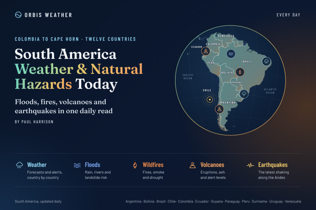
South America Weather & Natural Hazards Today

- Storm Charles causes floods and flight cancellations across southern Europe 9:30 AM
- North America Weather & Natural Hazards Today – November 13, 2026 9:11 AM
- Central America Weather & Natural Hazards Today – Friday, November 13, 2026 9:03 AM
- South America Weather & Natural Hazards Today – November 13, 2026 8:44 AM
- Daily Earthquakes, Storms, Fires & Floods Report — November 13, 2026 8:18 AM
- Global Natural Disasters This Week — November 13, 2026 8:01 AM
- Tropical Atlantic Daily Report: Friday, November 13, 2026 7:47 AM
- Eastern & Central Pacific Tropical Weather Update: Friday, November 13, 2026 7:38 AM
- WESTERN PACIFIC Tropical Weather Update – November 13, 2026 7:21 AM





South America Weather & Natural Hazards Today – November 13, 2026
Orbis Weather | Friday, November 13, 2026
By Paul Harrison | Orbis Weather
Severe Thunderstorms, Heavy Rainfall, Flood Threats and Powerful Winds Across South America
South America faces a mixture of severe thunderstorms, intense rainfall, dangerous winds and unusually high temperatures on Friday, November 13, 2026, with significant weather concerns developing across Brazil, Argentina and Peru.
Brazil’s central and southeastern regions are preparing for heavy thunderstorms, Argentina is experiencing severe storm and wind alerts, and Peru is facing a multiday rainfall warning that includes the possibility of extreme precipitation along parts of its northern coast.
The developing 2026–27 El Niño is also influencing longer-term weather risks across the continent, although individual storms cannot be attributed to El Niño alone.
1. Brazil – Severe Thunderstorms and Heavy Rainfall
Brazil’s National Institute of Meteorology (INMET) forecasts widespread heat, humidity and thunderstorms for Friday, November 13, continuing into Saturday.
A large mass of warm, humid air is creating favorable conditions for afternoon thunderstorms across much of the country.
Areas of concern include:
Central-West Brazil, where some of the heaviest rainfall is forecast.
Southeastern Brazil, with potentially strong thunderstorms and localized flooding.
Amazonas, Acre and Rondônia, where afternoon thunderstorms are expected.
Southern Pará and southwestern Tocantins, where heavy showers and lightning are possible.
INMET has issued yellow-level potential-danger thunderstorm alerts covering affected regions.
Temperature outlook
Northern Brazil remains particularly hot, with forecast maximum temperatures reaching approximately 35°C (95°F) in Manaus, Belém, Palmas and Porto Velho, and 36°C (97°F) in Rio Branco.
Boa Vista could reach 37°C (99°F).
The main hazards include lightning, brief intense rainfall, gusty winds and localized flooding, especially in urban areas with inadequate drainage.
Source: INMET – November 13–14 forecast.
2. Argentina – Severe Thunderstorms, Hail and Damaging Winds
Argentina’s National Meteorological Service (SMN) has issued warnings for thunderstorms and strong winds affecting several provinces.
Some thunderstorms could become locally severe, bringing intense rainfall, frequent lightning, hail and powerful wind gusts.
Thunderstorm threats
Warnings include parts of Buenos Aires Province, La Pampa and Córdoba.
The national weather service forecasts rainfall accumulations of 20–50 mm (0.8–2.0 inches) in affected warning areas, with locally higher amounts possible.
Short-duration rainfall could cause surface flooding, particularly where drainage systems become overwhelmed.
Patagonia – Powerful wind warnings
Parts of Río Negro and Chubut face easterly winds of 40–80 km/h (25–50 mph), with gusts potentially exceeding 90 km/h (56 mph).
Tierra del Fuego also faces strong westerly winds during Friday afternoon.
These conditions could create dangerous travel conditions, particularly for high-sided vehicles, and affect exposed coastal locations.
Yellow heat alerts have also been issued for locations including Orán, Jujuy and Bernardo de Irigoyen.
Source: Argentina SMN – Official weather alerts.
3. Peru – Extreme Rainfall Threat Across Northern Coastal and Andean Regions
Peru’s National Institute of Civil Defense (INDECI) has published Meteorological Bulletin No. 464-2026, covering November 12–14.
The warning identifies moderate to extreme rainfall in mountain areas, alongside potentially intense precipitation along the northern coast.
Forecast rainfall amounts
Region | Potential daily rainfall |
|---|---|
Northern coast | Near 80 mm (3.1 in) |
Northern Andes | 5–26 mm (0.2–1.0 in) |
Central Andes | 6–20 mm (0.2–0.8 in) |
Southern Andes | Near 27 mm (1.1 in) |
Tumbes is specifically highlighted for potentially strong to extreme rainfall, while inland Piura could experience moderate to heavy rain.
Hail is possible in mountainous areas above 2,800 meters (9,186 feet), accompanied by thunderstorms and wind gusts approaching 40 km/h (25 mph).
Flooding and landslide concerns
Intense rainfall can rapidly increase runoff along steep mountain slopes, creating dangerous conditions in valleys and areas susceptible to landslides or debris flows.
Residents should monitor river levels and local emergency information, particularly in northern Peru.
Source: INDECI – Meteorological Bulletin 464-2026.
4. Colombia, Venezuela and Ecuador – Tropical Rainfall and Landslide Monitoring
Northern South America continues through a season when tropical moisture, daytime heating and mountainous terrain can produce locally heavy thunderstorms.
In Colombia, particular attention should be paid to the Andean departments, Pacific coastal areas and communities near steep river valleys.
Western Venezuela and Ecuador’s mountainous regions also remain susceptible to localized heavy rainfall and slope instability when thunderstorms develop.
Principal hazards to monitor:
Flash flooding in urban areas and narrow valleys.
Landslides on saturated or unstable hillsides.
Lightning during afternoon and evening thunderstorms.
Rapid changes in river levels following intense rainfall.
These are seasonal and geographical risk considerations, not confirmation of active warnings for November 13. Specific local alerts should be checked through Colombia’s IDEAM, Venezuela’s INAMEH and Ecuador’s INAMHI.
5. Chile – Rainfall Variability and Andean Mountain Hazards
Chile’s weather varies substantially between its arid northern regions, central valleys, southern forests and Patagonian landscapes.
Central and southern Chile are entering the warmer part of the year, when weather patterns can still change rapidly as Pacific systems cross the region.
Mountain travelers should remain alert for strong winds, reduced visibility and abrupt temperature changes in the Andes.
El Niño influence
Research on previous strong El Niño events indicates an increased likelihood of above-average spring rainfall in parts of central and south-central Chile, particularly around 35°–38° south latitude.
However, this is a seasonal probability rather than confirmation of heavy rainfall today.
The precise location and intensity of individual weather systems require current observations from Chile’s Dirección Meteorológica de Chile.
The broader El Niño outlook is discussed in recent climate research.
6. Bolivia and Paraguay – Heat, Thunderstorms and Agricultural Weather Risks
Bolivia and Paraguay are entering a period when rising temperatures, seasonal moisture and atmospheric instability can produce significant weather changes.
In Bolivia, lowland areas can experience hot and humid conditions, while the Andes and Altiplano remain exposed to substantial temperature differences and rapidly changing mountain weather.
Paraguay’s agricultural regions are vulnerable to both intense thunderstorms and extended hot spells during the warmer months.
The principal concerns are localized flooding, lightning, wind damage and the effects of temperature extremes on outdoor workers and agriculture.
No specific nationwide emergency warning for either country has been independently confirmed for this edition.
7. Uruguay – Spring Thunderstorms and Coastal Weather
Uruguay’s spring weather can feature rapidly changing conditions as warm air from the north interacts with cooler systems arriving from Argentina and the South Atlantic.
Thunderstorms, gusty winds and sudden rainfall are important hazards to monitor, particularly in exposed agricultural and coastal areas.
Residents and visitors should consult the Instituto Uruguayo de Meteorología (INUMET) for the latest warnings.
No specific severe-weather alert for Uruguay has been verified for November 13 in this report.
8. Amazon Basin – Flooding, Drought and Environmental Conditions
The Amazon Basin remains one of South America’s most important regions for monitoring weather-related natural hazards.
Heavy tropical rainfall can create localized flooding, while seasonal rainfall deficits can affect river transport, agriculture, ecosystems and water availability.
Northern and western Brazil are among the areas where INMET forecasts thunderstorms on Friday.
However, conditions vary considerably across the enormous basin, and rainfall in one location does not necessarily indicate widespread flooding.
Longer-term El Niño concerns
The developing 2026–27 El Niño raises concerns about rainfall distribution across tropical South America.
Historically, strong El Niño events have been associated with drought risk in parts of northern South America and the Amazon, while other areas can experience unusually heavy rainfall.
These relationships are not guarantees, and local rainfall patterns can differ substantially from seasonal expectations.
9. Earthquakes, Volcanoes and Geological Hazards
South America’s Pacific margin is among the world’s most seismically active regions.
The Nazca tectonic plate is moving beneath the South American plate, creating conditions for powerful earthquakes and volcanic activity along the Andes.
Earthquake monitoring
Particular areas of long-term seismic concern include coastal Peru, Chile, Ecuador and southwestern Colombia.
Earthquakes can occur without warning, and coastal communities should understand tsunami evacuation procedures.
No specific significant earthquake occurring on November 13 has been independently verified for inclusion in this edition.
Volcano monitoring
Active volcanic systems in Colombia, Ecuador, Peru and Chile require continuous observation.
Volcanic ash, gas emissions, landslides and lahars can affect nearby communities, aviation and transportation.
This report does not confirm a new major volcanic eruption today.
For verified earthquake information, consult the USGS Earthquake Map and the Smithsonian Global Volcanism Program.
South America Natural Hazards Summary – November 13, 2026
Country or region | Main concern | Assessment |
|---|---|---|
Brazil | Heavy thunderstorms, heat and intense rain | Official forecast and alerts |
Argentina | Severe thunderstorms, hail and strong winds | Official alerts |
Peru | Heavy to extreme rainfall, hail and flooding potential | Official warning |
Colombia | Seasonal rainfall and landslide exposure | Monitoring |
Venezuela | Tropical rainfall and localized flooding potential | Monitoring |
Ecuador | Mountain rainfall and landslide exposure | Monitoring |
Chile | Changing spring weather and mountain hazards | Monitoring |
Bolivia | Heat and seasonal thunderstorms | Monitoring |
Paraguay | Heat and thunderstorm potential | Monitoring |
Uruguay | Spring weather variability | Monitoring |
Amazon Basin | Flooding and seasonal drought risks | Regional monitoring |
Assessment categories distinguish documented official forecasts and warnings from general hazards requiring monitoring. They are not a standardized international alert scale.
10. South America Weather Outlook – November 14–16, 2026
Looking ahead to the weekend and early next week, several important developments deserve attention.
Brazil: Warm and humid conditions are expected to support further thunderstorms on Saturday, particularly across central and southeastern regions. INMET’s November 13–14 forecast supports this short-term outlook.
Peru: The official multiday rainfall warning continues through Saturday, November 14, with northern coastal and Andean areas requiring particular attention.
Argentina: The evolution of thunderstorms and strong winds will depend on the movement of individual weather systems. Residents should follow updated SMN warnings rather than assume Friday’s alerts will remain unchanged.
Andean countries: Communities in steep terrain should remain attentive to rainfall accumulation and potential slope instability.
Forecast confidence is lower for November 15–16 because specific official forecasts for those dates were not independently verified in this report.
Safety Advice for Residents and Travelers
During severe thunderstorms, seek shelter inside a substantial building and avoid exposed areas, isolated trees and open water.
Never attempt to drive through floodwater. Even relatively shallow moving water can destabilize vehicles.
In mountainous regions, avoid steep slopes and river crossings during periods of intense rainfall, particularly where landslides have previously occurred.
People living in coastal earthquake zones should know their evacuation routes and follow official tsunami guidance after strong or prolonged shaking.
Official Weather and Natural Hazard Sources
Orbis Weather recommends consulting national meteorological and emergency management agencies for the most current information.
Orbis Weather Editorial Methodology
This report combines publicly available national meteorological forecasts, official hazard bulletins and established scientific information to provide a regional overview of weather and natural hazards.
Official alerts are distinguished from seasonal risk assessments. Where a current warning or incident could not be independently confirmed, the report identifies the information as general monitoring guidance rather than presenting it as a verified emergency.
Weather forecasts, warning areas and hazard severity may change after publication. Readers should follow their national meteorological service and local emergency authorities for real-time instructions.
Report date: November 13, 2026
Prepared for: Orbis Weather
Author: Paul Harrison
Editorial status: Based on official information available at preparation; not a live emergency alert feed.
Final Outlook
South America’s most clearly documented weather concerns today are concentrated across Brazil, Argentina and Peru, where official agencies are warning of thunderstorms, heavy rainfall, strong winds and potentially dangerous conditions.
Brazil faces widespread convective rainfall, Argentina is monitoring severe storms and damaging wind gusts, and Peru is preparing for significant rainfall across northern coastal and Andean regions.
Elsewhere, seasonal thunderstorms, mountain weather and the longer-term influence of El Niño remain important areas of monitoring.
With the Southern Hemisphere moving toward summer, changing rainfall patterns and rising temperatures will continue to influence weather-related risks across the continent.
Orbis Weather – Tracking the World’s Weather, One Region at a Time.
About the Author
Paul Harrison — Founder & Publisher, Orbis Weather
Paul Harrison founded Orbis Weather in 2026 to make global weather and natural-hazard information easier to find, follow and understand. His coverage includes tropical cyclones, severe weather, extreme temperatures, earthquakes, volcanoes, wildfires, flooding and significant natural disasters worldwide.
View all articles by Paul Harrison → | Editorial Standards →
Global Weather Tracker Hub
Explore weather maps, tropical systems, storms and natural hazards around the world.
No matching trackers found.