
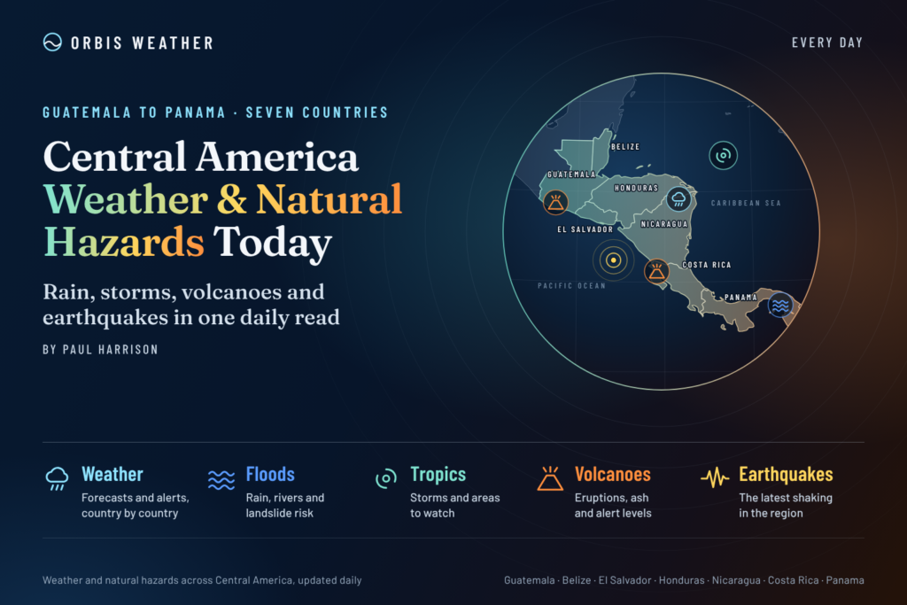
Central America Weather & Natural Hazards Today

- Flooding in Aceh Spurs Warnings as Severe Weather Threatens 9:09 AM
- North America Weather & Natural Hazards Today – November 15, 2026 8:57 AM
- Central America Weather & Natural Hazards Today – Sunday, November 15, 2026 8:49 AM
- South America Weather & Natural Hazards Today – November 15, 2026 8:41 AM
- Weekly Earth Watch: Volcanoes, Earthquakes & Natural Hazards – Week ending November 15, 2026 8:29 AM
- Daily Earthquakes, Storms, Fires & Floods Report November 15, 2026 8:21 AM
- Australian Region Tropical Weather Update: Sunday, November 15, 2026 8:14 AM
- Southwest Indian Ocean Tropical Weather Update: Sunday, November 15, 2026 8:06 AM
- WESTERN PACIFIC Tropical Weather Update – November 15, 2026 7:57 AM





Central America Weather & Natural Hazards Today – Sunday, November 15, 2026
By Paul Harrison | Orbis Weather
Published: Sunday, November 15, 2026
Coverage: Belize, Guatemala, Honduras, El Salvador, Nicaragua, Costa Rica and Panama
Forecast period: November 15–17, 2026
Regional Overview: Flooding Concerns, Tropical Showers and Unstable Hillsides Remain in Focus
Central America enters Sunday with several contrasting environmental concerns, including the possibility of localized heavy rainfall, lingering flood vulnerability, landslides, thunderstorms and longer-term drought.
Southern Central America remains a particular area of interest following substantial rainfall earlier this month, especially across Costa Rica, southern Nicaragua and Panama.
NOAA’s Climate Prediction Center identified flooding risks across these areas in its November 5–11 assessment. Although that outlook has expired, the earlier rainfall provides important context for monitoring rivers, drainage systems and saturated hillsides.
Meanwhile, parts of northern Central America continue to face longer-term water shortages and agricultural pressures associated with irregular rainfall.
The principal concern is that intense local rainfall can create dangerous conditions even without a named tropical storm.
This report distinguishes previously documented conditions from hazards requiring monitoring. A complete set of live national forecasts and warnings for November 15 could not be independently verified at publication time.
Today’s Main Weather and Natural Hazards
Hazard | Regional assessment |
|---|---|
🌧️ Heavy rainfall | Localized downpours remain a monitoring priority |
🌊 Flooding | Elevated vulnerability in previously affected communities |
⛰️ Landslides | Saturated mountain slopes and vulnerable roads |
⚡ Thunderstorms | Lightning, gusty winds and short-duration heavy rainfall |
🌀 Tropical cyclones | Check the latest NHC outlook for active systems |
🌋 Volcanoes | Routine monitoring of active volcanic systems |
🌎 Earthquakes | Continuing regional seismic risk |
☀️ Heat and drought | Longer-term dryness across parts of the Dry Corridor |
These are regional monitoring priorities, not newly issued official warnings.
Tropical Weather Update: Caribbean Sea and Eastern Pacific
Atlantic Ocean and Caribbean Sea
The Atlantic hurricane season officially continues until November 30.
Although November generally brings declining tropical cyclone activity compared with the seasonal peak, late-season systems can still develop in the Caribbean.
Belize, Honduras, Nicaragua, Costa Rica and Panama should continue monitoring tropical disturbances, particularly when atmospheric moisture increases over the western Caribbean.
Tropical rainfall can also occur independently of organized cyclones.
As of November 14, the National Hurricane Center had reported no active Atlantic tropical cyclones and no tropical cyclone formation expected during the following seven days. That assessment is historical and does not replace the November 15 outlook.
Latest official information: National Hurricane Center – Atlantic
Eastern North Pacific
The eastern Pacific hurricane season also continues until November 30.
Coastal communities from Guatemala to Costa Rica should monitor offshore disturbances, changing marine conditions and rainfall developments.
Even when tropical cyclone formation is unlikely, Pacific moisture can contribute to thunderstorms and heavy rainfall over coastal districts and mountainous terrain.
No newly verified November 15 tropical cyclone position, intensity or track is included in this report.
Latest official information: National Hurricane Center – Eastern Pacific
Country-by-Country Weather and Natural Hazards
🇧🇿 Belize: Caribbean Moisture, Localized Rainfall and Drought Monitoring
Belize faces a combination of potential short-term weather disruptions and longer-term environmental challenges.
Areas of interest include Belize City, Belmopan, Orange Walk, Corozal, Dangriga, Placencia and Punta Gorda.
Caribbean showers and thunderstorms can produce localized flooding, particularly in urban areas with limited drainage. Coastal communities should also monitor changing wind and sea conditions.
Northern Belize was identified in NOAA’s earlier November assessment as an area of concern for excessive heat, while parts of the country continued experiencing abnormal dryness and drought.
Those findings relate to an earlier forecast period and should not be interpreted as verified temperatures for Sunday.
Sunday outlook: Monitor updated rainfall forecasts, local drainage conditions, temperatures and marine advisories.
Official source: National Meteorological Service of Belize
🇬🇹 Guatemala: Mountain Weather, Landslides and Volcanic Hazards
Guatemala’s varied terrain creates substantial differences in weather between the Pacific coast, central highlands, northern Petén and Caribbean-facing regions.
Mountain communities should remain alert to the potential consequences of intense rainfall, including flash flooding, rockfalls and landslides.
Areas requiring particular attention include Alta Verapaz, Izabal, Quetzaltenango, Huehuetenango, Petén and the Guatemala City metropolitan region.
Volcanic monitoring
Guatemala’s active volcanic systems include Fuego, Santiaguito and Pacaya.
Rainfall over volcanic deposits can generate lahars, which are fast-moving flows of water, mud and volcanic debris.
No new eruption or lahar emergency dated November 15 has been independently confirmed for this report.
Parts of Guatemala also remain vulnerable to agricultural drought and longer-term rainfall deficits.
Sunday outlook: Monitor mountain roads, local rainfall developments, official volcanic bulletins and civil protection notices.
Official sources: INSIVUMEH and CONRED
🇭🇳 Honduras: Caribbean Showers, Flood-Prone Valleys and Water Shortages
Honduras remains exposed to several different weather hazards.
Northern and eastern districts can receive rainfall associated with Caribbean moisture, while mountainous inland areas are vulnerable to rapid runoff during intense showers.
Areas of interest include Tegucigalpa, San Pedro Sula, La Ceiba, Comayagua, Choluteca, Gracias a Dios and the Bay Islands.
Flooding can develop quickly where heavy rainfall affects steep catchments or densely populated urban areas.
At the same time, longer-term rainfall deficits continue to be a concern for agricultural communities in the Central American Dry Corridor.
NOAA’s November 5–11 assessment identified abnormal dryness and drought in parts of Honduras.
Sunday outlook: Monitor rainfall warnings, river conditions, landslide-prone roads and updated agricultural drought information.
Official source: COPECO Honduras
🇸🇻 El Salvador: Thunderstorms, Urban Flooding and Steep Terrain
El Salvador’s mountainous landscape and densely populated urban areas create particular vulnerability to short periods of intense rainfall.
San Salvador, Santa Ana, Sonsonate, La Libertad, San Miguel, Usulután and La Unión are among the areas where residents should monitor local weather developments.
Heavy showers can overwhelm drainage systems and produce rapid street flooding.
Steep hillsides may become unstable after prolonged or repeated rainfall.
Along the Pacific coast, fishermen and recreational boaters should monitor thunderstorms, changing winds and marine advisories.
El Salvador also lies along an active volcanic and seismic zone.
Santa Ana and San Miguel volcanoes remain important scientific monitoring locations, although no new major volcanic emergency has been verified for November 15.
Sunday outlook: Watch for localized heavy rainfall, lightning, changing coastal conditions and national emergency updates.
Official source: Ministerio de Medio Ambiente y Recursos Naturales
🇳🇮 Nicaragua: Flood Vulnerability, Caribbean Rainfall and Volcano Monitoring
Nicaragua remains an important country to watch following earlier heavy rainfall across southern Central America.
NOAA previously identified flooding concerns in parts of Nicaragua during November 5–11, alongside abnormal dryness in western areas and potentially excessive heat in eastern districts.
This illustrates the country’s contrasting environmental conditions.
Areas to monitor include Managua, León, Chinandega, Granada, Rivas, Bluefields and Puerto Cabezas.
The Caribbean coast can experience substantial tropical rainfall, while Pacific-facing districts are also exposed to volcanic and seismic hazards.
Volcanic activity
Nicaragua’s volcanic systems include Masaya, San Cristóbal and Telica.
Monitoring is particularly important where volcanic activity, heavy rainfall and populated communities overlap.
No specific new eruption or significant earthquake on November 15 has been independently established in this report.
Sunday outlook: Monitor rivers, local rainfall, coastal conditions and official geological bulletins.
Official source: INETER Nicaragua
🇨🇷 Costa Rica: Recent Heavy Rainfall Keeps Flooding and Landslides in Focus
Costa Rica remains a priority for weather monitoring following significant rainfall earlier in November.
On November 13, the country’s National Meteorological Institute highlighted brief but intense downpours affecting the Central Valley and Caribbean mountain areas.
The agency identified weak trade winds, daytime heating and local wind circulations as contributing factors.
Earlier in the month, rainfall associated with a low-pressure system exceeded 300 millimeters (11.8 inches) over two days in parts of the Nicoya Peninsula, according to information cited in the previous Orbis Weather regional update.
Although that weather system moved away, previously saturated ground can remain susceptible to additional runoff and slope instability.
Areas to monitor
Guanacaste and the Nicoya Peninsula
Puntarenas and the Pacific coastal districts
Central Valley communities
Northern Zone river basins
Caribbean-facing mountain slopes
Potential hazards include localized flooding, swollen streams, lightning and landslides.
The November 13 meteorological notice should not automatically be treated as an active nationwide warning for November 15.
Sunday outlook: Monitor renewed downpours, river levels and hillside conditions, particularly where substantial rain has already fallen.
Official sources: Instituto Meteorológico Nacional and Comisión Nacional de Emergencias
🇵🇦 Panama: Tropical Thunderstorms, Mountain Rainfall and Flood Monitoring
Panama continues to face the possibility of localized heavy rainfall and thunderstorms during the late-year wet season.
Western provinces and mountainous districts can experience rapid runoff when intense showers develop.
Areas of interest include Panama City, Colón, Bocas del Toro, Chiriquí, Veraguas, Darién and the Azuero Peninsula.
NOAA’s earlier November outlook identified flooding concerns across parts of Panama following substantial rainfall.
That historical assessment does not establish that flooding is occurring across the country today.
In Panama City, intense rainfall can cause localized street flooding and transport disruption.
In western mountain communities, repeated rainfall can increase the risk of slope instability.
Coastal thunderstorms may also disrupt fishing, tourism and small-vessel operations.
Sunday outlook: Monitor local thunderstorms, river levels, landslide advisories and updated national emergency information.
Official source: SINAPROC Panama
Heat and Drought: The Central American Dry Corridor
While flooding remains an important concern in southern Central America, drought continues to affect parts of the region.
NOAA’s November 5–11 assessment documented abnormal dryness and drought in portions of Guatemala, Belize, Honduras, western Nicaragua, western Costa Rica and Panama.
The same assessment highlighted the potential for temperatures or heat indices above 35°C (95°F) for several consecutive days in parts of northern Guatemala, northern Belize and eastern Nicaragua. These were forecasts for the earlier period, not confirmed November 15 observations.
Prolonged dryness can affect agricultural production, livestock, drinking-water supplies and food security.
The Central American Dry Corridor is particularly vulnerable to irregular rainfall patterns. Even substantial rainfall over a few days may not fully reverse accumulated water deficits.
Earthquake and Volcano Monitoring
Central America lies along an active tectonic boundary, where the Cocos Plate moves beneath the Caribbean Plate.
This geological setting produces frequent earthquakes and supports an extensive volcanic chain.
Volcanoes to monitor
Country | Major monitoring locations |
|---|---|
Guatemala | Fuego, Santiaguito, Pacaya |
El Salvador | Santa Ana, San Miguel |
Nicaragua | Masaya, San Cristóbal, Telica |
Costa Rica | Poás, Turrialba, Rincón de la Vieja |
These are established monitoring locations, not a list of confirmed new eruptions.
Earthquake activity
Earthquakes cannot be reliably predicted by exact date, location or magnitude.
No independently verified list of significant Central American earthquakes occurring on November 15 was available during preparation of this report.
Residents in seismic zones should remain familiar with evacuation routes and official emergency procedures.
Live monitoring: USGS Latest Earthquakes
Caribbean and Pacific Marine Conditions
Marine weather remains an important consideration for coastal communities, fishing fleets, commercial shipping and tourism operators.
Caribbean coast: Thunderstorms, changing trade winds and localized heavy showers can affect visibility and small-vessel safety.
Pacific coast: Coastal thunderstorms, changing swells and localized wind conditions may disrupt fishing and recreational boating.
Specific November 15 wave heights, wind speeds and marine warnings have not been independently verified for this regional report.
Boaters should consult national meteorological and maritime authorities before departure.
Central America Weather Outlook: November 15–17, 2026
The following is a regional monitoring outlook based on seasonal weather patterns and recently documented hazards, rather than a verified country-by-country numerical forecast.
Date | Main monitoring priorities |
|---|---|
Sunday, November 15 | Localized showers and thunderstorms, lingering flood vulnerability and mountain slope stability |
Monday, November 16 | Changing Caribbean and Pacific moisture, rainfall developments and river conditions |
Tuesday, November 17 | Updated tropical outlooks, localized rainfall, drought conditions and geological monitoring |
Conditions can change significantly over short distances, especially between coastal lowlands and mountainous districts.
Weather Safety: What Residents and Travelers Should Know
🌧️ Heavy rainfall: Avoid flooded roads and low-water crossings.
⛰️ Landslides: Exercise caution near steep slopes, especially after prolonged rainfall.
⚡ Lightning: Seek shelter indoors when thunderstorms approach.
🌊 Coastal conditions: Check local marine forecasts before boating or swimming.
🌎 Earthquakes: Follow official emergency guidance and practice Drop, Cover and Hold On.
🌋 Volcanoes: Follow scientific monitoring agencies and respect restricted zones.
☀️ Heat: Maintain hydration and limit strenuous outdoor activity during extreme heat.
Regional Outlook: What Matters Most
Central America continues to face a complex combination of weather and natural hazards as November progresses.
Three issues deserve particular attention.
First, flooding vulnerability in southern Central America. Costa Rica, Nicaragua and Panama experienced substantial rainfall earlier in the month, making continued monitoring of rivers and unstable slopes important.
Second, the contrast between flooding and drought. Parts of northern and western Central America continue to experience longer-term rainfall deficits, even while other locations contend with excessive rainfall.
Third, tropical and geological hazards. The Atlantic and eastern Pacific hurricane seasons remain officially active through November 30, while earthquake and volcanic risks are present throughout the year.
The most important message for Sunday is that the absence of a confirmed major tropical cyclone does not eliminate the possibility of dangerous local weather.
Official Sources and Weather Data
Orbis Weather uses established meteorological, geological and emergency-management agencies to provide regional weather context.
Regional and international sources
NOAA National Hurricane Center — Tropical cyclone monitoring and outlooks.
NOAA Climate Prediction Center — Regional climate and natural hazard assessments.
USGS Earthquake Hazards Program — Earthquake observations and seismic information.
Smithsonian Global Volcanism Program — Volcanic activity and geological reference information.
National meteorological and emergency sources
Belize National Meteorological Service, Guatemala INSIVUMEH and CONRED, Honduras COPECO, El Salvador MARN, Nicaragua INETER, Costa Rica IMN and CNE, and Panama SINAPROC.
Editorial Methodology and Verification
This report combines established scientific information, national monitoring resources and previously published regional hazard assessments.
Historical observations and expired forecasts are identified as such. Areas described as vulnerable are not necessarily experiencing an active emergency.
No unverified casualty figures, evacuation orders, new volcanic eruptions, earthquake magnitudes or tropical cyclone developments have been presented as confirmed events.
Forecasts and warnings may change after publication. Readers should always consult their national meteorological and emergency-management agencies for location-specific warnings.
Orbis Weather aims to provide clear, independent weather reporting, with corrections made when reliable new information becomes available.
Frequently Asked Questions
Is Central America experiencing widespread flooding today?
Flooding affected parts of southern Central America earlier in November. However, widespread active flooding across the region on November 15 has not been independently verified for this report.
Which countries face the greatest concern from recent heavy rainfall?
Costa Rica, Nicaragua and Panama remain important monitoring areas because of rainfall and flooding concerns documented earlier this month.
Is there a hurricane threatening Central America?
The November 14 National Hurricane Center outlook reported no active Atlantic tropical cyclones and no formation expected over the following seven days. Readers should check the latest November 15 advisory for any changes.
Can earthquakes and volcanic eruptions be predicted?
Scientists monitor seismic and volcanic activity, but exact earthquake predictions are not possible. Volcanic monitoring can sometimes identify changing conditions and provide warnings.
When does hurricane season end in Central America?
The official Atlantic and eastern North Pacific hurricane seasons both end on November 30, although tropical cyclones can occasionally occur outside the official season.
Orbis Weather | Independent Global Weather & Natural Hazards Reporting
Written by Paul Harrison for Orbis Weather.
Published: November 15, 2026.
Coverage: Belize, Guatemala, Honduras, El Salvador, Nicaragua, Costa Rica and Panama
About the Author
Paul Harrison — Founder & Publisher, Orbis Weather
Paul Harrison founded Orbis Weather in 2026 to make global weather and natural-hazard information easier to find, follow and understand. His coverage includes tropical cyclones, severe weather, extreme temperatures, earthquakes, volcanoes, wildfires, flooding and significant natural disasters worldwide.
View all articles by Paul Harrison → | Editorial Standards →
Global Weather Tracker Hub
Explore weather maps, tropical systems, storms and natural hazards around the world.
No matching trackers found.