

- Flooding in Aceh Spurs Warnings as Severe Weather Threatens 9:09 AM
- North America Weather & Natural Hazards Today – November 15, 2026 8:57 AM
- Central America Weather & Natural Hazards Today – Sunday, November 15, 2026 8:49 AM
- South America Weather & Natural Hazards Today – November 15, 2026 8:41 AM
- Weekly Earth Watch: Volcanoes, Earthquakes & Natural Hazards – Week ending November 15, 2026 8:29 AM
- Daily Earthquakes, Storms, Fires & Floods Report November 15, 2026 8:21 AM
- Australian Region Tropical Weather Update: Sunday, November 15, 2026 8:14 AM
- Southwest Indian Ocean Tropical Weather Update: Sunday, November 15, 2026 8:06 AM
- WESTERN PACIFIC Tropical Weather Update – November 15, 2026 7:57 AM





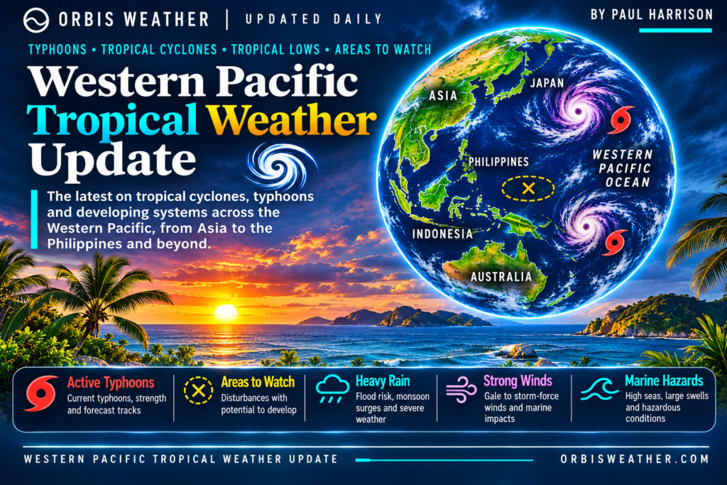
WESTERN PACIFIC Tropical Weather Update – November 15, 2026
Typhoons, Tropical Cyclones, Heavy Rainfall & Marine Weather Hazards
By Paul Harrison | Orbis Weather
Sunday, November 15, 2026
Western Pacific Remains Free of Active Tropical Cyclones as November Weather Risks Continue
The Western North Pacific remains free of active tropical cyclones and monitored tropical disturbances on Sunday, November 15, 2026, according to the latest Joint Typhoon Warning Center (JTWC) assessment.
The advisory, issued at 09:00 UTC, identifies no active tropical cyclones, tropical disturbances or subtropical systems across the Western North Pacific, extending from the International Date Line westward toward the Malay Peninsula.
This continues a relatively quiet period following the departure of Typhoon Cempaka earlier in November.
However, the absence of an organized tropical cyclone does not mean the region is free from dangerous weather. Seasonal northeast monsoon winds, localized thunderstorms, heavy rainfall and potentially hazardous marine conditions remain important concerns across parts of the Philippines, Taiwan, Japan and surrounding waters.
Current Western Pacific Tropical Cyclone Status
JTWC Basin Status
0
Active cyclones0
Disturbances0
Subtropical systemsThe assessment confirms that no organized tropical cyclone or disturbance is currently identified within the Western North Pacific monitoring area.
Importantly, this does not represent a guarantee that tropical cyclone development will remain absent throughout the coming week. Conditions can change, particularly over warm tropical waters.
Philippines: Northeast Monsoon and Rainfall Remain the Main Concerns
With no active tropical cyclone identified in the latest JTWC advisory, attention across the Philippines turns toward seasonal weather patterns.
The northeast monsoon, locally known as Amihan, is increasingly influential during November, particularly across northern and eastern sections of the country.
Northern Luzon and Batanes
Northeasterly winds may bring periods of cloud cover, occasional rainfall and breezy coastal conditions.
Exposed coastlines around Batanes, the Babuyan Islands and northeastern Luzon can experience rougher seas during stronger monsoon surges.
Eastern Visayas and Bicol Region
Moisture moving inland from the Philippine Sea can contribute to scattered showers and thunderstorms.
Localized heavy rainfall remains a potential concern, particularly in mountainous terrain and communities with poor drainage.
Mindanao and Southern Philippines
The Intertropical Convergence Zone and localized thunderstorms can produce periods of heavy rainfall across southern portions of the country.
PAGASA’s weekly outlook for November 14–20 identifies the possibility of scattered thunderstorms affecting Mindanao later in the forecast period.
Flash flooding and landslides remain potential hazards where intense rainfall develops, although these are not confirmed ongoing events across the entire region.
Taiwan and the South China Sea
Taiwan and surrounding waters are transitioning further into their late-autumn and early-winter weather patterns.
Northeasterly seasonal winds can strengthen across the Taiwan Strait and northern South China Sea, occasionally producing challenging conditions for fishing vessels and smaller boats.
The November 15 JTWC advisory identifies no active tropical cyclone approaching Taiwan.
Nevertheless, marine hazards can occur independently of tropical cyclones, particularly when strong seasonal pressure gradients develop.
Mariners should monitor national wind and wave warnings before departure.
Japan and the Ryukyu Islands
Japan’s southern islands, including Okinawa and the Ryukyu chain, remain within the wider Western Pacific tropical cyclone monitoring region.
No active tropical cyclone is identified in the latest basin-wide advisory.
As November progresses, frontal systems and seasonal northerly winds become increasingly important influences on regional weather.
These systems can produce periods of rain, stronger winds and rough seas, particularly around exposed islands and offshore shipping routes.
The Japan Meteorological Agency continues issuing regional warnings and advisories when hazardous weather conditions are expected.
Guam, Micronesia and the Philippine Sea
The tropical waters surrounding Guam, the Northern Mariana Islands, Palau and the Federated States of Micronesia remain important areas for monitoring potential cyclone formation.
Warm ocean temperatures can support tropical convection, although atmospheric conditions must also be favorable for a disturbance to organize.
At present, the JTWC has not identified an organized tropical disturbance within the Western North Pacific.
Localized showers, thunderstorms and changing marine conditions can still occur without the development of a named storm.
Typhoon Cempaka: The Latest Significant Western Pacific System
The recent departure of Typhoon Cempaka marks the end of the basin’s latest significant tropical cyclone episode.
Cempaka formed earlier in November and subsequently intensified over the open Northwest Pacific before weakening and losing its tropical characteristics.
The JTWC issued its final warning on November 11 as the system interacted with a mid-latitude frontal system.
Its development was another reminder that the Western Pacific can produce significant tropical cyclones well into November.
Unlike the Atlantic hurricane season, which has a defined official ending on November 30, the Western North Pacific can experience tropical cyclones throughout the year.
Western Pacific Tropical Development Outlook: November 15–18
The immediate outlook remains relatively quiet based on the latest JTWC assessment.
Period | Tropical outlook |
|---|---|
November 15 | No active tropical cyclones or monitored disturbances identified |
November 16 | No existing organized system identified in the latest advisory; reassessment required |
November 17 | Development uncertain; continued monitoring of tropical waters |
November 18 | No reliable storm-specific forecast established from the reviewed advisory |
This outlook should not be interpreted as a prediction that no tropical cyclone can form during the next several days.
The JTWC’s current basin-wide advisory does not assign a numerical formation probability for the entire four-day period.
Future development will depend on atmospheric moisture, sea-surface temperatures, wind shear, low-level circulation and broader tropical weather patterns.
El Niño and the Remaining 2026 Typhoon Season
El Niño remains an important influence on tropical Pacific atmospheric circulation.
PAGASA reported a very strong El Niño event in its November 4, 2026 climate communications.
El Niño can influence the geographical distribution of tropical convection and cyclone formation across the Pacific, but it does not determine whether a particular storm will develop or where it will travel.
Short-term satellite observations, atmospheric analysis and official cyclone advisories remain essential for assessing immediate tropical cyclone threats.
Marine and Coastal Weather Hazards
Although the Western Pacific currently has no active tropical cyclone, several hazards still deserve attention.
Strong seasonal winds: Northeast monsoon surges may produce gusty conditions and rough seas.
Heavy rainfall: Localized thunderstorms can cause flash flooding, especially in vulnerable urban and mountainous areas.
Coastal waves: Exposed coastlines and offshore waters may experience hazardous conditions during stronger wind events.
Lightning: Thunderstorms remain a risk to fishing vessels and outdoor activities.
Reduced visibility: Heavy showers and squalls can create difficult navigation conditions.
These are potential regional hazards rather than confirmed active warnings for every location.
What to Watch During the Coming Week
The main developments to monitor are the possibility of new low-pressure systems over the Philippine Sea, changes in northeast monsoon strength, and rainfall across eastern and southern portions of the Philippines.
Satellite monitoring will remain important, particularly across tropical waters east of the Philippines and around Micronesia.
PAGASA’s tropical cyclone threat-potential forecast covering November 12–25 provides additional longer-range guidance, although such forecasts should not be interpreted as confirmation that a cyclone will form.
Orbis Weather Summary – November 15, 2026
The Western Pacific remains in a relatively quiet period of tropical cyclone activity.
The latest JTWC advisory confirms zero active tropical cyclones, zero monitored tropical disturbances and zero subtropical systems across the Western North Pacific.
Following the departure of Typhoon Cempaka, the region’s immediate weather concerns are focused primarily on seasonal winds, localized rainfall, thunderstorms and marine conditions.
The Philippines remains an important area to monitor for rainfall and monsoon-related hazards, while Taiwan, Japan and surrounding island groups should continue following local marine forecasts.
Although the immediate organized tropical cyclone threat is low, November remains a month when new systems can develop.
Orbis Weather will continue monitoring the Western Pacific for tropical cyclone formation, typhoon development, heavy rainfall and changing marine conditions.
Official Sources and Weather Monitoring
This report uses the latest accessible basin-wide tropical cyclone advisory and official meteorological resources.
Joint Typhoon Warning Center (JTWC) — Tropical cyclone warnings and significant tropical weather advisories.
Japan Meteorological Agency (JMA) — Regional tropical cyclone information, forecasts and warnings.
PAGASA Philippines — Philippine tropical cyclone bulletins, rainfall forecasts and weather warnings.
Himawari Satellite Monitoring — Satellite observations across the Western Pacific.
Editorial methodology: Orbis Weather distinguishes confirmed tropical cyclone activity from broader weather hazards and potential development. Official meteorological agency bulletins take precedence over model projections. Forecast uncertainty increases with time, and conditions may change after publication.
Report reference time: November 15, 2026, 09:00 UTC JTWC advisory. This is a basin-wide assessment, not a substitute for local emergency warnings.
Published by Orbis Weather | Paul Harrison
Independent global weather reporting, tropical cyclone monitoring and natural hazards coverage.
About the Author
Paul Harrison — Founder & Publisher, Orbis Weather
Paul Harrison founded Orbis Weather in 2026 to make global weather and natural-hazard information easier to find, follow and understand. His coverage includes tropical cyclones, severe weather, extreme temperatures, earthquakes, volcanoes, wildfires, flooding and significant natural disasters worldwide.
View all articles by Paul Harrison → | Editorial Standards →
🌀 Western Pacific Basin
Live typhoon tracking, tropical cyclone activity, satellite imagery, weather, sea-surface temperatures and waves across the Western North Pacific, including Japan, the Philippines, Taiwan, Guam and Micronesia.
⚠️ Western Pacific Tropics Right Now
Live basin status🌀 Western Pacific Storm Tracker
Live tropical cyclones · click a storm for track/cone🌀 Western Pacific Storm Tracker
Live tropical cyclones across the Western Pacific. Drag to pan, Ctrl/⌘+scroll to zoom, and click a storm to show its track and cone.