
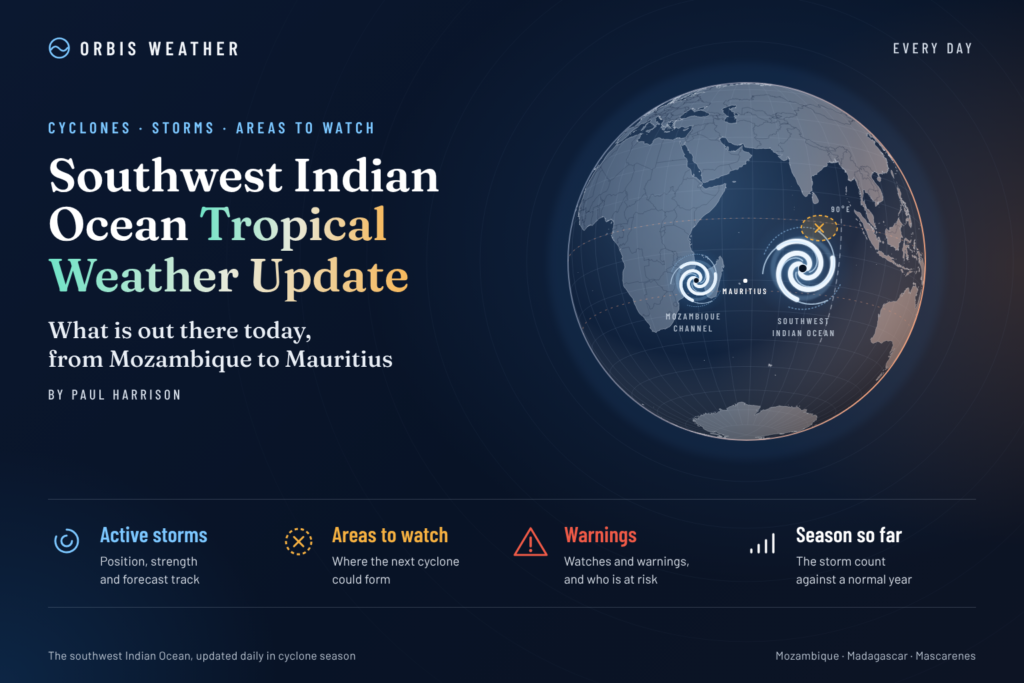
🌀 Southwest Indian Ocean Tropical Weather Update

- Europe Weather & Natural Hazards Today – Friday, November 13, 2026 7:18 PM
- Southeast Asia Earthquakes This Week: Friday, November 13, 2026 7:09 PM
- Southeast Asia Weather & Natural Hazards Today: Friday, November 13, 2026 6:58 PM
- Africa Weather & Natural Hazards Today — Friday, November 13, 2026 6:35 PM
- Middle East Weather & Natural Hazards Today – November 13, 2026 4:07 PM
- America’s Hot Spots This Week November 12, 2026 3:17 PM
- Australian Region Tropical Weather Update — Friday, November 13, 2026 11:49 AM
- Southwest Indian Ocean Tropical Weather Update – Friday, November 13, 2026 11:40 AM
- Australia, New Zealand & Oceania Weather & Natural Hazards Today — Friday, November 13, 2026 11:16 AM
- Evacuation Alert Issued for Entire Village of Pemberton as Flood Risk Rises 10:36 AM
- North America Weather & Natural Hazards Today — November 12, 2026 9:49 AM
- Central America Weather & Natural Hazards Today – Thursday, November 12, 2026 9:35 AM
- South America Weather & Natural Hazards Today – Thursday, November 12, 2026 9:09 AM
- Daily Earthquakes, Storms, Fires & Floods Report — November 12, 2026 9:00 AM
- Weekly Global Climate Pulse: Thursday, November 12, 2026 8:50 AM
- Tropical Atlantic Daily Report: Thursday, November 12, 2026 7:26 AM
- Eastern & Central Pacific Tropical Weather Update: Thursday, November 12, 2026 7:18 AM
- Western Pacific Tropical Weather Update – November 12, 2026 7:10 AM





Southwest Indian Ocean Tropical Weather Update – Friday, November 13, 2026
By Paul Harrison | Orbis Weather
Published: Friday, November 13, 2026 (Southwest Indian Ocean local date)
Forecast period: November 13–18, 2026
Coverage: Madagascar, Mozambique, Mozambique Channel, Mauritius, Réunion, Rodrigues, Mayotte, Comoros, Seychelles and surrounding Southwest Indian Ocean waters.
Verification note: This report uses the latest official and regional information available during preparation on November 12. A November 13 basin-wide cyclone bulletin has not yet been independently verified. Forecast conditions are distinguished from confirmed observations throughout.
Southwest Indian Ocean: Tropical Depression Fades as Attention Turns to Possible New Development
The Southwest Indian Ocean enters Friday, November 13, following a period of weakening tropical activity, with attention increasingly shifting toward the possibility of renewed atmospheric disturbances over the central and northeastern portions of the basin.
Earlier in the week, Tropical Depression 02 weakened as it moved through waters northwest of Madagascar, while a separate low-pressure circulation over the southern Mozambique Channel was also expected to lose organization.
Neither system was expected to become a significant tropical cyclone in the latest verified regional assessment.
However, forecasters have identified the possibility of another area of disturbed weather emerging later in the week, making continued monitoring important as the 2026–2027 Southwest Indian Ocean cyclone season progresses.
The latest reviewed official outlook did not identify an imminent tropical storm formation threat, although newer guidance is needed to establish the precise November 13 status.
1. Tropical Cyclone Activity: Regional Status
Tropical indicator | Latest assessment |
|---|---|
Named tropical cyclones | None identified in the latest verified basin assessment |
Tropical Depression 02 | Dissipation previously forecast |
Southern Mozambique Channel low | Weakening forecast |
New tropical disturbance | Possible later in the week |
Confirmed cyclone landfall threat | None identified in reviewed guidance |
Main monitoring priorities | Rainfall, thunderstorms, coastal conditions |
These assessments are based primarily on the November 10 official basin bulletin summarized in the previous Orbis Weather report. They must not be interpreted as independently confirmed observations for November 13.
What happened to Tropical Depression 02?
Tropical Depression 02 developed over the northern part of the Southwest Indian Ocean before weakening near the waters between the Seychelles, Madagascar and the northern Mozambique Channel.
By November 8, regional reporting indicated that the system was nearing the end of its life without reaching tropical storm intensity.
Its remaining circulation nevertheless presented a potential rainfall concern for northern Madagascar and the Comoros archipelago.
The system was subsequently forecast to dissipate by November 11. Confirmation of its final dissipation requires updated official analysis.
2. Madagascar: Northern Rainfall and Thunderstorm Risks
Madagascar remains one of the principal areas requiring attention during the early stages of the cyclone season.
The weakening circulation associated with Tropical Depression 02 previously raised concerns about rainfall across northern parts of the island.
Although the system was not expected to strengthen into a named tropical storm, tropical moisture can still produce significant local weather impacts.
Northern Madagascar
Areas to monitor include Antsiranana, Nosy Be and surrounding northern coastal districts.
Potential hazards from renewed thunderstorms include:
Localized heavy rainfall and temporary flooding.
Reduced visibility on roads.
Lightning and sudden wind gusts.
Rougher conditions for small fishing vessels.
Landslides where prolonged rainfall affects vulnerable slopes.
These are potential hazards rather than confirmed November 13 warnings.
Western Madagascar
Communities along the Mozambique Channel should continue monitoring offshore disturbances, particularly if a new low-pressure system develops.
Eastern Madagascar
The eastern coastline is not identified as a direct cyclone impact area in the latest reviewed basin assessment.
Nevertheless, tropical showers, coastal winds and changing sea conditions remain normal considerations during the developing cyclone season.
Outlook: No verified cyclone landfall forecast for Madagascar is available from the reviewed information. Local rainfall and warning updates remain essential.
3. Mayotte and Comoros: Monitoring After Recent Heavy Rainfall Concerns
Mayotte and the Comoros experienced heightened weather attention earlier this week as moisture associated with the weakening tropical depression affected the northern Mozambique Channel region.
On November 9, Mayotte was placed under yellow vigilance for heavy rainfall and thunderstorms as deteriorating conditions were anticipated.
Regional reporting on November 12 emphasized that tropical depressions can pose hazards even when they do not develop into powerful cyclones.
Mayotte
The main concerns following periods of heavy rain include localized flooding, rapidly changing road conditions and thunderstorms.
Residents should check the latest Météo-France Mayotte bulletins before assuming earlier warnings remain in force.
Comoros
The islands of Grande Comore, Anjouan and Mohéli should monitor any renewed rainfall or thunderstorm development.
Steep terrain can increase the consequences of intense rainfall, particularly where runoff becomes concentrated in populated valleys and coastal communities.
Outlook: The earlier tropical depression was expected to dissipate. No new cyclone threat to Mayotte or Comoros has been independently established for November 13.
4. Mauritius and Rodrigues: Monitoring the Central Indian Ocean
Mauritius and Rodrigues remain important observation points as the tropical cyclone season develops.
The latest reviewed basin guidance did not identify an organized tropical cyclone approaching either island.
However, forecasters have indicated that another disturbed weather area could emerge farther north or northeast within the basin.
Mauritius
Residents and maritime operators should monitor local forecasts for showers, thunderstorms, trade-wind changes and coastal sea conditions.
Rodrigues
Rodrigues lies farther east and may become particularly relevant if tropical activity develops over the central Indian Ocean.
Any new disturbance would require several days of observations before its development potential, movement and possible impacts could be assessed reliably.
Outlook: No direct cyclone impact has been established for Mauritius or Rodrigues in the reviewed guidance. Updated information should come from Mauritius Meteorological Services.
5. Réunion: Generally Settled Conditions Expected Friday
Réunion has a more specific short-range forecast available from Météo-France.
Its November 12 forecast indicates that Friday, November 13, should bring a relatively typical seasonal weather pattern.
Morning sunshine is expected across much of the island, followed by increasing cloud cover during the afternoon.
Light showers may develop over the higher terrain, while easterly winds are forecast to remain relatively weak.
Temperatures are expected to remain broadly steady.
Météo-France reported no special vigilance in its November 12 regional bulletin, although that status must be checked again for Friday.
Saturday, November 14
The forecast indicates additional high cloud, afternoon cloud development over the mountains and some light showers.
Coastal temperatures are expected to reach approximately 27–29°C (81–84°F).
No significant wind or marine deterioration was indicated in the reviewed forecast.
Outlook: Réunion is expected to experience mainly routine seasonal weather rather than a direct tropical cyclone impact during the immediate forecast period.
6. Seychelles: Watching for Renewed Disturbances
The Seychelles lie close to the northern portion of the basin where tropical disturbances can develop.
The remnants of Tropical Depression 02 were previously forecast to move southwest of parts of the archipelago before dissipating.
The latest reviewed outlook did not identify a direct organized cyclone threat to the Seychelles.
Nevertheless, maritime conditions can change rapidly when tropical thunderstorms develop.
Fishing operators, inter-island transport services and recreational boat users should monitor:
Thunderstorm development.
Sudden changes in wind direction.
Reduced visibility during heavy showers.
Coastal and offshore wave conditions.
Outlook: No confirmed new cyclone threat has been identified in the reviewed information, but the central and northeastern basin remains an area to watch.
7. Mozambique: No Verified Cyclone Landfall Threat
Mozambique’s extensive coastline makes it particularly vulnerable to tropical cyclones entering the Mozambique Channel.
The latest reviewed regional assessment indicated that a weak circulation over the southern Mozambique Channel was expected to dissipate without developing into a subtropical storm.
No confirmed cyclone landfall threat to Mozambique was identified in that assessment.
Northern Mozambique
Coastal districts should continue monitoring local rainfall and thunderstorms, particularly near the northern Mozambique Channel.
Central Mozambique
No organized tropical cyclone approach was identified in the reviewed guidance.
Southern Mozambique
The previously monitored southern-channel circulation was expected to weaken.
Outlook: The immediate organized cyclone risk appears limited in the latest verified assessment, but localized thunderstorms and marine hazards remain possible independently of tropical cyclone activity.
8. Could a New Tropical Disturbance Develop?
One of the most important developments to monitor over the coming days is the possibility of renewed disturbed weather over the central or northeastern Southwest Indian Ocean.
The November 10 regional assessment suggested that another area of disturbed weather could begin developing toward the weekend.
However, the same outlook did not indicate tropical storm formation during its five-day forecast window.
This distinction matters.
An area of disturbed weather does not automatically become a tropical depression, and a tropical depression does not necessarily develop into a named tropical storm.
Meteorologists will be looking for several indicators of possible organization, including persistent thunderstorms, a defined low-level circulation, favorable atmospheric winds and sustained development over time.
At present, the reviewed information does not justify assigning a storm name, projected landfall location or forecast intensity to any possible new disturbance.
9. Five-Day Tropical Weather Outlook: November 13–18
The following is a regional monitoring schedule based on available guidance, not a newly verified day-by-day cyclone forecast.
Date | Monitoring priority |
|---|---|
Fri, Nov 13 | Verify dissipation of earlier systems and assess residual moisture |
Sat, Nov 14 | Watch central and northeastern basin for new disturbed weather |
Sun, Nov 15 | Review organization of any developing low-pressure area |
Mon, Nov 16 | Check updated official formation probabilities |
Tue, Nov 17 | Reassess basin-wide cyclone activity and marine conditions |
Wed, Nov 18 | New official guidance required for reliable assessment |
Forecast confidence
Higher confidence: Earlier tropical circulations were weakening in the latest verified official guidance.
Moderate confidence: Renewed disturbed weather may emerge over the central or northeastern basin.
Lower confidence: The precise location, timing, intensity and eventual movement of any future tropical disturbance.
The absence of a verified cyclone threat should not be interpreted as an absence of all hazardous weather.
10. The 2026–2027 Southwest Indian Ocean Cyclone Season
The broader seasonal outlook continues to suggest that tropical cyclone activity may be below average.
Météo-France’s October seasonal assessment projects approximately six to ten tropical storms during the 2026–2027 season, including Tropical Storm Agueda, with three to five systems potentially reaching tropical cyclone intensity.
The forecast also suggests that cyclone activity may be somewhat more concentrated north and northeast of the Mascarene Islands.
A reduced risk of direct impacts is envisaged for Madagascar and Mozambique, while the Mascarene Islands face a risk closer to normal.
Seasonal named storms
6–10
Projected totalTropical cyclones
3–5
Projected totalWhy a quieter season can still be dangerous
Seasonal forecasts describe the expected overall level of activity, not the severity of individual events.
Even a below-average season can produce a destructive cyclone.
The December 2024 impact of Tropical Cyclone Chido on Mayotte demonstrated the potentially devastating consequences of an intense Southwest Indian Ocean cyclone.
Communities should therefore maintain normal cyclone preparedness regardless of the seasonal forecast.
11. Main Weather Hazards Across the Region
Heavy rainfall and flash flooding
Tropical disturbances can produce intense rainfall without reaching cyclone intensity. Flooding may occur when thunderstorms repeatedly affect the same location.
Dangerous marine conditions
Squalls, sudden gusts and rough seas can create hazardous conditions for fishing vessels and smaller boats.
Landslides
Madagascar, Réunion and parts of the Comoros are particularly sensitive to heavy rainfall over steep terrain.
Thunderstorms and lightning
Lightning, heavy showers and localized wind gusts may develop independently of organized tropical cyclone activity.
Coastal flooding
Large swells and elevated water levels can create coastal hazards, particularly when combined with strong onshore winds or high tides.
These are general hazards to monitor, not declarations that each is currently occurring throughout the region.
12. What Orbis Weather Is Monitoring Over the Next 72 Hours
The main developments requiring attention through the weekend are:
Confirmation that Tropical Depression 02 has fully dissipated.
Any residual rainfall or thunderstorms affecting Mayotte, Comoros and northern Madagascar.
The possible emergence of a new disturbed weather area over the central or northeastern basin.
Any change in cyclone formation guidance from Météo-France La Réunion.
Local marine warnings and rainfall forecasts for Mauritius, Rodrigues, Réunion, Seychelles and Mozambique.
No speculative storm tracks, wind speeds or rainfall totals are being assigned without verified supporting forecasts.
13. Official Tropical Cyclone Information and Sources
Orbis Weather uses official meteorological agencies and established scientific organizations as its primary references.
Météo-France La Réunion — Regional cyclone monitoring, forecasts and vigilance.
Mauritius Meteorological Services — Mauritius and Rodrigues forecasts and cyclone bulletins.
Météo Madagascar — National meteorological information.
World Meteorological Organization — International cyclone coordination and seasonal climate information.
Global Disaster Alert and Coordination System — International disaster monitoring.
Editorial methodology and verification
This report combines official cyclone outlooks, national weather forecasts and regional meteorological reporting.
Information is separated into three categories: verified observations, official forecasts and general weather hazards.
Where a current official bulletin cannot be independently verified, the report identifies the date of the latest reviewed guidance instead of presenting older information as live conditions.
Seasonal projections are not treated as short-term storm forecasts. Named storms, cyclone intensities and warning levels are reported only when supported by appropriate meteorological authorities.
Orbis Weather will identify and correct substantive factual errors when confirmed information becomes available.
14. Southwest Indian Ocean Tropical Weather Summary
The Southwest Indian Ocean enters Friday, November 13, 2026, with the latest verified regional guidance indicating a relatively quiet period for organized tropical cyclone activity.
Tropical Depression 02 was forecast to dissipate earlier in the week, while a separate circulation over the southern Mozambique Channel was also expected to weaken.
No confirmed cyclone landfall threat was identified in the latest reviewed basin assessment.
However, the possibility of a new area of disturbed weather developing over the central or northeastern basin warrants continued attention through the weekend.
Madagascar, Mayotte, Comoros, Mozambique, Seychelles, Mauritius, Rodrigues and Réunion should continue monitoring local forecasts for rainfall, thunderstorms and changing marine conditions.
The bottom line: The immediate outlook remains relatively quiet based on the latest verified information, but the Southwest Indian Ocean cyclone season is underway and renewed tropical development remains possible. Updated official bulletins are essential before confirming the November 13 cyclone status.
Orbis Weather | Global Weather, Tropical Cyclones & Natural Hazards
Reported by Paul Harrison
Published: November 13, 2026 (regional local date)
Latest verified basin assessment used: November 10, 2026.
Latest reviewed Réunion local forecast: November 12, 2026.
Disclaimer: This article provides independent weather reporting, forecast interpretation and educational analysis. It is not an official tropical cyclone warning or emergency notification. Weather conditions can change rapidly. Residents, travelers and maritime operators should consult their national meteorological services and local emergency authorities for current warnings and safety instructions.
About the Author
Paul Harrison — Founder & Publisher, Orbis Weather
Paul Harrison founded Orbis Weather in 2026 to make global weather and natural-hazard information easier to find, follow and understand. His coverage includes tropical cyclones, severe weather, extreme temperatures, earthquakes, volcanoes, wildfires, flooding and significant natural disasters worldwide.
View all articles by Paul Harrison → | Editorial Standards →
Global Weather Tracker Hub
Explore weather maps, tropical systems, storms and natural hazards around the world.
No matching trackers found.