
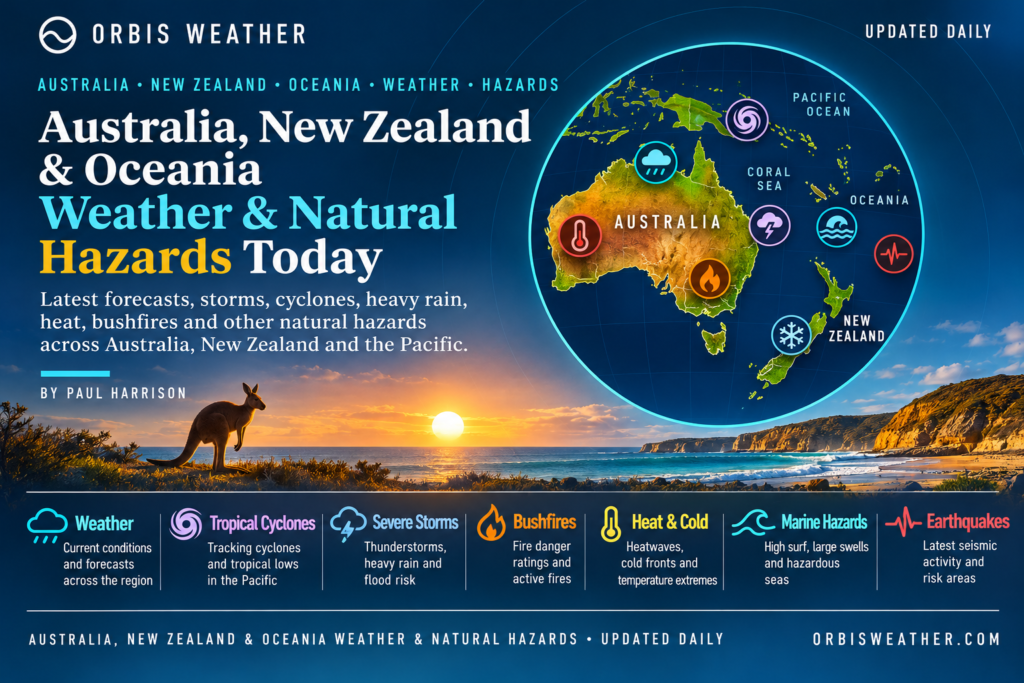
🌍 Australia, New Zealand & Oceania Weather & Natural Hazards Today

- Europe Weather & Natural Hazards Today – Friday, November 13, 2026 7:18 PM
- Southeast Asia Earthquakes This Week: Friday, November 13, 2026 7:09 PM
- Southeast Asia Weather & Natural Hazards Today: Friday, November 13, 2026 6:58 PM
- Africa Weather & Natural Hazards Today — Friday, November 13, 2026 6:35 PM
- Middle East Weather & Natural Hazards Today – November 13, 2026 4:07 PM
- America’s Hot Spots This Week November 12, 2026 3:17 PM
- Australian Region Tropical Weather Update — Friday, November 13, 2026 11:49 AM
- Southwest Indian Ocean Tropical Weather Update – Friday, November 13, 2026 11:40 AM
- Australia, New Zealand & Oceania Weather & Natural Hazards Today — Friday, November 13, 2026 11:16 AM
- Evacuation Alert Issued for Entire Village of Pemberton as Flood Risk Rises 10:36 AM
- North America Weather & Natural Hazards Today — November 12, 2026 9:49 AM
- Central America Weather & Natural Hazards Today – Thursday, November 12, 2026 9:35 AM
- South America Weather & Natural Hazards Today – Thursday, November 12, 2026 9:09 AM
- Daily Earthquakes, Storms, Fires & Floods Report — November 12, 2026 9:00 AM
- Weekly Global Climate Pulse: Thursday, November 12, 2026 8:50 AM
- Tropical Atlantic Daily Report: Thursday, November 12, 2026 7:26 AM
- Eastern & Central Pacific Tropical Weather Update: Thursday, November 12, 2026 7:18 AM
- Western Pacific Tropical Weather Update – November 12, 2026 7:10 AM





Australia, New Zealand & Oceania Weather & Natural Hazards Today — Friday, November 13, 2026
By Paul Harrison | Orbis Weather
Regional coverage: Australia, New Zealand, Papua New Guinea, Fiji, Vanuatu, Solomon Islands, Tonga, Samoa and the wider South Pacific.
Published for Friday, November 13, 2026 — Australia and Oceania local date
🌏 Regional Weather Overview: Severe Australian Storms, Flooding Concerns and Pacific Cyclone Monitoring
Severe thunderstorms across eastern Australia remain the leading weather story heading into Friday, November 13, following another period of dangerous conditions across Queensland and New South Wales.
Large hail, damaging winds, intense rainfall and localized flash flooding have affected the region, with communities facing the possibility of further unsettled weather as November’s spring storm season continues.
Australia’s Bureau of Meteorology issued severe-weather updates on Thursday, November 12, highlighting renewed thunderstorms across Queensland and New South Wales. The most dangerous storms have been associated with unstable, moisture-rich air and low-pressure troughs over eastern Australia.
Meanwhile, northern Queensland continues to face significant heat concerns, New Zealand remains vulnerable to heavy rainfall and landslides following recent wet weather, and tropical cyclone monitoring is becoming increasingly important across the southwest Pacific.
Friday’s main priorities are eastern Australian thunderstorms, northern Australian heat, New Zealand rainfall risks and developing tropical weather across the Pacific islands.
This report uses verified information available through November 12, together with a forward-looking assessment for Friday, November 13. Where fresh official warnings could not be independently confirmed, potential hazards are identified as monitoring priorities rather than active warnings.
🚨 Major Weather Hazards — November 13
Region | Primary concern | Outlook |
|---|---|---|
🌩️ Southeast Queensland | Severe thunderstorms, hail, damaging winds | Elevated |
🌧️ Northeast New South Wales | Renewed storms and localized flooding | Elevated |
🌡️ Far North Queensland | Persistent heat | Elevated |
⛈️ Northern Australia | Tropical showers and thunderstorms | Monitor |
🌧️ New Zealand North Island | Heavy rain, swollen rivers and slips | Monitor |
🌊 New Zealand South Island | Mountain rainfall and hazardous travel | Monitor |
🌀 Fiji and Vanuatu | Tropical cyclone development | Monitor |
🌧️ Papua New Guinea | Tropical rainfall and landslides | Monitor |
🌴 Solomon Islands | Rainfall variability and marine conditions | Monitor |
🌋 Pacific Ring of Fire | Earthquakes, volcanoes and tsunami exposure | Ongoing |
These are Orbis Weather editorial assessments, not official warning categories. An elevated assessment does not mean an official warning is active throughout the region.
🇦🇺 Australia Weather & Natural Hazards
🌩️ Queensland: Severe Storm Threat Remains a Major Concern
Southeast Queensland has experienced another round of potentially dangerous thunderstorms.
A Bureau of Meteorology warning issued Thursday afternoon identified severe storms affecting parts of Somerset, South Burnett, Lockyer Valley, Sunshine Coast and Toowoomba council areas.
The warning highlighted damaging winds, large hailstones and heavy rainfall capable of causing flash flooding. Storms were moving east to northeast when the warning was issued.
Areas requiring particular attention include Brisbane’s western districts, the Sunshine Coast hinterland, Toowoomba, the Lockyer Valley and surrounding communities.
For Friday, the key question is whether sufficient moisture and atmospheric instability remain to support further thunderstorms. A fresh Friday warning was not confirmed in the information reviewed.
Potential hazards include:
Large hail damaging vehicles, roofs and agricultural crops.
Strong wind gusts bringing down trees and power lines.
Intense rainfall overwhelming local drainage systems.
Lightning and interruptions to electricity supplies.
Rapidly changing road conditions.
Residents should monitor the Bureau of Meteorology’s current radar and warnings before traveling.
🌧️ New South Wales: Storms Ease, but Further Development Remains Possible
Northeastern New South Wales experienced severe thunderstorms during Thursday, particularly across the Northern Rivers, Northern Tablelands and Mid North Coast.
At 6:01 p.m. AEDT Thursday, the Bureau cancelled its severe thunderstorm warning for those districts, reporting that the immediate threat had eased.
However, the Bureau also indicated that further storm development remained possible later Thursday evening.
The cancellation should not be interpreted as confirmation that Friday will remain storm-free.
Communities around Lismore, Ballina, Byron Bay, Grafton and surrounding districts should continue monitoring rainfall, river conditions and local warnings.
Heavy thunderstorms can produce dangerous flash flooding even when broader regional rainfall totals are relatively modest.
🌡️ Far North Queensland: Heat Remains a Health Concern
Northern Queensland has experienced unusually hot November conditions, particularly around Cape York Peninsula.
The recent heat has increased concern about dehydration, heat exhaustion and prolonged exposure for outdoor workers.
Conditions are especially challenging when high temperatures combine with tropical humidity.
Residents and visitors should avoid unnecessary strenuous activity during the hottest part of the day, maintain adequate hydration and check on vulnerable people.
The precise Friday maximum temperatures and any active heatwave warning boundaries require confirmation from the latest Bureau forecasts.
🌦️ Victoria, Tasmania and South Australia
Southern Australia has recently experienced unusually cold spring conditions.
A cold outbreak earlier in November brought snowfall to alpine locations including Thredbo, Perisher and Mount Hotham, as well as Tasmania’s kunanyi/Mount Wellington.
Although those conditions occurred earlier in the week, they illustrate how quickly Australian spring weather can change.
For Friday, residents should monitor local forecasts for showers, changing winds, coastal hazards and possible thunderstorms.
No new statewide severe-weather emergency for Victoria, Tasmania or South Australia was independently confirmed for this edition.
⛈️ Western Australia and Northern Territory
Across tropical northern Australia, the transition into the wet season brings increasing opportunities for showers, thunderstorms and lightning.
The principal seasonal hazards include localized flash flooding, dangerous lightning and isolated damaging wind gusts.
Western Australia’s southwest experiences a different weather regime, with frontal systems and changing coastal winds more relevant than tropical storms.
No specific Friday severe-weather warning covering these entire regions was verified.
🔥 Australian Bushfire and Fire Weather Outlook
Australia’s fire danger varies considerably by location.
Hot temperatures, dry vegetation, low humidity and strong winds can increase the likelihood of rapidly spreading fires.
However, recent rainfall across parts of eastern Australia may temporarily reduce fire danger in some locations.
Orbis Weather has not independently verified a complete list of active bushfires, evacuation orders or Friday fire-danger ratings.
Residents should consult state emergency services and official fire-danger forecasts rather than relying on regional generalizations.
🇳🇿 New Zealand Weather & Natural Hazards
🌧️ North Island: Monitoring Heavy Rain and Landslide Risks
New Zealand’s North Island remains an important area for rainfall monitoring following recent heavy weather.
Earlier warnings affected parts of the Bay of Plenty and Gisborne/Tairāwhiti region, where mountainous terrain can concentrate runoff into rivers and streams.
The principal concerns following substantial rainfall include swollen waterways, surface flooding, unstable hillsides and slips affecting roads.
The earlier warning period had been scheduled to end before Friday, and its continuation has not been independently verified.
For November 13, residents should check current MetService warnings rather than assuming earlier alerts remain active.
🌧️ South Island: Mountain Weather and River Conditions
The South Island’s western ranges are particularly vulnerable to heavy orographic rainfall, where moist air is forced upward over mountainous terrain.
Areas around Westland, Fiordland and the Southern Alps can experience rapidly changing conditions.
Possible hazards include:
Rapidly rising rivers and streams.
Slips on mountain roads.
Reduced visibility during heavy rain.
Strong winds across exposed alpine routes.
These are regional hazards to monitor, not a claim that all these conditions are occurring on Friday.
🌋 Earthquake and Volcanic Monitoring
New Zealand sits along the boundary of the Pacific and Australian tectonic plates.
Important volcanic monitoring areas include Ruapehu, Whakaari/White Island and the Taupō volcanic region.
Earthquake activity is monitored continuously by GeoNet.
No specific new major earthquake emergency, volcanic eruption or volcanic alert-level change for November 13 was verified for this report.
Readers can follow GeoNet’s official earthquake and volcano monitoring for current information.
🌀 Southwest Pacific Tropical Cyclone Outlook
Friday, November 13, 2026
The South Pacific tropical cyclone season is underway, and monitoring will become increasingly important through the Southern Hemisphere summer.
The main areas of interest include the Coral Sea, waters surrounding Vanuatu, Fiji and the Solomon Islands, and the broader southwest Pacific.
🇻🇺 Vanuatu
Vanuatu’s meteorological authorities reported a low likelihood of tropical cyclone development in their November 11 outlook covering the following several days.
That assessment included Friday, November 13.
A low development likelihood does not mean that ordinary thunderstorms, heavy rainfall or hazardous seas cannot occur.
A newer Friday cyclone outlook was not independently confirmed.
🇫🇯 Fiji
Fiji’s Regional Specialized Meteorological Centre in Nadi is responsible for monitoring tropical disturbances across a large portion of the southwest Pacific.
Its November 10 tropical disturbance summary did not identify a significant tropical disturbance within the monitored region.
Because tropical conditions can change rapidly, that earlier assessment should not be treated as a definitive November 13 cyclone status.
Readers should consult the latest official tropical disturbance bulletins.
🇸🇧 Solomon Islands
The Solomon Islands are entering the wetter tropical cyclone season, although cyclone frequency and rainfall patterns vary substantially from year to year.
The country’s seasonal outlook has highlighted the possibility of below-normal rainfall associated with El Niño conditions, alongside the continuing threat from tropical cyclones and hazardous marine weather.
Seasonal drought concerns can coexist with short periods of intense rainfall.
🇦🇺 Australian Tropical Cyclone Region
The Australian tropical cyclone season officially runs from November through April.
Northern Queensland, the Northern Territory and northern Western Australia are among the regions requiring regular cyclone monitoring.
The Bureau of Meteorology provides separate tropical cyclone outlooks and warning services for the Australian region.
Cyclone status verification: No new named tropical cyclone affecting Australia or the southwest Pacific was independently established from the latest sources reviewed for this edition. This is not confirmation that every basin is cyclone-free.
🌴 Pacific Island Weather & Natural Hazards
🇵🇬 Papua New Guinea: Heavy Rain and Landslide Exposure
Papua New Guinea experiences substantial tropical rainfall, particularly in mountainous areas.
During periods of prolonged rain, the country’s steep terrain can produce landslides, rapidly rising rivers and damage to transport infrastructure.
Communities in the Highlands and along vulnerable river systems should monitor official forecasts and local emergency information.
A specific nationwide severe-weather emergency for November 13 was not independently verified.
🇫🇯 Fiji: Tropical Rainfall and Marine Conditions
Fiji’s wet season brings increased potential for thunderstorms, intense rainfall and localized flooding.
Marine operators should pay particular attention to wind, swell and thunderstorm forecasts, especially when traveling between islands.
Tropical disturbances are not the only source of dangerous weather. Ordinary rainbands and thunderstorms can also create hazardous conditions.
🇻🇺 Vanuatu: Multiple Natural Hazards
Vanuatu remains exposed to tropical cyclones, earthquakes, volcanic activity and localized flooding.
Its position within the Pacific Ring of Fire makes earthquake and volcano monitoring particularly important.
Cyclone alerts and geological hazard alerts are issued through different monitoring systems and should be checked separately.
🇸🇧 Solomon Islands: Rainfall and Water Supply
The Solomon Islands face a combination of tropical rainfall variability, coastal exposure and potential seasonal drought.
Below-normal rainfall over an extended period can affect agriculture, freshwater supplies and community infrastructure.
At the same time, localized thunderstorms may produce short-duration flooding.
🇹🇴 Tonga and 🇼🇸 Samoa
Tonga and Samoa are entering the wetter and more cyclone-prone part of the year.
Seasonal concerns include heavy thunderstorms, rough seas, coastal inundation and tropical cyclone development.
No specific November 13 cyclone warning for either country was independently verified in the material reviewed.
🌋 Earthquakes, Volcanoes and Tsunami Monitoring
The Australia–Oceania region contains some of the world’s most active tectonic boundaries.
Important monitoring areas include Papua New Guinea, Vanuatu, Tonga, the Kermadec Islands, the Solomon Islands and New Zealand.
Earthquakes can occur without warning, while volcanic activity may develop over longer periods.
A strong undersea earthquake can generate a tsunami, although not every earthquake produces one.
Current verification: No specific new region-wide tsunami warning or major volcanic emergency for November 13 was confirmed from the sources reviewed. This does not replace checking live official warning systems.
For real-time information, consult the U.S. Tsunami Warning System, USGS earthquake monitoring and relevant national geological agencies.
📅 Regional Weather Outlook: November 13–16, 2026
Date | Areas to monitor | Principal hazards |
|---|---|---|
Friday, Nov. 13 | Queensland and northeast NSW | Possible renewed thunderstorms and flooding |
Friday–Saturday | Far North Queensland | Heat and tropical humidity |
Friday–Sunday | Northern Australia | Wet-season thunderstorms |
Friday–Monday | New Zealand | Changes in rainfall and mountain conditions |
Friday–Monday | Fiji, Vanuatu and Solomon Islands | Tropical disturbance development |
Weekend | Papua New Guinea | Tropical rainfall and landslide exposure |
Throughout period | Pacific Ring of Fire | Earthquake and volcanic monitoring |
This is a regional hazard-monitoring outlook, not a confirmed daily forecast for every location. Updated national forecasts should be consulted for exact timing and warning status.
🛡️ Weather Safety: What Residents Should Know
For communities experiencing thunderstorms, the most immediate dangers are often lightning, falling trees, damaged power lines and floodwater crossing roads.
Never attempt to drive through flooded roads, even when the water appears shallow.
During severe storms, remain indoors and avoid exposed areas. People in mountainous regions should watch for unusual ground movement, rapidly rising streams and signs of unstable slopes.
Residents in cyclone-prone communities should maintain emergency supplies, know their evacuation routes and follow official national warnings.
Coastal residents should also remain aware of marine warnings and tsunami procedures.
🔎 Official Weather and Natural Hazard Sources
Orbis Weather recommends the following primary monitoring services:
Country or region | Official information |
|---|---|
Australia | |
New Zealand | |
New Zealand earthquakes | |
Fiji and southwest Pacific | |
Vanuatu | |
Papua New Guinea | |
Pacific tropical cyclones | |
Global earthquakes | |
Tsunami warnings |
Editorial Methodology and Verification
This Orbis Weather report combines official meteorological information, verified weather reporting and regional natural hazard assessments.
The principal verified developments include the November 12 Bureau of Meteorology severe-weather update, Thursday’s Queensland thunderstorm warnings, the cancellation of the northeast New South Wales warning and recent reports of unusually cold conditions in southern Australia.
Because the report is prepared ahead of Friday’s local weather developments, Friday-specific forecasts and active warning statuses are not presented as confirmed unless independently verified.
No unverified rainfall totals, earthquake magnitudes, cyclone intensities, casualty figures or evacuation numbers have been included.
Updates and Corrections Policy
Orbis Weather aims to distinguish observed weather events from forecasts, seasonal risks and unconfirmed developments. Material factual errors will be corrected when identified and supported by reliable evidence.
This article is intended for public weather awareness and does not replace official warnings or emergency instructions.
🌏 Final Outlook: Eastern Australian Storms Lead the Regional Weather Watch
As Australia, New Zealand and Oceania move into Friday, November 13, eastern Australia’s unsettled weather remains the most significant recently verified immediate concern.
Queensland has experienced another round of severe thunderstorms, while northeast New South Wales has seen damaging weather followed by an easing of the immediate warning situation.
Northern Queensland’s heat, New Zealand’s rainfall vulnerability and the developing South Pacific tropical cyclone season remain important monitoring priorities.
Across the Pacific islands, communities must remain prepared for both sudden extreme weather and longer-term climate-related pressures, including rainfall shortages and tropical cyclone exposure.
The message for Friday is straightforward: remain alert to changing conditions, check official warnings frequently and prepare for localized hazards even when broader regional forecasts appear relatively calm.
Weather changes quickly. Stay informed, stay prepared and stay safe.
Orbis Weather | Global Weather & Natural Hazards CoverageBy Paul HarrisonFriday, November 13, 2026 — Australia, New Zealand & Oceania Edition
About the Author
Paul Harrison — Founder & Publisher, Orbis Weather
Paul Harrison founded Orbis Weather in 2026 to make global weather and natural-hazard information easier to find, follow and understand. His coverage includes tropical cyclones, severe weather, extreme temperatures, earthquakes, volcanoes, wildfires, flooding and significant natural disasters worldwide.
View all articles by Paul Harrison → | Editorial Standards →
Global Weather Tracker Hub
Explore weather maps, tropical systems, storms and natural hazards around the world.
No matching trackers found.