Tropical Atlantic Daily Report: Thursday, November 12, 2026
By Paul Harrison, Orbis Weather
At a glance
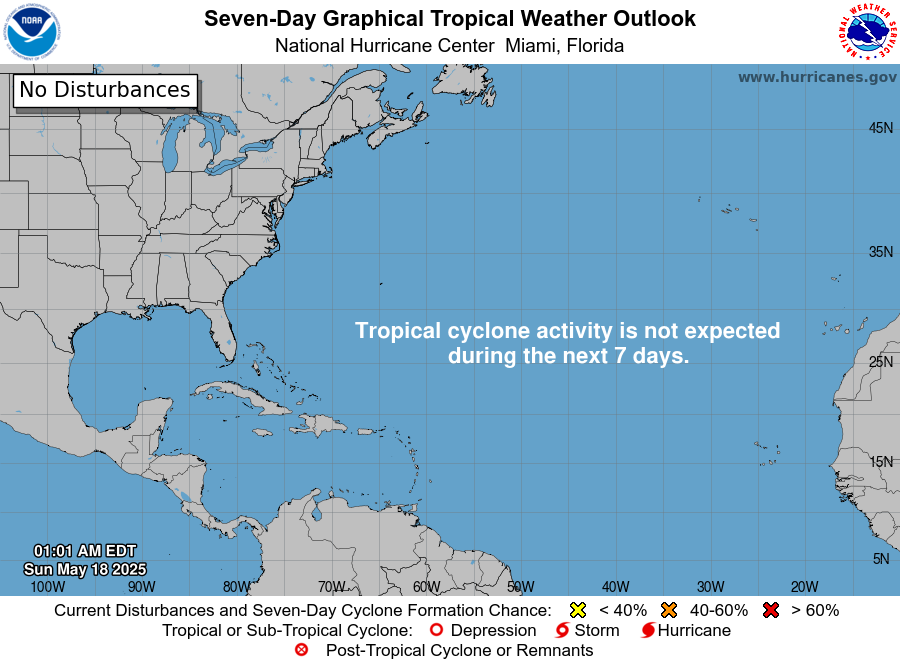
The Atlantic basin is quiet: there are no tropical cyclones, and the National Hurricane Center (NHC) does not expect any to form in the next seven days.
This report is current to 6:46 a.m. EST (11:46 UTC) on Thursday, November 12, 2026. It uses NHC’s Tropical Weather Outlook issued at 7:00 p.m. EST Wednesday, November 11, and its Tropical Weather Discussion issued at 1215 UTC (7:15 a.m. EST) Wednesday, November 11.
- Active storms: none in the open Atlantic, the Caribbean Sea or the Gulf of Mexico.
- Threats to land: none from tropical cyclones, so this report has no storm-threat section today.
- Disturbances: NHC is not monitoring any area; formation “is not expected during the next 7 days.”
- Season to date: 10 named storms, 1 hurricane and 1 major hurricane, all below the 1991-2020 average for this date.
- Calendar: the official season runs to November 30.
The National Hurricane Center and national weather services issue the official forecasts and warnings. Follow any evacuation order immediately.
Active storms
There are no active tropical cyclones, subtropical cyclones or potential tropical cyclones in the Atlantic basin. NHC’s Atlantic page states: “There are no tropical cyclones in the Atlantic at this time.”
Disturbances to watch
NHC has no areas of interest outlined in the Atlantic basin.
Area | Location | 48-hour chance | 7-day chance | NHC outlook issued |
|---|
None | Atlantic, Caribbean Sea and Gulf of Mexico | Not applicable | Not applicable | 7:00 p.m. EST Wed., Nov. 11 |
The Tropical Weather Discussion of 1215 UTC Wednesday names no tropical waves. It places the Intertropical Convergence Zone (ITCZ) from 8N 21W to 7N 53W, with scattered moderate thunderstorms between 21W and 42W.
The other features in that discussion are non-tropical:
- Eastern Atlantic: Meteo-France had a gale warning north of the Canary Islands to off Agadir, Morocco, with seas of 12 to 18 feet [3.7 to 5.5 m], expected to start easing after 1200 UTC Wednesday.
- Gulf of Mexico: a cold front was forecast to cross the Gulf through Thursday night and leave by Friday. Strong east winds are likely over parts of the northern Gulf starting Sunday.
- Caribbean: fresh to strong trade winds and seas of 6 to 8 feet [1.8 to 2.4 m] in the south-central Caribbean, easing from Friday as a cold front approaches the Yucatan Channel.
- Western Atlantic: another cold front was expected off the southeastern US coast Thursday, stalling by Saturday night from near 28N 55W toward the Turks and Caicos.
Season so far
The 2026 season is running below the 1991-2020 average to this date, most of all for hurricanes.
Count | 2026 to date | 1991-2020 average to this date | 1991-2020 full-season average |
|---|
Named storms | 10 | 13 | 14 |
Hurricanes | 1 | 6 | 7 |
Major hurricanes (Category 3+) | 1 | 3 | 3 |
Sources: NHC 2026 season list, data as of 2100 UTC November 11; NHC climatology (1991-2020). The averages to date follow NHC’s season table, which lists 2026 as 3 named storms, 5 hurricanes and 2 major hurricanes below normal.
Isaias, October 6-10, was the season’s only hurricane, peaking at 105 knots (about 120 mph [195 km/h]). The latest named system was Subtropical Storm Josephine, October 21-22. NHC puts accumulated cyclone energy (ACE) at 19.9, 83% below normal, and lists 1 direct death (Tropical Storm Arthur in June).
ENSO: NOAA’s Climate Prediction Center discussion of October 8 keeps an El Niño Advisory in place. It says “El Niño continues to strengthen,” with a strong-to-very strong event likely through January-March 2027.
What to watch next
- NHC Tropical Weather Outlook: the next outlooks will show whether any area is added to the seven-day forecast. Issued by the National Hurricane Center.
- Gulf of Mexico cold front, Thursday night to Friday: followed by strong east winds over the northern Gulf from Sunday. Marine forecasts come from NHC and local National Weather Service offices.
- Western Atlantic front, through Saturday night: forecast to stall from near 28N 55W toward the Turks and Caicos, per NHC’s Tropical Weather Discussion.
- ENSO update, November 12: the Climate Prediction Center has scheduled its next ENSO diagnostics discussion for today.
- End of season, November 30: the official Atlantic hurricane season closes, per NHC climatology.
About this report
This report summarizes official products from the National Hurricane Center and NOAA’s Climate Prediction Center. NHC outlooks use Eastern Standard Time (EST); its discussions and season data use Coordinated Universal Time (UTC). Positions such as 28N 55W are latitude and longitude. Figures reflect the issue times given and may be replaced by newer products at any time. Orbis Weather covers the Pacific basins in separate reports.
Glossary
- Tropical wave: a trough of low pressure moving westward through the tropics, which can seed tropical cyclones.
- ITCZ: the Intertropical Convergence Zone, a band near the equator where trade winds meet and thunderstorms form.
- Major hurricane: a hurricane of Category 3 or higher on the Saffir-Simpson scale, with winds of at least 111 mph [178 km/h].
- Subtropical storm: a storm with a mix of tropical and non-tropical traits, named from the same list as tropical storms.
- Accumulated cyclone energy (ACE): a measure of a season’s combined storm strength and duration.
Frequently asked questions
Is there a tropical storm or hurricane in the Atlantic today? No. NHC reports no tropical cyclones in the Atlantic, Caribbean Sea or Gulf of Mexico. Its latest outlook expects no formation in the next seven days.
Is hurricane season over? Not officially. The Atlantic season runs from June 1 to November 30, so NHC continues to issue outlooks until then.
How does 2026 compare with a normal season? It is below average to date. NHC counts 10 named storms, 1 hurricane and 1 major hurricane, against averages of 13, 6 and 3 by this date.
What weather should coastal areas expect this week? NHC’s latest discussion describes cold fronts rather than tropical systems. A front was forecast to cross the Gulf of Mexico by Friday, with strong east winds over the northern Gulf from Sunday. Local National Weather Service offices issue the forecasts for specific places.
Sources
- National Hurricane Center, active storms page (page updated 1340 UTC Wednesday, November 11, 2026)
- NHC Atlantic Tropical Weather Outlook (issued 7:00 p.m. EST Wednesday, November 11, 2026)
- NHC Atlantic Tropical Weather Discussion (issued 1215 UTC Wednesday, November 11, 2026)
- NHC 2026 Atlantic season list and summary (updated November 11, 2026; data as of 2100 UTC)
- NHC tropical cyclone climatology, 1991-2020 (accessed November 12, 2026)
- NOAA Climate Prediction Center, ENSO diagnostic discussion (issued October 8, 2026)