
Singapore Haze & Air Quality Tracker

- Australian Region Tropical Weather Update — Saturday, November 14, 2026 11:26 AM
- Southwest Indian Ocean Tropical Weather Nov 14 2026 11:18 AM
- Australia, New Zealand & Oceania Weather & Natural Hazards Today — Saturday, November 14, 2026 11:05 AM
- Nor’easter soaks I-95 and brings first snow inland 9:51 AM
- Storm Charles causes floods and flight cancellations across southern Europe 9:30 AM
- North America Weather & Natural Hazards Today – November 13, 2026 9:11 AM
- Central America Weather & Natural Hazards Today – Friday, November 13, 2026 9:03 AM
- South America Weather & Natural Hazards Today – November 13, 2026 8:44 AM
- Daily Earthquakes, Storms, Fires & Floods Report — November 13, 2026 8:18 AM
- Global Natural Disasters This Week — November 13, 2026 8:01 AM
- Tropical Atlantic Daily Report: Friday, November 13, 2026 7:47 AM
- Eastern & Central Pacific Tropical Weather Update: Friday, November 13, 2026 7:38 AM
- WESTERN PACIFIC Tropical Weather Update – November 13, 2026 7:21 AM




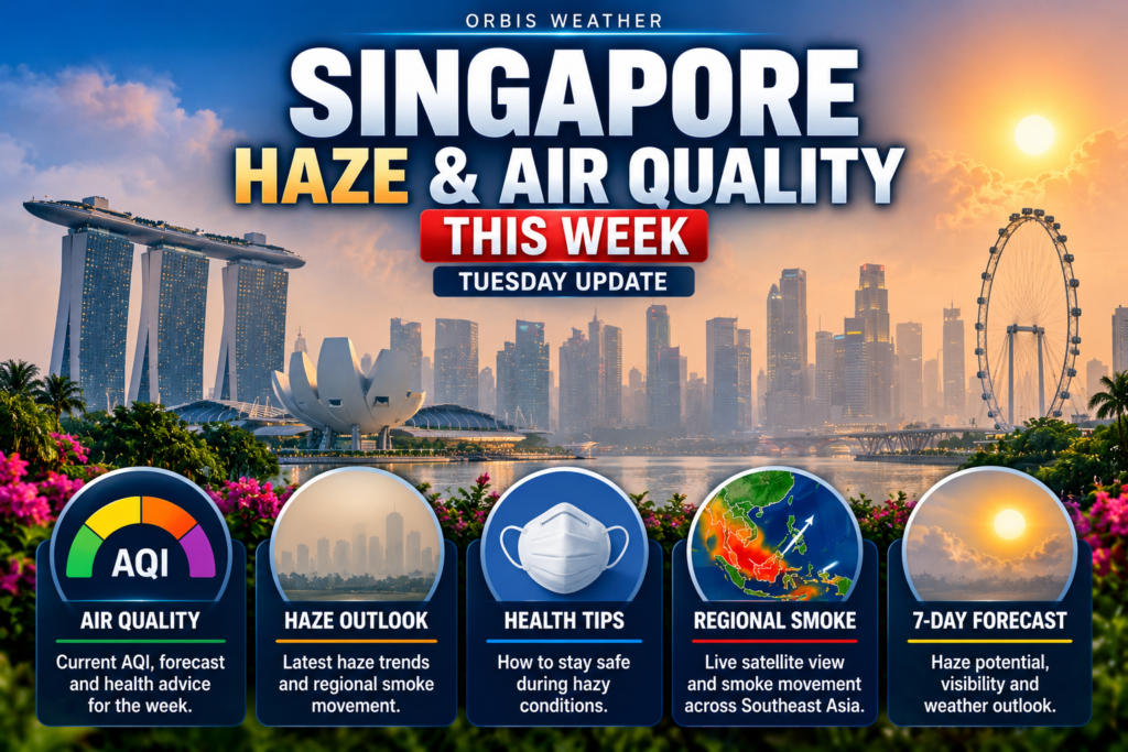
Singapore Haze & Air Quality This Week: Tuesday, November 10, 2026
By Paul Harrison, Orbis Weather
Current to 8:00am SGT (UTC+8) on Tuesday, November 10, 2026, which is 7:00pm US Eastern (EST) on Monday, November 9. Latest Singapore readings used: 7:00am SGT, November 10.
At a glance
Singapore’s 2026 haze episode has ended: the air is Good to Moderate, and the last haze measures stop this week as afternoon storms take over.
- Latest readings: the 24-hour PSI was 44 to 52 across all five regions at 7am on November 10, in the Good to Moderate range.
- The past week: the PSI stayed Moderate and eased from 63–81 on November 3 to 51–55 on November 7. NEA issued its last daily haze update on November 7.
- Cause and source: showers have kept smoke from reaching Singapore. NEA placed the remaining plumes over southern Kalimantan, and ASMC lowered its regional alert to Level 1 on November 5.
- Outlook: the Meteorological Service Singapore (MSS) expects afternoon thundery showers every day through Saturday, with highs of 34°C (93°F).
- Measures: the Haze Subsidy Scheme ends from November 12. Free N95 masks and haze shelters ended on November 7.
The National Environment Agency (NEA) and MSS issue Singapore’s official air quality readings, forecasts and health advisories.
Latest readings
All five regions were in the Good to Moderate range on Tuesday morning, and no region has reached Unhealthy since late October.
Region | 24-hr PSI, 7am Nov 10 | 1-hr PM2.5 (µg/m³), 7am Nov 10 |
|---|---|---|
North | 45 | 10 |
South | 52 | 9 |
East | 44 | 5 |
West | 45 | 8 |
Central | 50 | 11 |
The 7am figures are NEA data as relayed by checkpointsg.com. NEA’s last published update gave an island-wide range of 51–55 at 6pm on November 7. The 1-hour PM2.5 was 5 to 11 µg/m³, in Band I (Normal).
The 24-hour PSI is an average over the past day and suits planning for tomorrow. The 1-hour PM2.5 shows the air right now and suits decisions about the next few hours.
The past week
The 24-hour PSI stayed in the Moderate range every day NEA reported, and eased steadily as showers set in.
The week’s highest reading, 81, came on Tuesday, November 3, when smoke plumes still covered southern Sumatra and Kalimantan. By Thursday NEA said the plumes were confined to southern Kalimantan. NEA ended its daily updates after November 7, so there are no official evening ranges for Sunday or Monday. Rain was the bigger story by Monday: a heavy rain warning went out at 11:42am on November 9, and PUB flagged flash floods at Lorong Gambir and Mackenzie Road, AsiaOne reported.
Forecast and outlook
Rain, not haze, is the week’s main weather story. MSS forecasts thundery showers every afternoon from Tuesday to Saturday.
Day | Forecast | Temperature | Wind |
|---|---|---|---|
Tue Nov 10 | Thundery showers over many areas in the late morning and afternoon | 24–32°C (75–90°F) | Variable, 5–15 km/h (3–9 mph) |
Wed Nov 11 | Afternoon thundery showers | 24–34°C (75–93°F) | Variable, 5–15 km/h (3–9 mph) |
Thu Nov 12 | Afternoon thundery showers | 24–34°C (75–93°F) | Variable, 5–15 km/h (3–9 mph) |
Fri Nov 13 | Afternoon thundery showers | 24–34°C (75–93°F) | Variable, 5–15 km/h (3–9 mph) |
Sat Nov 14 | Afternoon thundery showers | 24–34°C (75–93°F) | Variable, 5–15 km/h (3–9 mph) |
Tuesday is from the MSS 24-hour forecast (5:30am SGT); Wednesday to Saturday from the four-day outlook issued at 5:35am SGT on November 10. No official day-by-day forecast covers Sunday or Monday.
NEA no longer issues a daily PSI forecast. Its final update on November 7 forecast a 24-hour PSI of 40–60 and said haze was “likely to stay suppressed” over the following days.
The MSS fortnightly outlook for October 29 to November 15 expects rainfall slightly above average, highs of 33–35°C (91–95°F) and improving air quality as winds turn light. ASMC’s outlook for November 9–22, issued November 4, expects drier and warmer than usual weather over much of the central and southern Maritime Continent in the first week. ASMC still describes the haze risk for southern ASEAN as low under inter-monsoon conditions.
Where the smoke comes from
Fires continue in Indonesia, mainly in Central Kalimantan, South Sumatra and South Papua, but rain has kept the smoke from reaching Singapore. The counts below come from different sources and are not comparable.
Source | What it counts | Latest figure | Date |
|---|---|---|---|
Indonesian Ministry of Forestry(SiPongi), via Indoposco | High-confidence hotspots, all Indonesia | 165 (up from 55 a day earlier); 13 in Central Kalimantan | 9pm WIB, Nov 7 |
Databoks/Katadata (SiPongi) | All-confidence hotspots, all Indonesia, 24 hours | 2,392; Central Kalimantan 748, South Papua 602 | 11:50am WIB, Nov 6 |
BMKG Pekanbaru, via Riaunews | Hotspots in Sumatra (confidence not stated) | 326; South Sumatra 176, Riau 0 | 11:03pm WIB, Nov 8 |
Hotspots in Sumatra and Kalimantan | Sumatra 7, Kalimantan 34 | Nov 4 |
The ASEAN Specialised Meteorological Centre (ASMC) lowered southern ASEAN to Alert Level 1 on November 5. It had cut the level from 3 to 2 on October 29, after Level 3 began on August 26. Showers kept counts low, ASMC said, and it expects conditions to stay subdued as rain increases. Indonesia’s ministry warns that zero hotspots does not mean peat fires are out. Firefighting suffered two helicopter crashes: an army Mi-17 off Seruyan on November 4, and a contracted Super Puma in the Barito River on November 8, which killed one crew member. South Kalimantan paused water bombing on November 9, saying rain had brought its fires under control.
Health advice and measures in place
At current levels, everyone can carry on with normal activities, and most haze measures have been stood down.
Group | Advice at 24-hr PSI 0–100 (Good to Moderate) |
|---|---|
Healthy persons | Normal activities |
Elderly, pregnant women, children | Normal activities |
Persons with chronic lung or heart disease | Normal activities |
The 1-hour PM2.5 is in Band I (0–55 µg/m³), where normal activities apply. In Band II (56–150), healthy people should reduce strenuous outdoor activity and vulnerable people should avoid it.
- Clinic subsidies: the Ministry of Health (MOH) ends the Haze Subsidy Scheme and the Public Health Preparedness Clinic (PHPC) Scheme from November 12. PHPCs recorded more than 100,000 visits by October 31.
- Masks and shelters: free N95 mask distribution and air-conditioned haze shelters at community centres ended at 6pm on November 7.
- Workplaces: the Ministry of Manpower (MOM) stood down its outdoor-worker measures from November 7; its haze page now carries standing guidance only.
- Schools: the Ministry of Education (MOE) keeps purifiers on and windows shut when PM2.5 is Elevated, and would consider closures if the forecast PSI exceeds 300.
- Policy: MOH cites NEA’s advice that “the likelihood of transboundary haze remains low for the rest of the year.”
Johor and the region
Johor’s stations read Moderate in the week’s published lists, well below the levels that closed schools in October. The latest full Johor list from Malaysia’s Department of Environment, reported by Bernama, is from 9am on November 4.
Station | API, 9am Nov 4 |
|---|---|
Pasir Gudang | 64 |
Larkin (Johor Bahru) | 63 |
Kota Tinggi | 60 |
Pengerang | 57 |
Tangkak | 55 |
Kluang | 53 |
On November 8, Klang in Selangor was Malaysia’s only unhealthy station, at 118 at 9:30am, Kosmo reported. Johor schools reopened by October 28 after a 10-day haze closure. Johor police have readied 2,867 personnel for 337 flood hotspots during the Northeast Monsoon, which MetMalaysia said began on October 27. In diplomacy, Singapore’s Parliament raised the maximum haze pollution fine tenfold to S$20 million on November 4, and said on November 3 it would ratify the ASEAN haze coordinating centre agreement within days.
What to watch this week
The week’s dates are about policy and rain rather than smoke.
Date | What happens |
|---|---|
Wed Nov 11 | Last day of the Haze Subsidy Scheme at PHPCs and polyclinics |
Wed Nov 11 to Sat Nov 14 | Afternoon thundery showers forecast daily by MSS |
Thu Nov 12 | ASEAN Foreign Ministers’ Meeting in Manila, where Malaysia plans to raise haze |
Thu Nov 12 | US NOAA Climate Prediction Center’s next El Niño update |
Sun Nov 15 to Tue Nov 17 | 49th ASEAN Summit in Manila; Indonesia will push to ratify the ASEAN haze centre |
Drier weather at the fire source is what could change the picture. ASMC expects drier than usual conditions over parts of the region this week, and its seasonal outlook expects below-normal November rain in the southern Maritime Continent with a strong El Niño; it still rates the haze risk for southern ASEAN as low.
About this report
This weekly report reviews Tuesday to Monday and looks ahead to the following Monday. Times are Singapore Time (SGT, UTC+8) unless marked WIB (Western Indonesia Time, UTC+7). Readings change hourly, and hotspot counts from different agencies and confidence levels cannot be compared. For decisions, check NEA’s haze.gov.sg or the myENV app.
- PSI (Pollutant Standards Index): Singapore’s air quality index. 0–50 is Good, 51–100 Moderate, 101–200 Unhealthy, 201–300 Very Unhealthy, above 300 Hazardous.
- PM2.5: fine particles 2.5 micrometres across or smaller, measured hourly in micrograms per cubic metre.
- API (Air Pollutant Index): Malaysia’s equivalent of the PSI; above 100 is unhealthy.
- Hotspot: a satellite-detected heat source that may be a fire. A high-confidence count includes only the clearest detections.
- Inter-monsoon: the transition between monsoons, with light, variable winds and afternoon thunderstorms.
Frequently asked questions
Is the haze over in Singapore? For now, yes. The 24-hour PSI has been Good to Moderate since late October, and NEA ended its daily haze updates on November 7.
How bad did it get this year? The 24-hour PSI peaked at 230 in the West at 10am on October 18, in the Very Unhealthy range, Malay Mail reported. Economists estimate the 2026 haze cost Singapore S$2.32 billion to October 31, AsiaOnereported.
Can I still use the haze clinic subsidy? Only until November 11. MOH ends the Haze Subsidy Scheme and the PHPC Scheme from November 12.
Could the haze come back this year? NEA advises the likelihood is low for the rest of the year. Fires are still burning in Kalimantan and South Sumatra, but ASMC expects the situation to stay subdued as rain increases.
Do I need a mask outdoors now? No. At current PSI and PM2.5 levels, the advice for all groups is normal activities.
Sources
Singapore readings and NEA
- NEA haze situation update, 3 November 2026 (6pm reading)
- NEA haze situation update, 4 November 2026 (5pm reading)
- NEA haze situation update, 5 November 2026 (7pm reading; cessation of masks and shelters)
- NEA haze situation update, 6 November 2026 (7pm reading)
- NEA haze situation update, 7 November 2026 (6pm reading; final update)
- Checkpointsg haze readings (NEA data, 7am SGT, November 10)
- haze.gov.sg (PM2.5 bands; regional outlook 5:33pm, November 8)
- Malay Mail, November 1, 2026
- Malay Mail, October 18, 2026
Weather and outlooks
- MSS four-day outlook (issued 5:35am SGT, November 10)
- MSS 24-hour forecast (5:30am SGT, November 10)
- MSS fortnightly outlook (October 29 to November 15) and AsiaOne write-up, October 29
- AsiaOne, heavy rain and flash floods, November 9
- ASMC home page and seasonal outlook (updated November 5)
- ASMC subseasonal outlooks (November 9–22, issued November 4)
Fires and hotspots
- ASMC alerts, November 2026 and Alert Level 2 list
- Indonesian Ministry of Forestry, 55 hotspots, November 7
- Indoposco, 165 hotspots, November 8
- Databoks, 2,392 hotspots, November 6
- Riaunews, BMKG Sumatra hotspots, November 9
- Jakarta Post, helicopter crash, November 4
- Banjarmasin Post, Barito crash, November 9 and water bombing paused, November 10
Health and measures
- MOH, Haze Subsidy Scheme to cease from November 12 (November 5, updated November 9)
- MOH, FAQ: Impact of Haze on Health
- MOM haze guidance (updated November 5)
- MOE parliamentary reply, November 3
- AsiaOne, haze cost estimate, November 9
Malaysia and diplomacy
- Bernama, API readings, November 4
- Kosmo, Klang unhealthy, November 8
- Bernama, Johor schools reopen, October 26
- The Star, Northeast Monsoon onset, October 23
- The Star, Johor flood preparations, November 6
- Malay Mail, haze fine raised, November 5
- The Star, ASEAN haze centre ratification, November 3
- ABC News, regional frustration, November 3
- Bernama, Indonesia and ASEAN Summit, November 4
- NOAA Climate Prediction Center ENSO discussion
Air Quality Scale — U.S. AQI
Pollutant Snapshot
Official Singapore Reporting Regions
Haze Context
Official & Related Sources
Global Weather Tracker Hub
Explore weather maps, tropical systems, storms and natural hazards around the world.
No matching trackers found.
Singapore Haze & Air Quality Tracker – Live PM2.5 & AQI
Monitor haze, fine-particle pollution and air-quality conditions across Singapore with the Orbis Weather Singapore Haze & Air Quality Tracker.
The dashboard provides a quick view of PM2.5, PM10 and other atmospheric pollutants while helping visitors understand whether regional smoke and haze may be affecting Singapore.
Air quality can change significantly depending on local pollution, rainfall, wind direction and regional fire activity. During transboundary haze episodes, smoke from vegetation and peat fires elsewhere in Southeast Asia can travel hundreds of kilometres and affect air quality across Singapore and neighbouring countries.
The Orbis Weather tracker is designed for situational awareness. For Singapore’s official Pollutant Standards Index (PSI), 1-hour PM2.5 readings and public-health guidance, always follow Singapore’s National Environment Agency.
🌫️ What Causes Haze in Singapore?
Singapore can experience haze when fine particles and smoke accumulate in the atmosphere.
Local pollution sources can contribute to air-quality changes, but some of Singapore’s most significant haze episodes have been associated with smoke transported from fires elsewhere in Southeast Asia.
Vegetation and peat fires can release enormous quantities of smoke containing fine particulate matter.
When regional winds transport that smoke toward Singapore, visibility may decrease and concentrations of PM2.5 can increase.
The severity of any haze episode depends on several factors, including the number and intensity of fires, wind direction, atmospheric stability and rainfall.
🔥 What Is Transboundary Haze?
Transboundary haze is air pollution that crosses national borders.
In Southeast Asia, the term is commonly associated with smoke from large vegetation and peat fires that is carried into neighbouring countries.
Singapore’s air quality can therefore be influenced by events occurring far beyond the country’s borders.
A fire does not have to be close to Singapore to affect the atmosphere over the island. If winds and atmospheric conditions are favorable for long-range smoke transport, pollution can travel considerable distances.
This is why understanding haze requires looking at both Singapore’s air-quality observations and the broader weather and fire situation across Southeast Asia.
🇮🇩 Why Indonesian Fires Matter to Singapore
Indonesia contains large areas of tropical forest and peatland.
During dry conditions, vegetation and peat fires can produce substantial smoke.
Peat fires are particularly important because they can burn beneath the surface and may be difficult to extinguish.
When prevailing winds carry smoke from affected parts of Sumatra or other areas toward Singapore and Peninsular Malaysia, regional air quality can deteriorate.
However, the presence of fires in Indonesia does not automatically mean Singapore will experience haze.
Wind direction and weather conditions determine where smoke travels.
🌧️ How Rain Affects Haze
Rain can temporarily improve air quality by removing some airborne particles from the atmosphere.
Heavy tropical showers and thunderstorms may therefore produce noticeable short-term improvements during polluted periods.
However, rainfall over Singapore does not necessarily stop the regional source of a haze event.
If fires continue burning and winds continue transporting smoke toward Singapore, pollution can return after the rain ends.
Rainfall over fire-affected areas can be more important because persistent rain may help suppress vegetation and peat fires.
💨 Why Wind Direction Matters
Wind is one of the most important factors determining whether regional smoke reaches Singapore.
A large number of fires may be burning somewhere in Southeast Asia while Singapore continues to experience relatively clean air because the smoke is being transported in another direction.
A change in regional winds can alter that situation.
This is why haze monitoring should consider air quality together with weather patterns, regional fire activity and smoke transport.
🧭 The Southwest Monsoon and Haze
Singapore’s Southwest Monsoon generally occurs during the middle portion of the year.
During some periods, regional wind patterns can transport smoke from fires in parts of Indonesia toward Singapore and Malaysia.
Dry weather across fire-prone areas can increase the possibility of vegetation and peat fires.
However, every Southwest Monsoon season is different.
Rainfall patterns, fire activity and wind direction determine whether significant transboundary haze develops.
🌬️ What Is PM2.5?
PM2.5 refers to airborne particles with diameters of approximately 2.5 micrometres or smaller.
These particles are extremely small — much smaller than the width of a human hair.
PM2.5 can originate from vehicle exhaust, industrial activity, combustion and smoke from vegetation or peat fires.
Because these particles are so small, they can penetrate deeply into the respiratory system.
PM2.5 is therefore one of the most important pollutants monitored during significant haze events.
💨 What Is PM10?
PM10 refers to inhalable particles with diameters of approximately 10 micrometres or smaller.
These particles include PM2.5 as well as larger airborne particles.
Dust, construction activity, road particles, smoke and other sources can contribute to PM10 concentrations.
PM10 measurements provide useful information about overall particulate pollution, while PM2.5 is particularly important when monitoring smoke and combustion-related pollution.
📊 What Is Singapore’s PSI?
Singapore uses the Pollutant Standards Index, or PSI, as an official measure for communicating air-quality conditions.
The PSI incorporates several major air pollutants into an index designed to help the public understand overall air quality.
Singapore’s National Environment Agency publishes official PSI information along with other air-quality observations and health guidance.
The Orbis Weather dashboard should not be confused with Singapore’s official PSI reporting system.
🇸🇬 Singapore’s Five Air-Quality Regions
Singapore’s official air-quality reporting divides the country into five regions:
North, South, East, West and Central.
Conditions can vary somewhat across the island because of wind direction, rainfall, traffic and the movement of pollution.
During a widespread regional haze episode, however, elevated particulate pollution may affect much of Singapore.
The five-region reporting system provides residents with a more localized picture than a single national measurement.
📊 U.S. AQI vs Singapore PSI
One particularly important distinction on the Orbis Weather tracker is the difference between U.S. AQI and Singapore PSI.
They are not interchangeable.
The U.S. Air Quality Index uses methodology developed for communicating air quality in the United States.
Singapore’s PSI is calculated according to Singapore’s official methodology.
A numerical U.S. AQI value displayed by a third-party dataset should therefore not be presented as Singapore’s official PSI.
For official Singapore readings and health recommendations, use NEA information.
🟢 What Does Good Air Quality Mean?
When particulate pollution is low, most people can generally participate in normal outdoor activities.
Air-quality conditions can nevertheless vary over time.
A relatively clear morning does not guarantee that conditions will remain unchanged throughout the day, particularly during a regional haze episode.
Monitoring trends can sometimes be more informative than looking at a single reading.
🟡 What Happens When Air Quality Worsens?
As concentrations of fine particles increase, air-quality agencies may recommend changes in outdoor activity, particularly for people more vulnerable to air pollution.
Official health recommendations depend on measured pollution levels and the reporting system being used.
Rather than relying solely on a color displayed by a third-party tracker, Singapore residents should consult current NEA guidance whenever pollution becomes elevated.
😷 Who Can Be More Sensitive to Haze?
Air pollution can affect people differently.
Children, older adults and people with certain heart or respiratory conditions may be more sensitive to elevated particulate pollution.
People who spend extended periods exercising or working outdoors can also inhale larger quantities of polluted air simply because they breathe more heavily during physical activity.
During significant haze episodes, follow official Singapore health recommendations regarding outdoor exposure.
👀 Why Does Haze Reduce Visibility?
The tiny particles contained in smoke scatter and absorb light.
When large concentrations accumulate in the atmosphere, distant buildings and landscapes can appear faded or obscured.
This produces the characteristic gray or brown appearance associated with haze.
Visibility can sometimes provide an obvious visual indication that conditions have changed, but appearance alone is not a reliable measurement of air quality.
Pollution instruments provide much more useful information.
☀️ Can It Be Hazy on a Sunny Day?
Yes.
Haze and clouds are completely different phenomena.
A day can have relatively little cloud cover while still experiencing elevated concentrations of airborne particles.
Sunlight passing through smoke or pollution can sometimes create a muted or reddish appearance, particularly near sunrise or sunset.
Air-quality readings are therefore more useful than simply looking at the sky.
🛰️ How Satellites Track Regional Smoke
Satellites are extremely valuable for monitoring vegetation fires and smoke across Southeast Asia.
Sensors aboard Earth-observing satellites can detect thermal anomalies associated with fires and observe large smoke plumes moving through the atmosphere.
Meteorologists and environmental agencies combine satellite observations with ground measurements and weather forecasts to understand where smoke may travel.
Satellite-detected hotspots are useful indicators of possible fire activity, but not every hotspot represents a major uncontrolled wildfire.
🔥 What Are Fire Hotspots?
A hotspot is an area where satellite instruments detect unusually high thermal energy.
Hotspots can indicate vegetation fires, agricultural burning or other heat sources.
During regional haze episodes, the number and location of hotspots can help authorities understand where significant burning may be occurring.
Hotspot counts should still be interpreted carefully because clouds, satellite coverage and other factors can affect detection.
🌏 Haze Across Southeast Asia
Transboundary haze is not exclusively a Singapore issue.
Smoke can affect parts of Indonesia, Malaysia, Singapore, Brunei and other areas depending on regional atmospheric conditions.
Because the problem crosses national borders, understanding a haze episode requires a regional perspective.
Orbis Weather’s broader Southeast Asia Natural Hazards dashboard can help visitors monitor weather and environmental conditions beyond Singapore.
✈️ Haze and Aviation
Significant haze can reduce visibility and affect aviation operations.
Singapore’s airports are equipped to operate in a wide variety of weather conditions, but severe regional smoke can still affect visibility or disrupt flights elsewhere in Southeast Asia.
Regional fires may also occur near airports or along important air routes.
Travelers should check directly with their airline and airport for operational information during major haze episodes.
🏃 Outdoor Activities During Haze
Running, cycling, outdoor sports and other physical activities increase breathing rates.
During poor air-quality conditions, this can increase exposure to fine particles.
The appropriate response depends on pollution levels, individual health circumstances and official health guidance.
Before strenuous outdoor activity during a significant haze episode, check the latest NEA air-quality information.
🏠 Indoor Air During Haze
Outdoor smoke can enter buildings through open doors, windows and ventilation.
During significant haze events, indoor air quality can therefore also be affected.
Official Singapore authorities may provide recommendations for reducing exposure when pollution becomes elevated.
People should follow current government health guidance rather than relying on generic advice when conditions become serious.
📍 Is Singapore Hazy Right Now?
The Orbis Weather Singapore Haze & Air Quality Tracker provides a quick way to examine current particulate-pollution information.
Check PM2.5 and PM10 levels and compare changing conditions over time.
For confirmation of Singapore’s official PSI and 1-hour PM2.5 readings, use information published by Singapore’s National Environment Agency.
During a developing regional haze episode, also monitor weather patterns, wind direction and official haze advisories.
🔎 Where Does Orbis Weather Get Air-Quality Data?
The current browser-based Orbis Weather Singapore tracker uses Open-Meteo air-quality data to provide live values.
Singapore’s official PSI and 1-hour PM2.5 observations are published by the National Environment Agency.
The tracker also directs visitors to Singapore’s official haze information and the Meteorological Service Singapore for additional environmental and weather information. (Orbis Weather)
Orbis Weather organizes these resources for situational awareness but does not independently measure air pollution or issue Singapore air-quality warnings.
🇸🇬 Monitor Singapore Haze & Air Quality
Singapore’s air quality can change as local pollution, rainfall, wind and regional smoke conditions evolve.
During significant Southeast Asian fire seasons, monitoring PM2.5 alongside wind direction and regional hotspot activity can provide valuable context.
Use the Orbis Weather Singapore Haze & Air Quality Tracker for a quick overview, then consult official Singapore sources when air-quality conditions become elevated.
For broader regional monitoring, explore Singapore Weather & Natural Hazards, Singapore Monsoon & Flood Tracker, Southeast Asia Natural Hazards and the Daily Southeast Asia Weather & Natural Hazards Briefing.
Important Air-Quality Disclaimer
The Orbis Weather Singapore Haze & Air Quality Tracker is provided for general information, education and situational awareness.
Live values displayed by the current browser-based tracker come from third-party air-quality data and are not Singapore’s official PSI readings. Singapore’s official PSI, 1-hour PM2.5 information, haze advisories and public-health recommendations are issued by the National Environment Agency. (Orbis Weather)
Air-quality information can change rapidly and individual monitoring systems can differ in methodology and update frequency.
Do not use the Orbis Weather tracker as a substitute for official health or emergency guidance.