
🌍 Australia, New Zealand & Oceania Weather & Natural Hazards Today
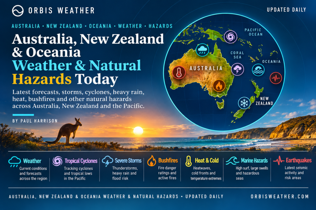

- Australia, New Zealand & Oceania Weather & Natural Hazards Today — Thursday, November 19, 2026 11:32 AM
- North America Weather & Natural Hazards Today — November 18, 2026 8:42 AM
- Central America Weather & Natural Hazards Today – Wednesday, November 18, 2026 8:34 AM
- South America Weather & Natural Hazards Today – Wednesday, November 18, 2026 8:26 AM
- Daily Earthquakes, Storms, Fires & Floods Report — November 18, 2026 8:18 AM
- Weekly Earth’s Extreme Weather Report — Wednesday, November 18, 2026 8:11 AM
- Australian Region Tropical Weather Update: Wednesday, November 18, 2026 7:58 AM
- Southwest Indian Ocean Tropical Weather Update: Wednesday, November 18, 2026 7:52 AM
- WESTERN PACIFIC Tropical Weather Update – November 18, 2026 7:42 AM





🌏 Australia, New Zealand & Oceania Weather & Natural Hazards Today — Thursday, November 19, 2026
By Paul Harrison | Orbis Weather | Regional Weather & Natural Hazards Report
Forecast period: Thursday, November 19, 2026, local time, with an outlook through Friday, November 20.
Coverage: Australia, New Zealand, Papua New Guinea, Fiji, Vanuatu, Solomon Islands, Tonga, Samoa, Cook Islands, New Caledonia and the wider Pacific region.
🚨 Regional Overview: Australian Thunderstorms, Queensland Heatwave and Pacific Drought Concerns
Australia, New Zealand and Oceania enter Thursday, November 19, facing a mixture of thunderstorms, prolonged heat, unsettled tropical weather and growing concerns about water shortages across parts of the Pacific.
In Australia, a low-pressure system over the Great Australian Bight is helping generate rain and thunderstorms across central parts of the continent. Hot, humid and stormy conditions are also expected across northern Australia, while showers and thunderstorms may develop across southeastern districts later in the day.
Far North Queensland remains particularly vulnerable to extreme heat, following an unusually prolonged spell of temperatures exceeding 36°C (96.8°F) around Weipa.
New Zealand has experienced unsettled weather associated with low pressure over the Tasman Sea, including heavy showers and thunderstorms across northern districts on Wednesday. The latest available outlook suggests a reduced thunderstorm risk during the first half of Thursday.
Across the Pacific, Fiji’s developing drought emergency is becoming an increasingly significant concern. Recent meteorological assessments indicate that unusually dry conditions could persist into early 2027.
⚠️ Main weather and natural hazards to monitor
⛈️ Central and northern Australia: Rain, thunderstorms, lightning and localized flash-flooding potential.
🌡️ Far North Queensland: Prolonged heatwave conditions and elevated heat-stress risks.
🌧️ Southeastern Australia: Developing showers and thunderstorms later Thursday.
🌦️ New Zealand: Residual wet-weather impacts following Wednesday’s low-pressure system.
💧 Fiji: Serious drought concerns and potential pressure on drinking-water supplies.
🌀 South Pacific: Continued tropical cyclone monitoring as the regional cyclone season develops.
These assessments use the latest available official forecasts and regional reporting. They are not a substitute for live warnings, which can change rapidly.
🇦🇺 Australia: Thunderstorms Spread Across Central and Northern Regions
⛈️ Queensland — Storms and Intense Heat Remain Major Concerns
Queensland faces two contrasting weather hazards on Thursday: thunderstorms affecting northern and western districts and continuing dangerous heat in the far north.
According to the Australian Bureau of Meteorology’s November 19 national forecast, a trough extending across Queensland will help produce showers and thunderstorms, with more widespread activity expected in western and northern areas.
Thunderstorms may produce lightning, sudden heavy rainfall and strong wind gusts. Localized flooding is possible where intense rainfall develops, particularly around poorly drained roads and creek crossings.
Recent severe thunderstorms in southeastern Queensland have already demonstrated the destructive potential of the current weather pattern. On November 16, hailstones reportedly reached 10 centimetres in parts of the Somerset region, while Wellcamp Airport recorded a 91 km/h wind gust.
🌡️ Far North Queensland — Heatwave Continues
The Cape York Peninsula and North Tropical Coast and Tablelands have experienced particularly persistent heat.
Weipa recorded 41 consecutive days with maximum temperatures above 36°C (96.8°F) through November 15, an exceptional run of hot weather.
A severe heatwave warning was reported to extend through Thursday, November 19.
Heat-related health concerns include dehydration, heat exhaustion and heatstroke, particularly among older residents, young children and outdoor workers.
Residents should reduce strenuous outdoor activity during the hottest hours, maintain adequate hydration and check on vulnerable neighbours.
⛈️ Northern Territory — Tropical Build-Up Season
Darwin, Katherine and surrounding northern districts are moving deeper into the tropical build-up season.
Increasing humidity, high daytime temperatures and atmospheric instability support the development of afternoon and evening thunderstorms.
The Bureau of Meteorology’s national outlook identifies hot, humid and stormy conditions across northern Australia for Thursday.
Lightning and brief intense downpours remain important hazards for outdoor activities, remote roads and exposed communities.
🌧️ South Australia — Low Pressure Brings Unsettled Weather
A low-pressure system centred around the Great Australian Bight is influencing conditions across central Australia.
Rain and thunderstorms are expected to affect parts of the interior, with the potential for locally heavy showers.
Motorists travelling through remote districts should exercise caution around low-lying roads, dry creek beds and floodways.
Even relatively brief thunderstorms can produce hazardous runoff in arid regions.
🌦️ Victoria, New South Wales and the ACT
Southeastern Australia is expected to experience increasing atmospheric instability as the weather system moves eastward.
Showers and thunderstorms may develop later Thursday, particularly across inland districts.
Conditions may change quickly where warmer air interacts with approaching troughs and frontal boundaries.
Residents should monitor updated Bureau of Meteorology forecasts for any changes in severe thunderstorm risk.
🌤️ Western Australia — Calmer Conditions for Many Areas
Western Australia is expected to experience a generally calmer Thursday across many districts as the main focus of unsettled weather shifts toward central and southeastern Australia.
However, local showers and thunderstorms remain possible, particularly in northern tropical districts.
The Bureau of Meteorology describes Thursday as a quieter day for much of Western Australia compared with the stormier conditions elsewhere.
🌦️ Tasmania — Changeable Spring Weather
Tasmania remains susceptible to rapidly changing spring conditions as weather systems move across the Southern Ocean.
Periods of cloud, showers and gusty winds are possible, particularly in exposed coastal and elevated areas.
Travellers and marine operators should check the latest local forecasts before departure.
No specific new statewide severe-weather emergency for Tasmania has been independently confirmed in the sources reviewed for this report.
🇳🇿 New Zealand: Low-Pressure System Brings Heavy Showers and Thunderstorms
New Zealand has experienced another unsettled period as an active low-pressure system moved from the northern Tasman Sea across the upper North Island.
A thunderstorm outlook issued Wednesday, November 18, identified a moderate risk of thunderstorms across Northland, Auckland, Great Barrier Island, northern Waikato and the Coromandel Peninsula.
Thunderstorms were capable of producing localized rainfall rates of 10–25 mm per hour, with a lower probability of severe downpours reaching 25–40 mm per hour.
Bay of Plenty and Gisborne were also identified as areas of concern during Wednesday afternoon and evening.
In the South Island, inland Canterbury faced a moderate thunderstorm risk, including possible hail.
Importantly, the forecast for 1 a.m. to 1 p.m. Thursday, November 19, indicated minimal risk of thunderstorms or significant convection nationwide. This suggests an easing of the immediate thunderstorm threat, although local forecasts should still be monitored for later developments.
🌧️ North Island
The principal concern is lingering wet-weather impacts following the passage of the low-pressure system.
Where heavy rainfall has occurred, localized surface flooding, slippery roads and elevated stream levels may persist.
Residents around Auckland, Northland, Waikato and Bay of Plenty should monitor local conditions, especially in flood-prone areas.
🌦️ South Island
Canterbury experienced a thunderstorm risk on Wednesday associated with colder air aloft and a northward-moving front.
Conditions are expected to become less favourable for widespread thunderstorm development early Thursday.
However, exposed mountain roads and coastal routes can remain vulnerable to rapidly changing weather.
Official forecast source: MetService New Zealand
🌀 Northern Cook Islands: Severe Tropical Cyclone Xavier Remains a Major Threat
Severe Tropical Cyclone Xavier is the most significant immediate tropical weather threat across Oceania.
The cyclone intensified to Category 5 on Wednesday, November 18, before beginning to weaken later in the day.
According to the Fiji Meteorological Service’s RSMC Nadi advisory issued at 1200 UTC on November 18, Xavier had weakened to Category 4, with maximum sustained winds near its centre of approximately 176 km/h (109 mph).
The cyclone was located near 10.4°S, 163.6°W and moving slowly southward.
Forecast guidance indicates that Xavier should continue weakening during Thursday, November 19, although it is expected to remain a dangerous severe tropical cyclone.
⚠️ Islands facing dangerous conditions
Pukapuka and Nassau: Gale warnings remain in force, with damaging winds, heavy rainfall, squally thunderstorms and dangerous seas possible.
Suwarrow: A tropical cyclone alert remains in effect. Winds are expected to strengthen, with damaging gales and coastal inundation possible.
Manihiki and Rakahanga: Strong wind warnings remain in force, alongside concerns about heavy showers, rough seas and coastal flooding during high tides.
Penrhyn: Gusty winds, occasional heavy rain and rough seas remain possible.
The cyclone’s centre is forecast to remain offshore, but dangerous conditions can extend well beyond its centre.
The slow movement of Xavier increases the potential for prolonged hazardous marine conditions around affected islands.
Residents should remain indoors during dangerous weather, avoid coastal areas and follow instructions from local emergency authorities.
Official cyclone information: Fiji Meteorological Service — Cyclone Warnings
🇫🇯 Fiji: National State of Disaster Declared as Drought Intensifies
Fiji has declared a national state of disaster in response to worsening drought conditions associated with El Niño.
Prime Minister Sitiveni Rabuka announced the declaration on Wednesday, November 18, following assessments indicating that national drought-response thresholds had been reached.
The government has allocated FJ$20 million to strengthen emergency operations, including water deliveries, agricultural assistance and support for affected communities.
Authorities reported that more than two million litres of emergency water had been delivered to affected maritime communities during the preceding month.
The declaration can remain in force for up to 30 days, with the possibility of extension under the country’s disaster-management legislation.
💧 Drought outlook
Fiji Meteorological Service assessments indicate a very high likelihood of unusually dry conditions continuing across the Fiji Group into January 2027.
Potential consequences include:
Reduced availability of safe drinking water.
Agricultural losses and livestock stress.
Increased wildfire risk in dry vegetation.
Pressure on sanitation and public health.
Additional hardship for remote island communities.
Residents are being encouraged to conserve water, repair leaks and store emergency supplies safely.
The drought emergency is a reminder that natural hazards across the Pacific are not limited to cyclones and flooding.
🇻🇺 Vanuatu: Tropical Cyclone Development Risk Remains Low
The Vanuatu Meteorology and Geo-Hazards Department reported no existing tropical cyclones within its area of responsibility in its Wednesday, November 18 outlook.
The department assessed the likelihood of tropical cyclone development as low for each day from Thursday through Monday.
This is encouraging for communities across Vanuatu, although low cyclone-development potential does not rule out localized heavy rain, thunderstorms or hazardous marine conditions.
Residents should continue monitoring forecasts, particularly as the South Pacific cyclone season progresses.
Official source: Vanuatu Meteorology and Geo-Hazards Department
🇵🇬 Papua New Guinea: Heavy Rain and Landslide Risks Require Monitoring
Papua New Guinea remains vulnerable to tropical rainfall, thunderstorms and localized flooding during periods of atmospheric instability.
Mountainous regions, including parts of the Highlands, are particularly susceptible to landslides when heavy rain saturates steep slopes.
Coastal and island communities may also experience hazardous seas and squally weather.
For Thursday, November 19, no specific new nationwide severe-weather warning for Papua New Guinea has been independently verified in the sources reviewed.
Residents should consult the Papua New Guinea National Weather Service for current local forecasts.
🇸🇧 Solomon Islands: Tropical Rainfall and Marine Conditions
The Solomon Islands experience frequent tropical showers and thunderstorms during the warmer, wetter part of the year.
Heavy downpours can lead to rapid increases in river levels, localized flooding and hazardous road conditions.
Small vessels should monitor marine forecasts before travelling between islands.
No specific new tropical cyclone warning for the Solomon Islands has been confirmed in the official regional advisories reviewed for this update.
🇹🇴 Tonga, 🇼🇸 Samoa and 🇦🇸 American Samoa
Tonga, Samoa and American Samoa are entering a period when tropical disturbances and developing cyclones require particularly close attention.
Severe Tropical Cyclone Xavier demonstrates the importance of monitoring weather systems across the wider South Pacific, even when their centres remain far from populated islands.
For Thursday, November 19, residents should monitor local forecasts for changes in winds, rainfall and sea conditions.
No direct cyclone landfall in Tonga, Samoa or American Samoa has been established from the Xavier advisories reviewed.
🇳🇨 New Caledonia and Other Pacific Islands
New Caledonia, French Polynesia, Kiribati, Tuvalu and other Pacific communities face differing weather risks depending on their location.
These include tropical downpours, drought, coastal erosion, high surf and, in some areas, tropical cyclones.
Low-lying atolls are especially vulnerable to coastal inundation when strong swells coincide with high tides.
However, no new region-wide emergency warning covering all these island groups has been independently confirmed for Thursday.
Local meteorological and disaster-management agencies remain the primary sources for island-specific alerts.
🌋 Earthquakes, Volcanoes and Tsunami Monitoring
Australia, New Zealand and Oceania include some of the world’s most geologically active regions.
The Pacific Ring of Fire passes through or near Papua New Guinea, the Solomon Islands, Vanuatu, Tonga and New Zealand.
🌍 Earthquake activity
Earthquakes are common along the tectonic plate boundaries surrounding the southwest Pacific.
Strong offshore earthquakes can sometimes generate tsunamis, while shallow inland earthquakes may produce damaging ground shaking and landslides.
This report does not identify a newly verified major regional earthquake or active tsunami warning for November 19. That should not be interpreted as confirmation that no seismic activity has occurred.
🌋 Volcanic activity
Important volcano-monitoring areas include:
Papua New Guinea — Ulawun, Manam and other active volcanic centres.
Vanuatu — Yasur, Ambrym and other volcanic systems.
New Zealand — Whakaari/White Island, Ruapehu and the Taupō Volcanic Zone.
Tonga — Submarine volcanic systems along the Tonga arc.
No new eruption or change in volcanic alert level is asserted here without a current official bulletin.
🌊 Tsunami safety
Following a strong or prolonged coastal earthquake, residents should move immediately to higher ground or inland if they experience natural tsunami warning signs.
Do not wait for an official alert if strong shaking, an unusual sea-level change or a loud ocean roar indicates an immediate threat.
Official monitoring resources include GeoNet New Zealand, USGS Earthquake Monitoring and Pacific Tsunami Warning Information.
📊 Regional Weather and Natural Hazards Summary
Assessment for Thursday, November 19, based on available November 18 forecasts and reports. These are editorial concern levels, not official warning classifications.
Region | Primary concern | Assessment |
|---|---|---|
Northern Cook Islands | Cyclone Xavier | Very high |
Fiji | National drought emergency | Very high |
Far North Queensland | Prolonged heatwave | High |
Central Australia | Rain and thunderstorms | Elevated |
Northern Australia | Heat, humidity and storms | Elevated |
Southeastern Australia | Developing thunderstorms | Moderate |
New Zealand | Residual wet-weather impacts | Moderate |
Vanuatu | Tropical weather monitoring | Low cyclone-development potential |
Papua New Guinea | Localized tropical rainfall | Monitor |
Solomon Islands | Rainfall and marine conditions | Monitor |
Tonga and Samoa | Seasonal cyclone preparedness | Monitor |
🔭 Weather Outlook: Friday, November 20, and the Coming Days
Australia
The central Australian low-pressure system and associated troughs will remain important features to monitor as unsettled weather shifts across the continent.
Thunderstorms may continue to affect parts of northern and eastern Australia, although their exact location and severity will depend on the evolution of the weather systems.
New Zealand
The immediate thunderstorm threat is expected to be lower early Thursday following Wednesday’s unsettled conditions.
Forecast updates will be needed to determine whether additional rain-bearing systems develop toward the weekend.
Northern Cook Islands
Xavier is forecast to weaken gradually, but it may remain a severe tropical cyclone into Friday.
Marine hazards and coastal flooding remain serious concerns, even if the cyclone’s maximum winds decrease.
Fiji
Drought conditions are expected to remain a longer-term emergency.
Emergency water distribution, agricultural assistance and water conservation are likely to remain important priorities in the coming weeks.
Wider Pacific
The South Pacific cyclone season continues through April.
Communities should maintain cyclone preparedness plans, particularly where transport, communications and emergency supplies can be disrupted by severe weather.
🛡️ Weather Safety and Preparedness
Residents and travellers across Australia, New Zealand and Oceania should take practical precautions appropriate to their location.
During thunderstorms: Avoid flooded roads, exposed ridgelines, isolated trees and open water. Move indoors when lightning approaches.
During extreme heat: Drink water regularly, limit strenuous outdoor activities and check on vulnerable people.
During tropical cyclones: Follow evacuation instructions, secure loose objects and stay away from beaches, coastal roads and exposed waterfronts.
During drought: Follow local water restrictions, conserve drinking water and use safe storage methods.
During earthquakes: Drop, Cover and Hold On. In coastal areas, respond immediately to natural tsunami warning signs.
📚 Official Weather Sources and Editorial Methodology
This Orbis Weather report draws on official meteorological information and independently reported regional developments.
Primary reference services include:
How this report is prepared
Orbis Weather reviews official forecasts, cyclone advisories, natural-hazard bulletins and credible regional reporting to identify significant weather developments.
The article distinguishes observed conditions from forecasts and potential hazards. Where current warnings cannot be verified, no specific alert is presented as active.
The report is prepared for November 19 local time using information available on November 18. Different Pacific islands operate in different time zones, and some source advisories use Coordinated Universal Time (UTC).
Weather conditions, cyclone intensity and warnings can change after publication. Readers should consult their national meteorological service for the latest information.
🌏 Final Outlook
Thursday, November 19, brings several important weather stories across Australia, New Zealand and Oceania.
Severe Tropical Cyclone Xavier remains the most urgent immediate storm threat, with dangerous winds and seas affecting the Northern Cook Islands despite signs of weakening.
In Australia, thunderstorms across central and northern regions combine with an exceptional heatwave in Far North Queensland to create contrasting weather hazards.
New Zealand is emerging from an unsettled spell, while Fiji faces a serious and potentially prolonged drought emergency that has prompted a national disaster declaration.
Across the wider Pacific, the beginning of the cyclone season reinforces the importance of preparation, reliable forecasts and rapid access to official warnings.
Orbis Weather will continue following significant tropical systems, severe weather, earthquakes, volcanic activity and other natural hazards affecting Australia, New Zealand and the Pacific region
About the Author
Paul Harrison — Founder & Publisher, Orbis Weather
Paul Harrison founded Orbis Weather in 2026 to make global weather and natural-hazard information easier to find, follow and understand. His coverage includes tropical cyclones, severe weather, extreme temperatures, earthquakes, volcanoes, wildfires, flooding and significant natural disasters worldwide.
View all articles by Paul Harrison → | Editorial Standards →
Global Weather Tracker Hub
Explore weather maps, tropical systems, storms and natural hazards around the world.
No matching trackers found.