
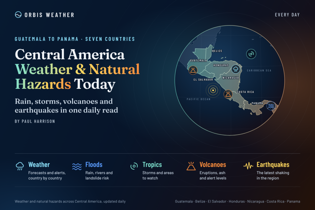
Central America Weather & Natural Hazards Today

- Nor’easter soaks I-95 and brings first snow inland 9:51 AM
- Storm Charles causes floods and flight cancellations across southern Europe 9:30 AM
- North America Weather & Natural Hazards Today – November 13, 2026 9:11 AM
- Central America Weather & Natural Hazards Today – Friday, November 13, 2026 9:03 AM
- South America Weather & Natural Hazards Today – November 13, 2026 8:44 AM
- Daily Earthquakes, Storms, Fires & Floods Report — November 13, 2026 8:18 AM
- Global Natural Disasters This Week — November 13, 2026 8:01 AM
- Tropical Atlantic Daily Report: Friday, November 13, 2026 7:47 AM
- Eastern & Central Pacific Tropical Weather Update: Friday, November 13, 2026 7:38 AM
- WESTERN PACIFIC Tropical Weather Update – November 13, 2026 7:21 AM





Central America Weather & Natural Hazards Today – Friday, November 13, 2026
By Paul Harrison | Founder & Publisher, Orbis Weather
Published: Friday, November 13, 2026
Regional coverage: Belize, Guatemala, Honduras, El Salvador, Nicaragua, Costa Rica and Panama
Forecast and monitoring period: November 13–15, 2026
Regional Overview: Flooding Concerns Continue Following a Wet Week Across Central America
Central America enters Friday, November 13, with attention focused on the aftermath of heavy rainfall, potential flooding, unstable hillsides and changing tropical weather patterns across the Caribbean and eastern Pacific.
The most significant recent rainfall concerns have been concentrated in parts of southern Central America, particularly Costa Rica, where a low-pressure system produced substantial rainfall earlier this week.
NOAA’s Climate Prediction Center identified flooding concerns across Costa Rica and portions of Nicaragua and Panama in its November 5–11 regional hazards outlook. Although that forecast period has ended, it provides important context for monitoring river levels, saturated ground and possible lingering flooding.
Meanwhile, Belize, Guatemala and Honduras continue to warrant attention for changing Caribbean moisture patterns and localized rainfall.
There is encouraging news from the tropics: the National Hurricane Center reported no active tropical cyclones in either the Atlantic or eastern North Pacific in its early November 13 update.
However, the absence of a named tropical storm does not eliminate the risk of localized flooding, thunderstorms or landslides.
Today’s principal natural hazards
🌧️ Localized heavy rainfall and thunderstorms.
🌊 Flooding and elevated river levels following recent rain.
⛰️ Landslides and unstable mountain slopes.
⚡ Lightning and gusty thunderstorm winds.
🌋 Volcanic activity monitoring in Guatemala, El Salvador, Nicaragua and Costa Rica.
🌎 Earthquake monitoring along the Central American volcanic arc.
🌊 Changing Caribbean and Pacific marine conditions.
Regional assessment: Flooding and slope instability remain important monitoring priorities, especially in areas affected by heavy rain earlier in the week. These are regional risk assessments, not declarations of active emergency warnings in every country.
Tropical Weather Update: Atlantic, Caribbean and Eastern Pacific
Atlantic Ocean and Caribbean Sea
According to the National Hurricane Center’s early Friday update, there are no active Atlantic tropical cyclones.
The Atlantic hurricane season officially continues until November 30, meaning late-season tropical development remains possible.
For Belize, Honduras, Nicaragua, Costa Rica and Panama, the western Caribbean remains an important region to monitor for changes in tropical moisture, winds and low-pressure systems.
Even without a tropical cyclone, bands of moisture moving across the Caribbean can generate locally heavy showers, especially where moist winds encounter mountainous terrain.
Eastern North Pacific
The National Hurricane Center also reported no active tropical cyclones in the eastern North Pacific as of its latest available early-Friday update.
This follows the offshore low-pressure activity that affected parts of Costa Rica and neighboring areas earlier in November.
The immediate concern is therefore less about a confirmed approaching tropical cyclone and more about localized rainfall, drainage conditions and any lingering effects from earlier heavy precipitation.
Tropical status as of early November 13:
Basin | Confirmed active tropical cyclones |
|---|---|
Atlantic and Caribbean | None |
Eastern North Pacific | None |
Source: NOAA National Hurricane Center.
Belize: Caribbean Showers and Localized Flooding Potential
Belize remains exposed to tropical moisture moving through the western Caribbean, particularly along its coastal districts and low-lying inland areas.
Communities in Belize City, Belmopan, Orange Walk, Corozal, Dangriga, Placencia and Punta Gorda should continue monitoring local forecasts.
The principal concerns include isolated heavy showers, thunderstorms, reduced road visibility and localized flooding where drainage is poor.
Coastal communities should also monitor wind and sea conditions, especially around the barrier reef and offshore cayes.
Outlook for November 13–15
The main priority is watching for any renewed rainfall and changes in Caribbean marine conditions.
No specific nationwide flooding emergency dated November 13 has been independently confirmed for this report.
Official source: Belize National Meteorological Service.
Guatemala: Mountain Rainfall, Landslides and Volcanic Monitoring
Guatemala’s mountainous landscape creates significant differences in weather between the Pacific coast, central highlands and Caribbean-facing departments.
Particular attention should be given to Izabal, Alta Verapaz, Petén and mountainous road corridors, where rainfall can lead to rapid runoff and slope instability.
Guatemala City, Quetzaltenango, Escuintla and Retalhuleu also remain important locations for localized weather monitoring.
Principal hazards
Heavy showers can cause flash flooding in narrow valleys, while saturated hillsides can become unstable even after rainfall ends.
Fog and low cloud may also reduce visibility on mountain roads.
Volcanic monitoring
Guatemala’s Fuego, Santiaguito and Pacaya volcanoes require continuing observation by national authorities.
Rainfall around volcanic slopes can mobilize ash and loose debris into volcanic mudflows, known as lahars.
These flows can move rapidly through drainage channels and pose a threat to downstream communities.
No new major volcanic eruption or lahar emergency dated November 13 has been independently verified for this article.
Outlook for November 13–15
Monitor localized rainfall, mountain road conditions and any updated volcanic bulletins.
Official sources: INSIVUMEH and CONRED.
Honduras: Flooding and Landslide Vulnerability Remain in Focus
Honduras remains one of the countries requiring close observation following unsettled weather and rainfall concerns earlier in November.
Areas of interest include Tegucigalpa, San Pedro Sula, Choluteca, Valle, El Paraíso, Comayagua and mountainous rural communities.
Rainfall warnings issued earlier in the week highlighted several southern and eastern departments. Those earlier warnings should not be assumed to remain active without a new official bulletin.
Principal hazards
The country’s steep terrain makes it particularly vulnerable to flash flooding and landslides during intense rainfall.
Rivers and streams can also respond rapidly to heavy rain in upstream catchments.
Road crossings, bridges and rural transportation routes may be affected when water levels rise.
Outlook for November 13–15
Attention should remain on new rainfall advisories, river levels and landslide-prone locations.
No specific nationwide severe-weather emergency for November 13 has been independently established here.
Official source: COPECO Honduras.
El Salvador: Localized Thunderstorms and Rapid Urban Runoff
El Salvador remains exposed to weather disturbances originating over the eastern Pacific, although the latest National Hurricane Center update shows no active eastern Pacific tropical cyclones.
The country’s mountainous terrain and densely populated urban centers make intense rainfall a particular concern.
Locations to monitor include San Salvador, Santa Ana, Sonsonate, La Libertad, La Paz, Usulután, San Miguel and La Unión.
Principal hazards
Localized thunderstorms may produce brief heavy downpours, lightning and gusty winds.
Urban flooding can develop quickly when rainfall overwhelms drainage systems, particularly around San Salvador and other developed areas.
Mountain roads and steep slopes remain vulnerable when soils are saturated.
Outlook for November 13–15
The primary concern is localized rainfall rather than a confirmed direct tropical cyclone threat.
Residents should monitor national meteorological updates for any new weather advisories.
Official source: El Salvador Environmental Observatory.
Nicaragua: Flooding Concerns Following Recent Regional Rainfall
Nicaragua remains an important country to monitor following the unsettled weather pattern affecting southern Central America earlier this month.
NOAA’s November 5–11 regional hazards outlook identified flooding concerns in parts of Nicaragua, alongside Costa Rica and Panama. That outlook is historical and does not establish the current status of flooding on November 13.
Areas to monitor include Managua, León, Chinandega, Rivas, Granada, Bluefields and Puerto Cabezas.
Principal hazards
Heavy showers can generate localized flooding in low-lying communities, while mountainous areas face additional risks from runoff and unstable slopes.
Communities along rivers should remain alert to changing water levels following significant upstream rainfall.
Volcanoes and earthquakes
Nicaragua sits along the Central American volcanic arc.
Masaya, San Cristóbal and Telica are among the volcanoes monitored by national scientific authorities.
Earthquake activity is also a continuing geological hazard because of the interaction between the Cocos and Caribbean tectonic plates.
No major damaging earthquake or new volcanic emergency dated November 13 has been independently verified for this report.
Outlook for November 13–15
Monitor rainfall, river conditions and official notices, particularly in areas recently affected by wet weather.
Official source: INETER Nicaragua.
Costa Rica: Heavy Rainfall Earlier This Week Leaves Lingering Flood Concerns
Costa Rica remains one of the most important countries in today’s regional natural hazards assessment.
A low-pressure system situated off the Pacific coast near Guanacaste produced significant rainfall during November 8–9.
Costa Rica’s National Meteorological Institute reported that rainfall totals exceeded 300 millimeters (11.8 inches) over two days in parts of the Nicoya Peninsula.
On November 9, the institute reported that the low-pressure system was moving away from the country.
That development reduced the system’s direct influence, but it does not establish that all flooding or landslide concerns have ended.
Areas requiring attention
Guanacaste, the Nicoya Peninsula, Puntarenas, the Northern Zone, Central Valley and Caribbean-facing districts remain important monitoring locations.
Principal hazards
The greatest residual concern is the possibility of elevated rivers, saturated ground and unstable slopes in areas that received significant rainfall.
Mountain roads may remain vulnerable to falling debris or localized landslides.
Weather conditions can vary considerably between Costa Rica’s Pacific and Caribbean sides, so national-level descriptions should not be interpreted as identical conditions everywhere.
Outlook for November 13–15
The priority is monitoring river conditions, slope stability and any renewed rainfall.
The earlier offshore system was reported moving away, but updated national forecasts are needed to establish the precise rainfall and wind outlook for the weekend.
Official sources: Instituto Meteorológico Nacional and National Emergency Commission.
Panama: Localized Flooding and Thunderstorm Monitoring
Panama remains vulnerable to localized heavy rainfall, particularly in western provinces and urban areas with limited drainage capacity.
NOAA’s November 5–11 Central America Hazards Outlook included flooding concerns across parts of Panama.
The latest conditions require confirmation through national weather and emergency management bulletins.
Areas to monitor include Panama City, Colón, Bocas del Toro, Chiriquí, Veraguas, Darién and the Azuero Peninsula.
Principal hazards
Intense tropical showers can produce rapid street flooding, particularly in urban districts.
Western Panama’s mountainous terrain creates additional vulnerability to landslides and rising rivers.
Thunderstorms may also bring lightning and sudden gusts affecting coastal and marine activities.
Outlook for November 13–15
Monitor localized rainfall forecasts, river levels and emergency advisories.
No specific nationwide flooding emergency dated November 13 has been independently verified for this report.
Official source: SINAPROC Panama.
Regional Hazard Assessment: November 13, 2026
The following table identifies the main concerns across all seven Central American countries.
These are editorial monitoring priorities based on recent conditions, geographic vulnerability and official regional guidance. They are not national alert levels.
Country | Main concern | Monitoring priority |
|---|---|---|
Belize | Caribbean showers, heat and longer-term dryness | Rainfall and temperature |
Guatemala | Mountain landslides, volcanic hazards and dryness | Slopes and volcanoes |
Honduras | Flooding vulnerability and drought conditions | Rivers and rainfall |
El Salvador | Thunderstorms and urban runoff | Localized rainfall |
Nicaragua | Recent flooding, heat and volcanic activity | Rivers and seismic activity |
Costa Rica | Recent heavy rainfall and unstable slopes | Flooding and landslides |
Panama | Recent flooding and thunderstorms | Rivers and urban drainage |
Drought and Heat: A Second Natural Hazard Across Central America
Although flooding dominates many regional weather discussions, parts of Central America are also experiencing longer-term rainfall deficits.
NOAA’s November 5–11 hazards assessment identified abnormal dryness and drought affecting portions of Guatemala, Belize, Honduras, western Nicaragua, western Costa Rica and Panama.
The same assessment highlighted potential heat-index or maximum-temperature conditions exceeding 35°C (95°F) for at least three consecutive days in northern Guatemala, northern Belize and eastern Nicaragua during its forecast period.
These findings demonstrate how contrasting natural hazards can occur across the region at the same time.
Heavy rainfall may affect one watershed while agricultural communities elsewhere continue to experience water shortages.
Agricultural concerns
Longer-term drought can reduce soil moisture, stress crops, affect livestock and increase pressure on local water supplies.
The Central American Dry Corridor is particularly vulnerable to irregular rainfall and prolonged dry periods.
However, the previous week’s heat and drought outlook should not be interpreted as a verified forecast for every location on November 13.
Earthquake and Volcano Monitoring Across Central America
Central America is located along a highly active tectonic boundary, where the Cocos Plate moves beneath portions of the Caribbean Plate.
This geological setting produces frequent earthquakes and supports the region’s volcanic chain.
Volcanoes requiring routine monitoring
Country | Principal volcanoes |
|---|---|
Guatemala | Fuego, Santiaguito, Pacaya |
El Salvador | Santa Ana, San Miguel |
Nicaragua | Masaya, San Cristóbal, Telica |
Costa Rica | Poás, Turrialba, Rincón de la Vieja |
The inclusion of these volcanoes does not indicate that each is erupting or experiencing unusual activity today.
Earthquake outlook
Earthquakes cannot be reliably predicted by date, time or magnitude.
No independently verified list of significant Central American earthquakes occurring on November 13 was available for this publication.
Residents should consult the USGS Latest Earthquakes Map and national geological agencies for current seismic observations.
Following a strong coastal earthquake, communities should also follow official tsunami guidance rather than relying on assumptions about the size or location of the earthquake.
Caribbean and Pacific Marine Conditions
Marine conditions remain important for fishing communities, commercial shipping, tourism and coastal transportation.
Caribbean coast
Belize, Honduras, Nicaragua, Costa Rica and Panama have Caribbean-facing coastlines where changes in wind, swell and tropical rainfall can affect boating conditions.
Pacific coast
Guatemala, El Salvador, Nicaragua, Costa Rica and Panama are exposed to Pacific swells and locally developing thunderstorms.
No specific November 13 wave-height measurements or coastal warning levels have been independently confirmed for this article.
Marine operators should consult official national forecasts before departing.
Central America Weather Outlook: November 13–15, 2026
FRI
13
NOV
Friday – Flooding and slope stability monitoring
Recent rainfall in southern Central America remains the main concern. Monitor rivers and vulnerable hillsides in Costa Rica, Nicaragua and Panama, alongside local weather advisories farther north.
SAT
14
NOV
Saturday – Monitor renewed rainfall
Attention should remain on localized showers, thunderstorms and any new rainfall advisories. The available sources do not establish a specific region-wide severe-weather event for Saturday.
SUN
15
NOV
Sunday – Updated tropical and flood guidance needed
Continue checking the Caribbean and eastern Pacific tropical outlooks, local river conditions and national forecasts. No specific Sunday storm or flooding event has been independently confirmed.
This is a qualitative monitoring outlook, not a verified daily rainfall forecast for individual cities.
Public Safety: What Residents and Travelers Should Know
Flooding: Never drive through floodwater or attempt to cross fast-moving streams.
Landslides: Watch for falling rocks, new ground cracks, leaning trees or unusual movement on slopes.
Lightning: Move indoors when thunder is heard and avoid exposed beaches, fields and open water.
Extreme heat: Stay hydrated, reduce strenuous outdoor activity during the hottest hours and check on vulnerable people.
Volcanoes: Follow official exclusion zones, ashfall instructions and evacuation orders.
Earthquakes: Drop, Cover and Hold On during shaking, and follow tsunami instructions if issued.
Marine safety: Check national weather and coastal advisories before boating or fishing.
Sources and Editorial Methodology
This report has been prepared using available official meteorological information, regional hazard assessments and national emergency-management resources.
Primary sources
NOAA National Hurricane Center — Atlantic and eastern Pacific tropical cyclone monitoring.
NOAA Climate Prediction Center – Central America Hazards Outlook — Regional flooding, heat and drought assessment for November 5–11.
Costa Rica National Meteorological Institute — November 8–9 rainfall and low-pressure system reports.
INETER Nicaragua — National weather, seismic and volcanic monitoring.
INSIVUMEH Guatemala — Weather and geological monitoring.
USGS Earthquake Hazards Program — Earthquake monitoring and scientific information.
Additional national meteorological and emergency-management agencies are linked within the country sections.
Verification and limitations
The National Hurricane Center’s early November 13 tropical cyclone information was available for this report.
The NOAA regional hazards outlook reviewed covers November 5–11, while Costa Rica’s reported low-pressure event occurred November 8–9. These are historical observations and assessments, not confirmation that identical conditions continue today.
Complete, independently verified November 13 forecasts and active-warning bulletins were not available for all seven countries. Consequently, this report does not present unverified rainfall totals, warning levels, earthquake magnitudes, casualty figures or flood emergencies as current facts.
Orbis Weather is an independent weather and natural hazards news publisher. Official national meteorological services and emergency authorities remain the primary sources for warnings and evacuation instructions.
Final Outlook: Central America, November 13, 2026
Central America enters the weekend with a mixture of weather and environmental concerns.
Costa Rica, Nicaragua and Panama deserve particular attention following the heavy rainfall and flooding concerns identified earlier this month.
Belize, Guatemala and Honduras remain important areas for monitoring changing Caribbean weather, while longer-term dryness and heat also present challenges across portions of the region.
The most encouraging development is the absence of active tropical cyclones in the Atlantic and eastern North Pacific in the latest National Hurricane Center information reviewed.
Nevertheless, flooding, landslides, lightning and other natural hazards can occur without a named tropical storm.
Orbis Weather will continue monitoring the region’s weather, tropical systems, earthquakes, volcanic activity and natural hazards across all seven Central American countries.
Published by Paul Harrison | Orbis Weather | Friday, November 13, 2026
About the Author
Paul Harrison — Founder & Publisher, Orbis Weather
Paul Harrison founded Orbis Weather in 2026 to make global weather and natural-hazard information easier to find, follow and understand. His coverage includes tropical cyclones, severe weather, extreme temperatures, earthquakes, volcanoes, wildfires, flooding and significant natural disasters worldwide.
View all articles by Paul Harrison → | Editorial Standards →
Global Weather Tracker Hub
Explore weather maps, tropical systems, storms and natural hazards around the world.
No matching trackers found.