
🌏 Southeast Asia Weather & Natural Hazards Today:

No news articles published today yet.




Southeast Asia Weather & Natural Hazards Today: Thursday, November 19, 2026
· @Paul
By Paul Harrison, Orbis Weather
Heavy rain is the main hazard across Southeast Asia on Thursday, November 19, 2026. Vietnam’s forecasters expect a multi-day downpour in the central provinces as a strong cold air mass pushes south, most of southern Thailand is on flood and landslide alert through the weekend, and Indonesia’s weather agency BMKG has placed West Kalimantan on its highest rain alert. A swarm of shallow earthquakes shook Flores island in eastern Indonesia on Wednesday, with no tsunami threat.
No tropical cyclone threatens Southeast Asia. Severe Cyclonic Storm Akvan in the Bay of Bengal is heading for India’s east coast, and a tropical disturbance far west of Sumatra could strengthen over open ocean. This report is current to about 7:00 a.m. Thursday in Bangkok, Hanoi and Jakarta (UTC+7), 8:00 a.m. in Manila, Singapore and Kuala Lumpur (UTC+8), and 7:00 p.m. Wednesday, November 18, US Eastern time.
Key facts
Hazard | Where | Latest |
|---|---|---|
Heavy rain, flash floods | Central Vietnam, Ha Tinh to Dak Lak | Heavy to very heavy rain through the weekend (NCHMF) |
Flood and landslide alert | Southern Thailand and Prachuap Khiri Khan | Flash floods and landslides possible through Sunday (DDPM) |
Highest rain alert (Awas) | West Kalimantan, Indonesia | Valid Thursday; much of Java, Bali and Nusa Tenggara one level lower (BMKG) |
Earthquake swarm | Flores, East Nusa Tenggara, Indonesia | Shallow quakes through Wednesday; no tsunami (BMKG) |
Cyclone, no threat to region | Bay of Bengal | Akvan expected to reach India on Friday (IMD) |
Dangerous heat index | Palawan and Zamboanga City, Philippines | Five areas at “danger” level Thursday (PAGASA) |
Tropical cyclones
The western Pacific and South China Sea are quiet: the US Joint Typhoon Warning Center (JTWC) listed no cyclones or disturbances there at 06:00 UTC on November 18, and the Japan Meteorological Agency’s active-storm list was empty.
System | Position | Strength | Movement | Agency |
|---|---|---|---|---|
Severe Cyclonic Storm Akvan (Bay of Bengal) | About 540 km southeast of Narsapur and 570 km east of Chennai, India, at 11:30 a.m. India time Wednesday (IMD); about 870 km west-southwest of Myanmar’s Coco Island at 12:30 p.m. Myanmar time (DMH) | Sustained winds 90–100 km/h, gusts to 110 km/h | North-northwest; forecast to cross the coast between Narsapur and Puri around noon Friday, November 20, India time | India Meteorological Department (IMD); Myanmar DMH |
Invest 96S (Indian Ocean west of Sumatra) | Near 5.6°S, 90.2°E, about 1,050 km northwest of the Cocos Islands (JTWC, 18:00 UTC Nov 17); BMKG gave 3.6°S, 90.6°E in its Wednesday statement | Winds 52–61 km/h, pressure about 1,006 hPa | South-southwest; chance of becoming a significant cyclone within 24 hours rated “high” | JTWC; BMKG |
An “invest” is a cluster of storms that forecasters are investigating for possible development. IMD says there is large uncertainty among forecast models on Akvan’s strength, and Down To Earth reports that some models weaken it below cyclone intensity before landfall.
Floods and heavy rain
Vietnam
The National Centre for Hydro-Meteorological Forecasting (NCHMF) expects 100–200 mm of rain, and more than 250 mm in places, from Quang Tri to Da Nang and eastern Quang Ngai between Thursday afternoon and Saturday night. The heaviest spell, 60–120 mm with over 150 mm locally, is forecast from Friday night to Saturday night. The north-central region could see 20–40 mm overnight into Thursday, locally over 100 mm. Forecasters warn of flooding in low-lying areas, flash floods on small rivers and landslides on slopes. In the week to November 15, the ASEAN AHA Centre, citing Vietnam’s disaster agency, reported about 5,000 houses flooded and two people injured in central provinces.
Thailand
The Department of Disaster Prevention and Mitigation (DDPM) has warned 15 provinces of flash floods, landslides and waterlogging from November 18 to 22: Prachuap Khiri Khan plus Chumphon, Surat Thani, Nakhon Si Thammarat, Phatthalung, Songkhla, Pattani, Yala, Narathiwat, Ranong, Phang Nga, Phuket, Krabi, Trang and Satun. The Thai Meteorological Department expects isolated very heavy rain on the southern east coast from November 20 to 22, with waves of 2–3 m in the lower Gulf of Thailand; small boats there should stay ashore. Separately, flooding that began on September 16 still affected about 48,700 households (121,400 people) in five central provinces as of November 15, and DDPM counts 89 deaths, according to the AHA Centre.
Indonesia
BMKG’s early warning for Thursday lists 16 provinces at the “Siaga” (alert) level for heavy to very heavy rain, including Jakarta, Banten, West, Central and East Java, Bali, West and East Nusa Tenggara, and parts of Sumatra, Kalimantan and Sulawesi. Tribunnews reports West Kalimantan at the top “Awas” level for very heavy to extreme rain; Kontan’s list of the same warning does not include it. BMKG also forecasts waves of 1.25–2.5 m from November 19 to 21 in waters west of Sumatra, south of Java to Nusa Tenggara, the North Natuna Sea, the Java Sea and the Makassar Strait.
Country-by-country weather today
Country | Main weather today | Hazard to watch |
|---|---|---|
Philippines | Shear line (where cold northeast winds meet warm easterlies) brings scattered rain to Cagayan and Isabela; the Intertropical Convergence Zone (ITCZ) brings rain to eastern and southern Mindanao and Leyte; isolated showers elsewhere, including Metro Manila. No low-pressure area monitored (PAGASA) | Flash floods and landslides in Cagayan and Isabela; heat index up to 45°C in Zamboanga City and 44°C in Puerto Princesa |
Vietnam | Cold air spreads south; lows of 12–15°C in northern hills and below 10°C on some high peaks; rain in Hanoi as the cold sets in (NCHMF) | Severe cold in northern mountains; central rain (see above) |
Thailand | Heavy rain in the south; temperatures 2–4°C lower in the Northeast as cooler air arrives (TMD) | Flash floods in the south |
Malaysia | MetMalaysia warned of torrential rain, lightning and gusty winds across much of the Peninsula, Sarawak, Sabah and Labuan on Wednesday afternoon, after similar warnings for 10 states on Tuesday evening | Flash floods during storms |
Singapore | Short thundery showers on most afternoons; highs 32–34°C; Northeast Monsoon expected to set in during the second half of November (Meteorological Service Singapore) | Occasional widespread heavy showers |
Indonesia | Heavy rain across Java, Bali, Nusa Tenggara, Kalimantan and parts of Sumatra and Sulawesi (BMKG) | Floods, high waves (see above) |
Myanmar | Few clouds to partly cloudy over the Andaman Sea; Akvan far to the west (DMH) | None reported |
Cambodia | Flooding reported in Pursat province in the week to November 15 (NCDM, via AHA Centre) | Local flooding |
Earthquakes
The largest event in the past 48 hours was a shallow quake off northern Flores at 12:41 p.m. Central Indonesia Time (WITA) on Wednesday. BMKG put it about 45 km northeast of Ruteng, felt at intensity IV–V on the Modified Mercalli scale (strong enough to wake sleepers and rattle objects) in Manggarai, with no damage reported. BMKG recorded 27 quakes in the area that day. Magnitudes below are from the US Geological Survey (USGS).
Magnitude | Location | Local time | Depth |
|---|---|---|---|
4.4 | 12 km SSE of Jimalalud, Negros Oriental, Philippines | 4:30 a.m. Thu, Nov 19 (Philippine time) | 10 km |
4.8 | 67 km NNE of Ruteng, Flores, Indonesia | 1:24 p.m. Wed, Nov 18 (WITA) | 10 km |
5.8 | 40 km N of Ruteng, Flores, Indonesia | 12:41 p.m. Wed, Nov 18 (WITA) | 10 km |
5.2 | 54 km NNE of Ruteng, Flores, Indonesia | 12:21 p.m. Wed, Nov 18 (WITA) | 10 km |
4.8 | 134 km ENE of Nabire, Papua, Indonesia | 12:23 p.m. Wed, Nov 18 (Eastern Indonesia Time) | 10 km |
Tsunami status: BMKG said its modelling showed no tsunami potential from the Flores quake, and USGS flagged no tsunami for any of these events.
Volcanoes
Philippine levels run from 0 to 5 (PHIVOLCS); Indonesian levels run from I to IV (PVMBG), with III meaning “Siaga” (alert).
Volcano | Country | Alert level | Latest activity |
|---|---|---|---|
Mayon | Philippines | 3 | Raised after a moderate eruption on October 30; PHIVOLCS said on November 2 it was watching for a possible rise to Level 4 |
Kanlaon | Philippines | 2 | Ash plume to 350 m above the crater on November 16; 4-km Permanent Danger Zone |
Taal, Bulusan | Philippines | 1 | Low-level unrest (PHIVOLCS, via AHA Centre, week to November 15) |
Semeru | Indonesia | III | Climbing banned; 5-km exclusion zone (BNPB, November 16) |
Merapi | Indonesia | III | Climbing banned; 3-km exclusion zone |
Anak Krakatau | Indonesia | III | Climbing banned; 5-km exclusion zone |
Ibu | Indonesia | II | Erupted at 10:56 a.m. Eastern Indonesia Time on November 18, ash 500 m above the summit; fifth eruption in 24 hours (Geological Agency) |
Haze, fires and air quality
There is no regional haze episode. The ASEAN Specialised Meteorological Centre (ASMC) lowered the southern ASEAN region to Alert Level 0, its lowest, on November 12, citing 13 and 1 fire hotspots in Sumatra and 3 and 54 in Kalimantan on November 10 and 11. The Mekong sub-region has been at Level 0 since May 14.
What to watch over the next few days
- Central Vietnam: the heaviest rain is forecast from Friday night into Saturday night, raising the risk of flash floods and landslides from Ha Tinh to Dak Lak.
- Southern Thailand: very heavy rain is possible on the east coast from Friday to Sunday, while the DDPM alert remains in force.
- Cyclone Akvan: landfall in India is expected around noon Friday, India time; IMD expects thunderstorms and gusty winds over India’s Andaman and Nicobar Islands until then.
- Invest 96S: may become a tropical cyclone west of Sumatra; BMKG links it to the higher waves off western Indonesia.
- Southern Vietnam: the Southern Regional Hydro-Meteorological Centre said on November 14 that rain could become more widespread around Ho Chi Minh City from about November 20–21.
About this article
This report summarizes official bulletins from national weather, disaster and geological agencies and from news reports that cite them. It is not an official warning: readers should follow their national agency and local authorities for decisions about safety. Figures are given as each source stated them, with the agency named; wind speeds were converted from knots to km/h and distances from nautical miles to km. Positions and forecasts change quickly, and some items summarized here, such as the volcano updates, are several days old; their dates are given where they appear.
Frequently asked questions
Will Cyclone Akvan affect Southeast Asia?
Akvan is in the Bay of Bengal and is forecast to move north-northwest toward India’s east coast. Myanmar’s weather department reports only few clouds to partly cloudy skies over the Andaman Sea. Travellers to Myanmar should still check DMH bulletins until the storm has made landfall.
Why is central Vietnam getting so much rain in November?
Vietnam’s forecasters tie this week’s rain to a strong cold air mass that reached the north on Wednesday and strengthens on Thursday night and Friday as it spreads to the central region. They expect heavy to very heavy rain from Ha Tinh to Da Nang and from eastern Quang Ngai to Dak Lak as it arrives.
Was the Flores earthquake linked to a tsunami?
No. BMKG said its tsunami modelling showed no tsunami potential, and it attributed the quake to the Flores Back-arc Thrust fault system. BMKG classed it as a shallow earthquake.
What do Indonesia’s rain alert levels mean?
BMKG uses three levels: “Waspada” (watch) for moderate to heavy rain, “Siaga” (alert) for heavy to very heavy rain, and “Awas” (danger) for very heavy to extreme rain. The warning summarized here was posted by BMKG on Wednesday for Thursday.
Sources
- JTWC significant tropical weather advisory, western and south Pacific
- JTWC significant tropical weather advisory, Indian Ocean
- Japan Meteorological Agency, active tropical cyclones
- News On AIR: Cyclone Akvan intensifies into severe cyclonic storm
- Down To Earth: Cyclone Akvan’s track and intensity remain uncertain
- Myanmar DMH daily weather report
- DTiNews: Cold snap brings rain to northern Vietnam
- DTiNews: Northern region braces for strong cold air
- DTiNews: Rain may return to southern Vietnam from November 20
- The Watchers: Southern Thailand flood and landslide alert, November 18–22
- AHA Centre: Weekly Disaster Update, 9–15 November 2026
- Tribunnews: BMKG extreme weather warning for Thursday, November 19
- Kontan: 16 provinces face very heavy rain on November 19
- Pos Kupang: BMKG high-wave warning, November 19–21
- GMA News: Amihan, ITCZ, easterlies to affect parts of the Philippines
- GMA News: Heat index forecast for Thursday, November 19
- Malay Mail: MetMalaysia issues nationwide storm warning
- Must Share News: Singapore wet weather to continue for rest of November
- USGS earthquake catalogue, past 48 hours
- Okezone: M5.8 earthquake shakes Manggarai Timur
- Samudrafakta: Flores shaken by 27 earthquakes in a day
- GMA News: Kanlaon emits ash anew, Alert Level 2 remains
- Manila Times: Mayon continues to show heightened activity
- Antara: Three Indonesian volcanoes remain at Siaga
- Suara Sulsel: Mount Ibu erupts five times in 24 hours
- ASMC alerts
About the Author
Paul Harrison — Founder & Publisher, Orbis Weather
Paul Harrison founded Orbis Weather in 2026 to make global weather and natural-hazard information easier to find, follow and understand. His coverage includes tropical cyclones, severe weather, extreme temperatures, earthquakes, volcanoes, wildfires, flooding and significant natural disasters worldwide.
View all articles by Paul Harrison → | Editorial Standards →
Global Weather Tracker Hub
Explore weather maps, tropical systems, storms and natural hazards around the world.
No matching trackers found.
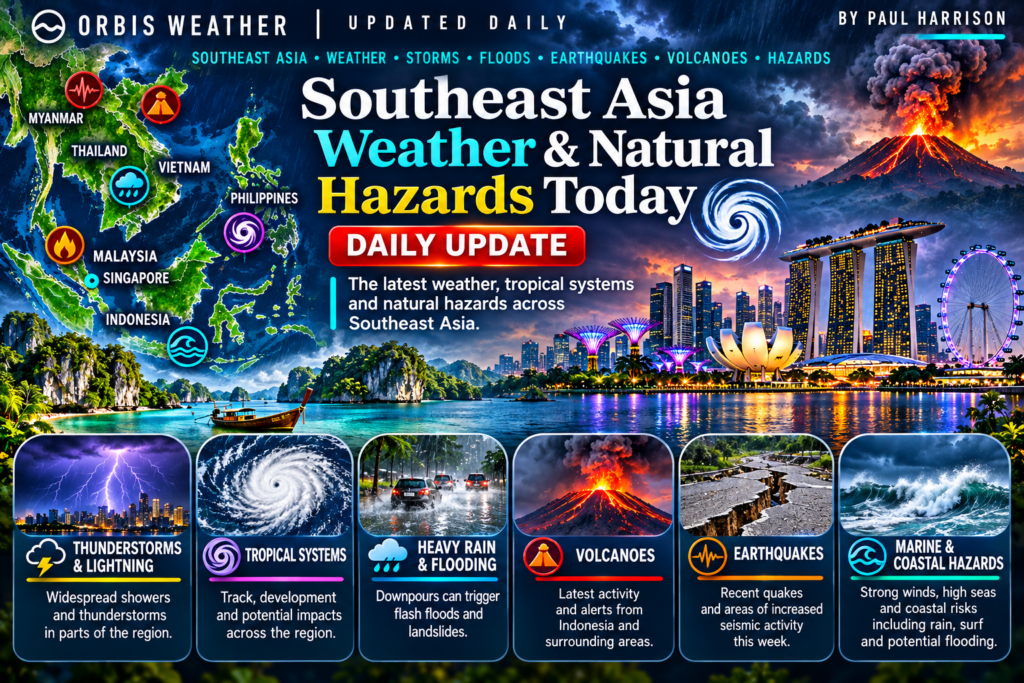
The Southeast Asia Weather & Natural Hazards Today briefing from Orbis Weather tracks the most important weather and natural-hazard developments across Singapore, Indonesia, the Philippines, Malaysia, Thailand, Vietnam, Myanmar and the wider Southeast Asia region.
Updated regularly, the briefing covers tropical weather, earthquakes, volcanic activity, monsoon flooding, severe thunderstorms, wildfire smoke, haze and other significant hazards. Conditions can change rapidly, so readers should follow official national authorities for warnings, evacuations and emergency information.