
Singapore Monsoon & Flood Tracker – Live Rain & Flood Risk

No news articles published today yet.




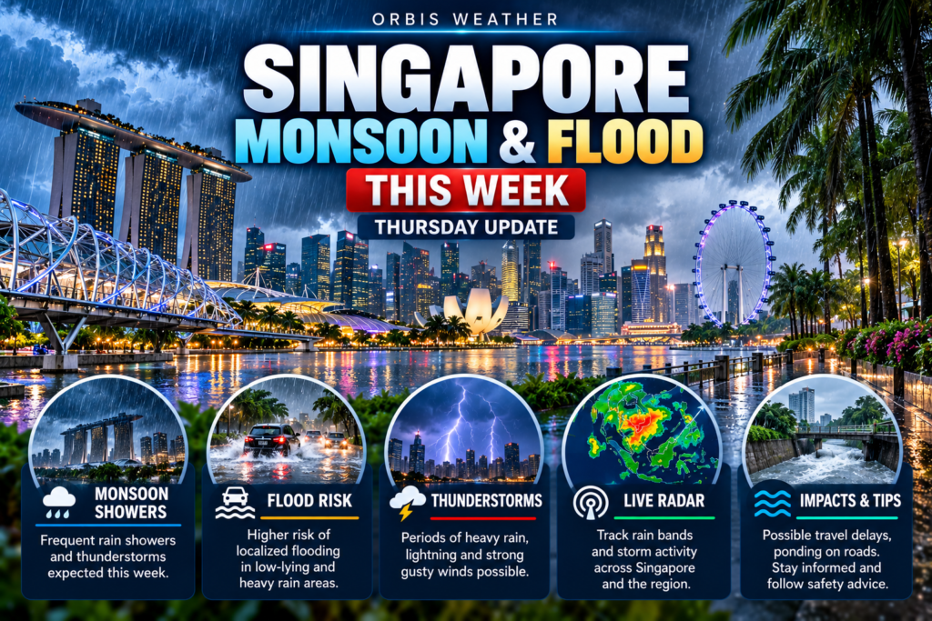
Singapore Monsoon & Flood This Week: Thursday, November 19, 2026
By Paul Harrison, Orbis Weather
Current to 7.45am SGT (UTC+8), Thursday 19 November 2026, which is 6.45pm US Eastern, Wednesday 18 November. Outlook: Thursday 19 to Wednesday 25 November. Review: 12 to 18 November. All times SGT.
At a glance
Singapore is ending the inter-monsoon period, and forecasters expect the Northeast Monsoon to set in before the end of November, with afternoon thundery showers forecast daily through Sunday.
- Monsoon phase: On 16 November, MSS and NEA said Northeast Monsoon conditions are expected to set in during the second half of November.
- Forecast: The MSS four-day outlook gives afternoon thundery showers from Thursday to Sunday, with winds turning northeasterly from Friday.
- Warnings and floods: MSS issued heavy rain warnings on 16, 17 and 18 November. PUB told road users to avoid several roads on 16 and 17 November. No flash flood was reported in news coverage of the week.
- Rainfall: Rainfall for 16 to 30 November is forecast to be slightly above the long-term average over most of the island.
- Haze: NEA’s 6 November haze update said showers and variable winds were expected to keep haze suppressed.
Official forecasts and heavy rain warnings come from the Meteorological Service Singapore (MSS), part of NEA. Flood alerts come from PUB, Singapore’s national water agency.
Monsoon status and rainfall
Singapore is in the last weeks of the inter-monsoon period. The MSS fortnightly outlook issued on 16 November says “Northeast Monsoon conditions are expected to set in over Singapore” during 16 to 30 November, with winds strengthening and turning northeast or northwest. The first half of November had inter-monsoon conditions, with light and variable winds.
The MSS monsoon update page was last updated on 29 October. It said the monsoon was expected to “progressively set in towards the end of November 2026 or early December 2026”. On the MSS climate page, the season runs from December to early March, and “Higher rainfall occurs from November to January during the wet phase of Northeast Monsoon season.”
Month | Average rainfall, 1991-2020 | Average rain days |
|---|---|---|
November | 252.3 mm (9.93 in) | 19 |
December | 331.9 mm (13.07 in) | 19 |
Averages are for Changi; a rain day has at least 0.2 mm (0.01 in) of rain (MSS climate page).
Rainfall in 1 to 15 November was mixed. About half the island was above average: Somerset was 44% above and Tanjong Katong 65% below. The highest daily total was 94.2 mm (3.71 in) around Rivervale Drive on 6 November (MSS review, 16 November).
The week’s forecast
MSS forecasts afternoon thundery showers on all four days from Thursday to Sunday, with similar temperatures each day.
Day | Forecast | Temperature (low to high) | Wind |
|---|---|---|---|
Thu 19 Nov | Afternoon thundery showers | 24 to 33°C (75 to 91°F) | Variable, 5-15 km/h (3-9 mph) |
Fri 20 Nov | Afternoon thundery showers | 24 to 33°C (75 to 91°F) | NE, 5-15 km/h (3-9 mph) |
Sat 21 Nov | Afternoon thundery showers | 24 to 33°C (75 to 91°F) | NE, 5-15 km/h (3-9 mph) |
Sun 22 Nov | Afternoon thundery showers | 24 to 33°C (75 to 91°F) | NNE, 5-15 km/h (3-9 mph) |
Source: MSS four-day outlook, updated 5.35pm, 18 November. The MSS 24-hour forecast for Thursday gives “Thundery showers over many areas in the afternoon.”
The four-day outlook does not cover Monday 23 to Wednesday 25 November. For those days, the fortnightly outlook expects short-duration afternoon thundery showers on most days, extending into the night on a few days and “widespread and heavy” on some. Daily highs are expected at 32 to 34°C (90 to 93°F) on most days, with lows around 23°C (73°F) on some rainy days.
Heavy rain and flash floods
The week brought three days of heavy rain warnings and PUB road alerts in the north and centre, but no reported flash flood. No heavy rain warning appeared on the MSS home page early on Thursday 19 November.
Date | Time | Warning or alert | Source |
|---|---|---|---|
Wed 18 Nov | 3.40pm | MSS warning of moderate to heavy thundery showers over northern, western and central areas, 4pm to 5pm. PUB posted a heavy rain warning around 3.50pm. | |
Tue 17 Nov | 5.55pm | MSS warning of moderate to heavy thundery showers with gusty winds over northern, western and central areas, 6.15pm to 7.15pm. PUB flood alerts at Senoko Road and Admiralty Road West, to about 7.40pm. | |
Mon 16 Nov | 4.04pm and 5.05pm | Heavy rain alerts for 4.30pm to 6pm. PUB told road users to avoid Lorong Gambir, Puay Hee Avenue, Wan Tho and Pheng Geck Avenues, Happy Avenue North, Riverside Road and Senoko Road, each for about an hour. |
The most recent reported flash flood came before this week. It was at West Coast Road and West Coast Way on 10 November and subsided at 3pm (AsiaOne).
On haze, NEA’s 6 November update said showers and variable winds “are expected to keep the haze situation suppressed.” Across the Causeway, Johor has listed 337 flood hotspots and expects the monsoon to affect the state until January (Malay Mail, 3 November).
Staying safe and getting alerts
PUB’s main advice is to follow its flood alerts and keep out of floodwater, on foot or by car.
- On foot: Do not walk into flooded areas. If one is ahead, turn back and move to higher ground. PUB says 15 cm (6 in) of moving water can make a person fall.
- Drains: Watch for open drains. If walking through water is unavoidable, use a stick or umbrella to check for open drains and firm ground.
- Driving: Do not drive into flooded areas. PUB says 30 cm (12 in) of water may stall a car and 60 cm (24 in) can carry away most vehicles. If the car stalls, do not restart it; leave it and move to higher ground if safe.
- At home or work: Do not touch electrical switches or appliances while wet or standing in water. Keep compound drains clear and flood barriers ready.
Sources: PUB Flood Safety Tips, PUB Public Advisory.
Alert tool | What it gives | Where |
|---|---|---|
PUB SMS alerts | MSS heavy rain warnings by SMS; canal water-level alerts at 50%, 75%, 90% and 100% of depth from 210 sensors | |
PUB Flood Alerts Telegram | Rainfall updates, flood alerts and tips | |
myENV app | NEA app that PUB lists alongside its Telegram channel for flood alerts | Google Play and App Store |
MSS website | 24-hour and four-day forecasts, heavy rain warnings |
What to watch
The key item this week is an MSS statement that the Northeast Monsoon has set in.
When | What | Source |
|---|---|---|
Thu 19 to Sun 22 Nov, afternoons | Thundery showers each day; check for MSS heavy rain warnings and PUB road alerts | MSS four-day outlook |
Fri 20 to Sun 22 Nov | Winds forecast to turn northeast and north-northeast | MSS four-day outlook |
By Mon 30 Nov | Northeast Monsoon conditions expected to set in | NEA advisory, 16 Nov |
Early December | Next MSS fortnightly outlook, with a review of 16 to 30 November rainfall | MSS fortnightly outlook |
December to early January | Wet phase of the Northeast Monsoon; December averages 331.9 mm | MSS climate page |
About this report
This report summarises official products: the MSS four-day outlook (5.35pm, 18 November), the MSS 24-hour forecast for 19 November, the MSS and NEA fortnightly outlook (16 November) and the MSS monsoon update (29 October). Forecasts change; MSS updates the four-day outlook twice daily. Temperatures are in °C with °F, rainfall in mm with inches and wind in km/h with mph. Event listings come from news reports and may be incomplete.
Term | Meaning |
|---|---|
Inter-monsoon | The period between monsoons, with light, variable winds; in Singapore, October to November. |
Northeast Monsoon | The season of north to northeasterly winds, December to early March, with its wet phase from December to early January. |
Heavy rain warning | An MSS alert that moderate to heavy rain is expected over named regions within a stated time window. |
Flash flood | A short, sudden flood, usually where drains overflow during intense rain. |
Rain day | A day with at least 0.2 mm (0.01 in) of rain. |
Frequently asked questions
Has the Northeast Monsoon started? Not formally. The latest MSS and NEA statement, on 16 November, said monsoon conditions are expected to set in during the second half of November.
Will it rain every day this week? MSS forecasts afternoon thundery showers from Thursday to Sunday. For the rest of the fortnight, it expects showers on most afternoons, sometimes into the night.
Were there floods this week? No flash flood was reported in news coverage of 12 to 18 November. PUB did issue road alerts on 16 and 17 November during heavy rain.
Is November rainfall above normal? The first half was mixed, with some areas well above and others well below average. Rainfall for 16 to 30 November is forecast to be slightly above average over most of the island.
How do I get flood alerts? PUB sends alerts through its Telegram channel and SMS service, and lists the myENV app. MSS posts heavy rain warnings on weather.gov.sg.
Sources
- MSS four-day outlook, updated 5.35pm, 18 Nov 2026
- MSS home page: 24-hour forecast and observations, observations to 5am, 19 Nov 2026
- MSS fortnightly outlook, 16-30 November 2026, issued 16 Nov 2026
- MSS monsoon update, updated 29 Oct 2026
- MSS Climate of Singapore, 1991-2020 averages
- NEA: Wet Weather To Continue For Rest Of November 2026 With Onset Of Northeast Monsoon, 16 Nov 2026
- NEA: Haze Situation Update (6 November 2026), 6 Nov 2026
- AsiaOne: Thundery showers expected over 3 Singapore regions on Nov 18 afternoon, 18 Nov 2026
- AsiaOne: Thundery showers with gusty winds expected over parts of Singapore on Nov 17 evening, 17 Nov 2026
- Straits Times via Yahoo: Motorists advised to avoid several areas in Singapore over risk of flash floods, 16 Nov 2026
- AsiaOne: Flash flood at West Coast Road amid heavy rain on Nov 10 afternoon, 10 Nov 2026
- AsiaOne: Wet weather to continue in Singapore for rest of November as northeast monsoon sets in, 16 Nov 2026
- Malay Mail: Johor identifies 337 flood hotspots as state braces for northeast monsoon, 3 Nov 2026
- PUB Flood Safety Tips, accessed 19 Nov 2026
- PUB Public Advisory, accessed 19 Nov 2026
- PUB flood SMS alerts, accessed 19 Nov 2026
🌧️ Next 6 Hours
🧭 Singapore Monsoon Calendar
Wet phase typically Dec–Jan.
Frequent afternoon thunderstorms.
Sumatra squalls can occur.
Light winds and thunderstorms.
🌊 Flood Safety
Official Live Flood Information
Global Weather Tracker Hub
Explore weather maps, tropical systems, storms and natural hazards around the world.
No matching trackers found.
🌧️ Singapore Monsoon & Flood Tracker – Live Rain & Flood Risk
Monitor heavy rain, monsoon conditions and potential flash-flood risk across Singapore with the Orbis Weather Singapore Monsoon & Flood Tracker.
Singapore’s tropical climate produces abundant rainfall throughout the year, but rainfall patterns change with the Northeast Monsoon, Southwest Monsoon and the two inter-monsoon periods.
Heavy tropical downpours can develop rapidly. Although Singapore has an extensive drainage and flood-management system, exceptionally intense rainfall can temporarily exceed drainage capacity and cause localized flash flooding. Singapore’s national water agency, PUB, says these flash floods are generally small and localized and typically subside within an hour.
The Orbis Weather tracker provides general situational awareness using rainfall, short-range precipitation forecasts, wind and Singapore’s seasonal monsoon cycle. For official heavy-rain warnings and flood alerts, always follow PUB and the Meteorological Service Singapore.
🌧️ Why Singapore Gets So Much Rain
Singapore is located close to the equator and has a tropical climate characterized by high humidity, warm temperatures and abundant rainfall throughout the year.
Strong solar heating warms the surface and the humid air above it. When that warm air rises, it cools and water vapor condenses into clouds.
Under unstable atmospheric conditions, towering cumulonimbus clouds can develop and produce intense thunderstorms.
Singapore’s rainfall is also influenced by regional monsoon winds, sea breezes, Sumatra squalls and larger weather systems.
🧭 Singapore’s Monsoon Seasons
Singapore experiences two primary monsoon seasons separated by inter-monsoon periods.
The Northeast Monsoon generally lasts from December to early March.
The Southwest Monsoon generally occurs from June through September.
Inter-monsoon conditions typically occur from late March through May and again during October and November.
These seasons influence wind direction, rainfall patterns and the types of thunderstorms most likely to affect Singapore.
🌧️ Northeast Monsoon
The Northeast Monsoon is especially important for heavy-rain monitoring.
Its wetter phase usually occurs during the earlier part of the season, when monsoon surges can produce widespread and persistent moderate to heavy rain.
Unlike isolated afternoon thunderstorms, these rain events can affect large parts of Singapore for extended periods.
Later in the Northeast Monsoon, conditions typically become comparatively drier and windier.
💨 What Is a Monsoon Surge?
A monsoon surge is a strengthening of the northeasterly winds associated with the Northeast Monsoon.
These surges can move across the South China Sea and bring widespread cloud cover, stronger winds and prolonged rainfall to Singapore and surrounding areas.
The Meteorological Service Singapore identifies monsoon surges as one of the major weather systems capable of producing heavy rainfall in Singapore.
Because rainfall may continue much longer than a typical afternoon thunderstorm, monsoon surges deserve particular attention when monitoring flood potential.
🌦️ Southwest Monsoon
The Southwest Monsoon generally lasts from June through September.
Singapore often experiences short-duration showers and thunderstorms during this period.
Another important feature of the Southwest Monsoon is the possibility of Sumatra squalls.
These organized lines of thunderstorms can approach Singapore from the west and bring sudden heavy rain, frequent lightning and powerful wind gusts.
⛈️ What Is a Sumatra Squall?
A Sumatra squall is an organized line of thunderstorms that usually develops over Sumatra or the Strait of Malacca before moving eastward toward Singapore.
These systems commonly occur during the Southwest Monsoon and inter-monsoon periods.
According to the Meteorological Service Singapore, they often affect Singapore overnight or during the morning and can produce heavy rainfall lasting roughly one to two hours, along with strong gusty winds.
Because they can arrive rapidly, Sumatra squalls are important for commuters, aviation, marine operations and outdoor activities.
⛈️ Singapore’s Inter-Monsoon Thunderstorms
Singapore experiences two inter-monsoon periods each year.
Winds are often lighter and more variable during these transitional periods.
Strong daytime heating and interactions between local land and sea breezes can then create favorable conditions for thunderstorms.
Afternoon and early-evening thunderstorms can sometimes become intense.
These storms may be relatively short-lived but capable of producing very heavy rainfall over localized parts of the island.
🌊 What Causes Flash Floods in Singapore?
Flash flooding occurs when rainfall produces water faster than drains and waterways can safely carry it away.
Singapore has invested heavily in drainage infrastructure and flood management, but no urban drainage system can completely eliminate flood risk during every extreme rainfall event.
PUB explains that extremely heavy rainfall over a short period can exceed drainage capacity, resulting in localized flash floods.
⏱️ Why Flash Floods Can Develop So Quickly
The intensity of rainfall is crucial.
A moderate amount of rain spread across an entire day may create fewer problems than an enormous amount falling over one neighborhood in a very short period.
Tropical thunderstorms can release large quantities of water rapidly.
Roads, drains and canals must then handle that runoff almost immediately.
This is why conditions can change from normal to flooded within a relatively short time during an intense downpour.
🏙️ Urban Development and Flooding
Singapore is one of the world’s most highly urbanized countries.
Roads, buildings, pavements and other hard surfaces prevent rainfall from soaking naturally into the ground as easily as it might in undeveloped areas.
Instead, much of that water becomes surface runoff that must be managed by drains, canals and other infrastructure.
Singapore has developed an extensive drainage system and continues to invest in flood-resilience improvements.
PUB says it uses a holistic approach that includes drainage improvements, flood monitoring and longer-term coastal protection.
📡 How Singapore Monitors Flood Risk
Singapore has a sophisticated flood-monitoring network.
PUB says its Catchment and Waterways Operations System combines information from more than 1,000 water-level sensors, more than 500 CCTV cameras, rain gauges, weather radar and flood-response resources.
PUB also operates an X-band weather radar capable of providing short-range rainfall forecasts to support flood operations.
These official systems are much more comprehensive than the weather-based indicator displayed by Orbis Weather.
⚠️ Orbis Flood Risk vs Official PUB Flood Alerts
This distinction is extremely important.
The Orbis Weather Flash Flood Risk Indicator is not an official Singapore flood warning.
It uses weather conditions and forecast rainfall to provide general situational awareness.
An elevated Orbis risk level does not mean flooding is definitely occurring.
Likewise, conditions at a specific location can differ from a broad weather-based indicator.
For confirmed flood incidents and official warnings, use PUB and Meteorological Service Singapore information.
🌧️ Heavy Rain Doesn’t Always Mean Flooding
An intense thunderstorm does not automatically produce a flash flood.
Whether flooding develops depends on rainfall intensity, duration, drainage conditions, location, previous rainfall and other factors.
Some parts of Singapore may experience extremely heavy rain while drainage continues to function normally.
This is another reason the weather-based Orbis risk indicator should be treated as an early awareness tool rather than confirmation of flooding.
🚗 Driving During Heavy Rain
Tropical downpours can quickly reduce visibility and leave standing water on roads.
Drivers should slow down, allow additional stopping distance and remain alert for water collecting in low-lying areas.
Never deliberately drive into a flooded road when the depth or condition of the roadway cannot be determined.
Follow road closures, flood alerts and instructions from Singapore authorities.
🚶 Walking During Flash Flooding
Pedestrians should avoid entering floodwater.
Water can conceal drains, uneven surfaces, debris and other hazards.
Fast-moving water can also be more powerful than it appears.
If water is rising, move away from the affected area and follow instructions from local authorities.
🌊 Coastal Flooding Is Different From Flash Flooding
Not all flooding in Singapore is caused by heavy rain.
Coastal flooding can occur when elevated sea levels affect low-lying coastal areas.
PUB notes that high tides, storm surges and longer-term sea-level rise all contribute to Singapore’s coastal flood considerations.
This differs from the localized flash flooding that can develop when intense rainfall overwhelms drainage capacity.
🌕 High Tides and Flood Risk
Singapore generally experiences two high tides each day.
Most high tides do not cause significant flooding.
However, unusually high tides combined with other factors can increase coastal water levels.
Over the longer term, rising sea levels make coastal protection increasingly important for a low-lying island nation.
🌍 Climate Change and Singapore Flood Risk
A warming climate can increase the potential for more extreme rainfall and rising sea levels.
PUB specifically identifies more frequent and intense rainfall as an increasing challenge for Singapore’s drainage and flood-management systems.
Climate change does not mean every thunderstorm will cause flooding.
Instead, it changes the background risk by increasing the potential for extreme weather and coastal-water events.
📍 Is Singapore Flooding Right Now?
The Orbis Weather Singapore Monsoon & Flood Tracker can help identify whether current and short-range weather conditions favor heavy rainfall.
The dashboard displays current rain, forecast rain probability, expected six-hour precipitation and wind conditions.
However, the tracker does not confirm that a particular street or neighborhood is flooded.
For active flood incidents, water levels and official alerts, consult PUB Singapore.
☔ Understanding the 6-Hour Rain Forecast
Short-range rainfall information can be particularly useful in Singapore because tropical weather can change rapidly.
The tracker displays forecast precipitation and rain probability over the next six hours.
These values provide guidance about the possibility and potential amount of rainfall.
They should not be interpreted as a guarantee that a specific neighborhood will receive the displayed amount.
Tropical thunderstorms can be highly localized.
📱 Official Singapore Flood Alerts
PUB provides official flood-monitoring and alert services.
Members of the public can also subscribe to official alerts for heavy rain and rising water levels in selected canals and drains.
For potentially dangerous conditions, these official services should take priority over third-party weather dashboards.
🛰️ Where Does Orbis Weather Get Its Data?
The Orbis Weather Singapore Monsoon & Flood Tracker currently uses Open-Meteo weather information for its weather-based rainfall and flood-risk indicators. The page identifies PUB Singapore as its official flood reference and the Meteorological Service Singapore as its weather reference.
Orbis Weather does not independently issue Singapore flood warnings.
🇸🇬 Monitor Singapore’s Monsoon & Flood Risk
Singapore’s weather can change quickly.
Localized thunderstorms, Sumatra squalls and Northeast Monsoon surges can all produce heavy rainfall, while exceptionally intense downpours can temporarily overwhelm drainage systems and cause flash flooding.
Use the Orbis Weather Singapore Monsoon & Flood Tracker to monitor changing weather conditions and short-range rainfall potential.
For broader regional awareness, also explore Singapore Weather & Natural Hazards, Singapore Lightning & Thunderstorm Tracker, Singapore Haze & Air Quality Tracker and Southeast Asia Natural Hazards.
Important Flood & Weather Disclaimer
The Orbis Weather Singapore Monsoon & Flood Tracker is provided for general information, education and situational awareness.
The Orbis Flash Flood Risk Indicator is a weather-based indicator and is not an official PUB flood alert or warning. Weather forecasts may change, and rainfall can vary significantly across Singapore.
For confirmed flooding, official flood alerts and water-level information, consult PUB Singapore. For official weather forecasts and heavy-rain warnings, consult the Meteorological Service Singapore.
Do not use the Orbis Weather tracker alone for emergency or life-safety decisions.