
Indonesia Volcano Tracker – Live Eruptions & Alerts

No news articles published today yet.




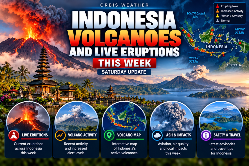
Indonesia Volcanoes and Live Eruptions This Week: Saturday, November 14, 2026
· @Paul
By Paul Harrison, Orbis Weather
At least five Indonesian volcanoes erupted or shed lava between Saturday 7 November and Saturday morning 14 November 2026, according to reports from the Centre for Volcanology and Geological Hazard Mitigation (PVMBG) and the Merapi observatory in Yogyakarta (BPPTKG). Semeru in East Java and Merapi in Central Java remain at Level III (Siaga), the second-highest of four alert levels; no volcano was reported at the top Level IV. This report is current to 07:00 WIB on Saturday 14 November (19:00 EST on Friday 13 November).
Semeru was the most persistent, erupting repeatedly through the week and twice more before dawn on Saturday. Karangetang in North Sulawesi threw incandescent lava above its north crater on Friday evening, Dukono in North Maluku produced two ash eruptions on 7 November, and Marapi in West Sumatra dusted nearby villages with ash. None of the reports covering the week mentioned deaths, injuries, evacuations or flight cancellations.
Key facts
Measure | This week |
|---|---|
Volcanoes with reported eruptive activity | 5: Semeru, Merapi, Karangetang, Dukono, Marapi |
Highest alert level in force | Level III (Siaga) at Semeru and Merapi; none at Level IV |
Most notable eruption | Semeru, six eruptions in about three hours on the morning of 12 November |
Deaths, injuries or evacuations | None reported |
Flight disruption | None reported |
Alert levels at a glance
Volcano | Region | Alert level | Keep-out zone | This week’s activity |
|---|---|---|---|---|
Semeru | East Java | III (Siaga) | 5 km radius of the crater; 13 km along Besuk Kobokan valley (southeast) | Repeated ash eruptions through the week (see below) |
Merapi | Central Java / Yogyakarta | III (Siaga) | 3 km radius; up to 7 km in south–southwest valleys and up to 5 km in the southeast | Lava avalanches into southwest valleys (see below) |
Karangetang | Siau Island, North Sulawesi | II (Waspada) | 1.5 km from both summit craters; 2.5 km to the south-southwest | Ash and lava on 9 and 13 November (see below) |
Dukono | Halmahera, North Maluku | II (Waspada) | 4 km from Malupang Warirang crater | 7 Nov, 12:26 WIT: ash about 1,000 m above the summit (about 2,087 m above sea level), drifting southeast; 17:02 WIT: about 2,000 m (about 3,087 m above sea level), drifting north |
Marapi | West Sumatra | II (Waspada) | 3 km from Verbeek crater | Eruptions at 09:55 WIB on 7 Nov and 00:34 WIB on 8 Nov; columns hidden by cloud; ash fell in Sungai Pua, Agam |
Anak Krakatau in the Sunda Strait was last confirmed at Level III (Siaga), with a 5 km exclusion zone, in reports dated 1 November; no eruption was reported for it this week. Ile Lewotolok (East Nusa Tenggara) and Ibu (North Maluku) were last confirmed at Level II (Waspada) on 7 November and 26 October respectively, and Lewotobi Laki-laki on Flores was last reported at Level II after being lowered from Level III on 16 September.
Volcanoes erupting this week
Semeru, East Java (Level III)
Semeru produced the week’s tallest ash column on Thursday 12 November, during a burst of six eruptions between 04:48 and 07:57 WIB. Columns rose about 400 to 1,000 m above the 3,676 m summit, and the last reached about 4,676 m above sea level, drifting south. Liswanto, an officer at the Semeru observation post, reported that the first column was grey and thick and drifted southwest, with a seismograph reading of 22 mm lasting 126 seconds.
Earlier, at 01:23 WIB on 7 November, ash rose about 200 m above the summit. On 13 November a 05:57 WIB eruption reached about 800 m, and that day’s 24-hour record logged 72 eruption earthquakes, 34 exhalation (gas-release) earthquakes and 12 rockfall earthquakes. Two more eruptions followed on Saturday 14 November, at 01:11 WIB (about 300 m) and 05:07 WIB (about 700 m, or about 4,376 m above sea level).
Beyond the 13 km limit, PVMBG advises staying 500 m back from the Besuk Kobokan riverbanks, because pyroclastic flows and lahars could travel up to 17 km from the summit. On 5 November, just before this period, a pyroclastic flow ran about 4.5 km to the southeast.
Merapi, Central Java (Level III)
Merapi continued its slow lava-dome eruption, with blocks of hot lava breaking off and sliding into southwest valleys. BPPTKG reported one lava avalanche reaching 2,000 m down Kali Bebeng by midday on 8 November, three toward Kali Sat/Putih reaching up to 1,800 m before dawn on 12 November, and another that night. Instruments logged 148 earthquakes on 12 November and 95 on 13 November, including 49 avalanche and 34 hybrid earthquakes, a type linked to magma movement.
In its weekly summary for 30 October to 5 November, BPPTKG counted 17 lava avalanches. “Monitoring data show magma supply is still ongoing,” said BPPTKG head Agus Budi Santoso, adding that this could trigger pyroclastic flows within the danger zone. Merapi has been at Level III since 5 November 2020.
Karangetang, North Sulawesi (Level II)
Karangetang erupted twice from its north crater, with lava flowing down several valleys. At 19:14 WITA on Monday 9 November, ash rose about 1,000 m above the summit (about 2,784 m above sea level) and drifted northwest, while lava avalanches ran 700 to 1,000 m to the northwest, west and southwest, according to Geological Agency head Lana Saria. The seismograph recorded 50 mm for about 1 minute 10 seconds.
At 18:17 WITA on Friday 13 November, incandescent lava was thrown 300 to 400 m above the north crater, with flows of 700 to 1,000 m to the west-southwest and 500 to 700 m to the northwest and south. “A Karangetang eruption occurred on 13 November 2026 at 18:17 WITA, but the ash column height was not observed,” said Muhamad Fadlan Rasyidin, an observer at the Karangetang post. PVMBG warned that unstable lava piles could collapse into rockfalls or pyroclastic flows, mainly to the south, southeast, west and southwest.
Ash and aviation
Reported ash columns this week ranged from about 200 m to 2,000 m above the summits. Dukono’s late-afternoon eruption on 7 November rose highest above its own peak, while Semeru’s 12 November column reached the greatest altitude above sea level, because Semeru’s summit is far higher. At Marapi, the columns were hidden by cloud and fog, but ash fell on farmland in Sungai Pua; Ismail Damar, who chairs the disaster-preparedness group in Sariak village, said the ash “badly disturbs vision and makes breathing hard.”
PVMBG sends Volcano Observatory Notices for Aviation (VONAs) to airlines, and the Darwin Volcanic Ash Advisory Centre in Australia issues ash advisories for this region. No airport closures or flight cancellations linked to this week’s eruptions were reported.
What to watch in the coming week
- Semeru: further eruptions and pyroclastic flows toward Besuk Kobokan, and rain-triggered lahars in the valleys of Besuk Kobokan, Besuk Bang, Besuk Kembar and Besuk Sat.
- Merapi: BPPTKG’s weekly summary for 6 to 12 November, and lahar risk from loose deposits at the heads of the Bebeng, Krasak, Putih and Boyong rivers during heavy rain.
- Karangetang: more lava flows and rockfalls from the north crater, and lahars or flash floods in valleys draining the summit.
- Dukono and Marapi: further ash eruptions and ashfall on nearby communities; residents near Marapi have been advised to wear masks.
- Anak Krakatau: whether PVMBG keeps it at Level III after a quieter spell.
How Indonesia’s volcano alert system works
Level | Name | What it means |
|---|---|---|
I | Normal | Background activity; no eruption expected |
II | Waspada (Advisory) | Activity above background; small eruptions possible, with a keep-out zone around the crater |
III | Siaga (Watch) | Activity rising or eruption under way that threatens nearby areas; wider keep-out zones and evacuation preparations |
IV | Awas (Warning) | Major eruption imminent or under way; people are evacuated from the danger zone |
Levels are set by PVMBG, part of the Geological Agency (Badan Geologi) in the Ministry of Energy and Mineral Resources; BPPTKG monitors Merapi.
About this article
This is a summary of published reports from PVMBG, BPPTKG and Indonesian news outlets, not an official warning; residents and travellers should follow PVMBG, BPPTKG and local authorities. Times are local: WIB (UTC+7) for Sumatra and Java, WITA (UTC+8) for Sulawesi and East Nusa Tenggara, and WIT (UTC+9) for Maluku. Eruption counts differ between sources because some count each ash column seen, others count eruption earthquakes on the seismograph, and eruptions hidden by cloud may go unrecorded. Heights are approximate visual estimates.
Glossary
- Pyroclastic flow (awan panas): a fast, ground-hugging avalanche of hot gas, ash and rock.
- Lava avalanche (guguran lava): blocks of hot lava breaking off a dome or lava pile and rolling downhill.
- Lahar: a mudflow of volcanic debris and water, usually triggered by heavy rain.
- Above sea level: column height added to the summit’s elevation; “above the summit” measures from the peak.
- Seismograph amplitude: the size of the ground-shaking signal, in millimetres on the recording, used to gauge eruption strength.
Frequently asked questions
Which Indonesian volcano was most active this week? Semeru in East Java erupted repeatedly, including six times on the morning of 12 November. It remains at Level III (Siaga), with a 13 km keep-out zone along the Besuk Kobokan valley.
Is any Indonesian volcano at the highest alert level? No volcano was reported at Level IV (Awas) this week. Semeru and Merapi are at Level III, and Anak Krakatau was last confirmed at Level III on 1 November.
Were flights affected? No airport closures or flight cancellations were reported for this week’s eruptions. Travellers should check with their airline, as ash conditions can change within hours.
Is it safe to climb or visit Merapi or Semeru? Both volcanoes have keep-out zones, listed in the alert table above, where no activity is allowed. Lumajang regent Indah Amperawati has asked Semeru climbers to obey trail closures and avoid unofficial routes.
Why does Merapi have lava avalanches but few ash columns? Merapi’s current eruption is mainly effusive: lava slowly builds domes at the summit, and pieces break off as glowing avalanches. BPPTKG says magma supply continues, so pyroclastic flows remain possible.
Sources
- Koran Jakarta: PVMBG: Gunung Semeru enam kali erupsi pagi hari ini (12 Nov 2026)
- iNews: Gunung Semeru erupsi pagi ini, muntahkan abu vulkanik 1.000 meter (12 Nov 2026)
- Jawa Pos: Gunung Semeru kembali erupsi Sabtu 7 November 2026 dini hari
- Lintas Priangan: Gunung Semeru erupsi dua kali pagi ini (14 Nov 2026)
- CNN Indonesia: Semeru kembali erupsi, awan panas guguran meluncur 4,5 km (5 Nov 2026)
- JPNN Jogja: Gunung Merapi dalam sepekan (7 Nov 2026)
- Disway Jogja: Gunung Merapi masih berstatus Siaga (8 Nov 2026)
- Disway Jogja: BPPTKG ungkap aktivitas Merapi sepekan (3 Oct 2026)
- Tribun Jogja: Update aktivitas kegempaan Gunung Merapi, 8 November 2026
- Radar Jogja: Merapi kembali erupsi, 3 guguran lava meluncur 1.800 meter (12 Nov 2026)
- Lintas Priangan: Gunung Merapi masih Siaga, BPPTKG catat 95 gempa dalam sehari (14 Nov 2026)
- Antara: Karangetang kembali erupsi lontarkan material pijar setinggi 400 meter (13 Nov 2026)
- Metro TV: Gunung Karangetang erupsi disertai dentuman keras (9 Nov 2026)
- Okezone: Gunung Dukono kembali erupsi, kolom abu mencapai 1.000 meter (7 Nov 2026)
- Okezone: Gunung Dukono erupsi sore ini, kolom abu mencapai 2.000 meter (7 Nov 2026)
- Antara: Gunung Marapi di Sumbar kembali erupsi pada 7 November 2026
- Tribun Padang: Gunung Marapi kembali erupsi Minggu dini hari (8 Nov 2026)
- Antara: PPG sebut aktivitas vulkanik Gunung Ile Lewotolok masih tinggi (7 Nov 2026)
- IDN Times Lampung: Gunung Anak Krakatau erupsi 15 kali dalam semalam (1 Nov 2026)
- IDX Channel: Gunung Ibu erupsi pagi ini, kolom abu capai 500 meter (26 Oct 2026)
- Komodo Resort: Mount Lewotobi volcano status (27 Sep 2026)
🚦 Indonesia's Official Volcano Alert Levels
🌋 Volcanoes to Watch
⚠️ Main Volcanic Hazards
🔗 Official Live Volcano Status
Global Weather Tracker Hub
Explore weather maps, tropical systems, storms and natural hazards around the world.
No matching trackers found.
Indonesia Volcano Tracker: Current Activity, Eruptions & Volcanic Hazards
Indonesia is one of the most volcanically active countries on Earth. From the densely populated islands of Java and Sumatra to the volcanic chains of Bali, Flores, Sulawesi and the Maluku Islands, eruptions are a regular part of life across the Indonesian archipelago.
The Indonesia Volcano Tracker from Orbis Weather is designed to help readers follow volcanic activity across the country in one place. Use the live tracker above to identify volcano locations and monitor areas where volcanic unrest or eruptions may be occurring.
Volcanic conditions can change quickly. An apparently quiet volcano can experience increased earthquakes, gas emissions or other signs of unrest, while an active eruption can produce ash clouds capable of traveling hundreds of miles from the volcano.
For official warnings, evacuation orders and exclusion zones, always follow Indonesian authorities and local emergency officials.
🌋 Why Does Indonesia Have So Many Volcanoes?
Indonesia sits within one of the world’s great zones of tectonic and volcanic activity.
The country lies along several interacting tectonic plate boundaries where, in many areas, one plate is forced beneath another through a process called subduction. This can generate magma that eventually rises toward the surface and feeds volcanoes.
Indonesia is therefore commonly associated with the Pacific Ring of Fire, the broad collection of highly active volcanic and earthquake regions around much of the Pacific. The Smithsonian Institution’s Global Volcanism Program lists 101 Holocene volcanoes in Indonesia, meaning volcanoes with evidence of activity during roughly the past 12,000 years. (CF11)
This geology also helps explain why Indonesia experiences frequent earthquakes as well as volcanic eruptions.
🔥 Some of Indonesia’s Most Closely Watched Volcanoes
Indonesia has numerous volcanoes with histories of significant or persistent activity. Among the names frequently encountered in Indonesian volcano reports are Mount Merapi, Semeru, Ibu, Dukono, Lewotobi Laki-laki, Anak Krakatau and Agung.
Each volcano behaves differently.
Some can experience frequent smaller explosions and ash emissions, while others may remain relatively quiet for long periods before entering a period of renewed unrest. Past behavior does not guarantee what a volcano will do next, which is why monitoring earthquakes, deformation, gas emissions and other volcanic signals is so important.
The tracker above should therefore be viewed as a way to understand where volcanic activity is occurring, rather than as a prediction of exactly when the next major eruption will happen.
⚠️ Understanding Indonesia Volcano Alerts
Indonesia’s volcano monitoring authorities use alert levels to communicate changes in volcanic activity and the potential danger surrounding a volcano.
A higher alert level can result in expanded exclusion zones and recommendations for residents, tourists and climbers to stay farther from the crater or other hazardous areas.
An alert level does not mean that every location surrounding a volcano faces the same risk. Topography, wind direction, eruption type, rainfall and distance from the volcano can dramatically affect which communities are threatened.
Always check the latest instructions from Indonesian authorities before approaching an active volcano.
☁️ Volcanic Ash and Air Quality
Volcanic ash is very different from the soft ash produced by a wood fire. It consists largely of tiny fragments of rock, minerals and volcanic glass.
Heavy ashfall can reduce visibility, contaminate water supplies, damage machinery and create dangerous driving conditions. Fine particles can also aggravate respiratory problems, particularly among vulnerable people. (U.S. Geological Survey)
Wind direction is extremely important during an eruption. Communities far from the crater can sometimes experience ashfall while locations much closer to the volcano remain relatively unaffected.
This is why an eruption’s impacts can extend well beyond the immediate exclusion zone.
✈️ Why Indonesian Volcanoes Matter to Aviation
Indonesia’s location makes volcanic ash particularly important for aviation.
Aircraft flying through volcanic ash can suffer abrasion to windscreens and other surfaces, contamination of instruments and potentially serious engine problems. The U.S. Geological Survey notes that ash particles entering jet engines can melt and accumulate inside the engine, degrading performance and potentially causing a loss of thrust. (USGS)
Consequently, significant eruptions in Indonesia can result in flight diversions, delays or airport closures even when the airport itself is some distance from the erupting volcano.
Travelers should check official airline and airport information whenever a major Indonesian eruption is producing an ash plume.
🌊 Pyroclastic Flows, Lahars and Volcanic Tsunamis
Ash isn’t the only danger associated with Indonesian volcanoes.
Pyroclastic flows are extremely hot, rapidly moving mixtures of volcanic material and gas that can travel down the sides of a volcano. They are among the most dangerous hazards associated with explosive eruptions.
Lahars are another major concern. These destructive flows can occur when water mixes with loose volcanic ash and debris. Heavy tropical rainfall means lahar hazards can sometimes persist after the main eruption has ended.
Indonesia’s island geography also creates another unusual threat: volcanic tsunamis. Under certain circumstances, the collapse of part of a volcanic island, landslides or volcanic activity entering the sea can displace water and generate dangerous waves.
The 2018 collapse of part of Anak Krakatau demonstrated the devastating potential of this type of event.
🧭 What Should You Do During an Indonesian Volcanic Eruption?
If you’re near an erupting volcano, official evacuation instructions should take priority over information from websites, social media or unofficial maps.
Never enter an established exclusion zone simply because the volcano appears quiet.
During ashfall, stay indoors when authorities recommend doing so, protect drinking water and avoid unnecessary driving where visibility is poor or ash is accumulating. Travelers should monitor airline notices because volcanic ash can alter flight operations with little warning.
People living near river valleys draining an active volcano should also remain aware of lahar warnings, especially during periods of heavy rain.
📡 How Scientists Monitor Indonesia’s Volcanoes
Scientists don’t rely on a single measurement to determine whether a volcano is becoming more active.
Monitoring can include earthquake activity beneath the volcano, ground deformation, volcanic gas emissions, thermal observations, satellite imagery and visual observations of the crater.
Changes in several of these signals can provide evidence that magma or volcanic gases are moving underground. However, volcano forecasting is complex. Increased unrest does not always lead to a major eruption, and the timing and size of an eruption cannot always be predicted precisely.
That’s why continuous monitoring is so important in a country with as many potentially active volcanic systems as Indonesia.
❓ Indonesia Volcano Tracker FAQ
How many volcanoes does Indonesia have?
The Smithsonian Global Volcanism Program currently lists 101 Holocene volcanoes associated with Indonesia. Different organizations may publish different totals because the definition of an “active volcano” can vary. (CF11)
Why are there so many volcanoes in Indonesia?
Indonesia lies across highly active tectonic regions where interacting plates and subduction create conditions favorable for magma formation and volcanic activity.
Can Indonesian volcanoes disrupt flights?
Yes. Volcanic ash can travel far downwind and represents a serious aviation hazard, potentially causing airlines to reroute or cancel flights. (USGS)
Can an Indonesian volcano cause a tsunami?
Yes, under certain circumstances. Volcanic flank collapses, landslides and other displacement of seawater can generate tsunamis.
Does volcanic unrest mean an eruption is definitely coming?
No. Increased earthquakes, gas emissions or deformation can indicate changing conditions beneath a volcano, but they do not guarantee that a major eruption will occur.
🌏 Follow Southeast Asia’s Natural Hazards
Indonesia’s volcanoes are part of a much larger network of natural hazards affecting Southeast Asia. Earthquakes, tropical storms, monsoon flooding, volcanic eruptions, lightning and transboundary haze can all affect the region.
Continue exploring Orbis Weather’s Asia-Pacific trackers for Southeast Asia earthquakes, Singapore weather and natural hazards, haze and air quality, thunderstorms, monsoon flooding and other developing hazards across the region.
Data & Safety Note: Orbis Weather provides weather and natural-hazard information for educational and situational-awareness purposes. It should not replace official emergency warnings. During volcanic emergencies, follow instructions issued by Indonesian authorities, local disaster-management agencies and aviation authorities.
Indonesia Volcano Tracker: Current Activity, Eruptions & Volcanic Hazards
Indonesia is one of the most volcanically active countries on Earth. From the densely populated islands of Java and Sumatra to the volcanic chains of Bali, Flores, Sulawesi and the Maluku Islands, eruptions are a regular part of life across the Indonesian archipelago.
The Indonesia Volcano Tracker from Orbis Weather is designed to help readers follow volcanic activity across the country in one place. Use the live tracker above to identify volcano locations and monitor areas where volcanic unrest or eruptions may be occurring.
Volcanic conditions can change quickly. An apparently quiet volcano can experience increased earthquakes, gas emissions or other signs of unrest, while an active eruption can produce ash clouds capable of traveling hundreds of miles from the volcano.
For official warnings, evacuation orders and exclusion zones, always follow Indonesian authorities and local emergency officials.
🌋 Why Does Indonesia Have So Many Volcanoes?
Indonesia sits within one of the world’s great zones of tectonic and volcanic activity.
The country lies along several interacting tectonic plate boundaries where, in many areas, one plate is forced beneath another through a process called subduction. This can generate magma that eventually rises toward the surface and feeds volcanoes.
Indonesia is therefore commonly associated with the Pacific Ring of Fire, the broad collection of highly active volcanic and earthquake regions around much of the Pacific. The Smithsonian Institution’s Global Volcanism Program lists 101 Holocene volcanoes in Indonesia, meaning volcanoes with evidence of activity during roughly the past 12,000 years. (CF11)
This geology also helps explain why Indonesia experiences frequent earthquakes as well as volcanic eruptions.
🔥 Some of Indonesia’s Most Closely Watched Volcanoes
Indonesia has numerous volcanoes with histories of significant or persistent activity. Among the names frequently encountered in Indonesian volcano reports are Mount Merapi, Semeru, Ibu, Dukono, Lewotobi Laki-laki, Anak Krakatau and Agung.
Each volcano behaves differently.
Some can experience frequent smaller explosions and ash emissions, while others may remain relatively quiet for long periods before entering a period of renewed unrest. Past behavior does not guarantee what a volcano will do next, which is why monitoring earthquakes, deformation, gas emissions and other volcanic signals is so important.
The tracker above should therefore be viewed as a way to understand where volcanic activity is occurring, rather than as a prediction of exactly when the next major eruption will happen.
⚠️ Understanding Indonesia Volcano Alerts
Indonesia’s volcano monitoring authorities use alert levels to communicate changes in volcanic activity and the potential danger surrounding a volcano.
A higher alert level can result in expanded exclusion zones and recommendations for residents, tourists and climbers to stay farther from the crater or other hazardous areas.
An alert level does not mean that every location surrounding a volcano faces the same risk. Topography, wind direction, eruption type, rainfall and distance from the volcano can dramatically affect which communities are threatened.
Always check the latest instructions from Indonesian authorities before approaching an active volcano.
☁️ Volcanic Ash and Air Quality
Volcanic ash is very different from the soft ash produced by a wood fire. It consists largely of tiny fragments of rock, minerals and volcanic glass.
Heavy ashfall can reduce visibility, contaminate water supplies, damage machinery and create dangerous driving conditions. Fine particles can also aggravate respiratory problems, particularly among vulnerable people. (U.S. Geological Survey)
Wind direction is extremely important during an eruption. Communities far from the crater can sometimes experience ashfall while locations much closer to the volcano remain relatively unaffected.
This is why an eruption’s impacts can extend well beyond the immediate exclusion zone.
✈️ Why Indonesian Volcanoes Matter to Aviation
Indonesia’s location makes volcanic ash particularly important for aviation.
Aircraft flying through volcanic ash can suffer abrasion to windscreens and other surfaces, contamination of instruments and potentially serious engine problems. The U.S. Geological Survey notes that ash particles entering jet engines can melt and accumulate inside the engine, degrading performance and potentially causing a loss of thrust. (USGS)
Consequently, significant eruptions in Indonesia can result in flight diversions, delays or airport closures even when the airport itself is some distance from the erupting volcano.
Travelers should check official airline and airport information whenever a major Indonesian eruption is producing an ash plume.
🌊 Pyroclastic Flows, Lahars and Volcanic Tsunamis
Ash isn’t the only danger associated with Indonesian volcanoes.
Pyroclastic flows are extremely hot, rapidly moving mixtures of volcanic material and gas that can travel down the sides of a volcano. They are among the most dangerous hazards associated with explosive eruptions.
Lahars are another major concern. These destructive flows can occur when water mixes with loose volcanic ash and debris. Heavy tropical rainfall means lahar hazards can sometimes persist after the main eruption has ended.
Indonesia’s island geography also creates another unusual threat: volcanic tsunamis. Under certain circumstances, the collapse of part of a volcanic island, landslides or volcanic activity entering the sea can displace water and generate dangerous waves.
The 2018 collapse of part of Anak Krakatau demonstrated the devastating potential of this type of event.
🧭 What Should You Do During an Indonesian Volcanic Eruption?
If you’re near an erupting volcano, official evacuation instructions should take priority over information from websites, social media or unofficial maps.
Never enter an established exclusion zone simply because the volcano appears quiet.
During ashfall, stay indoors when authorities recommend doing so, protect drinking water and avoid unnecessary driving where visibility is poor or ash is accumulating. Travelers should monitor airline notices because volcanic ash can alter flight operations with little warning.
People living near river valleys draining an active volcano should also remain aware of lahar warnings, especially during periods of heavy rain.
📡 How Scientists Monitor Indonesia’s Volcanoes
Scientists don’t rely on a single measurement to determine whether a volcano is becoming more active.
Monitoring can include earthquake activity beneath the volcano, ground deformation, volcanic gas emissions, thermal observations, satellite imagery and visual observations of the crater.
Changes in several of these signals can provide evidence that magma or volcanic gases are moving underground. However, volcano forecasting is complex. Increased unrest does not always lead to a major eruption, and the timing and size of an eruption cannot always be predicted precisely.
That’s why continuous monitoring is so important in a country with as many potentially active volcanic systems as Indonesia.
❓ Indonesia Volcano Tracker FAQ
How many volcanoes does Indonesia have?
The Smithsonian Global Volcanism Program currently lists 101 Holocene volcanoes associated with Indonesia. Different organizations may publish different totals because the definition of an “active volcano” can vary. (CF11)
Why are there so many volcanoes in Indonesia?
Indonesia lies across highly active tectonic regions where interacting plates and subduction create conditions favorable for magma formation and volcanic activity.
Can Indonesian volcanoes disrupt flights?
Yes. Volcanic ash can travel far downwind and represents a serious aviation hazard, potentially causing airlines to reroute or cancel flights. (USGS)
Can an Indonesian volcano cause a tsunami?
Yes, under certain circumstances. Volcanic flank collapses, landslides and other displacement of seawater can generate tsunamis.
Does volcanic unrest mean an eruption is definitely coming?
No. Increased earthquakes, gas emissions or deformation can indicate changing conditions beneath a volcano, but they do not guarantee that a major eruption will occur.
🌏 Follow Southeast Asia’s Natural Hazards
Indonesia’s volcanoes are part of a much larger network of natural hazards affecting Southeast Asia. Earthquakes, tropical storms, monsoon flooding, volcanic eruptions, lightning and transboundary haze can all affect the region.
Continue exploring Orbis Weather’s Asia-Pacific trackers for Southeast Asia earthquakes, Singapore weather and natural hazards, haze and air quality, thunderstorms, monsoon flooding and other developing hazards across the region.
Data & Safety Note: Orbis Weather provides weather and natural-hazard information for educational and situational-awareness purposes. It should not replace official emergency warnings. During volcanic emergencies, follow instructions issued by Indonesian authorities, local disaster-management agencies and aviation authorities.