
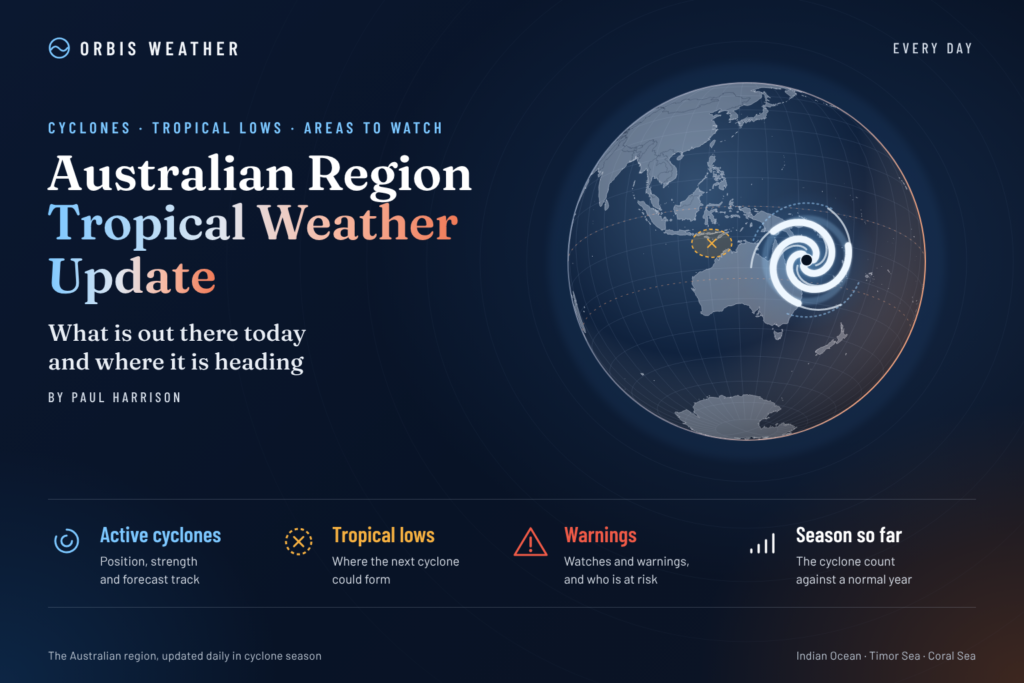
🌀 Australian Region Tropical Weather Update
By Paul Harrison | Founder & Publisher, Orbis Weather

No news articles published today yet.





🌀 Australian Region Tropical Weather Update — Tuesday, November 10, 2026
By Paul Harrison | Orbis Weather
2026–2027 Australian Tropical Cyclone Season | Eastern Indian Ocean • Western Australia • Timor Sea • Arafura Sea • Northern Territory • Gulf of Carpentaria • Queensland • Coral Sea
Published: Tuesday, November 10, 2026 — Australian local date
Forecast period: November 10–16, 2026
Primary source: Australian Bureau of Meteorology (BOM)
🌏 Australian Tropical Overview: Rainfall, Thunderstorms and Early-Season Cyclone Monitoring
Australia’s 2026–2027 tropical cyclone season is entering its second week, with attention focused on increasing tropical moisture, thunderstorms, heavy rainfall and the possibility of tropical low development across northern Australian waters.
The latest verified Bureau of Meteorology Tropical Climate Update, issued November 3, indicates that above-average rainfall is likely across much of northern Western Australia, the Northern Territory and northwestern Queensland during November 8–21.
However, conditions are expected to vary significantly across the region. Far northern Queensland and parts of the northern coastal Northern Territory are favoured to experience below-average rainfall during the same period.
The broader tropical weather picture is being influenced by warm ocean waters, atmospheric moisture, seasonal heating and large-scale climate patterns, including a strong El Niño and positive Indian Ocean Dipole.
The most important message for Tuesday, November 10, is that dangerous tropical weather can occur without a named cyclone. Intense thunderstorms, flash flooding, lightning and damaging wind gusts remain important hazards as northern Australia moves deeper into its wet season.
🚨 1. Australian Tropical Cyclone Status — November 10, 2026
Category | Current assessment |
|---|---|
🌀 Named tropical cyclones | No active system independently verified |
🌧️ Tropical lows | Operational status not confirmed |
⚠️ Cyclone watches | Live status requires BOM verification |
🚨 Cyclone warnings | Live status requires BOM verification |
🌊 Tropical development | Monitoring across northern waters |
⛈️ Thunderstorm potential | Important seasonal concern |
📅 Cyclone season | November 1–April 30 |
Verification notice: A Bureau of Meteorology operational cyclone bulletin specifically confirming all active systems and warnings for November 10 was not independently available during preparation.
This means the absence of a verified active cyclone in this report should not be interpreted as official confirmation that the region is cyclone-free.
No storm coordinates, maximum sustained winds, formation probabilities or projected landfall locations are being published without supporting operational data.
For the latest official status, consult the Australian Bureau of Meteorology.
🌊 2. Western Australia — Kimberley, Pilbara and Eastern Indian Ocean
🌧️ Rainfall and Thunderstorm Potential
Northern Western Australia is one of the principal areas of interest during the coming week.
The Bureau’s November 3 climate guidance favours above-average rainfall across much of northern Western Australia between November 8 and 21.
The Kimberley and Pilbara regions are particularly important areas for monitoring because heavy rainfall can affect remote roads, river crossings and isolated communities.
Locations to monitor include Broome, Derby, Kununurra, Wyndham, Port Hedland and surrounding districts.
The rainfall outlook is a broad regional forecast, not confirmation that heavy rain will affect every location.
⚡ Potential Hazards
Localised heavy thunderstorms and lightning.
Sudden flooding of creeks and low-lying roads.
Strong wind gusts associated with thunderstorms.
Reduced visibility during intense rainfall.
Heat and humidity, particularly where overnight temperatures remain elevated.
🌀 Eastern Indian Ocean Cyclone Monitoring
The eastern Indian Ocean, including waters northwest of Western Australia, is an important region for tropical cyclone formation.
Forecasters monitor developing low-pressure systems, persistent thunderstorm clusters and atmospheric circulation.
Warm ocean temperatures can provide energy for cyclone development, but favourable upper-level winds and organised circulation are also necessary.
November 10 assessment: No specific tropical cyclone track or formation probability for the eastern Indian Ocean has been independently confirmed for this edition.
🌴 3. Northern Territory — Darwin, Top End, Timor Sea and Arafura Sea
⛈️ Wet-Season Conditions Developing
The Northern Territory is moving further into its northern wet season, when tropical moisture, daytime heating and atmospheric instability can support widespread thunderstorm activity.
The Bureau’s November 3 guidance favours above-average rainfall across much of the Territory during November 8–21.
However, the northern coastal fringes of the Top End are an exception, with below-average rainfall favoured.
This distinction is important for Darwin, the Tiwi Islands and nearby coastal communities. A wetter-than-average outlook for much of the Territory does not necessarily mean unusually wet conditions along every northern coastline.
🌊 Timor and Arafura Seas
The Timor and Arafura seas are important monitoring areas for tropical disturbances.
During favourable atmospheric conditions, broad low-pressure areas can develop over these waters and potentially become more organised.
Meteorologists examine sea-level pressure, thunderstorm persistence, wind shear and the location of the monsoon trough when assessing possible development.
There is currently no independently verified forecast establishing a specific cyclone threat to Darwin or the Top End for November 10.
⚠️ Main Weather Concerns
Lightning, heavy showers, flash flooding and strong thunderstorm gusts remain relevant seasonal hazards.
Marine operators should monitor local coastal forecasts, particularly where thunderstorms could produce sudden changes in wind direction and visibility.
🌀 4. Gulf of Carpentaria — Tropical Low Development Monitoring
The Gulf of Carpentaria is one of Australia’s significant tropical cyclone development regions.
Its warm, relatively shallow waters can provide favourable conditions for tropical lows when atmospheric circulation becomes sufficiently organised.
Communities around the Gulf include Nhulunbuy, Groote Eylandt, Borroloola, Mornington Island, Burketown and Karumba.
🔎 What Forecasters Are Watching
Several atmospheric ingredients are important when assessing the potential for tropical cyclone development:
Low-level circulation: A developing tropical system requires a sufficiently organised area of low pressure.
Persistent thunderstorms: Sustained convection near the circulation centre can support intensification.
Vertical wind shear: Strong changes in wind speed or direction with altitude can disrupt cyclone organisation.
Atmospheric moisture: Dry air entering a developing circulation can suppress thunderstorm activity.
Ocean heat: Warm waters provide energy, although ocean temperature alone cannot determine whether a cyclone forms.
No specific Gulf of Carpentaria cyclone formation probability or landfall forecast has been independently verified for this report.
🌧️ Flooding Can Occur Without Cyclone Formation
A tropical low does not need to reach cyclone intensity to produce dangerous rainfall.
Slow-moving disturbances can generate prolonged showers, flash flooding and river rises.
Residents and travellers should therefore monitor rainfall and flood forecasts as well as tropical cyclone bulletins.
🌧️ 5. Queensland and the Coral Sea
🌴 North Queensland Tropical Conditions
Queensland’s tropical north is entering the warmer, more humid part of the year.
Locations of interest include Cairns, Townsville, Cooktown, Innisfail, Ingham, Cape York Peninsula and communities bordering the Gulf of Carpentaria.
The Bureau’s November 3 outlook suggests a notable regional contrast during November 8–21.
Northwestern Queensland is favoured to receive above-average rainfall, while far northern Queensland is favoured to experience below-average rainfall.
This does not mean thunderstorms or heavy showers are impossible in far northern Queensland. Short-lived intense rainfall can occur even during a period that finishes below its normal rainfall total.
🌀 Coral Sea Tropical Development
The Coral Sea is a major monitoring region for tropical systems that may eventually influence Queensland or move into the wider South Pacific.
A tropical disturbance developing offshore may remain over water, move toward the Australian coast or travel farther east, depending on surrounding atmospheric steering patterns.
Current assessment: No specific Coral Sea cyclone track, intensity forecast or Queensland landfall threat has been independently established for November 10.
🌊 Coastal and Marine Conditions
Strong winds, offshore thunderstorms and rough seas can occur independently of tropical cyclone activity.
Boaters and fishing operators should consult official marine forecasts before travelling.
📅 6. Seven-Day Australian Region Tropical Outlook — November 10–16, 2026
The following outlook identifies monitoring priorities for the next seven days, based on the Bureau’s published broad-scale guidance and the established meteorology of the Australian tropics.
It is not a prediction that a cyclone or severe thunderstorm will develop on any particular day.
Date | Regional monitoring priority |
|---|---|
Tue, Nov. 10 | Northern WA and NT — rainfall and thunderstorms |
Wed, Nov. 11 | Timor and Arafura seas — tropical convection |
Thu, Nov. 12 | Gulf of Carpentaria — low-pressure organisation |
Fri, Nov. 13 | Kimberley and Pilbara — rainfall and flooding potential |
Sat, Nov. 14 | Eastern Indian Ocean — offshore tropical disturbances |
Sun, Nov. 15 | Coral Sea and Queensland — marine and tropical conditions |
Mon, Nov. 16 | Entire Australian region — reassess cyclone and rainfall outlook |
These are editorial monitoring priorities rather than verified daily forecasts. Official short-range forecasts should be consulted for location-specific conditions.
🌧️ Rainfall Outlook: November 8–21
Region | Broad BOM forecast |
|---|---|
Northern Western Australia | Above-average rainfall favoured |
Much of Northern Territory | Above-average rainfall favoured |
Northwestern Queensland | Above-average rainfall favoured |
Far northern Queensland | Below-average rainfall favoured |
Northern coastal Top End | Below-average rainfall favoured |
The Bureau also indicates that temperatures are generally likely to be warmer than average, particularly overnight.
🌡️ 7. Atmospheric Conditions Influencing Australian Tropical Weather
🌊 El Niño and the Indian Ocean Dipole
A strong El Niño and positive Indian Ocean Dipole are influencing the broader Indo-Pacific climate system.
El Niño involves unusually warm sea-surface temperatures in the central and eastern equatorial Pacific and changes to tropical atmospheric circulation.
A positive Indian Ocean Dipole occurs when the western tropical Indian Ocean is relatively warmer than waters near Indonesia.
These patterns can affect Australian rainfall, tropical moisture transport and atmospheric circulation.
However, neither pattern determines the weather in a particular town on a particular day.
The World Meteorological Organization reported in September that El Niño was established and expected to strengthen further.
🌍 Madden–Julian Oscillation
The Madden–Julian Oscillation, commonly known as the MJO, is an eastward-moving pattern of enhanced and suppressed tropical rainfall and thunderstorms.
The Bureau’s November 3 update placed the MJO at moderate strength over the Indian Ocean.
Most forecast models indicated strengthening during the following seven days, although longer-range projections differed.
The Bureau noted that an Indian Ocean MJO at this time of year generally has limited influence on Australian rainfall.
Consequently, a strengthening MJO should not automatically be interpreted as evidence of an approaching Australian cyclone.
💨 Vertical Wind Shear
Vertical wind shear describes changes in wind speed or direction with height.
Strong shear can disrupt tropical development by displacing thunderstorms away from the centre of circulation.
Weak shear may support tropical cyclone organisation when other conditions are favourable.
🌡️ Sea-Surface Temperatures
Tropical cyclones generally require sufficiently warm ocean waters to sustain deep convection.
Temperatures around 26.5°C (79.7°F) or higher are commonly associated with potentially supportive environments.
However, a warm sea does not guarantee cyclone formation.
🌀 8. Australian Tropical Cyclone Season 2026–2027
Australia’s main tropical cyclone season extends from November through April.
According to the Bureau of Meteorology’s historical statistics, the Australian region has experienced approximately 10 tropical cyclones per season over the longer term, with around three to four making landfall at cyclone strength.
Since 2000, the seasonal average has been closer to eight or nine tropical cyclones.
The first cyclone to cross the Australian coastline typically occurs in late December, although earlier events are possible.
⚠️ Does El Niño Mean Fewer Cyclones?
El Niño can influence cyclone development and the distribution of tropical rainfall, but seasonal relationships are not sufficiently reliable to determine the exact number or location of future cyclones.
The Bureau no longer issues its former statistical seasonal cyclone outlook, citing reduced forecast reliability as climate patterns change.
Even a season with relatively few cyclones can produce a destructive landfall.
🚨 9. Tropical Weather Preparedness
Residents and visitors across northern Australia should prepare for both tropical cyclones and severe wet-season weather.
Important precautions include:
Checking Bureau of Meteorology warnings before travelling.
Avoiding flooded roads, creeks and causeways.
Securing loose outdoor objects ahead of severe thunderstorms.
Maintaining emergency supplies, drinking water and charged communications equipment.
Monitoring local emergency services for evacuation advice and road closures.
Following official coastal waters forecasts before boating.
Never attempt to drive through floodwater. Flood depth, road damage and water movement can be difficult to assess.
Official Emergency and Weather Resources
Organisation | Information |
|---|---|
Cyclone forecasts, warnings and rainfall | |
Western Australia emergency alerts | |
Northern Territory emergency information | |
Queensland emergency updates | |
Flood and storm assistance |
❓ 10. Australian Tropical Weather — Frequently Asked Questions
Is there an active tropical cyclone near Australia on November 10, 2026?
No active tropical cyclone was independently verified for this report. However, current operational bulletins were not fully confirmed, so this is not an official declaration that no cyclone exists.
Could a tropical cyclone form during November?
Yes. November is the beginning of Australia’s main cyclone season. Although cyclone activity generally becomes more frequent later in the season, early development remains possible.
Which areas are being monitored?
The eastern Indian Ocean, Timor Sea, Arafura Sea, Gulf of Carpentaria and Coral Sea are important tropical development regions. These monitoring areas do not represent confirmed cyclone threats.
Can flooding occur without a tropical cyclone?
Yes. Tropical lows, thunderstorms and persistent rainfall can produce serious flooding even when winds remain below cyclone intensity.
Does a below-average rainfall outlook mean there will be no storms?
No. Rainfall outlooks describe the probability of total rainfall being above or below normal over a specified period. They do not rule out individual heavy-rainfall events.
🔎 11. Editorial Methodology, Sources and Verification
Prepared by Paul Harrison | Orbis Weather
This report uses published official meteorological guidance, established tropical cyclone climatology and independent editorial interpretation.
About the Author
Paul Harrison — Founder & Publisher, Orbis Weather
Paul Harrison founded Orbis Weather in 2026 to make global weather and natural-hazard information easier to find, follow and understand. His coverage includes tropical cyclones, severe weather, extreme temperatures, earthquakes, volcanoes, wildfires, flooding and significant natural disasters worldwide.
View all articles by Paul Harrison → | Editorial Standards →
Global Weather Tracker Hub
Explore weather maps, tropical systems, storms and natural hazards around the world.
No matching trackers found.