
Singapore Weather & Natural Hazards – Live Conditions & Alerts
By Paul Harrison | Founder & Publisher, Orbis Weather

No news articles published today yet.





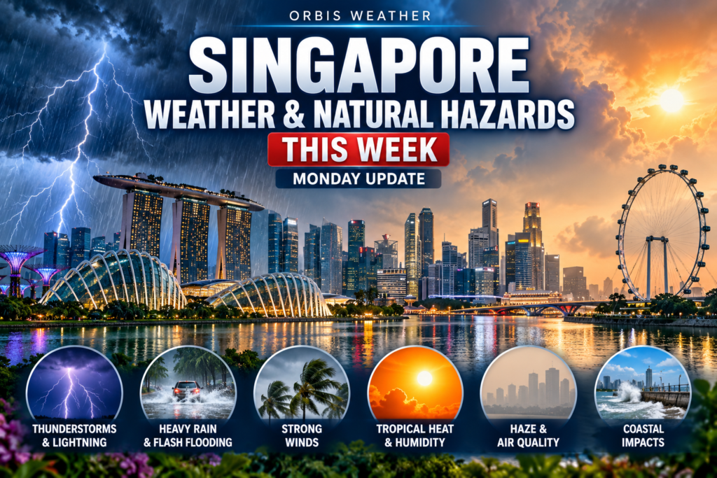
Singapore Weather & Natural Hazards This Week
By Paul Harrison, Orbis Weather
At a glance
Singapore’s three-week haze episode is easing: NEA forecasts a Moderate 24-hour PSI of 70 to 100 for Monday, October 26, as southwest to west winds and showers keep smoke away.
- Air quality: At 7pm on Sunday, October 25, the 24-hour PSI was 91 to 107 (Moderate to Unhealthy) and one-hour PM2.5 was in the Normal band. NEA expects the haze situation to improve on Monday and Tuesday.
- Weather: Afternoon thundery showers on most days, with highs of 33 to 34°C (91 to 93°F). Fortnight rainfall to November 1 is forecast below average.
- Measures: The Haze Subsidy Scheme, which began on October 12, has no announced end date. A second round of N95 masks for people aged 60 and above began on October 23.
- Tropics: No tropical cyclone or disturbance in the South China Sea; nothing in the tropics affects Singapore.
- Earthquakes and volcanoes: Two moderate, deep quakes off Sumatra, none reported felt in Singapore. Anak Krakatau in the Sunda Strait remains at Alert Level 3.
The Meteorological Service Singapore (MSS) and the National Environment Agency (NEA) issue the official forecasts, warnings and health advisories.
This week’s weather
Expect hot days with afternoon thundery showers, after moderate rain in the early hours of Monday. The MSS four-day outlook, updated at 9.55pm SGT on October 25, covers Monday to Thursday.
Day | Forecast | High | Low | Wind |
|---|---|---|---|---|
Mon, Oct 26 | Early hours moderate rain | 33°C (91°F) | 23°C (73°F) | Southwest 10–20 km/h (6–12 mph) |
Tue, Oct 27 | Afternoon thundery showers | 34°C (93°F) | 24°C (75°F) | Variable 5–15 km/h (3–9 mph) |
Wed, Oct 28 | Afternoon thundery showers | 34°C (93°F) | 24°C (75°F) | Variable 5–15 km/h (3–9 mph) |
Thu, Oct 29 | Late morning and early afternoon thundery showers | 33°C (91°F) | 24°C (75°F) | Southeast 5–15 km/h (3–9 mph) |
There is no official day-by-day forecast yet for Friday, October 30, to Sunday, November 1. MSS updates the four-day outlook twice daily.
Southwest Monsoon conditions prevail, according to the MSS fortnightly outlook for October 16 to November 1. It expects localised, short-duration afternoon thundery showers on most days and below-average rainfall over most of the island. Highs are likely to range from 33 to 35°C (91 to 95°F), with some nights staying above 27°C (81°F).
Haze and air quality
Air quality is improving but the 24-hour PSI was still at the edge of the Unhealthy range on Sunday night. The one-hour PM2.5, the better guide for immediate activity, was Normal in every region.
Region | 24-hour PSI | One-hour PM2.5 (µg/m³) |
|---|---|---|
North | 90 | 24 |
South | 88 | 32 |
East | 96 | 34 |
West | 103 | 55 |
Central | 95 | 41 |
Readings at 9pm SGT on Sunday, October 25, as published on the independent aggregator NEA Weather (neaweather.com). NEA’s own 7pm update gave an island-wide range rather than regional figures.
The season’s highest 24-hour PSI was 230 in the west at 10am and 11am on October 18, as reported by AsiaOne. Readings eased to the Moderate range by 6pm on October 22, then rose again to 108–151 on October 24 as smoke from Sumatra drifted in. On Sunday, southwest to west winds and showers helped, and NEA forecasts a 24-hour PSI of 70 to 100 for Monday. Its advice for Monday is to continue normal activities and to check the one-hour PM2.5 before immediate outdoor activity. IQAir’s live city ranking showed Singapore at US AQI 110 at about 7am SGT on Monday.
- Haze Subsidy Scheme: Since October 12, eligible Singapore citizens pay no more than S$10 for haze-related conditions at participating clinics and polyclinics. No end date has been announced.
- N95 masks: A second round of two-mask packs for Singaporeans aged 60 and above has been available at community clubs and vending machines since October 23.
Rain, heat and UV
Short afternoon storms are the main rain risk this week, and Sunday evening showed how quickly they can trigger flash-flood alerts.
- Sunday, October 25: MSS issued a heavy rain warning at 5.42pm SGT, later extended to 8pm. PUB warned of a flash-flood risk on Jalan Boon Lay (International Road to Enterprise Road) from 6.37pm and at Boon Lay Way and Corporation Road from 6.48pm. Reports on the event did not confirm actual flooding.
- This week: The four-day outlook expects thundery showers on Tuesday and Wednesday afternoons and from late morning on Thursday.
- Heat: Highs of 33 to 34°C (91 to 93°F) are forecast through Thursday. In the first half of October, Pulau Ubin reached 34.9°C (94.8°F) on October 6, and Punggol’s rainfall was about 94 per cent below average.
- UV: NEA measures the UV index at Changi every 15 minutes from 7am to 7pm. Its scale runs from Low (0–2) to Extreme (11 and above).
Regional hazards
The region is quiet for Singapore: no cyclone threat, two moderate deep earthquakes off Sumatra, and several Indonesian volcanoes erupting within their exclusion zones.
Tropical cyclones: The latest JTWC bulletins list no system or disturbance in the South China Sea. Typhoon Champi (29W) was east of Taiwan and Tropical Storm In-Fa (30W) near the Marshall Islands at 0000 UTC on October 24. Invest 98B in the Bay of Bengal had a high chance of forming a cyclone (1800 UTC, October 24). None has any bearing on Singapore.
Earthquakes, magnitude 4.5 and above, October 18–25 (USGS):
Singapore time | Magnitude | Location | Depth |
|---|---|---|---|
Thu, Oct 22, 6.57pm | 4.9 | 85 km NNW of Curup, southern Sumatra | 135 km |
Wed, Oct 21, 12.29am | 5.0 | 21 km SW of Meulaboh, Aceh, Sumatra | 76 km |
USGS lists no felt reports for either event.
Volcanoes nearest Singapore (Smithsonian/USGS weekly report, October 15–21):
Volcano | Island | Activity | Alert level and keep-out distance |
|---|---|---|---|
Krakatau (Anak Krakatau) | Sunda Strait | New eruptive activity; plumes up to 600 m above the vent on October 18–20 | Level 3 of 4; 5 km from the summit |
Marapi | Sumatra | One eruptive event on October 16, detected seismically | Level 2; 3 km from the crater |
Sinabung | Sumatra | Alert lowered on October 17 | Level 2; 3 km (4 km on the southeast flank) |
Merapi | Java | Lava avalanches up to 2.5 km down drainages | Level 3; 3–7 km by sector |
Semeru | Java | Ash plumes 300–1,000 m above the summit | Level 3; 5 km, up to 13 km to the southeast |
Indonesia’s PVMBG reported a further Anak Krakatau eruption at 6.40am WIB (7.40am SGT) on October 20, with the plume not visually observed.
What to watch this week
The main question is whether the wind shift holds long enough to end the haze episode.
When | What to watch | Source |
|---|---|---|
Daily, evenings | NEA haze update and next-day PSI forecast | NEA |
Mon–Tue, Oct 26–27 | Whether showers and southwest to west winds keep the PSI Moderate | NEA, MSS |
Tue–Thu afternoons, Oct 27–29 | Thundery showers; heavy rain warnings and PUB flash-flood alerts | MSS, PUB |
Thu, Oct 29 (by 2300 UTC) | Next Smithsonian/USGS weekly volcano report, including Anak Krakatau | Smithsonian GVP |
Around Nov 1–2 | New MSS fortnightly outlook and review of the second half of October | MSS |
A return of southeasterly or southerly winds during dry spells could again carry smoke from Sumatra or Kalimantan, as it did on October 23 and 24. MSS’s fortnightly outlook still expects dry conditions over southern Sumatra and parts of Kalimantan, with some days of PSI spikes possible.
About this report
This report draws on MSS, NEA, PUB, JTWC, USGS and the Smithsonian Global Volcanism Program, plus news reports, checked on the morning of Monday, October 26 (SGT). Monday’s air readings were not yet published, so the latest are from Sunday evening (NEA at 7pm; regional values at 9pm). The four-day outlook dates from 9.55pm on October 25, JTWC bulletins from October 24, the volcano report from October 15–21, and the fortnightly outlook from October 17. Times are SGT (UTC+8) unless marked UTC or WIB (UTC+7). Temperatures are in Celsius with Fahrenheit in brackets.
Term | Meaning |
|---|---|
PSI | Pollutant Standards Index; NEA’s 24-hour air-quality measure. 51–100 is Moderate, 101–200 Unhealthy. |
PM2.5 | Fine particles 2.5 micrometres or smaller, the main pollutant in haze; NEA’s one-hour reading guides immediate activity. |
Southwest Monsoon | The seasonal wind pattern MSS says is still prevailing, with winds mainly from the southeast or southwest. |
Invest | A tropical disturbance that forecasters are monitoring for possible cyclone development. |
Alert Level (Indonesia) | PVMBG’s volcano scale from 1 (normal) to 4 (highest), with keep-out zones around the crater. |
Frequently asked questions
Is the haze over? Not officially. NEA expects improvement on Monday and Tuesday with a Moderate PSI forecast, but MSS warns that PSI spikes remain possible while southern Sumatra and Kalimantan stay dry.
Can I exercise outdoors this week? NEA’s advice for Monday is to continue normal activities. For immediate plans, check the one-hour PM2.5: in the Normal band, normal activities can continue.
Will it rain? Yes, mostly as afternoon thundery showers from Tuesday to Thursday, after early-morning rain on Monday. MSS still expects below-average rainfall overall for the fortnight to November 1.
Is any typhoon heading for Singapore? No. The active systems are near Taiwan, the Marshall Islands and in the Bay of Bengal, and none is in the South China Sea.
Do the Sumatra earthquakes or Anak Krakatau affect Singapore? Neither quake has any felt report on USGS. Anak Krakatau’s official keep-out zone covers 5 km around its summit in the Sunda Strait, and its plumes reached at most 600 m above the vent.
Sources
Weather
- MSS four-day outlook — updated 9.55pm SGT, October 25, 2026
- MSS fortnightly outlook — October 16 to November 1, 2026 (page updated October 17)
Haze and air quality
- NEA Haze Situation Update, October 25, 2026 — readings as at 7pm
- NEA Haze Situation Update, October 24, 2026 — readings as at 5pm
- NEA Haze Situation Update, October 23, 2026 — readings as at 6pm
- NEA Haze Situation Update, October 22, 2026 — readings as at 6pm
- NEA Haze Situation Update, October 21, 2026 — readings as at 7pm
- NEA Weather haze page (independent aggregator) — regional readings at 9pm, October 25, 2026
- AsiaOne: PM2.5 normal on Sunday morning; haze likely to ease from Monday — October 25, 2026
- AsiaOne: Western region not in unhealthy PSI range for first time since Oct 5 — October 22, 2026
- Mothership: Haze Subsidy Scheme from Oct 12 — October 11, 2026
- IQAir world air quality ranking — read about 7am SGT, October 26, 2026
- ASMC home page — regional haze outlook, undated
Rain, heat and UV
- News Directory 3: PUB issues flood alerts during heavy rain — October 25, 2026
- Newsy Today: Jalan Boon Lay flash flood warnings — October 25, 2026
- NEA ultraviolet index
Regional hazards
- JTWC western Pacific advisory — 0600 UTC, October 24, 2026
- JTWC Indian Ocean advisory — 1800 UTC, October 24, 2026
- USGS earthquake catalog query — generated 6.53am SGT, October 26, 2026
- USGS event us6000u42q (Curup) and us6000u3nc (Meulaboh)
- Smithsonian/USGS Weekly Volcanic Activity Report — October 15–21, 2026
- Databoks: Anak Krakatau erupted again, October 20, 2026 — citing PVMBG
🌫️ Singapore Air Quality Snapshot
🌏 Recent Regional Earthquakes
Global Weather Tracker Hub
Explore weather maps, tropical systems, storms and natural hazards around the world.
No matching trackers found.
🇸🇬 Singapore Weather & Natural Hazards – Live Conditions & Alerts
Monitor Singapore’s weather and regional natural hazards with the Orbis Weather Singapore Weather & Natural Hazards dashboard.
The live dashboard brings together current weather, rain and thunderstorm conditions, air-quality information, regional earthquake activity, volcanic hazards and tropical weather affecting Singapore and Southeast Asia.
Singapore does not experience many of the major natural hazards found elsewhere in the region, but its location near the equator and close to Indonesia, Malaysia and the South China Sea means weather and environmental events elsewhere in Southeast Asia can still have important effects.
Heavy thunderstorms can produce flash flooding and dangerous lightning, Indonesian fires can affect air quality, volcanic eruptions can disrupt regional aviation, and major earthquakes in surrounding tectonic zones may occasionally be felt in Singapore.
🌦️ Understanding Singapore’s Weather
Singapore has a tropical climate characterized by warm temperatures, high humidity and significant rainfall throughout the year.
Because the country is located very close to the equator, temperatures do not vary as dramatically between seasons as they do in temperate climates.
Instead, changes in rainfall, wind patterns and thunderstorm frequency are strongly influenced by the regional monsoon cycle.
Weather can also change quickly.
A hot and humid morning can be followed by intense thunderstorms and torrential rain later in the day.
🌡️ Why Singapore Is Hot and Humid
Singapore receives strong solar energy throughout the year because of its equatorial location.
Warm surrounding seas also provide abundant atmospheric moisture.
Together, these factors create the hot and humid conditions associated with Singapore’s tropical climate.
Humidity can make the air feel considerably warmer than the measured temperature.
This is why apparent temperature or “feels like” conditions can be important when planning outdoor activities.
During particularly hot and humid periods, people spending extended periods outside should take appropriate precautions against heat stress.
⛈️ Why Singapore Gets So Many Thunderstorms
Singapore experiences frequent thunderstorms because the atmosphere often contains the three ingredients thunderstorms need: heat, moisture and atmospheric instability.
Strong daytime heating can cause warm, humid air to rise rapidly.
As that air rises and cools, thunderstorms can develop.
Regional wind patterns and sea breezes can further help initiate storms.
Thunderstorms may produce intense rainfall, gusty winds and frequent lightning.
Even when storms are relatively localized, rainfall can be extremely heavy.
⚡ Singapore and Lightning
Singapore’s tropical environment is highly favorable for thunderstorms and lightning.
Lightning should be taken seriously even when rainfall is not particularly heavy at your exact location.
Thunderstorms can produce lightning beyond the area experiencing the heaviest rain.
If thunder can be heard, outdoor activities should be reconsidered and appropriate shelter should be sought.
People participating in boating, swimming, golf, construction and other exposed outdoor activities should pay particular attention to developing thunderstorms.
The Orbis Weather Singapore Lightning & Thunderstorm Tracker provides a more detailed view of regional storm activity.
🌧️ Heavy Rain and Flash Flooding
Intense tropical rainfall can overwhelm drainage systems and produce localized flash flooding.
Singapore has invested extensively in drainage and flood-management infrastructure, but exceptionally heavy rainfall can still create temporary flooding in vulnerable locations.
Flood conditions can develop quickly during intense thunderstorms.
Motorists should never attempt to drive through water when the depth or road condition cannot be determined.
Pedestrians should also avoid fast-moving floodwater and flooded drainage areas.
For current local warnings and flood information, always follow Singapore’s official authorities.
🌬️ Singapore’s Monsoon Seasons
Singapore’s weather is strongly influenced by two major monsoon periods.
The Northeast Monsoon generally affects the region during the northern-hemisphere winter months.
Periods of persistent rain can occur, particularly during monsoon surges.
The Southwest Monsoon generally influences Singapore during the middle portion of the year.
Weather during this period can include thunderstorms and occasional episodes of strong winds associated with regional storm systems.
Between the major monsoon periods are inter-monsoon seasons.
Light winds and strong daytime heating during these transition periods can help produce frequent afternoon and evening thunderstorms.
🌧️ What Is a Monsoon Surge?
A monsoon surge occurs when stronger northeasterly winds push across the South China Sea during the Northeast Monsoon.
These events can bring widespread cloud cover, stronger winds and extended periods of rain to Singapore and surrounding areas.
Unlike a short afternoon thunderstorm, a monsoon surge can affect the region for a much longer period.
Persistent rainfall can increase the potential for localized flooding and travel disruption.
💨 What Is a Sumatra Squall?
One particularly interesting weather phenomenon affecting Singapore is the Sumatra squall.
These organized lines of thunderstorms can develop over or near Sumatra and move eastward across the Strait of Malacca toward Singapore and Peninsular Malaysia.
A Sumatra squall can bring sudden heavy rain, frequent lightning and strong gusty winds.
Some occur during the night or early morning.
Because conditions can deteriorate quickly, these systems are particularly important for marine activities, aviation and outdoor events.
🌫️ Singapore Haze and Air Quality
Air quality is another important environmental issue for Singapore.
During some periods, smoke from vegetation and peat fires in parts of Southeast Asia can be transported toward Singapore by prevailing winds.
This can create regional haze.
The severity of a haze episode depends on fire activity, wind direction, rainfall and broader atmospheric conditions.
Orbis Weather provides PM2.5 and other air-quality information for general situational awareness.
However, Singapore’s official Pollutant Standards Index, or PSI, should be obtained from Singapore’s National Environment Agency.
🌫️ What Is PM2.5?
PM2.5 refers to fine airborne particles measuring 2.5 micrometers or less in diameter.
Because these particles are extremely small, they can penetrate deep into the respiratory system.
Wildfire and vegetation-fire smoke can contain significant amounts of PM2.5.
Traffic, industry and other combustion sources can also contribute.
People concerned about air quality should pay attention to official health guidance, particularly during significant haze events.
🌏 Can Singapore Experience Earthquakes?
Singapore is not located directly on one of the world’s major active plate boundaries.
As a result, damaging local earthquakes are far less common than in neighboring Indonesia.
However, Indonesia contains some of the most seismically active regions on Earth.
Very large earthquakes in Sumatra and surrounding areas can sometimes produce shaking that is noticeable in Singapore, particularly in taller buildings.
The Orbis Weather dashboard therefore monitors significant regional earthquakes rather than only earthquakes located within Singapore itself.
🇮🇩 Why Indonesia Has So Many Earthquakes
Indonesia lies along several interacting tectonic plates and forms part of the broader Pacific Ring of Fire.
Subduction zones near Sumatra and Java are capable of producing very powerful earthquakes.
These tectonic systems have generated some of the world’s largest recorded earthquakes and tsunamis.
Because Singapore is geographically close to Indonesia, major regional earthquakes are relevant even though Singapore itself has much lower seismic hazard.
The Orbis Weather Southeast Asia Earthquake Tracker provides a broader view of seismic activity across the region.
🌊 Could a Regional Earthquake Cause a Tsunami?
Large undersea earthquakes can generate tsunamis when they cause significant vertical displacement of the seafloor.
However, not every large earthquake produces a tsunami.
Singapore’s geographic position provides some protection from many direct Indian Ocean tsunami sources, but tsunami risk should never be determined from a general earthquake map alone.
If a significant regional earthquake produces an official tsunami advisory or warning affecting Singapore or neighboring areas, follow the responsible authorities immediately.
🌋 Can Indonesian Volcanoes Affect Singapore?
Indonesia contains a large number of active volcanoes.
Most eruptions pose no direct ground-level danger to Singapore because of the distance involved.
However, major volcanic eruptions can still affect the wider region.
Volcanic ash can disrupt aviation, particularly when ash clouds reach commonly used flight levels.
Large eruptions can cause airports to close and aircraft to reroute around hazardous airspace.
This is why the Orbis Weather Singapore dashboard includes regional volcano awareness.
For more detailed information, use the Orbis Weather Indonesia Volcano Tracker.
✈️ Volcanoes and Singapore Aviation
Singapore is one of Southeast Asia’s major aviation hubs.
Flights operating through Singapore connect with destinations throughout Indonesia, Australia, East Asia and the rest of the world.
An eruption does not have to occur near Singapore to affect those flights.
Volcanic ash over Indonesia can force aircraft to alter routes or cause temporary closures at airports serving popular destinations.
Travelers should always check directly with their airline when significant volcanic activity is affecting the region.
🌀 Do Tropical Cyclones Hit Singapore?
Direct tropical cyclone impacts are uncommon in Singapore because the country lies very close to the equator.
The Coriolis effect, which helps tropical cyclones develop organized rotation, is weak near the equator.
That makes tropical cyclone formation close to Singapore relatively unusual.
However, tropical cyclones elsewhere in the South China Sea or Western Pacific can still influence regional weather patterns, winds, rainfall, waves and aviation.
This is why Orbis Weather includes tropical activity as part of the Singapore natural-hazards dashboard.
🌀 South China Sea Tropical Weather
Tropical depressions, tropical storms and typhoons regularly occur farther north across the South China Sea and Western Pacific.
Systems affecting Vietnam, the Philippines, southern China and surrounding waters can alter regional wind patterns and rainfall.
Their effects on Singapore are usually indirect.
The Orbis Weather Western Pacific Typhoon Tracker provides a broader view of tropical cyclone activity across this region.
🌊 Coastal and Marine Weather
Singapore is surrounded by busy coastal waters.
Thunderstorms, lightning, heavy rain, gusty winds and reduced visibility can create hazards for recreational boating and marine activities.
Conditions can change rapidly during tropical thunderstorms.
Anyone heading onto the water should check current weather information and official marine forecasts before departure.
🌡️ Heat and Outdoor Activities
Singapore’s combination of high temperatures and humidity can create uncomfortable and potentially hazardous heat conditions.
People working, exercising or sightseeing outdoors should consider temperature, humidity and sun exposure.
Drinking sufficient water, taking breaks and reducing prolonged exposure during particularly hot periods can help reduce heat-related risk.
Heat conditions can vary considerably depending on cloud cover, wind and time of day.
📍 How to Use the Singapore Weather & Natural Hazards Dashboard
The Orbis Weather dashboard is designed as a quick overview of several different hazards rather than a replacement for specialized official warning systems.
Start with Singapore Risk Right Now for a quick snapshot.
Then examine the individual sections for current weather, thunderstorms, air quality and regional earthquake activity.
If one hazard appears particularly important, continue to the dedicated Orbis Weather tracker for more detailed information.
For example, significant haze can be explored through the Singapore Haze & Air Quality Tracker, while increasing thunderstorm activity can be examined through the Singapore Lightning & Thunderstorm Tracker.
🛰️ Where Does Orbis Weather Get Singapore Data?
Orbis Weather combines information from established meteorological, environmental and geological sources.
Singapore weather information should be compared with observations and forecasts from the Meteorological Service Singapore.
Official Singapore air-quality and PSI information comes from the National Environment Agency.
Regional earthquake information is provided using data from the U.S. Geological Survey.
Additional weather and air-quality information may be provided by Open-Meteo.
Orbis Weather organizes these datasets into a convenient regional dashboard but does not replace official Singapore government warnings or emergency information.
🇸🇬 Monitor Singapore and Southeast Asia
Singapore may be geographically small, but its weather is connected to one of the world’s most active environmental regions.
Tropical thunderstorms can develop quickly, monsoon rainfall can produce flooding, regional fires can affect air quality, Indonesian earthquakes can occasionally be felt and volcanic eruptions can disrupt aviation.
The Orbis Weather Singapore Weather & Natural Hazards dashboard brings these different risks together in one place.
Return regularly to monitor Singapore weather, thunderstorms, haze, air quality and significant natural hazards across Southeast Asia.
For more detailed regional monitoring, explore the Orbis Weather Singapore Haze & Air Quality Tracker, Singapore Lightning & Thunderstorm Tracker, Singapore Monsoon & Flood Tracker, Southeast Asia Earthquake Tracker, Indonesia Volcano Tracker and Southeast Asia Natural Hazards dashboard.
Important Singapore Weather & Hazard Disclaimer
The Orbis Weather Singapore Weather & Natural Hazards dashboard is provided for general information, education and situational awareness.
Weather, air-quality, earthquake, volcanic and tropical-cyclone information may update at different intervals and can be delayed or incomplete.
Air-quality values displayed from third-party datasets should not be interpreted as Singapore’s official PSI unless explicitly identified as official NEA data.
Do not use Orbis Weather alone to make emergency or life-safety decisions.
For official Singapore weather warnings, heavy-rain alerts and meteorological information, follow the Meteorological Service Singapore. For official Singapore air-quality and haze information, follow the National Environment Agency. During emergencies, follow instructions from Singapore’s appropriate government and emergency authorities.