By Paul Harrison | Founder & Publisher, Orbis Weather
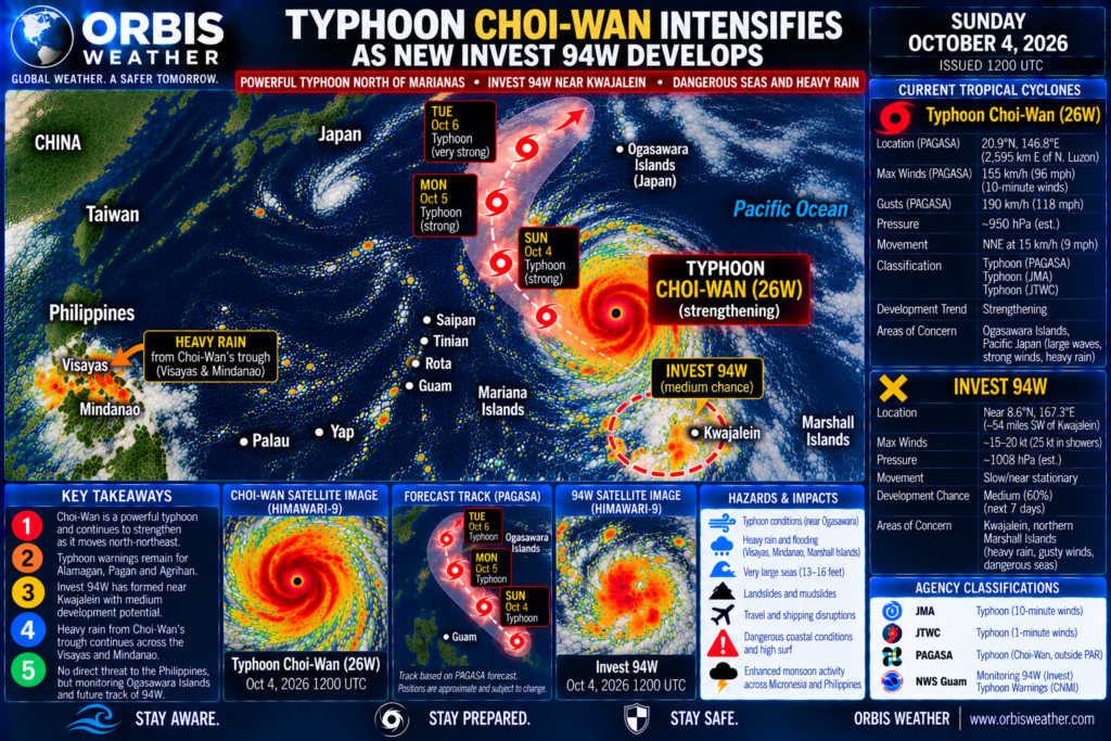

🌀 ORBIS WEATHER — Choi-Wan Intensifies Into a Powerful Typhoon as New Invest 94W Develops Near Kwajalein
Sunday, October 4, 2026
🌏 WESTERN PACIFIC ACTIVITY LEVEL: 🔴 HIGH — CHOI-WAN STRENGTHENING / INVEST 94W NOW BEING MONITORED
The Western North Pacific remains highly active Sunday, with Typhoon Choi-Wan strengthening rapidly over open water south of Japan while a new disturbance, JTWC Invest 94W, develops near Kwajalein in the northern Marshall Islands.
At 3 a.m. Philippine time Sunday, PAGASA located Choi-Wan near 20.9°N, 146.8°E, approximately 2,595 km east of Extreme Northern Luzon, with sustained winds of 155 km/h (96 mph) and gusts reaching 190 km/h (118 mph). The typhoon was moving north-northeast at 15 km/h (9 mph). PAGASA
The cyclone continues moving away from the Mariana Islands and toward the waters surrounding Japan’s Ogasawara Islands, where the risk from large waves, strong winds and heavy rain will increase.
Meanwhile, the Joint Typhoon Warning Center has designated a new disturbance near Kwajalein as Invest 94W. Development potential is rated MEDIUM, meaning tropical cyclone formation is considered likely beyond 24 hours. GovOneStop
That makes 94W the Western Pacific’s next disturbance to watch closely.
🌀 TYPHOON CHOI-WAN / 26W
ORBIS STATUS: 🔴 POWERFUL TYPHOON — INTENSIFYING
Latest PAGASA analysis:
📍 20.9°N, 146.8°E
📏 2,595 km east of Extreme Northern Luzon
🌬️ Sustained winds: 155 km/h / 96 mph
💨 Gusts: 190 km/h / 118 mph
↗️ Movement: North-northeast at 15 km/h / 9 mph
🌀 Classification: Typhoon — PAGASA
Choi-Wan remains outside the Philippine Area of Responsibility. PAGASA
The storm has strengthened considerably since Saturday, when PAGASA estimated sustained winds around 140 km/h.
📈 Choi-Wan Continues to Strengthen
Satellite and observational trends indicate Choi-Wan is continuing to consolidate as it gains latitude.
The typhoon is traveling across a region of the western Pacific containing sufficient ocean heat to support additional strengthening before environmental conditions eventually become less favorable farther north.
Official Japanese forecasts have consistently called for Choi-Wan to become a very strong typhoon near the Ogasawara region, followed by eventual weakening as it accelerates northeastward east of Japan. News Minimalist
ORBIS INTENSITY TREND: 📈 STRENGTHENING
⚠️ Agency Classification — JMA vs. JTWC vs. PAGASA
Different wind values may appear in tropical cyclone reports today because the major agencies use different wind-averaging periods.
PAGASA: Typhoon — 155 km/h sustained winds, gusting to 190 km/h at 3 a.m. Philippine time. PAGASA
JMA: Typhoon No. 27, Choi-Wan. JMA uses 10-minute sustained winds.
JTWC: Typhoon 26W. JTWC uses 1-minute sustained winds, which generally produces higher peak wind estimates than JMA’s 10-minute standard.
These values should therefore not be compared directly without identifying the reporting agency and observation time.
All agencies agree on the important point:
Choi-Wan is a significant and strengthening typhoon.
🧭 Track — Choi-Wan Heading Toward Ogasawara Waters
Choi-Wan has completed its recurvature and is moving:
↗️ NORTH-NORTHEAST → ⬆️ NORTH → ↗️ NORTHEAST
through the western Pacific.
The typhoon should continue gaining latitude while approaching waters around the Ogasawara Islands.
Japanese guidance then favors an eventual acceleration toward the northeast, taking Choi-Wan into the open Pacific east of mainland Japan. News Minimalist
ORBIS TRACK CONFIDENCE: 🟠 MODERATE-HIGH
The broad recurvature is becoming increasingly established, but the exact closest approach to the Ogasawara Islands remains important.
🇯🇵 Ogasawara Islands — Threat Increasing
The Ogasawara Islands are now the most important land area to monitor for Choi-Wan.
Japanese forecasts have warned that Choi-Wan could approach the region at very strong typhoon intensity, with dangerous winds and large seas.
Potential hazards include:
🌊 Very high waves and powerful swell
💨 Damaging wind gusts
🌧️ Heavy tropical rainfall
🌊 Coastal inundation and wave overtopping
🚢 Dangerous marine conditions
✈️ Air and sea transportation disruption.
ORBIS OGASAWARA STATUS: 🔴 CLOSE WATCH
Residents and marine interests should follow the latest Japan Meteorological Agency warnings closely.
🌊 Pacific Japan — Typhoon Swell Increasing
Even if Choi-Wan remains offshore, its expanding circulation will generate a large swell field.
The Pacific-facing coasts of Japan may experience increasing long-period swell as the typhoon gains latitude.
The greatest initial concern is around the Ogasawara chain, but swell can eventually propagate toward:
🌊 Izu Islands
🌊 Kanto coastal waters
🌊 Tokai
🌊 Pacific Honshu.
A direct mainland Japanese landfall is not currently an established forecast.
🇲🇵 Marianas — Choi-Wan Moving Away
The center of Choi-Wan is now well north of:
🟢 Guam
🟢 Rota
🟢 Tinian
🟢 Saipan.
The direct tropical cyclone threat is rapidly diminishing.
However, the storm’s large circulation and trailing southwest monsoon continue influencing weather and marine conditions across Micronesia.
ORBIS MARIANAS STATUS: 🟡 IMPROVING — MARINE HAZARDS LINGER
Large seas and strong southwest winds will require time to subside.
🇵🇭 Philippines — No Direct Typhoon Threat
Choi-Wan remains thousands of kilometers east of the Philippines and well outside PAR.
There is:
🟢 NO DIRECT TYPHOON WIND THREAT TO THE PHILIPPINES.
However, the storm’s enormous trough continues affecting the country.
🌧️ Choi-Wan Trough — Heavy Rain Risk in Visayas & Mindanao
PAGASA reports that Choi-Wan’s trough is affecting the Visayas and Mindanao Sunday.
Cloudy skies with scattered rain and thunderstorms are expected across:
🌧️ Mindanao
🌧️ Western Visayas
🌧️ Negros Island Region
🌧️ Central Visayas
🌧️ Southern Leyte.
Moderate to occasionally heavy rainfall could cause flash flooding or landslides. PAGASA
PAGASA rainfall advisories Sunday have also highlighted locally moderate to heavy rainfall across portions of Mindanao. PAGASA
ORBIS PHILIPPINES STATUS: 🟢 NO DIRECT CYCLONE THREAT / 🟠 HEAVY-RAIN RISK
🆕 INVEST 94W — New Western Pacific Disturbance
A new system has appeared east of the Marianas.
JTWC has designated the disturbance:
🟡 INVEST 94W
NWS Guam reports that 94W is located approximately:
📍 54 miles / 87 km southwest of Kwajalein
in the northern Marshall Islands. GovOneStop
Scatterometer observations indicate winds of approximately:
🌬️ 15–20 kt / 28–37 km/h
around Kwajalein, Ebadon, Ujae, Bikini and Rongelap.
Winds near heavier showers may reach:
💨 25 kt / 46 km/h. GovOneStop
ORBIS 94W STATUS: 🟡 DEVELOPING INVEST
📈 Invest 94W Development Potential: MEDIUM
JTWC currently assesses tropical cyclone development potential as:
🟠 MEDIUM
This means tropical cyclone formation is considered likely beyond the next 24 hours, rather than imminent during the immediate short term. GovOneStop
94W remains poorly organized, but the environment could allow gradual consolidation.
The next important milestones would be:
• establishment of a well-defined low-level circulation,
• persistent deep convection near the center,
• increasing organization of the wind field,
• and eventually a JTWC Tropical Cyclone Formation Alert if conditions warrant.
DEVELOPMENT TREND: 📈 GRADUAL ORGANIZATION POSSIBLE
🇲🇭 Kwajalein & Northern Marshall Islands — New Threat Developing
Unlike Choi-Wan, 94W is moving very slowly.
NWS Guam expects the disturbance to remain near the northern Marshall Islands through Tuesday night. GovOneStop
That slow movement increases the rainfall concern.
Areas worth monitoring include:
🟠 Kwajalein
🟠 Ebadon
🟠 Ujae
🟠 Bikini
🟠 Rongelap
🟡 surrounding northern Marshall Islands.
ORBIS NORTHERN MARSHALLS STATUS: 🟠 INCREASING WATCH
🌧️ Invest 94W — 4 to 6 Inches of Rain Possible
The most immediate threat from 94W is not destructive wind.
It is rainfall.
NWS Guam says scattered to numerous showers and isolated thunderstorms could produce:
🌧️ 4–6 inches / 100–150 mm of rain through Friday
with locally higher totals possible. GovOneStop
Because 94W may move slowly, repeated showers could affect the same islands for several days.
Potential impacts include:
💧 Localized flooding
🌊 Standing water
🌧️ Heavy tropical downpours
⚡ Thunderstorms
🚤 Difficult inter-island boating conditions.
🌊 94W Marine Conditions
Gusty winds accompanying thunderstorms will create elevated and choppy seas around the northern Marshall Islands.
NWS Guam specifically cautions that residents may need to reconsider inter-island boating plans as the week progresses. GovOneStop
Marine hazards could increase if 94W develops a more organized circulation.
🧭 Where Could Invest 94W Go?
This part of the forecast remains highly uncertain.
NWS Guam expects the disturbance to remain relatively slow-moving around the northern Marshall Islands through Tuesday night.
Beyond that period, computer models may depict different westward or northwestward scenarios.
Those longer-range solutions are:
🖥️ MODEL GUIDANCE — NOT AN OFFICIAL TRACK FORECAST.
Until 94W becomes a tropical cyclone, there is no conventional official tropical cyclone forecast cone.
Therefore, claims that 94W will eventually strike Guam, the Northern Marianas, the Philippines or Japan would be premature.
🌏 Other Western Pacific Disturbances
Current authoritative information identifies two systems requiring attention today:
🔴 Typhoon Choi-Wan / 26W
🟡 Invest 94W
No additional numbered JTWC invest or organized tropical cyclone requiring separate coverage was identified in the latest basin information reviewed for this report.
Broad tropical convection remains scattered along the monsoon trough elsewhere across Micronesia and the Philippine Sea.
⚠️ OFFICIAL FORECAST vs. MODEL GUIDANCE
✅ OFFICIAL / OPERATIONAL INFORMATION
PAGASA: Choi-Wan remains a typhoon outside PAR. At 3 a.m. Sunday it had 155 km/h sustained winds, 190 km/h gusts and was moving north-northeast at 15 km/h. PAGASA
JMA: Choi-Wan is expected to remain a powerful typhoon while approaching the Ogasawara region before eventually accelerating northeastward east of Japan. News Minimalist
JTWC/NWS Guam: Invest 94W has MEDIUM development potential near Kwajalein and is expected to remain slow-moving over the northern Marshall Islands during the next several days. GovOneStop
PAGASA: Choi-Wan’s trough continues producing scattered rain and thunderstorms over portions of the Visayas and Mindanao, with localized flash flooding or landslides possible. PAGASA
🖥️ MODEL GUIDANCE / UNCERTAINTY
For Choi-Wan, confidence is increasing that the cyclone will continue northward and eventually northeastward over the open Pacific. Uncertainty remains regarding its peak intensity and closest approach to the Ogasawara Islands.
For 94W, uncertainty is much greater.
The disturbance has only recently been designated an invest. Its circulation remains broad, and its future track and intensity depend heavily on how quickly a defined center develops.
Specific long-range model tracks for 94W should therefore not be presented as an official forecast.
📊 ORBIS WESTERN PACIFIC STATUS — OCTOBER 4
| System / Region | Status | Trend |
|---|---|---|
| 🔴 Choi-Wan / 26W | Typhoon — PAGASA/JMA/JTWC | 📈 Strengthening |
| 🔴 Ogasawara Islands | Choi-Wan approach zone | ⚠️ Threat increasing |
| 🟠 Pacific Japan | Typhoon swell risk | 🌊 Increasing |
| 🟡 Marianas | Choi-Wan departing | ↘️ Improving |
| 🟠 Visayas / Mindanao | Choi-Wan trough | 🌧️ Heavy-rain risk |
| 🟡 Invest 94W | JTWC Invest | 📈 Development possible |
| 🟠 Kwajalein | Near 94W | 🌧️ Heavy rain |
| 🟠 Northern Marshall Islands | 94W watch area | 🌧️ 4–6 inches possible |
| 🟢 Other WNP systems | No additional designated systems identified | Monitoring |
👀 ORBIS TOP AREAS TO WATCH
🔴 Choi-Wan / 26W — The typhoon continues strengthening while moving north-northeast. PAGASA estimated 155 km/h sustained winds and 190 km/h gusts early Sunday. PAGASA
🔴 Ogasawara Islands — Choi-Wan is approaching the waters south of Japan, with dangerous waves, strong winds and heavy rain becoming increasingly possible.
🟡 Invest 94W — This newly designated JTWC invest near Kwajalein now has medium tropical cyclone development potential. GovOneStop
🟠 Northern Marshall Islands — 94W’s slow movement could produce 4–6 inches of rain through Friday, locally higher, along with gusty winds and increasingly difficult marine conditions. GovOneStop
🟠 Visayas & Mindanao — Choi-Wan remains far away, but its trough continues producing potentially heavy thunderstorms capable of triggering localized flooding and landslides. PAGASA
🌀 ORBIS BOTTOM LINE
The Western Pacific now has two systems demanding close attention.
Typhoon Choi-Wan continues strengthening while recurving toward the waters around Japan’s Ogasawara Islands. PAGASA’s early-Sunday analysis placed the typhoon near 20.9°N, 146.8°E, with 155 km/h sustained winds, gusts to 190 km/h and north-northeast movement at 15 km/h. PAGASA
The cyclone is moving away from the Marianas, but the Ogasawara Islands are becoming the primary land area to watch, while large typhoon-generated swell could eventually spread toward Pacific Japan.
At the same time, JTWC Invest 94W has formed near Kwajalein. Development potential is rated MEDIUM, and the disturbance is expected to remain slow-moving around the northern Marshall Islands through Tuesday night. Rainfall of 4–6 inches, locally higher, is possible through Friday, creating an increasing flooding and marine threat. GovOneStop
For the Philippines, Choi-Wan remains far outside PAR and poses no direct typhoon threat, but its broad trough continues bringing scattered rain and thunderstorms to the Visayas and Mindanao. PAGASA
Today’s headline: Powerful Typhoon Choi-Wan is strengthening as it heads toward Japan’s Ogasawara waters, while newly designated Invest 94W develops near Kwajalein — giving the Western Pacific a second tropical system to watch closely.
Japan Meteorological Agency — Tropical Cyclone Information • Joint Typhoon Warning Center • NWS Guam — Official Forecasts and Statements • PAGASA — October 4 Weather & Choi-Wan Update
Stay Aware. Stay Prepared. Stay Safe.
About the Author
Paul Harrison — Founder & Publisher, Orbis Weather
Paul Harrison founded Orbis Weather in 2026 to make global weather and natural-hazard information easier to find, follow and understand. His coverage includes tropical cyclones, severe weather, extreme temperatures, earthquakes, volcanoes, wildfires, flooding and significant natural disasters worldwide.
View all articles by Paul Harrison → | Editorial Standards →
🌀 TROPICS RIGHT NOW
Quick access to the Atlantic, Pacific and Western Pacific tropical basins.
🌀 Western Pacific Basin
Live typhoon tracking, tropical cyclone activity, satellite imagery, weather, sea-surface temperatures and waves across the Western North Pacific, including Japan, the Philippines, Taiwan, Guam and Micronesia.
⚠️ Western Pacific Tropics Right Now
Live basin status🌀 Western Pacific Storm Tracker
Live tropical cyclones · click a storm for track/cone🌀 Western Pacific Storm Tracker
Live tropical cyclones across the Western Pacific. Drag to pan, Ctrl/⌘+scroll to zoom, and click a storm to show its track and cone.
🌏 Official Western Pacific Cyclone Centers
Forecasts · advisories · warnings🛰️ HIMAWARI-9 Western Pacific Satellite
Live satellite view🌦️ Western Pacific Live Weather Map
Windy · ECMWF🌊 Western Pacific Sea Surface Temperatures
Live SST map🌊 Western Pacific Waves & Swell
Windy · ECMWF🔗 Western Pacific Tropical Resources
Official & operational sources
Live Lightning Map
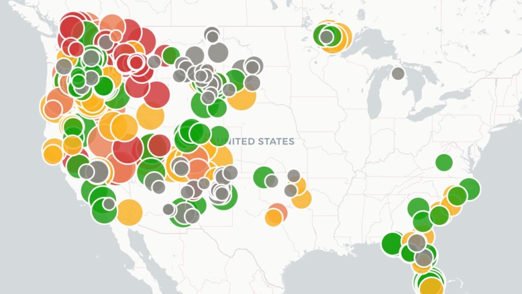
Live U.S. Wildfire Tracker

Live Wildfire Smoke & Air Quality Tracker

Live Earthquake Map
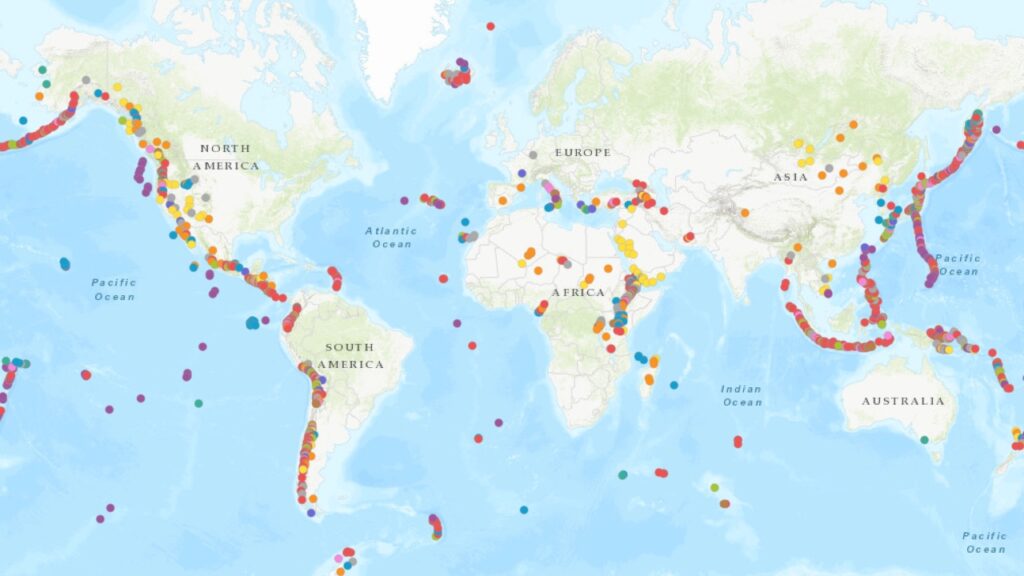
Live Volcano Eruption Tracker